February 17, 2021
The Yaqui Pass loop
The great toe is more of a mottled mauve this morning than plum. It continues to progress, and gives me no reason to favor it any longer. I’ll hold off taking a hike for a few more days but otherwise I feel ready to resume normal activity. Luckier than I deserve, as usual.
And speaking of being lucky, Team Anderson feels almost embarrassed by our good fortune when we see this map of recent weather conditions in our country. We’re in one of the few corners that hasn’t seen freezing temperatures in the past week. Thinking back, we realize what a stroke of luck it was for us that we were unable to travel to New Mexico as our plan had been just over a week ago.
| Heart | 1 | Comment | 0 | Link |
Today is just like yesterday here - sunny and warm all day - except even better, because the wind has quiesced considerably. We’ll experience quite manageable maximum winds of about 10 mph today. It’s in the sixties when we leave our motel at 10, and by the time we return it will have warmed up enough that we’ll wish we had gotten started earlier.

| Heart | 2 | Comment | 0 | Link |

| Heart | 2 | Comment | 0 | Link |

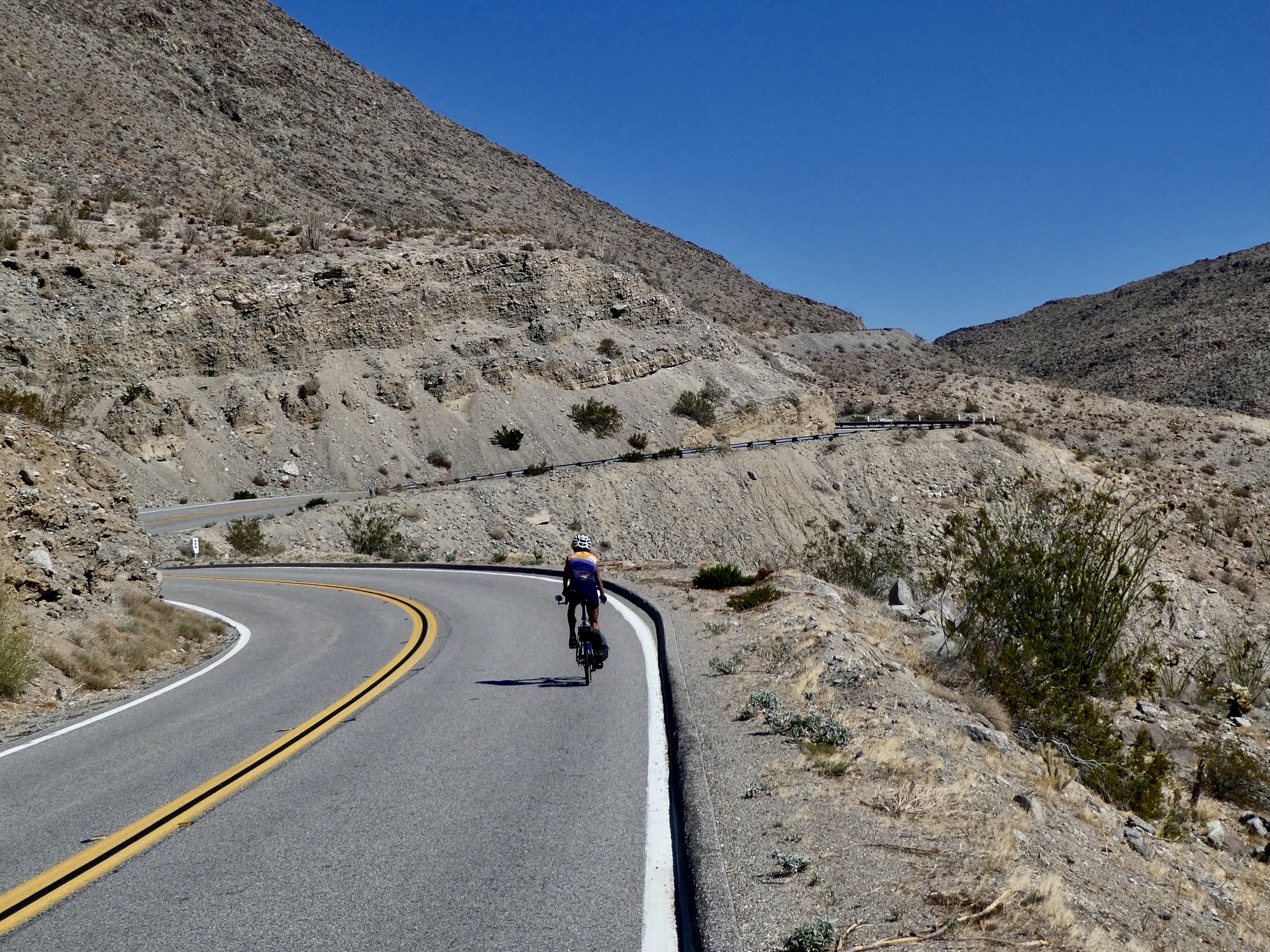
The ride plan for today is a triangular loop to the south: leaving the basin to the southeast out Borrego Springs Road, crossing west for about ten miles on Route 78, and then dropping back to town over Yaqui Pass. The road is very quiet today as we leave town on the nearly empty road. Nearly as many bikes on the road this morning as cars, it seems like.

| Heart | 3 | Comment | 0 | Link |


| Heart | 1 | Comment | 0 | Link |
I was a bit concerned about how the ten miles on Route 78 would go. It’s a highway, and one of the primary routes from the California Coast to Salton Sea and points east. When we drove along this highway on the ride to Borrego Springs from Ajo two days ago the road was busy with huge campers towing their ATV’s behind them, weekenders returning back home after laying waste to the desert.
Today though it’s very quiet, still enough that we can appreciate the ride and the scenery as we climb further into the hills. Road signs indicate the distances to Julian and Oceanside, making me long for the time when we’re on a real tour again. Soon, I’m sure.

| Heart | 1 | Comment | 0 | Link |

| Heart | 2 | Comment | 0 | Link |
Rachael has gotten a bit ahead of me when I stop for another photo, which is too bad for her because soon afterwards I’m startled to see a Desert Agave beside the road in full bloom. I’ve never seen this before, which I see is no surprise when I read up on this plant:
This common agave grows in dense clumps on rocky hillsides below 6,000 feet. The plant has an elusive flower, it only appears after approximately 20 years of growth. The parent plant then dies once the flower appears.
I’m just lucky. It’s all in the timing.

| Heart | 8 | Comment | 2 | Link |

| Heart | 3 | Comment | 1 | Link |

| Heart | 3 | Comment | 6 | Link |
4 years ago
4 years ago
4 years ago
Leaving the highway, we stop briefly at Tamarisk Grove Campground for a loo and snack break before the short, scenic climb up Yaqui Pass. It’s not much of a climb, but it gives a lot back for the modest effort. Views back south as we climb to the summit are impressive, and the five mile drop down the north side back into Borrego basin is exhilarating, watching the desert open up before us in a broad panorama backed by a semicircle of dramatic, colorful peaks. A ride worth repeating.

| Heart | 1 | Comment | 0 | Link |

| Heart | 1 | Comment | 2 | Link |
4 years ago


| Heart | 0 | Comment | 0 | Link |

| Heart | 1 | Comment | 2 | Link |
In the vicinity of Borrego Springs.
The awesome views
Are all the news
They're the views of desert kings.
4 years ago
4 years ago
Video sound track: You are the Sunshine of My Life, by Stevie Wonder
Ride stats today: 42 miles, 2,100’; for the tour: 2,802 miles, 106,400’; for the year: 35 riding days, 1,539 miles, 49,400’, and 2 flat tires
Today's ride: 42 miles (68 km)
Total: 2,803 miles (4,511 km)
| Rate this entry's writing | Heart | 6 |
| Comment on this entry | Comment | 0 |