March 1, 2021
Highland Park
We’re staying in a condo in a ridge-top development a few miles west of town. When I look out the bedroom window this morning I see the full moon approaching the red hills to the west, and quickly rouse myself to walk somewhere where I can get a better view. We’re only a few blocks from a large open expanse overlooking the valley, so I don’t have to go far. The land here slopes up a bit, so I keep walking just a bit farther to get a better view.
Eventually I end up perhaps a quarter mile from home, in a sandy, desert-like field full of burrow openings that make me wonder how smart it was to be walking out here in sandals. Views are astounding - what a place we’ve landed in for the next ten days! - and fortunately I get back out of the field and onto pavement again without suffering a scorpion or snake bite.

| Heart | 6 | Comment | 0 | Link |

| Heart | 2 | Comment | 0 | Link |

| Heart | 3 | Comment | 0 | Link |
I should have worn sturdier shoes. Another mistake I made when I rushed out the door was in not taking along a phone or gps, as I realize when I get back into the neighborhood and don’t recognize which street we’re living on. It’s cold out - right at freezing - and I’m starting to feel panicky when I finally figure it out and make it back to shelter.
“You left at the wrong time”, Rachael states when I enter the door of our apartment. Shawn called from the hospital, and the two of them had an extended FaceTime chat. We send him a text, and soon my iPad rings again. For the next fifteen minutes he fills us in on how he’s doing. He’s doing great, we’re happy to report. He’s been out walking this morning already, and after breakfast he’s off to the workout room for some therapeutic exercise. Everything is upbeat, and he’ll go home as soon as some of his numbers get back to the normal range - perhaps in two days.

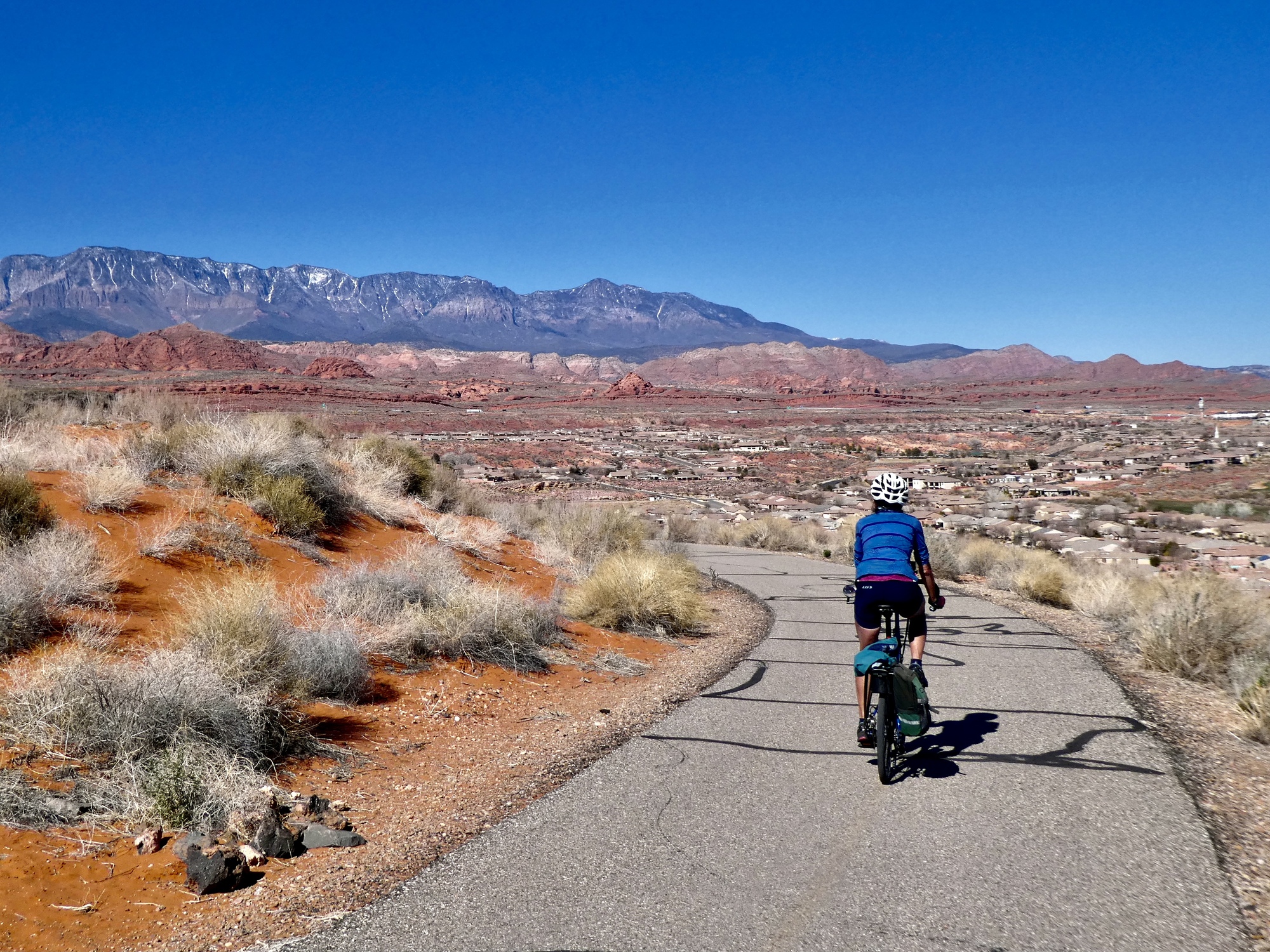
As cold as it is, we plan a shorter, faster ride today because we don’t intend to start out until after noon once it rises above 50. Our plan is to ride east along the Virgin River Trail, a paved cycleway that starts a few blocks from home and continues east for about 10 miles. After that we’re going to hit the roads and continue east to Quail Creek State Park before backtracking.
The Virgin River Trail is stunning - one of those rides we could revisit endlessly. Smooth, high quality, it makes us feel like we’re back in Tucson riding the loop again. But better perhaps, because the scenery is so exceptional.

| Heart | 2 | Comment | 0 | Link |

| Heart | 1 | Comment | 0 | Link |

| Heart | 2 | Comment | 0 | Link |


| Heart | 4 | Comment | 0 | Link |

The trail eventually ends after about eleven miles, but it looks like construction work is under way to continue it still further upriver. We exit it and break away from the river by climbing a steep half mile up to the outskirts of Washington, the next town upriver after from Saint George. From there we have about a mile and a half climb up Telegraph Street - actually, a four lane minor highway - before reaching a crown. It’s busy, but the shoulder is good and the views to the north are striking, with a rich red range of hills fronting Pine Mountain.
At the top of the climb, I see that there’s another bike path that picks up on the opposite side of the road. We decide to leave the highway and follow this path to its end, scrapping the plan of biking to Quail Creek. The bike path we left was so great that we decide we should explore all of these paths around here to know what’s available.
It’s a short trail, forming about a three mile loop to the crown of a small knoll and ending at Highland Park, climbing up the east side and then back down the western one. Short but very, very sweet. Vast 365 degree views, stunning everywhere you look.

| Heart | 5 | Comment | 0 | Link |
| Heart | 2 | Comment | 0 | Link |


| Heart | 2 | Comment | 0 | Link |

| Heart | 1 | Comment | 0 | Link |


| Heart | 4 | Comment | 1 | Link |
4 years ago
We coast back down the hill, and then retrace those wonderful miles along the Virgin River Trail back to town. It’s beautiful in this direction too of course, especially with the golden rushes lining the river illuminated as they are now by the afternoon sun. There’s bird life here to be explored here too, but we’re not stopping - we have dinner plans we’re hurrying back to. This looks like a trail Rachael and I will want to explore on our own some day before we leave.
Dinner finds us overlooking this same stunning terrain again, from the top of one of the ridges lining the river valley. We have a cliffside table with an enormous view. The meal itself is exceptional too - tonight’s special is hazelnut crusted cod. I foolishly forgot to bring my camera with me so the landscape shots from the phone aren’t the best, but I’m sure we’ll be back.

| Heart | 3 | Comment | 0 | Link |

| Heart | 2 | Comment | 2 | Link |
4 years ago
Video sound track: Sweet Child o’ Mine, by the Dallas String Quartet
Ride stats today: 34 miles, 1,300’; for the tour: 3,164 miles, 128,900’; for the year: 44 riding days, 1,899 miles, 71,900’, and 3 flat tires
Today's ride: 34 miles (55 km)
Total: 3,164 miles (5,092 km)
| Rate this entry's writing | Heart | 7 |
| Comment on this entry | Comment | 5 |
As I sit here at my desk reading this while glancing out the window at my current snowy landscape, I have to say that this scenery, particularly the video, looks pretty spectacular. I'm thinking it's time for winter to be over.
4 years ago
And love that version of Sweet Child o' Mine.
4 years ago
4 years ago
4 years ago
4 years ago