A short post today, of another local hike - and hopefully the last hiking report for awhile. Tomorrow marks the beginning of a warming period, with a series of five beautiful days in the forecast. Rachael is definitely itching to get back on her bike again, and I think I’ll join her tomorrow but at a leisurely pace. We’ll find a quiet, flat road to let her ride ahead as I test out my leg. If it’s feeling well enough for a decent hike with a bit of climbing, it seems like it should be fine for some relaxed pedaling too.
We went on separate walks again today. Rachael walked east a few miles along Highway 26 and then south up Dog Creek Road before backtracking. She reported a walk of 10.3 miles when she returned, and later complained of some aches and pains. After logging nearly 40 miles in the last four days she’s ready to change her routine.
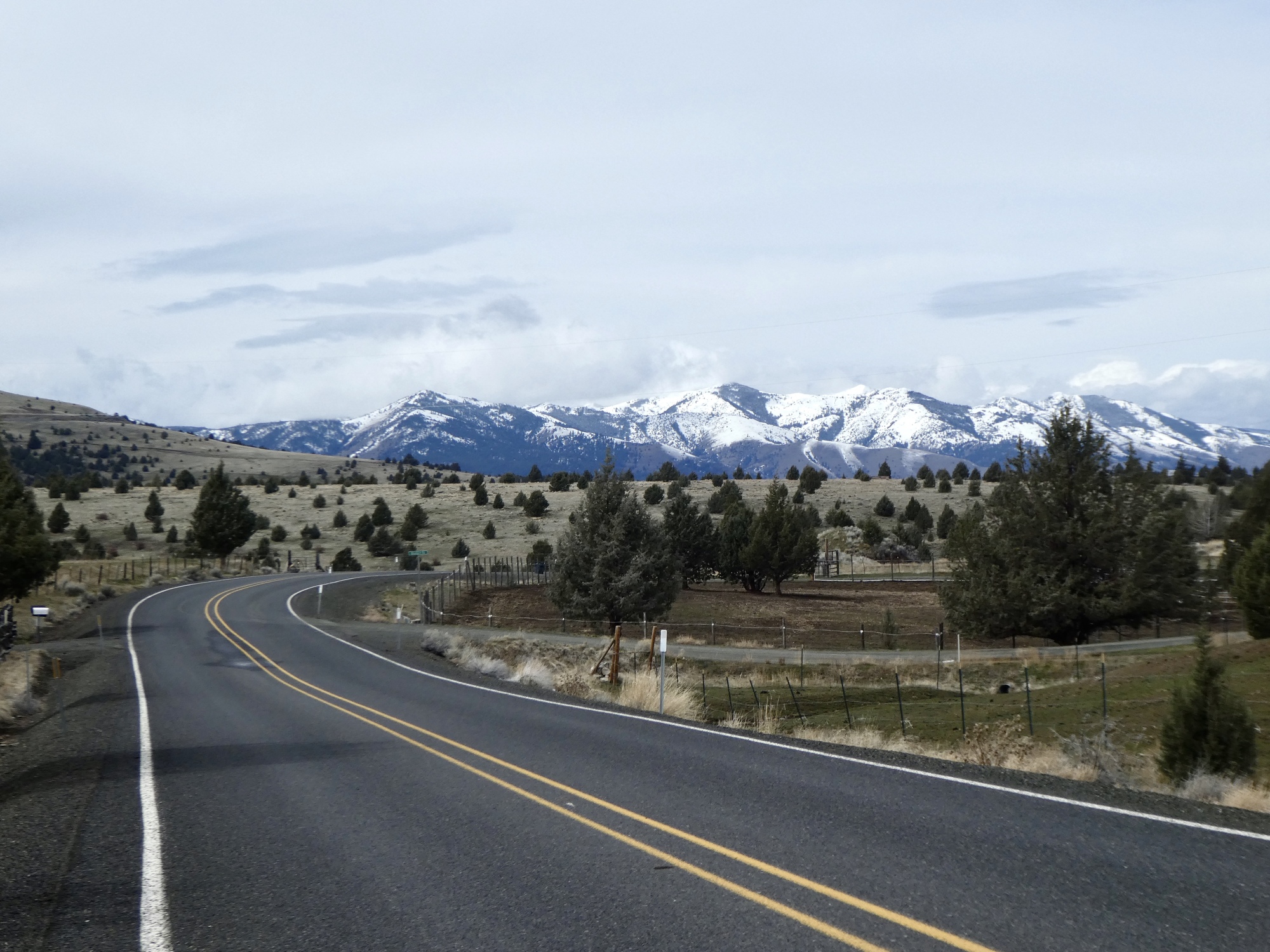
I walked up to the airport, in the same direction she went yesterday. Instead of looping back through Canyon Creek as she did though I continued on south and east, circling the airport before dropping back to the highway a bit west of town. It’s a beautiful, quiet loop: 8.1 miles, 800 feet of elevation, decently paved the whole way. It would make a nice training ride if you looped it a few times, or a decent course for a criterium.
It also makes for a beautiful walk, especially when you’re up on top around the regional airport. Very quiet roads, long views with mountains in the distance. I saw two other solitary hikers on top, and very few cars until I started descending toward the highway again.
There’s starting to be a bit more spring bird life too, but with it as open as it is most of the action is too far from the road to get a decent look. The first swallows are back, a vulture soars far overhead. I was excited to see a Stellar’s jay not far from the road and was just opening up the camera when a pickup drove past and scared it off.
And, I very nearly got a decent photo of a western meadowlark, Oregon’s State Bird. This is something I’ve been trying to capture for a long time. They’re quite elusive birds, and much less common than they were decades ago when there was more meadowland habitat to support them. They always remind me of my ride across southern Iowa and the Nebraska sand hills 45 years ago. They were still quite common, and I’d pass them all day long.
Today, they’re almost abundant up near the airport. I’ll hear their characteristic song in the distance, and as soon as I pass and the sound recedes behind me, I’ll hear the next one ahead. They keep their distance, from each other and from intruders like me - you hear them much more often than see them. Usually when I see one it’s flying away from me, its characteristic white outer tail feathers fanned out in a V, taking a few weak wing beats before gliding to a landing a safe distance away.
I’m in luck this morning though. One alit briefly on the top branch of a juniper tree not far off, and perched there for about a minute as the branch whipped around in the wind. I think if it hadn’t been so windy I might have gotten a clearer shot. Blurrier than I’d like, but I’ll include it here so you can see what a lovely species this is.
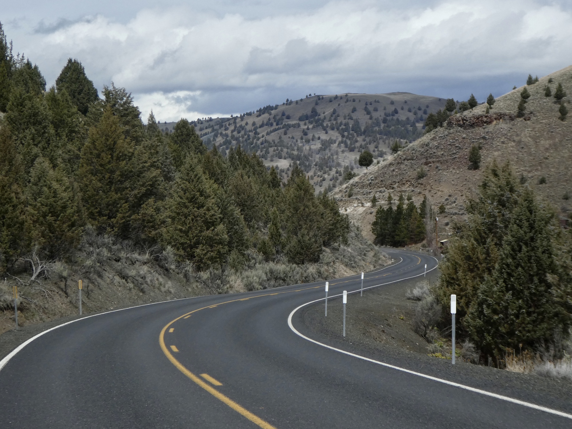
Climbing away from Canyon Creek, looking south. Canyon City is hidden, just around the bend.
The road up to the airport gives the best view of John Day. I made a video from this spot that I’ll post if we get to a spot with strong enough WiFi to upload it.
Juniper berries. From Wikipedia: “ A juniper berry is the female seed cone produced by the various species of junipers. It is not a true berry but a cone with unusually fleshy and merged scales, which gives it a berry-like appearance.“
This is an interesting road cut along the descent. I wonder what that highest bed is. It reminds me of the bauxite sample I had in my mineral kit as a child.
The song comes to us from an article in Oregon Live, the online version of The Oregonian. Not that climbing 600’ qualifies as a mountain, but it still seems like the best choice for today. It just makes me feel warm all over every time I watch it.
Rate this entry's writing
Heart
9
Comment on this entry
Comment
6
Gregory GarceauCall me a Rocky fan, but I think it's a testament to her intrepid spirit that she walked up and down something named "Dog Creek Road" only a few days after getting attacked by one of the local dogs. Reply to this comment 5 years ago
Andrea BrownPlease check for ticks after each hike. This is prime tick season and you are in prime tick country. Reply to this comment 5 years ago
Scott AndersonTo Andrea BrownOh, thank you for that. It wasn’t in my consciousness at all. In general we should be fine, because most of our ‘hikes’ are just walks on county roads; but we do stray off the path on occasion. Reply to this comment 5 years ago
Bruce LellmanDeer ticks are the ones that carry Lyme Disease and they are nearly invisible. The nymphs carry the disease as well and they are basically invisible to the naked eye. Avoid grasses and rock falls/scree. Mice live in the rocks and they carry the deer ticks as well. People think Lyme isn't a big deal in Oregon but it definitely is. Reply to this comment 5 years ago
Jen RahnLove that video! Have you seen the similar one with the Colorado Symphony:
Rachael AndersonTo Gregory GarceauI certainly wondered if I was tempting fate but I did zoom in on the satellite view to see if there were any houses close to the road that might have dogs. I also bought some pepper spray that I kept handy. Reply to this comment 5 years ago