December 7, 2020
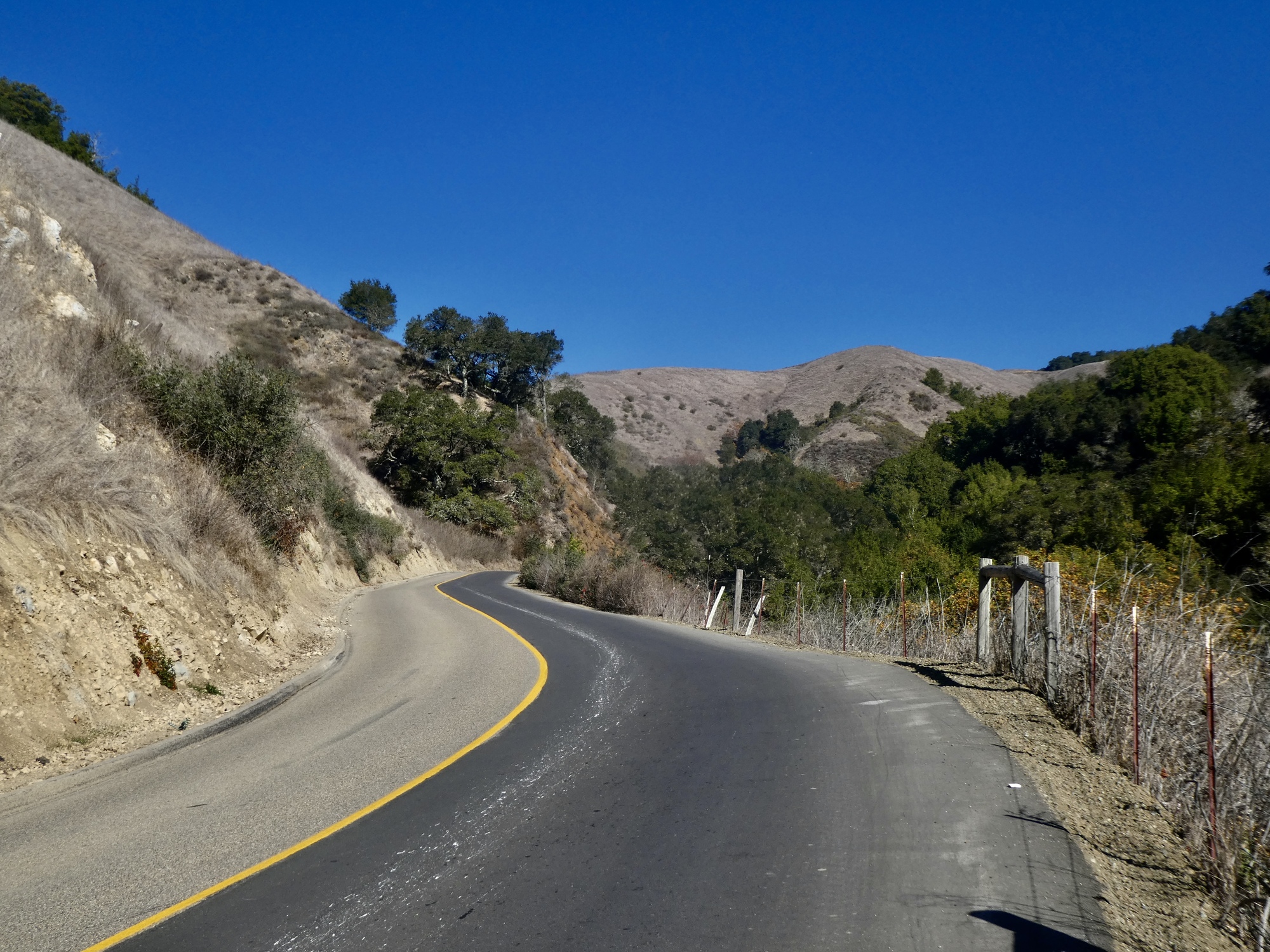
Old Creek Road
A long day today, a longer one tomorrow. We need to get to bed early tonight and get up early in the morning for the 400+ mile drive to Boulder City, our next base. There. I’ve spilled the beans, and you know what’s next for Team Anderson.
And besides that I seem to have thrown out my back a bit - at the moment it seems the worst I’ve done this for a long time. I don’t know what triggered it, but maybe I was careless shuffling our baggage around in our rushed evacuation two nights back. How well do you think that will pair with a 400 mile drive tomorrow? Not so well, is my guess.
So, besides being tired I don’t feel great and am out of sorts. Poor me. On the upside though: no fever, cough, or other Covid symptoms (other than a lack of sense of smell, but I never had one anyway). So I’m probably going to be uncomfortable for a while, but hopefully not leave the planet quite yet.
All of which means, as you’d expect, a slapdash post.
Rachael’s day
We went our separate ways today, taking a last chance at social distancing from each other before Rachael is stuck in the car with me for eight hours straight tomorrow. It’s the right time for this anyway - it’s very windy today, and Rachael would rather walk than bike in these conditions. She went on an epic hike - 13 and 1/2 miles, with 2,000+ feet of climbing - and came back quite worn out. She took a trek south of town up into the hills east of a Morro Bay State Park. Constant up and down, she complained/ bragged when we met up at day’s end.
I’m envious. I was tempted at the last minute to join her, but I would have just held her up - no way could I do a hike like that myself right now - and I had my own plans I was excited about anyway.

| Heart | 6 | Comment | 0 | Link |

| Heart | 4 | Comment | 0 | Link |

| Heart | 5 | Comment | 0 | Link |


Scott’s day
We briefly discussed who had the toughest day when we met up at the motel in late afternoon. We called it a draw, agreeing that we’re both awesomely tough but old enough that we should have known better.
I took the ride I was considering yesterday: a hilly loop that climbs inland from Cayucos up Old Creek Road to its end at highway 46 and then drops back along Santa Rosa Creek Road to the coast at Cambria. Starting from home as I did, those two roads plus the stretches on Highway 1 that connect them, add up to over 50 miles with over 5,000’ of climbing. For me, a full day. Biking my age in kilometers, as it happens.
And not the easiest climbing either. The ride summits out at almost 1,900’ and includes several long stretches at about 10%. And I was going the easy way, counterclockwise. The reverse direction, climbing up Santa Rosa, is significantly stiffer. The final two miles of the climb, a section the local riders affectionally call The Wall, climbs a thousand feet up an irregular slope with some stretches that must be in the 20% range. On an uneven surface, it was challenging enough riding down this stretch. I was glad I got my bike in for servicing and a brake adjustment back in Chico.
Oh, and there was the wind. Predominantly from the northeast, it was 10+ mph when I left early this AM, and 20+ by days end. Some gusts were strong enough that they nearly stopped me in my tracks, and left me struggling for control a bit. Frustratingly, the winds on the final 20 miles down the coast from Cambria were very erratic. I’d encouraged myself through the hills with the thought that I’d get blown down the coast at the end, but it was much more challenging than I’d been planning for.
Really though, it wasn’t that bad. I just like to whine and feel sorry for myself. A beautiful route, and I managed to ride the whole thing - except for the final third of a mile to the summit, which stiffened to maybe the 15% range. I considered powering through, but then remembered my physician’s advice to remember that I’m not a young lad of 60 any more, and not push myself too far.
It seems disrespectful not to heed professional advice like that, especially now. It seems sort of like refusing to wear a mask, don’t you think? Much smarter to walk that teeny bit and feel virtuous about it.

| Heart | 3 | Comment | 2 | Link |
3 years ago

| Heart | 5 | Comment | 4 | Link |
3 years ago
3 years ago
3 years ago

| Heart | 2 | Comment | 0 | Link |

| Heart | 2 | Comment | 0 | Link |


| Heart | 1 | Comment | 1 | Link |
| Heart | 2 | Comment | 0 | Link |

| Heart | 3 | Comment | 0 | Link |

| Heart | 3 | Comment | 0 | Link |

| Heart | 2 | Comment | 0 | Link |

| Heart | 3 | Comment | 2 | Link |
3 years ago
3 years ago

| Heart | 1 | Comment | 3 | Link |
California buckeye, to be picky... :-) Hulls of the buckeyes here in Ohio (and most everywhere else) are thicker and have thorn like projections.
http://plantid.net/RptOutput/California%20Buckeye%20(Aesculus%20californica)132519108496734399.pdf
3 years ago
3 years ago


| Heart | 5 | Comment | 0 | Link |

| Heart | 3 | Comment | 0 | Link |

| Heart | 2 | Comment | 3 | Link |
3 years ago

| Heart | 4 | Comment | 0 | Link |

| Heart | 7 | Comment | 0 | Link |

| Heart | 3 | Comment | 0 | Link |
Ride stats today: 51 miles, 5,100’ (Scott, solo); for the tour: 629 miles, 21,600’
Today's ride: 51 miles (82 km)
Total: 627 miles (1,009 km)
| Rate this entry's writing | Heart | 6 |
| Comment on this entry | Comment | 2 |
3 years ago