To Hawes - Three Seasons Around France: Summer - CycleBlaze

July 18, 2022

To Hawes

For some reason Rachael has started studying our upcoming routes lately, peering closely at elevation profiles and contour lines and comparing against routing solutions from Google Maps and Cycle Travel.  I’m not sure what that’s all about but it played out well for us today when she proposed an alternate to the one that I picked out, a route I came up with by marrying parts of NCN 71 and the Yorkshire Dales Cycle Route.  

She’s curious why I came up with this one that weighs in at 31 miles and almost 3,000’ of climbing when Google and Cycle Travel both propose this lower elevation alternative that’s six miles shorter with a thousand feet less climbing; and, if lying RideWith GPS is to be believed (and why should it?) hers doesn’t have any of those 15+% climbs mine comes with.

I point out that the NCN and YDC planners have probably scoped out the safest, quietest route, and the one she’s arguing for looks apt to be significantly busier.  And don’t we care about safety, btw?

She counters that on what looks likely to be the second hottest day of the summer we don’t need any extra miles or stinking steep hills.  With that, she wins.  I can’t take the heat any more, and wilt under the pressure. And it’s a good thing too, because in this heat it really does sound nice to have a shorter, easier ride; and I see now when I look more closely at my offering it really does have a terribly steep stretch that we’d both hate.

So the verdict?  We’ll soon discover that traffic isn’t bad, the route feels safe, and we make it into Hawes not long after one, before it starts heating up too seriously.

And, there will be the cows.

___________

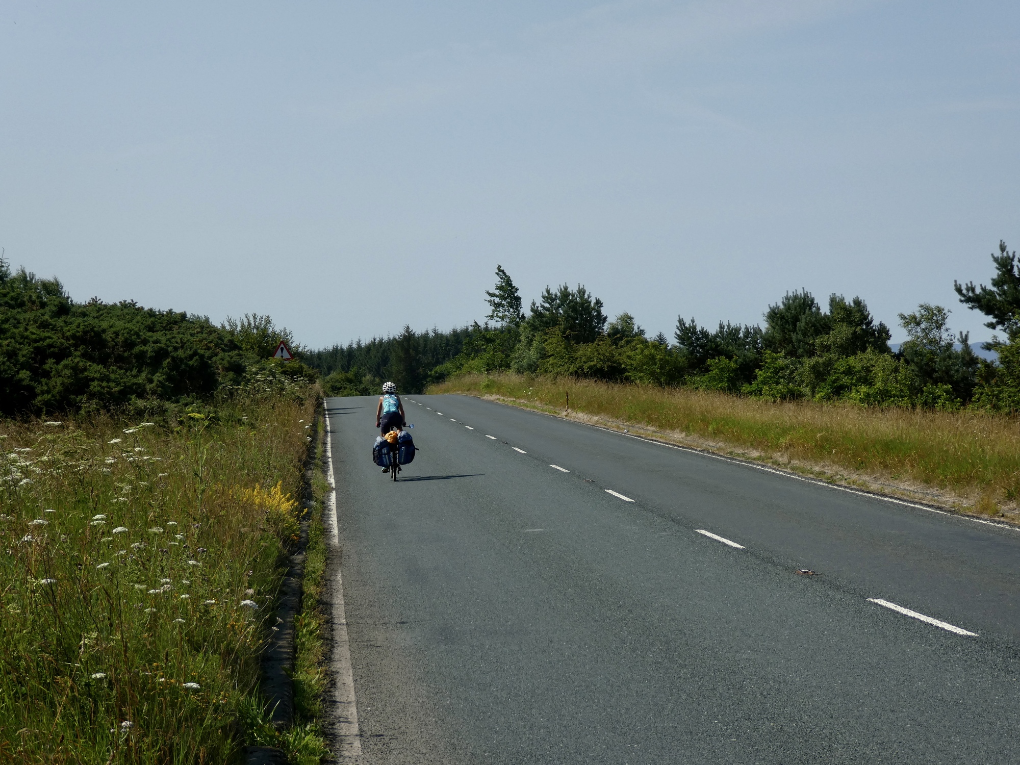
We’re on the road by 9:30, which is not the planned 9:00 departure we agreed to last night, Scott.  The ride begins the same as our day ride two days back did, with the same 16% drop to the Swale and 14% climb back out.  At least this time we turn west before reaching Sand Beck though and avoid the next +14/-14 couplet.

Leaving Richmond.
Heart 1 Comment 0
The day begins with something of a sustained climb, first along a pleasant wooded lane and then on this minor highway. Nothing bad, and doubtless we’d be hating the hillier alternate route by now had we foolishly gone that way instead.
Heart 2 Comment 0
Approaching the Yorkshire Dales. It looks like we have some interesting miles and days ahead.
Heart 2 Comment 0
Thanks, but no tanks. I’d rather take my chances with the hedgehogs.
Heart 3 Comment 1
Bruce LellmanI'd rather have bees.
Reply to this comment
1 year ago
About seven miles of today’s road look like this, although with more cars and trucks than we’re showing here. Safe and efficient, the right choice if you want to make time and aren’t so much into physical pain today.
Heart 0 Comment 0
Nope, no oysters here today! Let’s try our luck down by the shore.
Heart 3 Comment 0

We’re off A6108, the busiest highway of the day, after not much more than a mile of it.  Then we’ve got several miles on quieter secondary roads with the quaint names of Scarth Nick and Sissy Bank that seduce you into thinking they’ll be quieter than they really are.  After a few more miles of that we finally branch off onto a really quiet road, and then an even quieter one that’s gated and looks like it would be private but isn’t.  Rachael is distrustful of this one, fearing that it will deteriorate into a gravelly torture fest on a hot day; but it’s brilliant, the best miles of the ride.  And there are cows!

More like it! Along about Redmire we leave the highway and enjoy fine, quiet roads most of the rest of the way to Hawes.
Heart 3 Comment 0
Consider ourselves warned. We don’t see anything against trespassing though, so we cinch up our courage and proceed.
Heart 2 Comment 0
Yup. Just what we were warned about. Definitely cows up there.
Heart 3 Comment 0
Rachael holds back and let’s me go first. I approach cautiously, whistling Streets of Laredo, hoping they’ll find it calming and unthreatening. Seems to work OK.
Heart 3 Comment 5
marilyn swettIt's not the cows that bother us but the little brown splat they leave behind!
Reply to this comment
1 year ago
Scott AndersonTo marilyn swettNo big deal. Just watch your step. The Paul Simon song Slip sliding’ Away does come to mind though.
Reply to this comment
1 year ago
Kathleen JonesBJ and I are still laughing about Streets of Laredo. Situational singing.
Reply to this comment
1 year ago
Scott AndersonTo Kathleen JonesI can recommend it. Practice it in case you find yourself in a similar situation. I hear they have cows down your way too.
Reply to this comment
1 year ago
Jacquie GaudetAt least they didn't have wide pointy horns!
Reply to this comment
1 year ago
Except for this stubborn lady who takes her sweet time before grudgingly easing off the path.
Heart 5 Comment 0
The cows in our rear view mirrors, we have smooth sailing the rest of the way to Hawes. Ahead is Bolton Castle.
Heart 2 Comment 0
Approaching Bolton Castle, and the village of Castle Bolton.
Heart 3 Comment 0
Bolton Castle, completed in 1399, is one of the best preserved medieval castles in England. Built as a fortified personal residence by the first Baron Scrope of Bolton, it’s still owned by his descendants. Mary Queen of Scots was imprisoned here for six months.
Heart 4 Comment 0

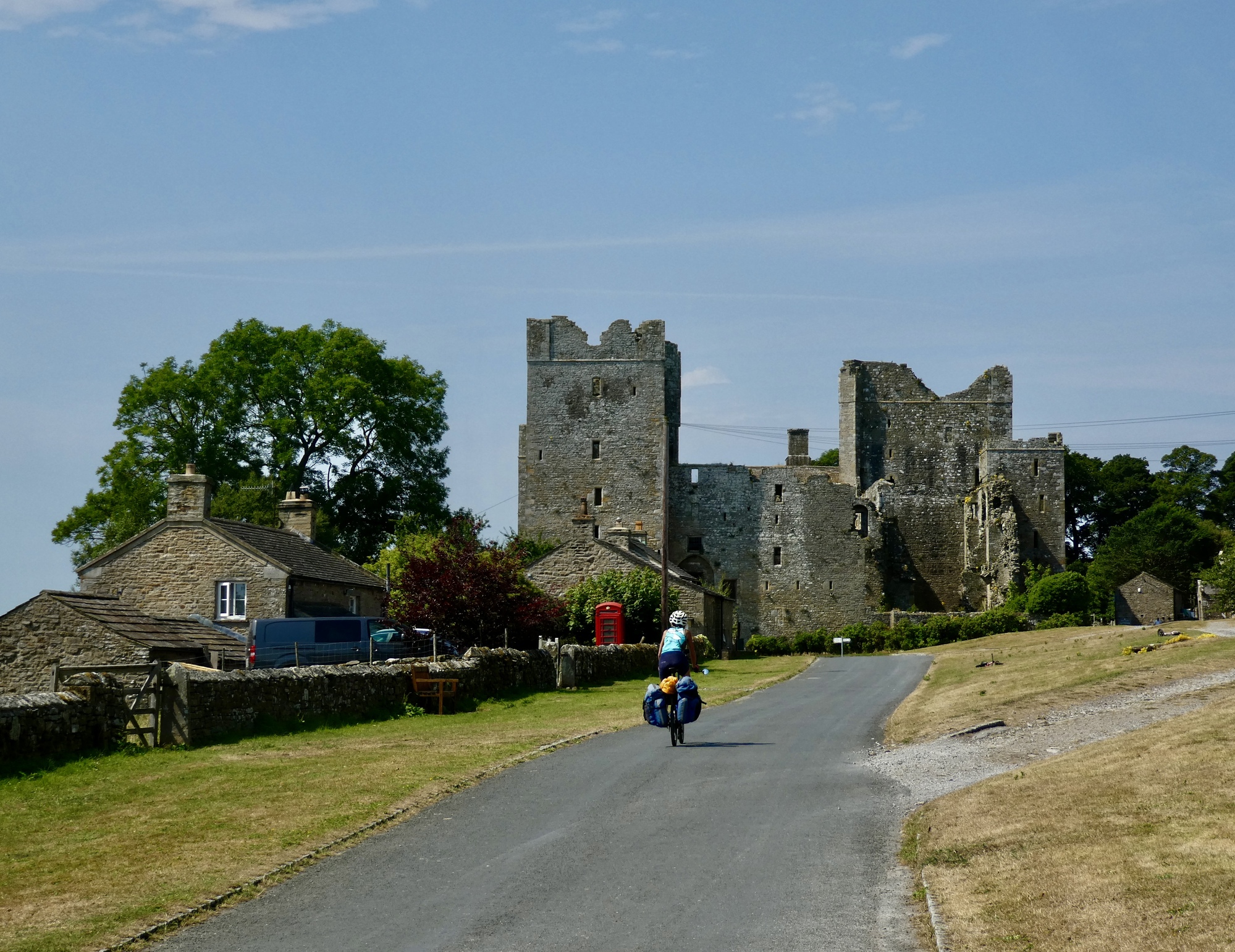
The last few miles into Hawes are a bit like riding the blade of a cross cut saw, as we climb and then drop across a series of four or five short spikes.  Nothing serious, but the day is warming up and we’re ready to get off the road by the time we reach touristy Hawes.  We’re happy to see that the street is lined with bars and ice cream stops, and head straight across the street for huge double wide ice cream servings as soon as we’ve left off our bikes and changed clothes at our inn.

We’ll be in Hawes for three nights, giving us a chance to see something of the National Park if the weather permits.  Tomorrow is slated to be the hottest day in recorded history in England, and the day after that temps are due to drop 25 degrees and usher in some rain, so we’ll see what happens.

Ratcheting our way down the road to Hawes across a series of low rises. The mesa-like formation ahead is the Height of Hazely, a prominent lump we’ve been tracking in the distance for the last ten miles.
Heart 2 Comment 0
On Long Shaw Road.
Heart 2 Comment 0
These blocky stone barns are characteristic here. We’ll see dozens of them before leaving the area.
Heart 5 Comment 0
Hawes is still a mile or two off now. We’ve been within the Yorkshire Dales National Park for most of the day’s ride.
Heart 4 Comment 0

Video sound track: Juvenescence, by Yasmin Williams

Hawes is maybe the most important town in the national park, so we shouldn’t have been surprised at how touristy and busy it is.
Heart 2 Comment 0
Heart 0 Comment 0

Ride stats today: 25 miles, 2,200’; for the tour: 1,139 miles, 51,600’

Today's ride: 25 miles (40 km)
Total: 1,139 miles (1,833 km)

Rate this entry's writing Heart 8
Comment on this entry Comment 8
David MathersTake care in the extremely hot weather. I see the Tour de France riders are wearing cooling vests pre and post rides, ice on the back of their necks and some even put ice in their socks!
Reply to this comment
1 year ago
Scott AndersonTo David MathersThanks, Dave. I’ve been worried about those poor TDF riders. We’re fine though. We’re just north of the worst of it and it ‘only’ hit 95 here today, which is still pretty unprecedented for the Yorkshire Dales. We beat the heat today, getting out the door at 5:30 and getting back before it got too warm. It’s all passing as we speak though and it’s quite comfortable this evening.
Reply to this comment
1 year ago
Carolyn van HoeveHey Scott & Rachael!
Glad you're where you are right now and not in south west France. Your itinerary is working out well. Meanwhile I'm having fun plotting our tour in September including some of your great suggestions. Stay cool and try to avoid those 15%+ climbs!
Reply to this comment
1 year ago
Ben ParkePlotaroute and Garmin connect are two other routing options you could look into. Plotaroute overestimates election gain, but may do well for examining routing options. Garmin connect seems more accurate for elevation estimates but isn’t quite as good about showing actual cycle paths. The best mapping option may actually be the mapping service through Strava, but they charge for that now.
Reply to this comment
1 year ago
Graham FinchHave you tried the Black Sheep beer yet? I think you'll approve.
Reply to this comment
1 year ago
Scott AndersonTo Graham FinchI’ve seen bottles of it in coolers and have been tempted just by the name - another label named for the likes of me. I’ll check it out.
Reply to this comment
1 year ago
Scott AndersonTo Ben ParkeThanks for the tip. We haven’t experimented with either of these and will check them out.
Reply to this comment
1 year ago
Patrick O'HaraKeep cool out there. Nice shots today. Sue and I are cutting our time at our un-airconditioned room in Bolzano short. We're headed for an air conditioned room in Trento. After re-reading your journal about your Adige experience, we are looking forward to the cycle path, and, of course at flat ride!
Reply to this comment
1 year ago