May 17, 2016
White Gold: km1301 to Antofagasta.
Not having a cycle-computer, many of which measure altitude, I have no way of telling what altitude I'm at here. But since leaving the coast and, having looking at the google map, my only map, the Pan Americana (route 5) goes a good way inland into the Andes, gaining altitude all the way. I feel it as soon as I unzip the sleeping bag in the morning. The air's frosty. And it can only get colder ahead when my way takes me across the Andes Altoplano (high plateau), where from previous experience, it can feel colder than even Norway. Today however is all downhill, back to the coast.
| Heart | 0 | Comment | 0 | Link |
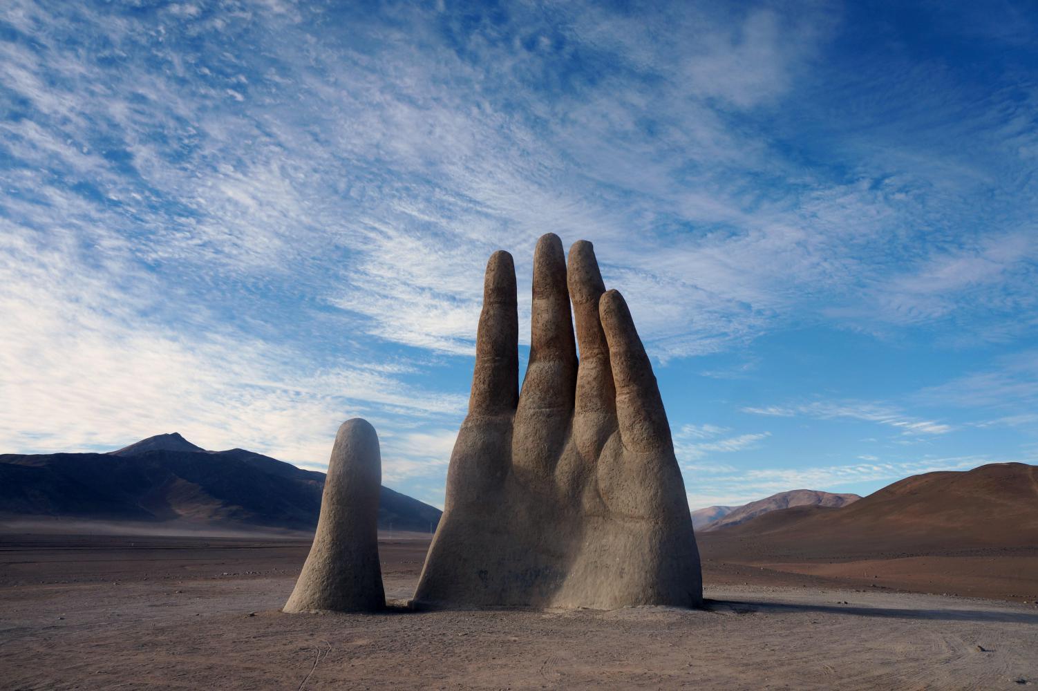
I hadn't realised the sculpture "El Mano Del Deiserto" (the hand of the desert) is only six kilometres on from the old mine I'd camped by, otherwise, I would've pressed on to it and camped within walking distance of it. Only, it may have been nice to photograph the sculpture at sunset. I have to make do with the morning light when I ride off up the unpaved access road. There's just one car there; its occupants remaining inside, which is good as I can get a photo with the background empty of people. I think the people in the car had the same thing in mind: they didn't want me to the side, so waited until I took mine and left.
Further on can be seen a thick band of fog as the road is a constant steady descent, barely noticeable as a downhill, except the kilometre marker-boards are pasting rapidly as I easily spin a big gear. And the fog looks to be ahead, rather than in reality filling the valley below.
Soon I reach the valley, which continues out to the coast from whence the fog has rolled in. There's a left turnoff here to the coast as the road swings right and before long the tan hued hills to the side disappear in the fog and I'm engulfed in a fine drizzle with visibility down to a hundred metres or so. My glasses are impossible to see through with the fine beads of water, so I resort to looking over the top of them in order to see where I'm going. For another hour I'm riding in this dismal grey until visibility slowly increases to the point where the hills to the side reappear, though faint in the grey light.
Then I see the white columns of steam from some sort of industrial plant, which I soon reach; it follows the left side of the road for a bit, some kind of mining refining works as there's tipper-trucks from mines queued up inside. The heart of the plant looks like a giant truck engine with filthy exhaust manifold and low pipes pumping out steam.
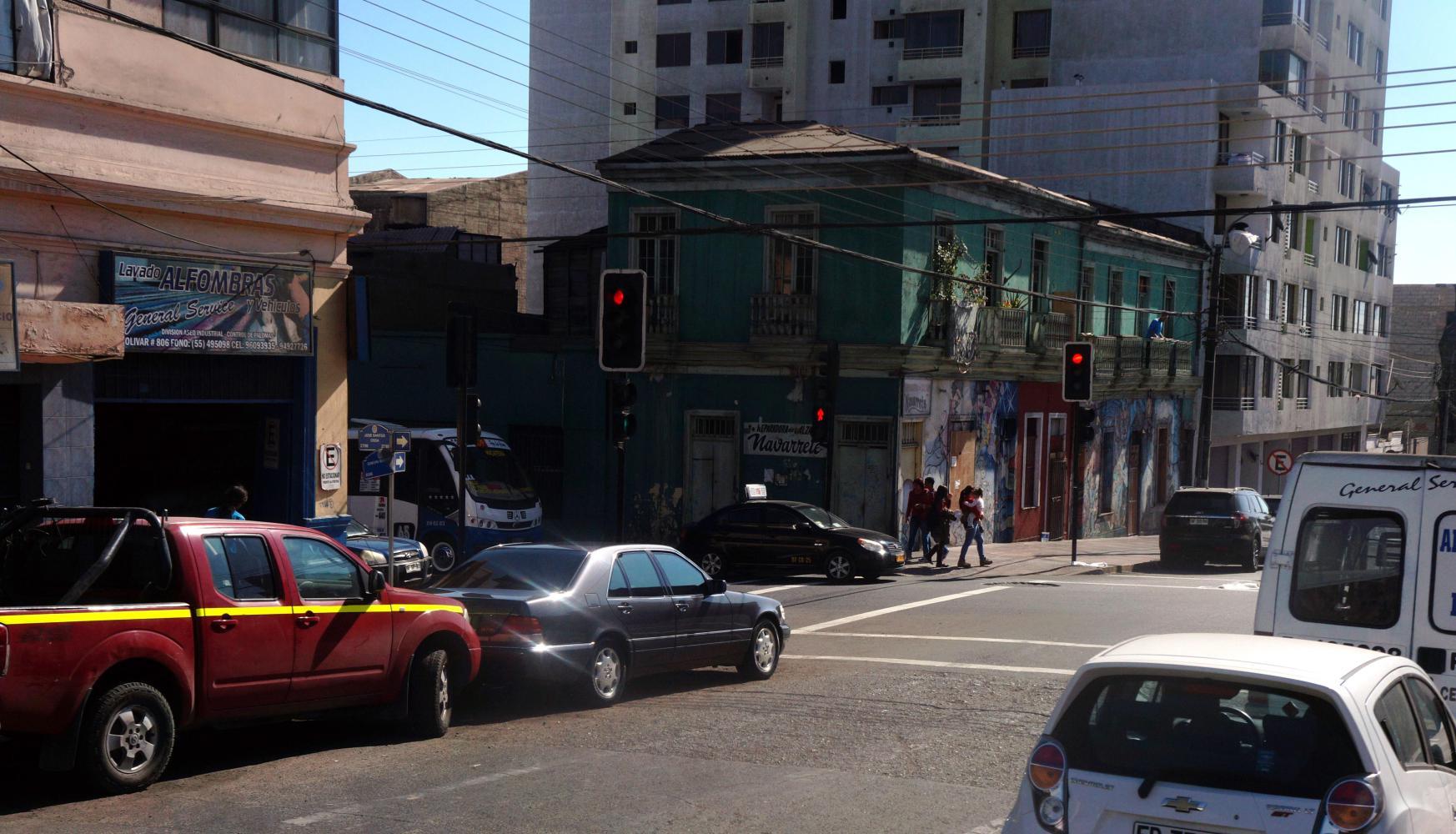
It is the start of a large route 5 service area, with Shell, Copec and Petrobras petrol stations, many roadside restaurants etc: there's also a cement factory and a mine on the hillside behind. On the map its called "La Negra". And there's a motorway style junction with a sign for Antofagasta. A slip-road taking me off and over 5 onto a route R28, going toward the hills on the left. A dual-carriageway and another 16km on the signboard to Antofagasta, which turn out a constant downhill through a narrow valley in said hills to the coast in the southern outskirts of the city.
| Heart | 0 | Comment | 0 | Link |
| Heart | 0 | Comment | 0 | Link |
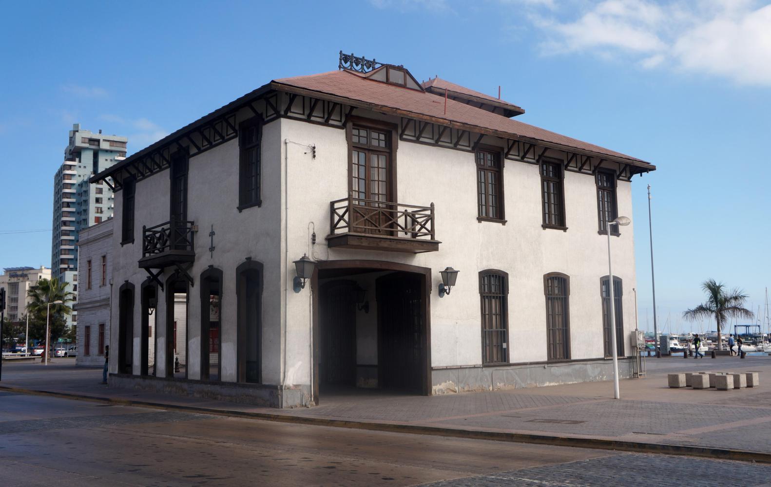
With a handful of leaflets including a city-map from the tourist information office in the city centre plaza (one with a simple but useful map of the whole Antofagasta region, useful as a reference for my route ahead) and a list of hotels and hostels with prices, I head first to a hostel a block away. I'm shown by the woman of the house a dim windowless room like a prison cell, which she wants 10,000 pesos for (£10). I say I'll keep looking and head for the next nearest. A place calling itself a hostel too, but in Spanish speaking countries, hostels often mean cheap hotel, not a backpackers or such; anyway, cheap hotel often means much dearer than the latter named. The woman who was busy cleaning shows me a single room with en-suit bathroom, nothing special, but there's a window and the room opens out into an outdoor courtyard making it less claustrophobic than the first. The price is 15,000 a night, almost double a backpackers, though I bite the bullet and pay for two nights, knowing I make up for this expense with many nights free camping.
-----
Wednesday, I'm having a well needed rest day; a lay in and with wifi, I get stuck into the humdrum task of editing and uploading photos to journal. This is the one journal associated jobs I loath like watching paint dry. Though in the long run, months and years down the line, I appreciate having the photos to look through.
I catch up on writing sat outside a café on the main pedestrianised street. The rest of the morning I hope to have a look in the city museum, which is free.
___________Later.
So I've been to the museum, passing a couple of hours. I went through the ancient stuff quickly, as it is very much speculation. Then post Spanish conquest, the colonial era where this area, the Atacama desert had been crossed by Pedro Valdivia. He who founded Santiago, and thereby modern Chile. The Atacama however, was near enough untouched by the Spanish because of its inhospitable environment. Not until the post-colonial 19th century and industrial revolution, which in Chile is largely to do with Saltpeter mining in the North, did non-indigenous people, mainly from Europe, come to live in the Atacama.
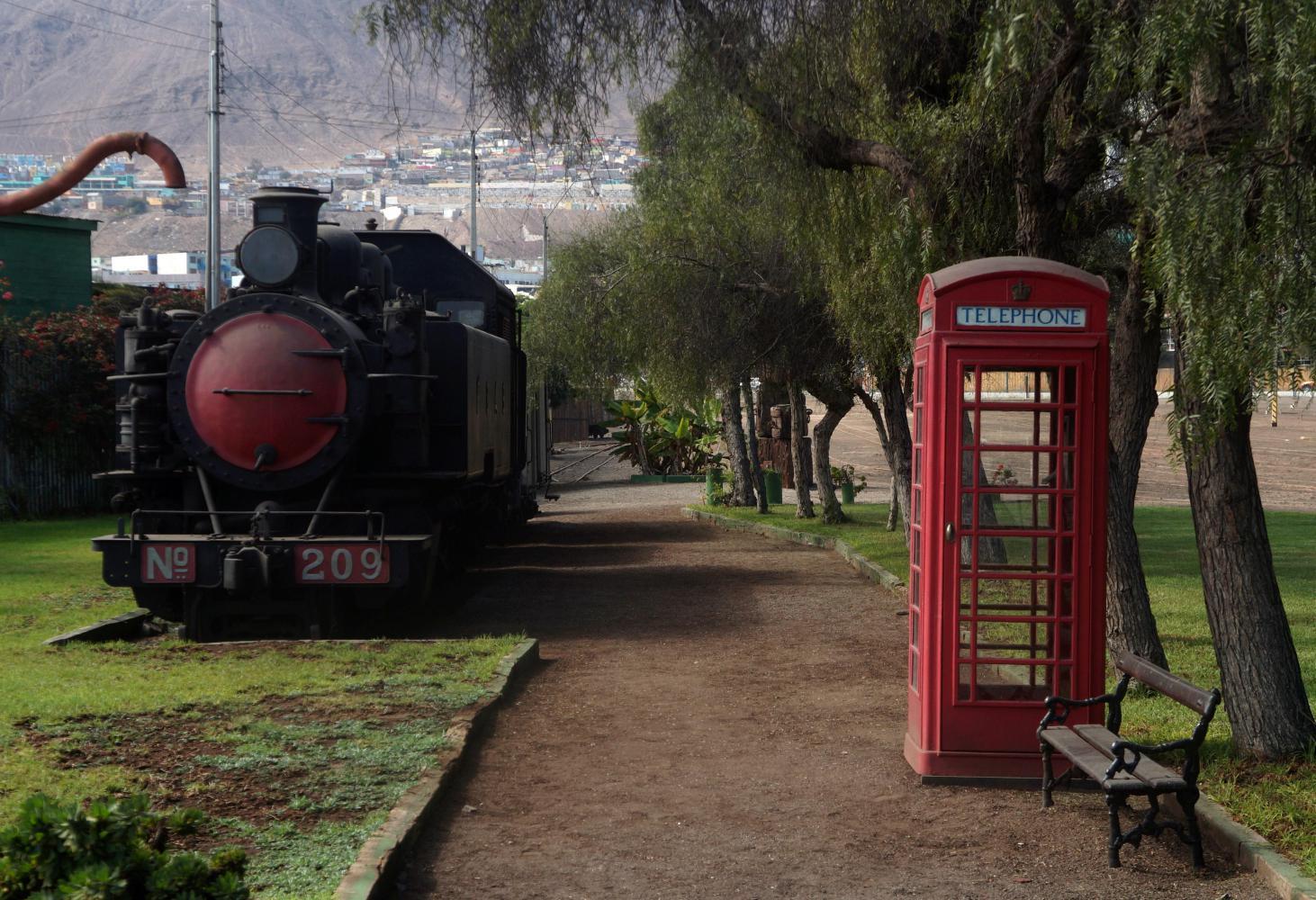
Saltpeter, or nitrate was the raw material used in the firing of weaponry and found in abundance in the desert here. However it wasn't possible to fully exploit before, not until the technology of steam trains. Antofagasta was therefore founded in 1869, by the then president of Bolivia, when this northern part of Chile was part of Bolivia, until the "War of the Pacific" (Chile against Bolivia and Peru in 1879) as a port city to access the rich nitrate deposits in the interior, or "White Gold" as it was known.
The principal actors is the British. Once the Spanish left, the new South American republics, have become somewhere between business partners and defacto British colonies, through monopolization of resources, key being the railway companies, making the logistics of moving building materials for houses, mining tools and equipment (coal to drive steam driven mills for refining the nitrate) and personal into the interior, or nitrate pampa, as they've become known; also, moving the nitrate to the port for shipment, there being no overland route at this time, so Antofagasta become the link to the rest of Chile and the world beyond.
The main thing that makes this period in history accessible is photographs. Old monotone photos of the city in the late 19th century. I am struck by a picture of a man on a horse drawing a big barrel of water, which was another hurdle to be overcome. Stream locomotives alone use a lot of water and had soon monopolized what little water there was. Early houses build of wood in Antofagasta for instance, caught fire and there wasn't water to put the fire out. And so desalination plants are built and a fire corp soon established. Even today a lot of the trucks on the road are tankers drawing water.
The museum also shows in photographs the streets and the different immigrant groups. As well as ethnic Chileans, British, French, Italian and Croatian, there was also a sizeable Chinese community making up the early city's mix.
Today's ride: 77 km (48 miles)
Total: 9,974 km (6,194 miles)
| Rate this entry's writing | Heart | 0 |
| Comment on this entry | Comment | 0 |