June 4, 2023
Day 21 - ending near Ferris, OK
| Heart | 0 | Comment | 0 | Link |
This morning it was raining when I got up at 5:15am. Rain was off and on until mid-morning. Ate the rest of my strawberry fig bars as I worked on the yesterday's report. Started packing at 10:49am. Still couldn't find any way to make the $16 payment for last night's stay, so I'll mail that in when I get home.
Today's planned destination is McGee Creek State Park near Ferris, Oklahoma. With such a late start and being somewhat wet, I was thinking maybe I'll find a motel in Antlers instead. It looks like a big enough town on my map to have a few motels. But first I was thinking more about getting to Clayton for breakfast, well I guess it would be lunch.
Left the campground at 12:07pm for the 4 miles to Clayton. What a surprise that it was all downhill. I arrived at Mama's Kitchen at 12:35pm. I went with their all-you-can-eat buffet. Dessert was an extra charge, and I had red velvet cake for that. Left there at 1:41pm, stopping a short time later at Choctaw County Market for ice.
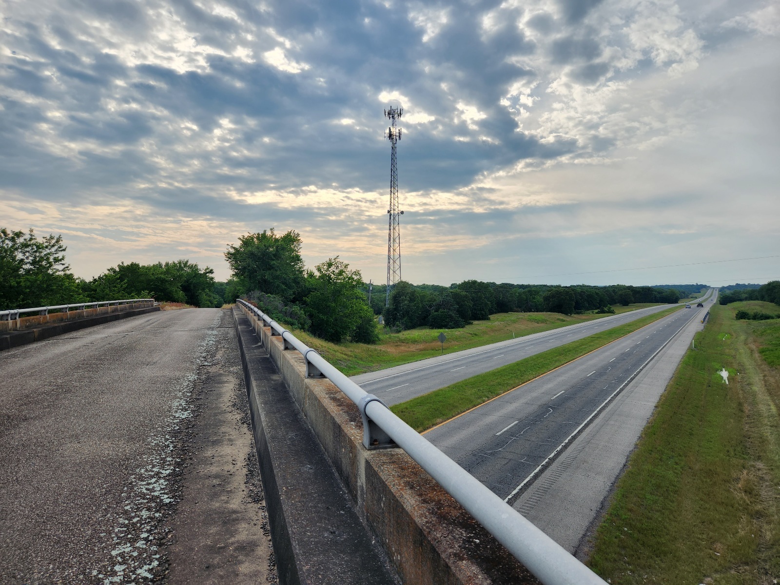
At 1:56pm I made a left turn onto OK-2, the highway to Antlers. There was a good enough shoulder along this highway and not too many vehicles. Bluffs on both sides but the road was mostly downhill it seemed. Passed little towns along the way, but they were no more than signposts at the side of the road.
I've noticed for the last day or so that cemeteries in this area often have a pavilion for services at the cemetery. One of those pavilions I passed today even had pews.
I arrived in Moyers about 5:15pm. I stopped to call some motels in Antlers. The first one wouldn't let me to keep my bike in the room, and the second one had me leave my number and they'd call back, but they never did. My pre-trip plan had waypoints heading west on back roads from Moyers to get to McGee Creek State Park, about 15 miles from here. Maybe I could make it to the state park before it got too dark. Two gals in a pickup truck pulled up and offered me water. I said I had some, but thanks, and I was stopped just trying to make a decision on which way to go.
Finally, I turned west toward the state park. I wasn't too far along when I was glad I made this choice, for the roads were in good shape and very scenic. One of the roads was going to take me over the Indian Nation Turnpike. As I got close, my phone reconnected with the network, so I stopped to load pictures and get yesterday's report posted.
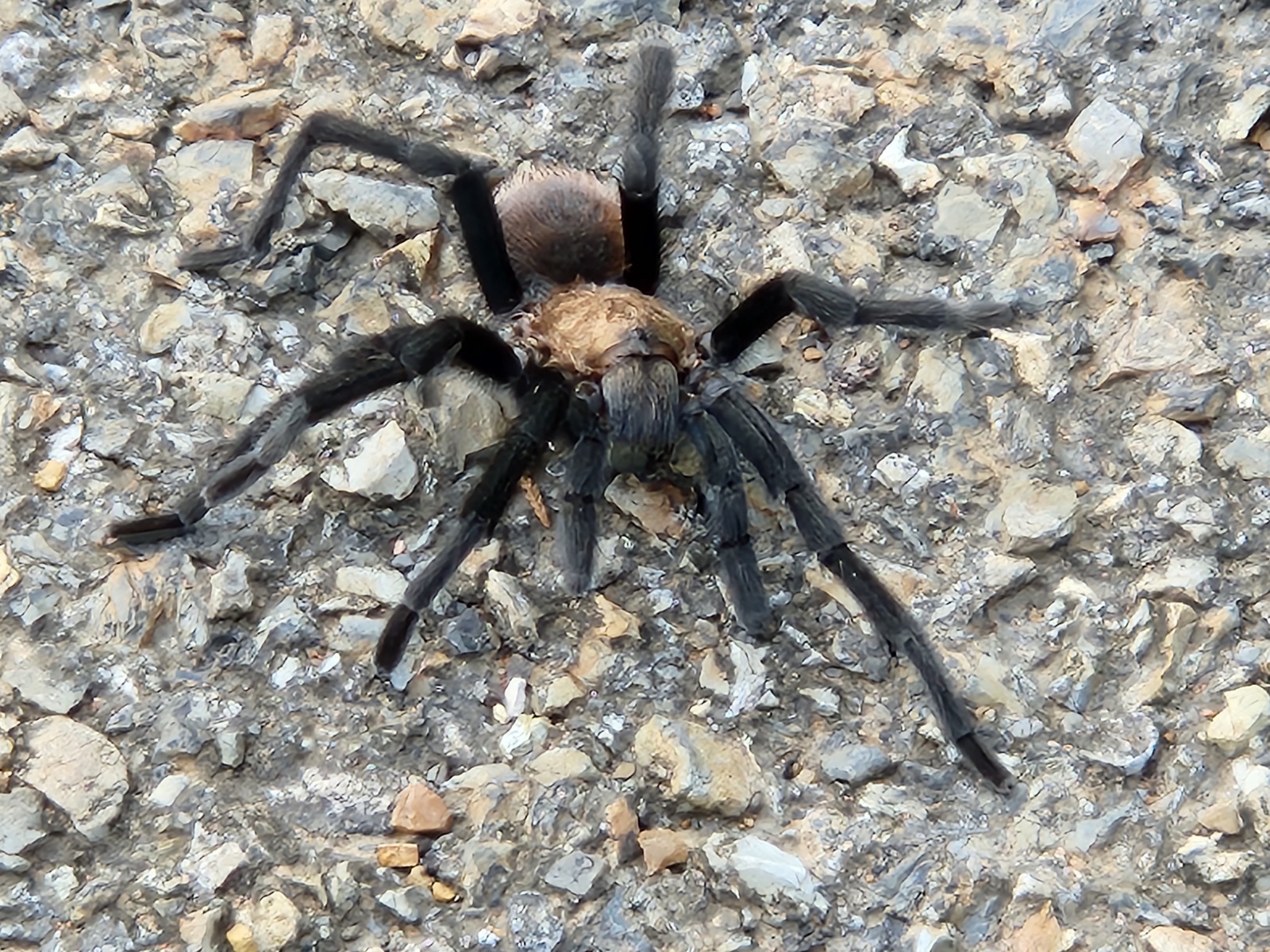
Back riding, I rode past a big spider sitting in the middle of the road. Just then a pickup truck approached from the opposite direction I was going, and I thought, "Oh no, he's going to run over my photo op." He missed it by 6 inches! I was moving the camera in real close to get a clear picture, but the spider didn't like that, so I backed off and used the digital zoom.
There are a few uphills on this route and several downhills. I was enjoying it. Dogs were coming out to greet me from time to time, but that wasn't a problem.
No good sunset picture this evening - there were too many clouds in the western sky.
Around sunset I made it to the Park Office - closed of course. Proceeded on north across the dam and to the first campground - Buster Hight Area. I was hoping to get a site with electricity tonight. I made it to the RV area, but a sign there said sites must be reserved online with RV.OKparks.com before occupying. I had no cell signal so that wasn't going to work. It also made me wonder if tents were allowed in the "RV area". I rode back to a non-electric tent site area I'd passed and chose Site #10 there at 9:10pm. It was dark now so I used my headlamp to get the tent set up. All done with that at 9:50pm. Turned my light out at 10:35pm.
Jeff
Spent: $17.40 plus $5 (lunch) + $0.55 (ice) + $16 (campsite) = $38.95


| Heart | 1 | Comment | 1 | Link |
https://www.inaturalist.org/taxa/49342-Castilleja-coccinea
2 years ago


| Heart | 3 | Comment | 1 | Link |
https://www.inaturalist.org/taxa/10224-Passerina-ciris/browse_photos
2 years ago
| Heart | 2 | Comment | 5 | Link |
https://www.inaturalist.org/taxa/120596-Aphonopelma-hentzi
2 years ago
I wondered if it was a tarantula. It's the first one I've ever seen in the wild. I guess I'm further south and west than I realized.
Thanks for the identification.
Jeff
2 years ago
| Heart | 0 | Comment | 2 | Link |
Two roads diverged in [Arkansas], and I -
I took the one less traveled by,
And that has made all the difference.
2 years ago


Today's ride: 51 miles (82 km)
Total: 883 miles (1,421 km)
| Rate this entry's writing | Heart | 6 |
| Comment on this entry | Comment | 0 |