May 21, 2020
The Harrison & Medimont loops
Yesterday
Yesterday was rained out. Wet and windy most of the day, it was one we were content to sit out, reading books and catching up on sleep a bit. Not much to pass on here, other than a book report: They Came Like Swallows, by William Maxwell. If you’re not familiar with Maxwell, he was an American writer primarily from the mid-20th century. He was the fiction editor for the New Yorker for 40 years. His best known work, So Long, See You Tomorrow, won the National Book Award.
Thirty or forty years ago I was quite taken by his novels, but had more or less forgotten about him until coming across a reference to They Came like Swallows in an article about writing influenced by the Spanish Flu. Maxwell barely survived the Spanish Flu in his childhood when it ravaged his family, and his childhood experience is the central theme of the novel. I’d read the the book before, but it was certainly a much different experience reading it in these times.
The Harrison Loop
It’s expected to stay dry today, but cold and windy. It doesn’t make much sense to invest too much in a ride that we might wish to shorten anyway, so we pick an option that starts from home. We have two choices I’ve mapped out, other than of course just hopping on the CDA Trail again: a 32 mile ride that includes a loop away from the lake south of Harrison; and a longer extension of this ride, that continues further east to Medimont.
Rachael has really been struggling with allergy symptoms lately, and windy days really exacerbate them and bring her difficulty with breathing. She likes the idea of a ride that she can start from home and just double back if she’s suffering too much; and in any case, she’s sure she doesn’t want to spring for a 47 mile ride today in any case. I’m not sure I do either, so we start out together on the shorter of the two rides, not certain how the day will end up.
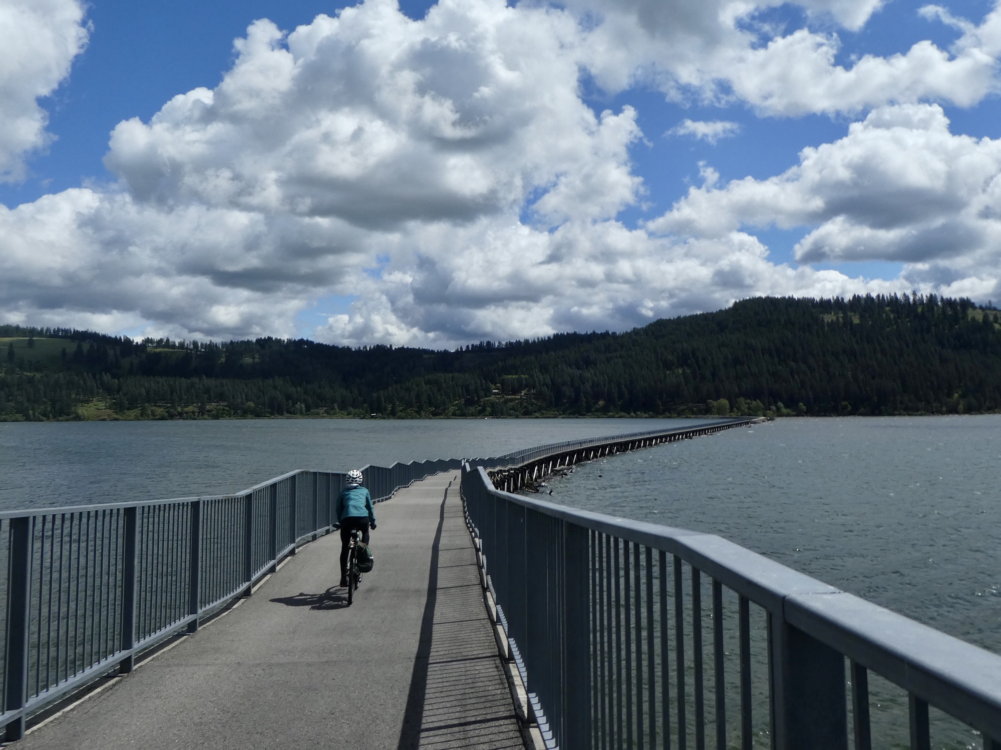
The ride starts on the CDA, as we cross the bridge and ride the 8 miles north to Harrison. This is the third time we’ve ridden this stretch, so we don’t have anything new to say about it - except that there’s a strong crosswind as we bike across the bridge this morning, strong enough so that the bridge sings to us as we cycle along.
| Heart | 3 | Comment | 0 | Link |

| Heart | 1 | Comment | 1 | Link |
On the other hand, it's not a Pratt truss (with all diagonal members slanting down towards the centre) but it is a through truss.
5 years ago
At Harrison, we completely double back south on quiet O’Gara Road. Looking at the map, you have to really zoom in to see that we aren’t completely backtracking here. For about four miles O‘Gara Road parallels the bike path, barely fifty feet away and thirty feet above it. Finally it breaks away from the trail and lake and follows a small unnamed creek uphill for a few miles before topping out on a slender plateau between Chatcolet Lake and the Coeur d’Alene Valley.
We take stock at the top, and then separate. As planned, Rachael turns left and drops back down to Harrison along Route 97. When she reaches Harrison she turns east on the CDA and following it for five miles before turning back toward home. Most of today’s video is from her ride down 97, which I won’t see otherwise myself because I’m off for the longer ride, east to Medimont.

| Heart | 1 | Comment | 0 | Link |

| Heart | 2 | Comment | 0 | Link |

| Heart | 2 | Comment | 0 | Link |

| Heart | 1 | Comment | 0 | Link |
Video sound track: The Craftsman, by Eric Tingstad
The Medimont Loop
From the junction, I turn south on 97 and then shortly after leave it to follow Route 3 northeast to Medimont. It’s just as well Rachael didn’t come with me on this route, because I don’t think she’d have cared for it much. Route 3 is a narrow 2 lane road and a bit busy - it’s a through road that continues on to Rose Lake and then I-90. It’s not too bad today, when traffic volumes are so low anyway; but I don’t know that I’d ride it again. And I definitely wouldn’t ride it going the other direction. Going my way, it’s mostly a fast downhill drop to the river. Fine, as long as I’m paying attention.
Seven miles later and I’m back on the CDA Trail again, at the trailhead just west of Medimont. Before I get there though I find an attractive spot by the lake to stop, enjoy the views, and enjoy the leftover pizza from yesterday’s lunch in Saint Maries. Did I forget to mention that we drove in to Saint Maries for lunch yesterday, as a way to break up the rained out day?

| Heart | 1 | Comment | 0 | Link |

| Heart | 2 | Comment | 0 | Link |


| Heart | 2 | Comment | 1 | Link |
5 years ago


| Heart | 3 | Comment | 2 | Link |
With that leg wound you have, you could be the protagonist!
Despite injury and misfortune, a cyclist and his partner find great wealth in a country paralyzed by a tiny little microorganism.
5 years ago

| Heart | 4 | Comment | 0 | Link |


| Heart | 3 | Comment | 2 | Link |
5 years ago
The ride home from here is a three-peat, most recently on my birthday ride. It’s nice to not hear any thunder rumbling above me, but today I’ve got a pretty fair headwind pushing back at me most of the way home. Rounding the bend south of Harrison, the skies suddenly turn quite dark ahead; and for a mile or two it looks like I’m going to get doused again, thunder or no. There is a light sprinkle, but it doesn’t last long though; and for the last two miles I’m thankfully back in the sun once more. Crossing the bridge again the wind is still fierce, and the bridge sings. I don’t have much of an ear, so I don’t know what the pitch is. I’m tempted to stop and take a video so you can hear for yourself but I’m more tempted to get home and breakout an IPA.


| Heart | 1 | Comment | 0 | Link |

| Heart | 2 | Comment | 0 | Link |

| Heart | 1 | Comment | 0 | Link |


| Heart | 1 | Comment | 0 | Link |

| Heart | 1 | Comment | 0 | Link |
Ride stats today: Scott: 47 miles, 2,000’; Rachael: 42 miles, 1,800’
| Rate this entry's writing | Heart | 7 |
| Comment on this entry | Comment | 0 |