January 29, 2023
The Phoneline Trail
It’s Sunday, so nothing will happen with the expired medication problem today because I have to involve Kaiser to get their authorization for an emergency prescription refill down here. So even though it’s the warmest day we’ve seen in nearly a month a strenuous bike ride is off the table for today. On the agenda instead is a hike somewhere, preferably an out and back that’s not too challenging - something I can walk for as long as it’s working for me, and that Rachael can continue on beyond and pick me up on her way back.
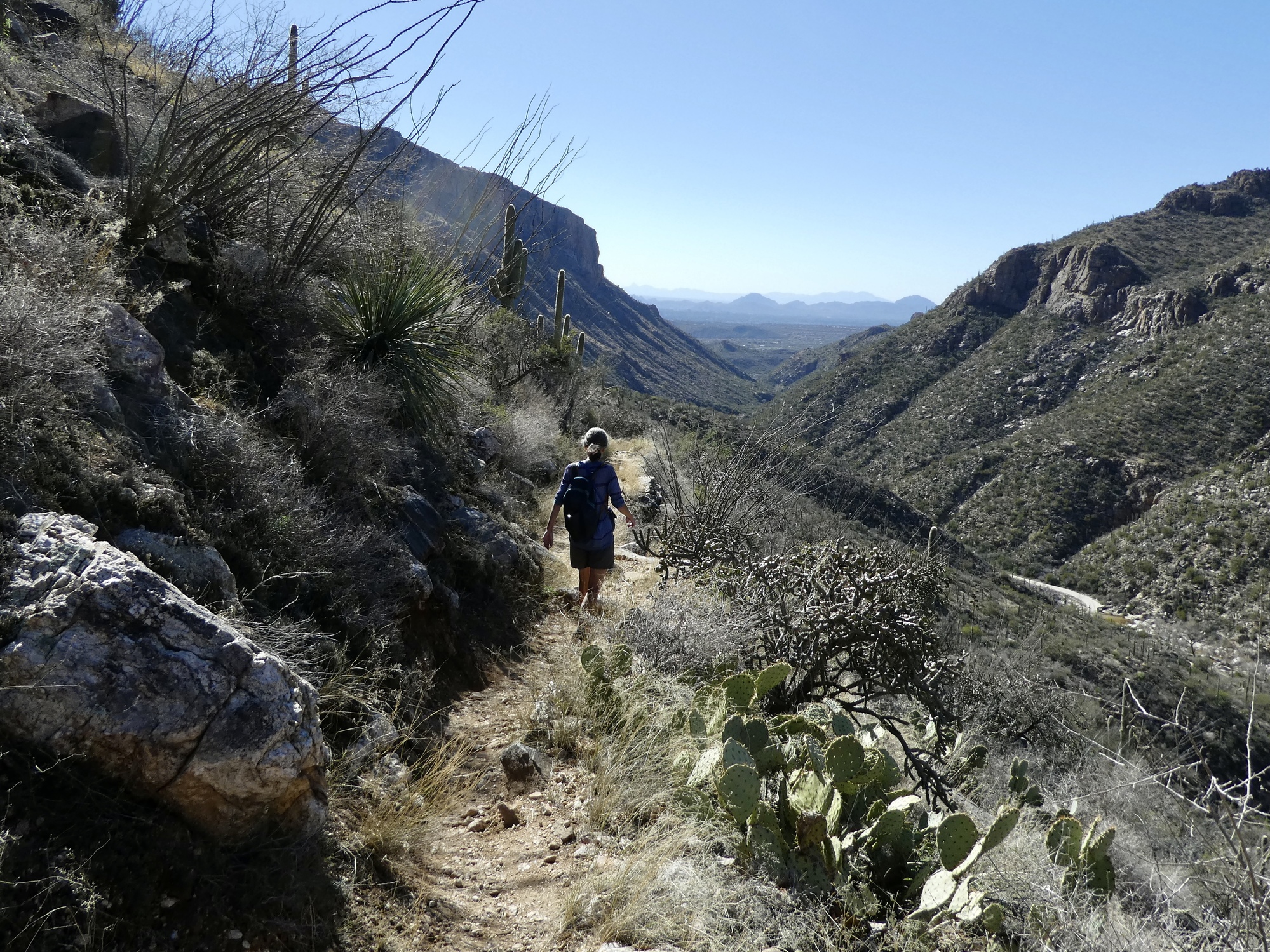
I mentally run through the hikes we’ve taken here in the past, read the write-ups from old blogs, and decide that the Phoneline Trail out in Sabino Canyon is the best candidate. We hiked it for the first time last winter and fell in love with it. It’s fantastically scenic but technically pretty easy - for minimal climbing on a well-maintained trail you start getting wonderful desert and mountain views almost immediately.
Just one problem - near the beginning of the hike we have to cross Sabino Creek at the same spot where the water flowing over the road turned me back last week. If it’s still that high today we’ll have to take our shoes off and wade across like we did a few years back when we hiked up Bear Creek.
This is very nearly a deal breaker for Rachael, so there’s some back and forth discussion until we reach agreement. She’s concerned about her feet because she has trouble walking if her feet or footwear get wet or damp. She thinks it through and comes up with a solution: she’ll wear warm wool socks at the start, take plastic bags and rubber bands to cover her shoes and ankles for the crossing, a towel to dry her feet off if they get wet, and a second pair of socks to change into once we’re safely on the other side.
It’s already warm when we arrive at Sabino Canyon about 10:30. The parking lot is nearly full already, but we find one of the last slots before they have to start sending cars up the road to the overflow lot. We slap our national park senior pass on the dash so we can park for free, and start walking.
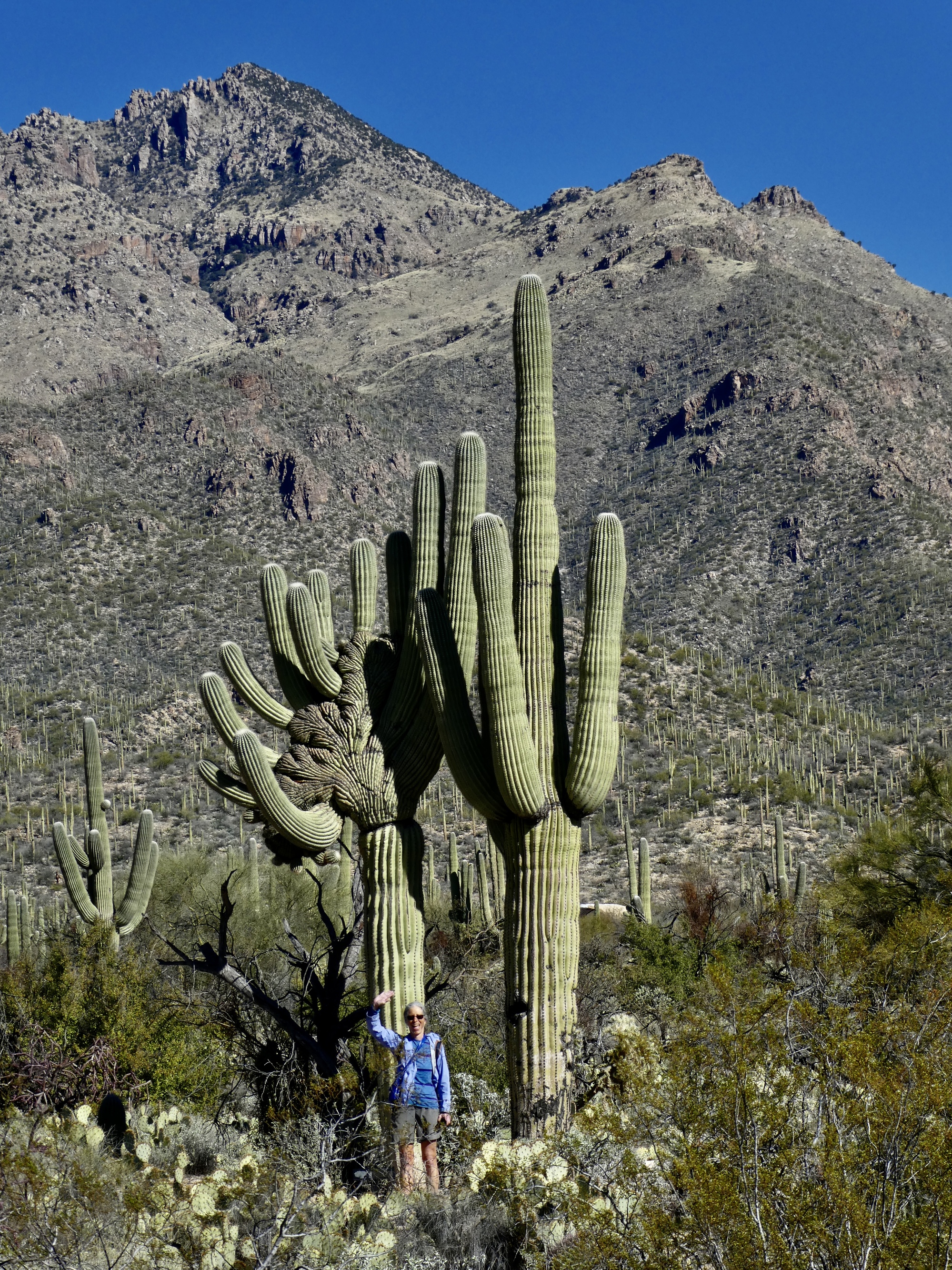
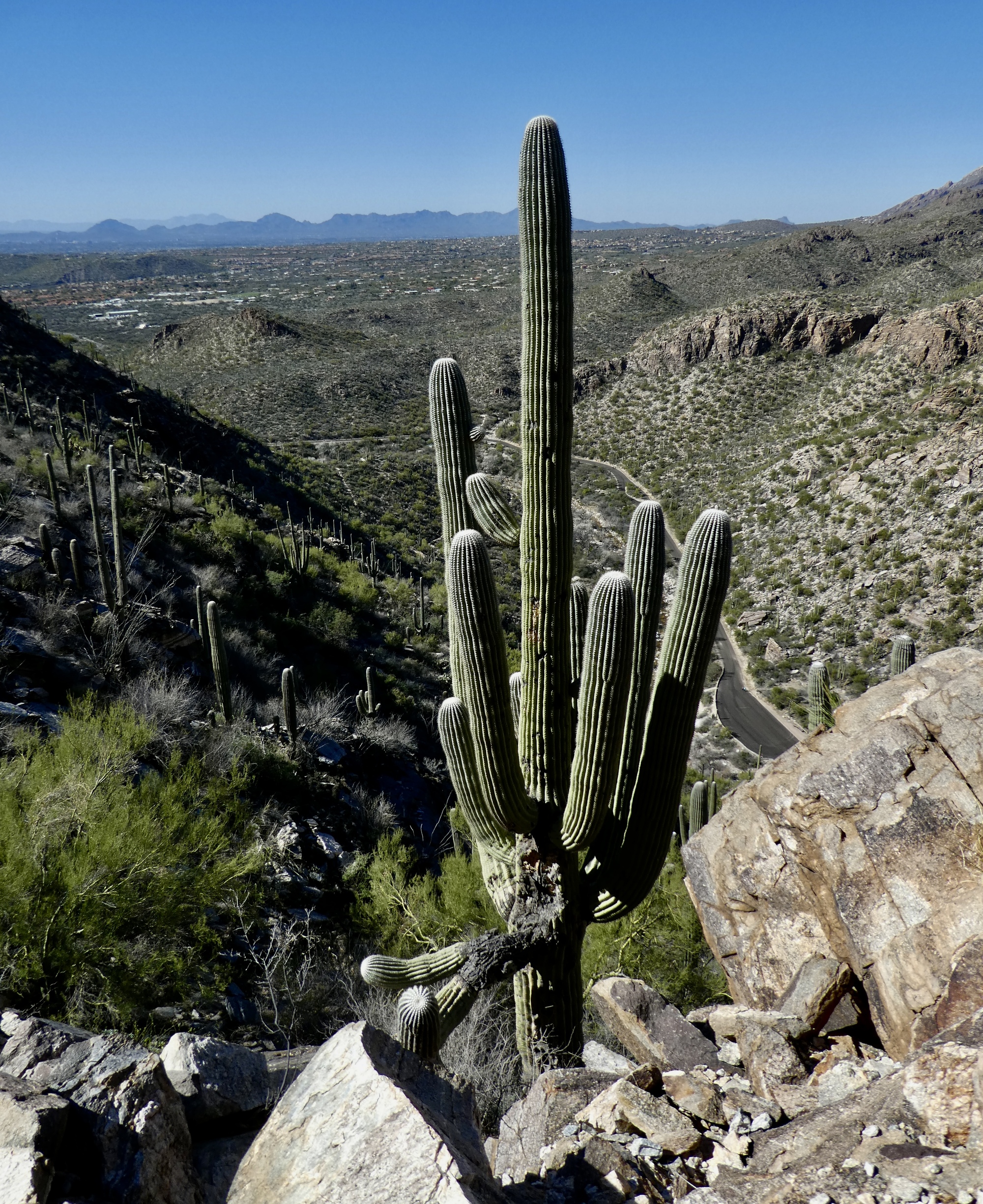
We don’t get far. First there’s the mandatory stop at the restroom, because Rachael won’t find anything but wilderness until we get back four or five hours later. Then there is a slight detour along the Nature Trail so she can see the astonishing crested saguaro again.
And then the hike begins in earnest. At first we have plenty of company as we walk along the road on the way to the creek crossing Rachael’s been apprehensive about. As we walk I start feeling very stupid and anxious myself - not because of the water, but because of the sun. I’m out of practice preparing for hikes, and didn’t think to pack either sunscreen or my red crush hat. I’m feeling it already on my balding pate, and pretty sure I’ll have a burn to deal with by the end of the day. As I walk along I look at the twenty or thirty other hikers I see. They all have hats, save for one young woman with the protection of a full head of hair protecting her scalp and the nape of her neck. There’s only one hatless balding fool out here at the moment - me.
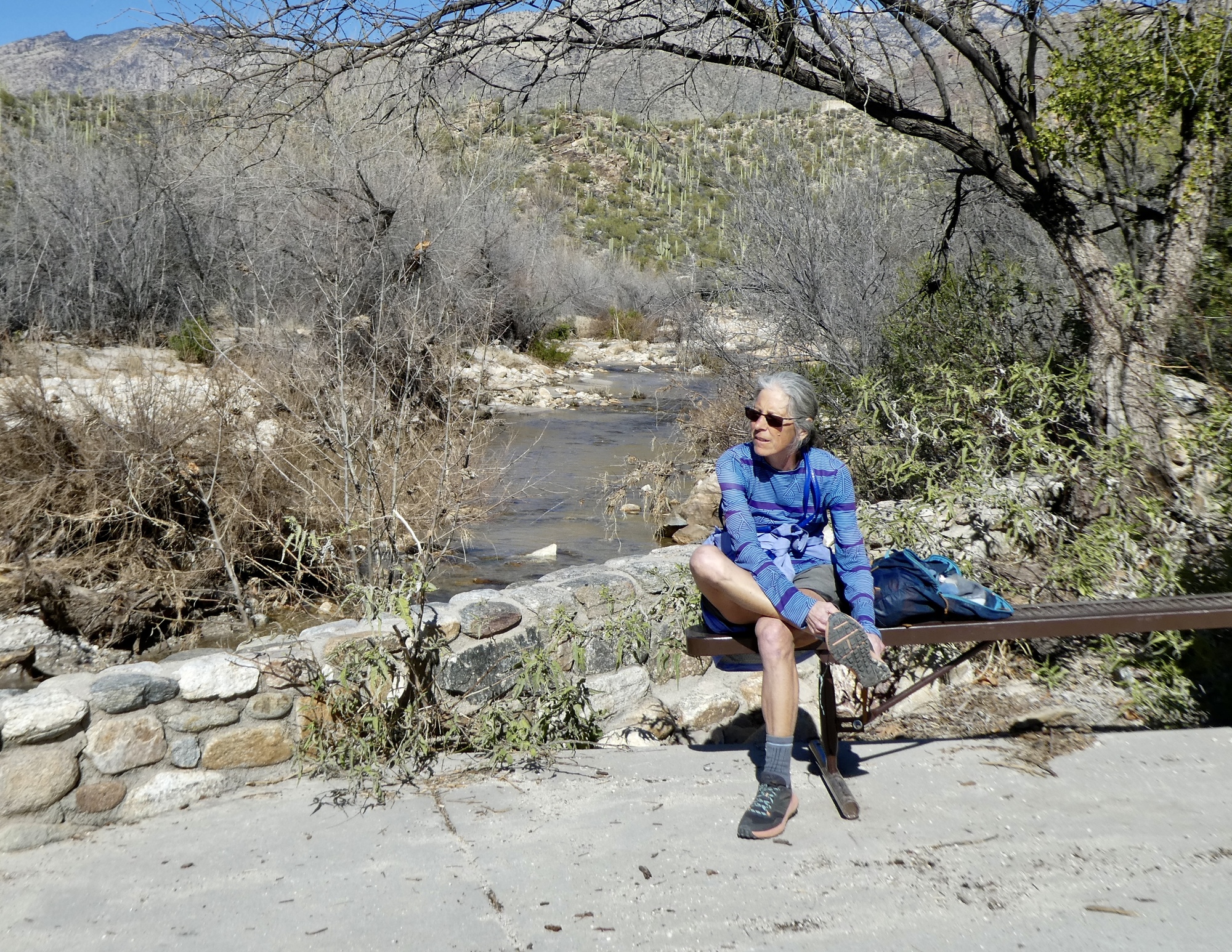
After a half mile we come to the bridge across the creek. The road is dry. The water level has dropped significantly over the few days since I was out here, so Rachael’s worries were for naught. We stop on the other side so she can change into her more comfortable socks, and not long after we leave the road and start climbing up the Phoneline Trail.

| Heart | 2 | Comment | 0 | Link |
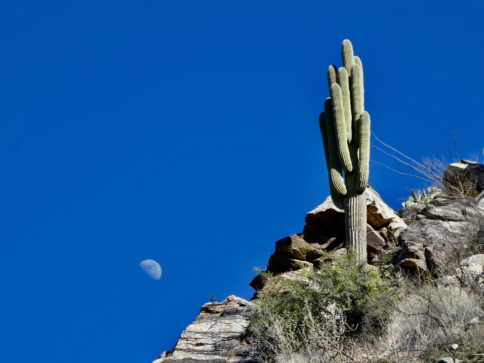
The hike is just as spectacular as we remembered from last year, and to my relief we’re largely in the shade from the south side of the canyon soon so my foolish hatlessness isn’t a concern after all. Within another half mile we lose nearly all the traffic and are high enough to start getting great views up and down the canyon.

| Heart | 2 | Comment | 0 | Link |

| Heart | 2 | Comment | 0 | Link |

| Heart | 3 | Comment | 0 | Link |

| Heart | 3 | Comment | 0 | Link |

| Heart | 3 | Comment | 0 | Link |

| Heart | 2 | Comment | 1 | Link |
Might be wavy scaly cloak fern.
https://swbiodiversity.org/seinet/taxa/index.php?taxon=2024
And who knew there were over 80 species of moss!!
Might be spike moss
https://swbiodiversity.org/seinet/taxa/index.php?taxon=1957
1 year ago

| Heart | 4 | Comment | 2 | Link |
In this photo alone I see at least 9, maybe more... Every time I look at lichen encrusted rocks, I'm amazed at how many there are, and the variety of colors too. A few black, lots of different grays, some brown, some chartreuse, and orange... I take lots of photos of them too.
1 year ago

| Heart | 4 | Comment | 0 | Link |

| Heart | 5 | Comment | 0 | Link |

| Heart | 4 | Comment | 0 | Link |
About three and a half miles into the hike, the half-expected event comes and a mild arrhythmia encourages me to find a cool granite slab in the shade to lie down on for awhile. It passes soon enough though and I continue up the trail for another mile and a half before I see Rachael ahead coming back my way. Five miles is about as far as I got last year, and deep enough into the canyon to round the bend and start getting views of Mount Lemmon.

| Heart | 1 | Comment | 0 | Link |

| Heart | 5 | Comment | 0 | Link |

| Heart | 3 | Comment | 0 | Link |

| Heart | 3 | Comment | 0 | Link |

| Heart | 5 | Comment | 2 | Link |
1 year ago

| Heart | 3 | Comment | 0 | Link |

| Heart | 3 | Comment | 2 | Link |
1 year ago

| Heart | 1 | Comment | 0 | Link |
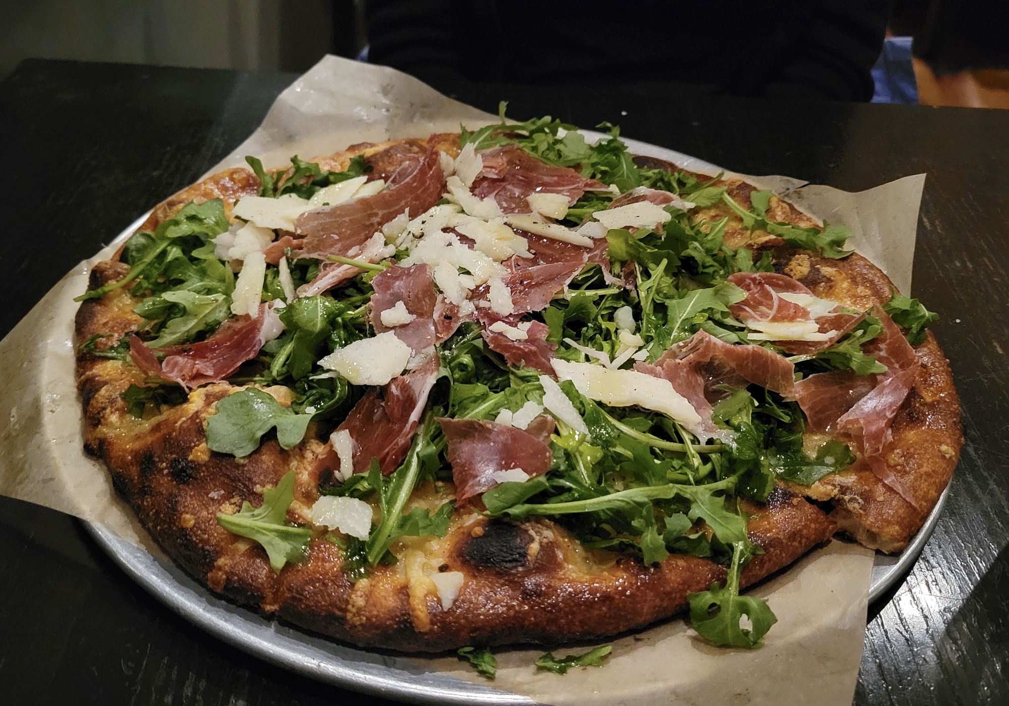
Somehow, no matter how long a significant hike is, at the end it always feels about a mile too long for me. By the time we make it back to the car there’s pain everywhere - sore feet and aching knees in particular. A happy heart though. It’s been a wonderful day. And the aches and pains are nothing that some ibuprofen, pizza and a Copperhead Pale Ale can’t handle.
| Rate this entry's writing | Heart | 6 |
| Comment on this entry | Comment | 3 |
1 year ago
1 year ago
1 year ago