After Caroline's impressive performance on the far-from-easy Bedfordshire loop, I thought we'd try out a (slightly more considered) similar sally into Cambridgeshire. I have a favourite "back route" into Cambridge - avoiding the B roads which become more and more heavily trafficked as you approach the city, this is nearly all off road. Instead of going into Cambridge, which seemed like a bad idea, we would then loop around and return on some similarly rural tracks. I hadn't tried the route back, but it looked alright on the satellite view so was intrigued to see if it was another viable way to the east.
The route leads east out of Potton, up to the ridge separating Cambridgeshire and Bedfordshire and past the prominent water tower near Potton wood. This would bring us to the tiny, and absurdly named, hamlet of Cockayne Hatley, marooned in a cut-off corner of the county. No roads cross over into Cambridgeshire here, making it a very peaceful backwater - but bridleways cut across into the Hatley estate allowing you to cross the border and access the very quiet roads heading east.
What this does mean is the ride starts with, for someone not used to it, quite a long climb. Gave Caroline no real trouble though!
St. John's church outside the village of Cockayne Hatley. Parts of the church date to the 13th century, but it has been heavily restored. Apparently some of the stained glass was "liberated" from Flanders by the then vicar, when he was fighting in the Napoleonic war. The poet W. E. Henley is also buried here: having a wooden leg, he was apparently the model for Long John Silver and inspiring the name of Wendy in Peter Pan.
From CH we cut down the tracks - technically footpaths, but widely cycled on - that cross the short distance to the Cambridgeshire border (and where the track mysteriously does become a bridleway). Then we turned north up the lovely green lanes that take us through the Hatley estate.
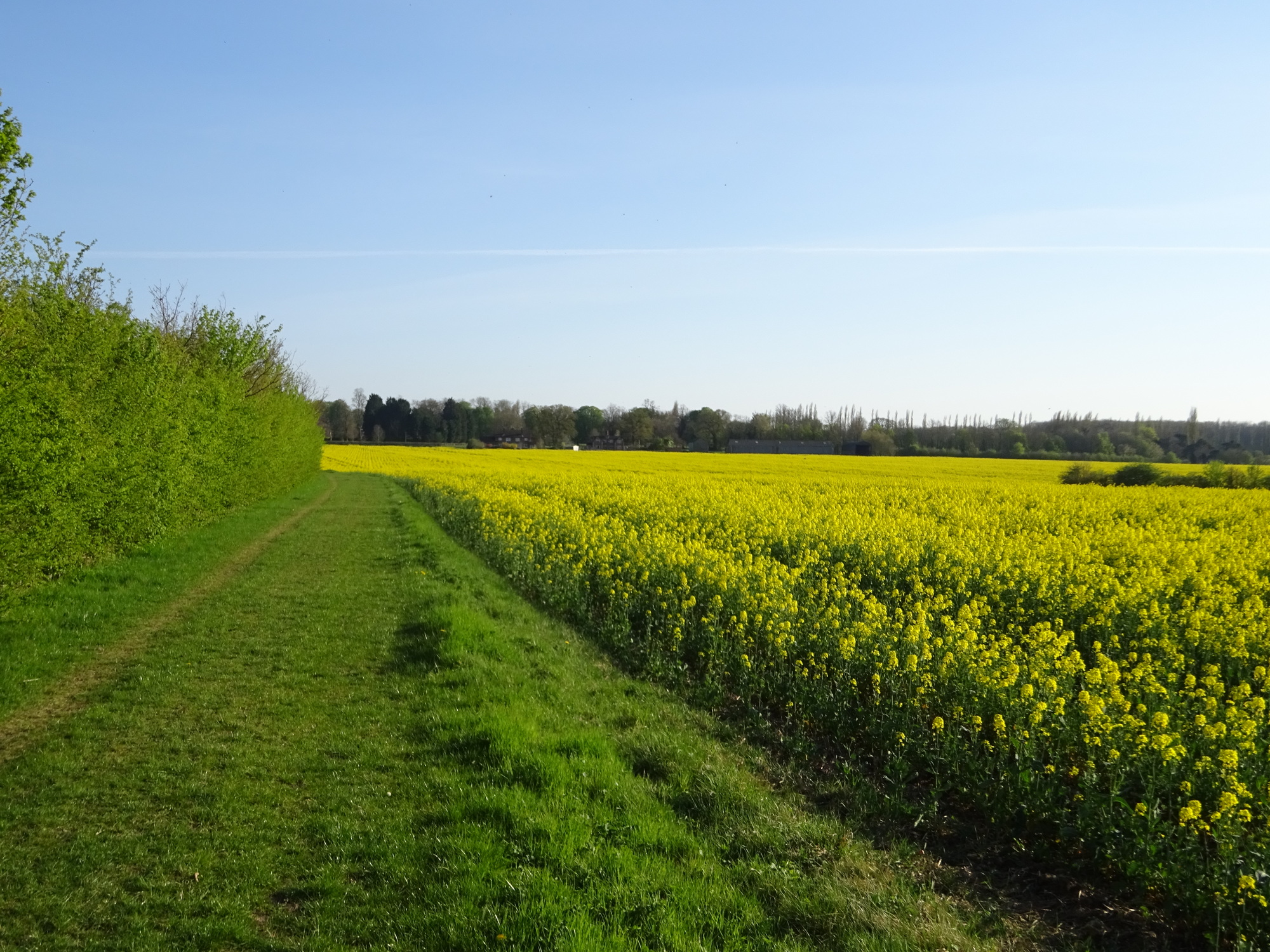
Cutting through the fields around the back of Cockayne H. Apparently this area contained the largest apple orchard in England in the 1920s - the railway to Potton was originally built to serve the prosperous fruit farms up here. Today neither fruit or railway remain - now it's some of the best arable land in the country.
Looking down into the vale separating the Greensand from the high ground at Therfield. The big catalyst factory at Royston below is just about visible as the white buildings in the distance. Fun fact: as you travel north up the Greenwich meridian line of 0 degrees longitude, the ridge at Therfield is the highest land until you get to .... the North Pole. The line travels up past Cambridge and the fens, which is very flat, and then it's open sea all the way to the arctic. In fact, since the pole is at sea level, you would need to keep going all the way to Siberia before you find as high ground!
Which turns into a gravel road. All these are public access rights of way, despite going right through the middle of the manor lands - but they're also well maintained and kept welcomingly open, so kudos is due here.
This brought us out onto the very minor road running to the east through the various villages that were once associated with the major Hatley manor: Hatley St. George and East Hatley. It's not busy at the best of times, and today there were significantly more people out on bikes than cars, of which we saw a couple at most.
Road through the Hatley estate running to St. George, the church that can be seen in the distance
At East Hatley we would pick up another track that runs across the fields, narrowing to smaller and smaller paths that would take us through an obscure strip of woodland (where I once camped on a shakedown trip for my tent). This is a good way to meet the main road which runs north between Royston and Huntingdon: following the course of the ancient Roman road Ermine Street, this is now the busy, fast and (of course) straight A1198. I try not to ride on it if I can help it, and this off-road route, while being charming in itself, brings us to a convenient place to cross it and dive back into the countryside west of Cambridge.
This is a rather obscure route, with both the ends being several miles away and nowhere near any villages of size. I have literally never seen anyone else using it. To my astonishment, we saw *two* other people walking it today. Unprecedented times!
This is what I often refer to as "the Roman road", the modernisation of Ermine Street, a major Roman highway that ran from London to the major centres of Lincoln and York. "Ermine" is a corruption of "Earningas", which is related to the name of the tribes that ruled this area around Royston in first centuries AD. We pass here near the village of Arrington, which has the same derivation. It greatly amuses me that this very prosperous and middle-class village is named after a savage tribe that once fought the Romans. The roads the Romans established have been in continuous use for almost two thousand years, with medieval and later highways following the same route. Claiming all the land as their own, the Romans built their military highways dead straight - this makes old Roman roads easy to spot in England, where nearly all subsequent roads (even motorways) have needed to weave between a patchwork of landowners and so are invariably twisty and indirect - sometimes irrationally so.
In the event Ermine street was very quiet, and we easily cycled the few hundred meters before turning onto the small roads through another estate, this one attached to Wimpole.
We left the lanes to off-road along the sides of the fields, before beginning a low climb up to the edge of the Greensand ridge before it descends into the flatness of Cambridgeshire. There were great views over towards Cambridge, which is visible as a cluster of white buildings and construction cranes - Cambridge is the fastest expanding city in the country - in the distance.
There were quite a few people about, enjoying the sunshine and views, on foot, cycle and horseback. We gave them a good social-distancing wide-berth but waved as we passed.
Views from the ridge down towards Cambridge and the flat fens beyond. The cluster of white buildings is part of the huge hospital and biomedical complex at Addenbrookes, to the south of the city.
Also in the vale is this strange thing, the Travelling Telescope of the Mullard observatory. This is an array of three or four radiotelescopes that have been mounted on railway chassis and can be shunted back and forth for triangulation purposes. The actual track is part of the old Sandy - Cambridge railway, which used to include a station in Potton, but is now defunct. There are plans to rebuild this rail line (though likely passing through the new town of Cambourne, to the north). We'll be crossing the old rail line again later in the day.
The track turns into a dead-end road, which takes us to the village of little Eversden. Through both Eversdens we turned north, on quiet roads through these very trim villages, housing prosperous commuters for Cambridge. Generally the fanciness of the villages increases in direct relation to proximity to Cambridge, with its abundance of high-tech and university work. Some of them lose a bit of individual character by this gentrification- despite the rural aspect, make no mistake that the residents of places like this are lecturers, project managers and bioinformaticians (plus the odd farmer). But the Eversdens are just far enough out the way to retain their style.
Classic thatched cottage in Great Eversden. They look great, but if you were tempted you'd have to be aware they need rethatching every few years - and this specialist job can cost tens of thousands of pounds. In general they will also be listed, so you can't remove the thatch if you decide you prefer a modern roof!
More thatched houses. They're too common round here - there are two thatched cottages within 200m of our house in Potton - so I frequently forget they're there, but am aware they must look quite quirky to those not familiar!
Near Kingston we crossed a ford over Bourne brook, a tributary of the one arm of the Cam (Granta) and then made our way to the quiet B road. I was a bit nervous about this, as it is very bendy and has no shoulder - but today we saw a grand total of two cars. After a mile or so we peeled off through the village of Bourne - which gives its name to the large new town of Cambourne, purpose built to the north as a bedroom community for Cambridge.
From here we headed up quiet lanes - I was maximising time on minor roads, as 40+km offroad is no joke - to Caxton, where we could cross over the Roman road once again. Caxton is an old place that gives its name to a major crossing point of Ermine Street and the main (and traffic choked) Cambridge-Bedford road A428. Known as Caxton Gibbet, there really was a gibbet here where the bodies of criminals, principally highwaymen, were exhibited to travellers. Fortunately they stopped this practice back in the 90s (just kidding - it was actually 1973).
Eventually they will replace this stretch (to the also evocatively-named Black Cat junction) with a proper dual-carriageway road - fortunately the decision it to roughly follow the existing road and not plough through the lovely countryside we'll ride through on the way back.
The ford over the brook. Not a very good photo, as I was taking it while simultaneously riding through the water (maybe not my best idea).
The ford is extended over quite a long stretch of the road, which doubles as the stream when the water gets high. Pedestrians can avoid it on the walkway to the left - vehicles (and cyclists) need to get a little wet.
After Caxton, there was an interesting off-road alternative that would effectively take us parallel to the lanes, through Hardewicke farm. I couldn't remember ever doing this route before, but the gods of cycling surfaces were with us and it was a great run through the fields and lanes.
After passing a massive intensive farm under construction, things got a got quieter until we heard distant music ringing out over the fields. "Is that ... All By Myself?" I asked Caroline, and it did sound like the famous powerballad. As we approached closer to the lonely farmhouse, it became clear it was this eerily appropriate song. This conjured up images of some tearful farmer, driven mad by isolation and loneliness in quarantine, belting out the tune to what he thought was the empty fields. We made tracks rather quickly, I can tell you.
I like the light behind this tree's translucent leaves
We came out at the Gransdens, lovely villages on the edge of Bedfordshire. After cutting through these, we could take what are very familiar paths to me around Gransden and Waresley woods, over the turf runway of the still-functioning airfield, and back to East Hatley where we would re-trace our steps to return to Cockayne Hatley and Bedfordshire.
Coming into Great Gransden, with the church spire just peeking through
It's traditional to have an animal figure sculpted at the top of the thatch. Pigs and foxes are common, but in this case they've gone for boxing hares, which is very apt (I see dozens of hares in the surrounding countryside - something that broadly is quite rare in England).
Bluebells in Gransden woods. Bluebell woods are so typical of the area that if you arrive in Stansted airport (one of the major London airports), the walls are covered with murals of them
Amusingly the bridleway runs right over the airfield. In theory they're supposed to post a sentry on either end if there's any aircraft activity - in practice I think they'd just avoid you.
Popping out onto the road, you can then immediately take another cut across country to get to Hatley. In this case we descend through the fields to the line of the old Sandy-Cambridge railway, which would have run from the nearby village of Gamlingay. The rails have long been torn up, but the course of the line is now a weird green lane, not owned by either of the farms either side. It's not a right of way, but there'd be very little to stop you following it for many miles.
This is the course of the old Sandy-Cambridge railway, the last stretch of the "Varsity Line" that linked Oxford and Cambridge. The rails are long gone, and it's now this weirdly enclosed and secluded lane. This would be a great place to wild camp.
It was then a matter of re-tracing our steps, through my slightly unimaginative re-approach to Potton from the east. It allowed me to get some good photos in the other direction though.
We regained the road at Cockayne H, and pulled up past the water tower - Caroline doing well even after 45km. As we spun down the hill past the water tower back into town I went all out, and reached 56kph. Potton also looked good in the evening light.