September 2, 2014
How hard can it be?: Looking for some direction
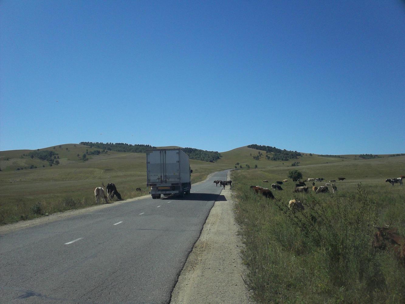
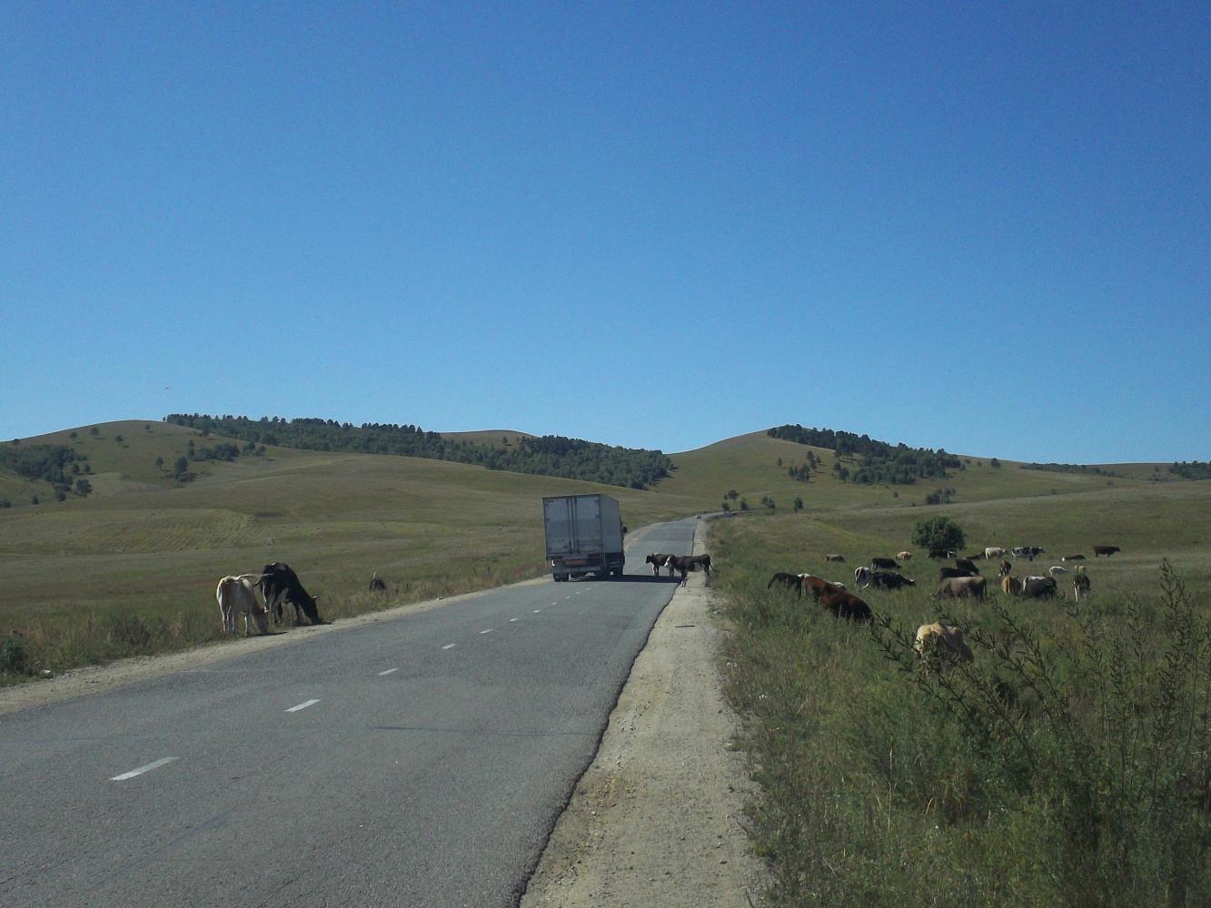
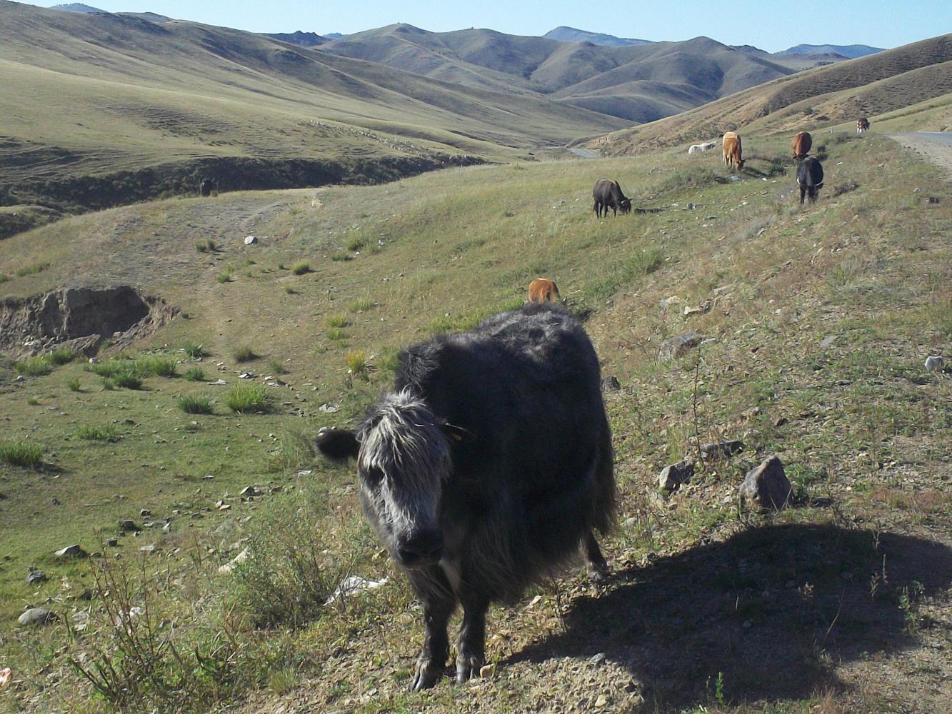
The first few days continued to be tough. Although the road was paved it rose and fell steeply, and it was doing a lot more rising than falling as I gained altitude. To add to the difficulties I was riding into the wind, and my average speed was barely above ten kilometres per hour. I couldn't even reach a hundred kilometres per day, and this on the perfect tarmac road, what would happen when I got to the horrible sandy tracks that I'd read about?
| Heart | 3 | Comment | 0 | Link |
| Heart | 1 | Comment | 0 | Link |
Researching my route through Mongolia had been difficult. The route that google-maps was advising me to take, which was also the shortest way, involved taking the main road south to Ulan Bator and then going west across the south of the country, through the three relatively-big (by Mongolian standards) towns of Arvaiheer, Bayankhongor, and Altay. These seemed to be linked by a fairly major road, but beyond Altay I would have to find a way through the western mountains to the border near the town of Bulgan, which would likely be the most difficult part. The problem was that I couldn't find a single blog online in which anyone had ever taken this southern route before, and so I didn't really know what it would be like. All of the cyclist journals I found that had cycled west of Ulan Bator had taken more northern routes and, worryingly, all had ended up taking alternative means of transportation due to the relentless difficulties of the 'road' conditions. I couldn't even find a blog from anyone that had driven the southern road but Arvaiheer had a wikipedia page that said it was linked to Ulan Bator by a paved road, and if there's one thing more reliable than a wikipedia page, it's a wikipedia page about an obscure Mongolian town. Beyond Arvaiheer I was sure the tarmac would disappear, but that was something to worry about later on.
Another thing to worry about was the information I read that said 'You will need a very good map and a GPS to navigate in Mongolia.' Naturally enough I had neither of these things. I'd looked for a map a bit in Ulan-Ude, and at the border, and in the third largest city in Mongolia, but without any luck. I didn't panic though, instead I took photos of a map that some Russians showed me in a lay-by. Unfortunately I soon realised that my camera couldn't take pictures of things close up, and the map just looked fuzzy.
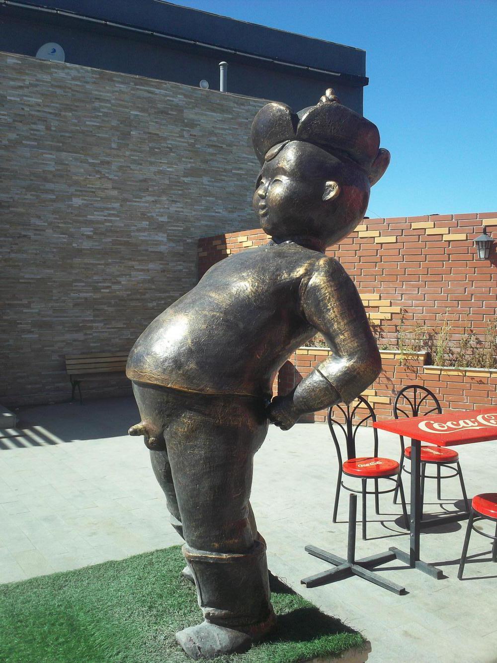
Still, Mongolia was full of surprises, such as at a rest area where I found not only a well-stocked supermarket and a statue of a boy with his willy out, but also a man from Ulan-Bator who could speak English. I asked him about the road and he told me that it was actually good not only as far as Arvaiheer but all the way to Bayankhongor, although he quickly checked himself and corrected the word 'good' to 'not bad.' Beyond Bayankhongor, however, it would be 'bad', 'very bad.'
| Heart | 2 | Comment | 0 | Link |
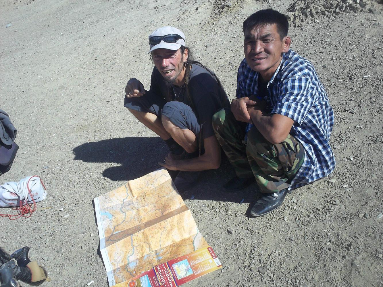
The next day I gained more information from a Frenchman that had come in the opposite direction, arriving from China via the Bulgan border crossing that I planned to leave by. I met him at the top of yet another peak, we reached the summit at exactly the same time. When I first saw him, walking up and pushing a bicycle with just a backpack strapped to the back I actually thought he must be a local such was his un-tourist-like appearance, but on closer inspection I saw he was a Frenchman. Bearded and with a ponytail, Cedric's story was even more impressive than mine. He had left France three years earlier and actually walked all the way from France to China, where he wandered hungry and picking up random bottles of water from ditches for nine days before realising China was too big to walk across. Then he bought a bike, new, for fifty euros, and continued by cycling to Mongolia.
I asked him about the mountains in the west and he fished out his map and showed me the route he had taken. Although he couldn't do so exactly because the road he had taken wasn't on the map. "I thought I was on this road," he said, "but actually I was on a new road that went around here and down here. It was paved though." I took out a pen and paper and drew a crude map of where he was telling me about. Cedric had only taken the southern 'road' as far as Altay, from which he had taken a 'road' further north, not on my planned route.
"How was the road to Altay?" I asked.
"Bad," he said, "very bad."
"But it's possible?"
"Mmm"
"Well, this doesn't look so bad" I said, and it didn't. I mean, it looked like I would only have 600 kilometres of unpaved 'road' to get through, and I basically only had to make two turns in the whole country.
"I don't know," Cedric looked concerned, "Mongolia is the hardest country to navigate in. I got lost several times." This was a man with a GPS and a very good map, but I dismissed his concerns. I mean, I did now have a map drawn with pen and paper by my own fair hands. What could go wrong?
| Heart | 2 | Comment | 0 | Link |
As for the rest of his trip across Mongolia, it turned out that even Cedric had taken motorised transport half of the way to Ulan Bator. And this was a man that had walked from France to China.
Okay, so maybe I was a little bit worried.
Today's ride: 94 km (58 miles)
Total: 27,394 km (17,012 miles)
| Rate this entry's writing | Heart | 5 |
| Comment on this entry | Comment | 0 |