November 22, 2016
Tue 22th Nov: Turning for Paso Raballos to Rio ?
I couldn't go any further when I halted at this campsite yesterday afternoon. Today I could only hope for a less hilly easier day. And, I'm waking extremely early these mornings; at daybreak, when it starts getting light.
The campsite is west facing, meaning it remains in the shade while the top of the far side of the valley is in sunlight with a line of shade receding down the slope; it'll be a while before it reaches here.
I'd thought with yesterday evening's breeze and it clouding over that I was in for a change today. But it looks as though it'll be another fine day.
Today's road is almost like sealed road. Like a fine gravel drive or forestry road. Except there are some isolated sections of washboard, which I don't see until I'm on top of them, and the front wheel gets a violent jolt and whole bike a rocking. The grey ribbon of the road ahead dances up and down, high up the left side of a deep canyon with mossy green slope that drops down to a snaking aquamarine river, far below. The way on then as I get ever nearer Cochrane opens to a wider valley with farming along the riverbank.
In Cochrane I find a pleasant town centered around a main plaza with forty year old mature pine trees providing good shade as it is already warm. Water sprinklers keep the greens watered, and there are plenty of benches to sit down and rest, which I do with second breakfast: a big meat empanada, followed by an alfahora, procured from a very good bakery on the corner, which sold most other things too. The only thing else I needed was wine. Which I buy in the supermercado, general hardware shop, the other side of the plaza.
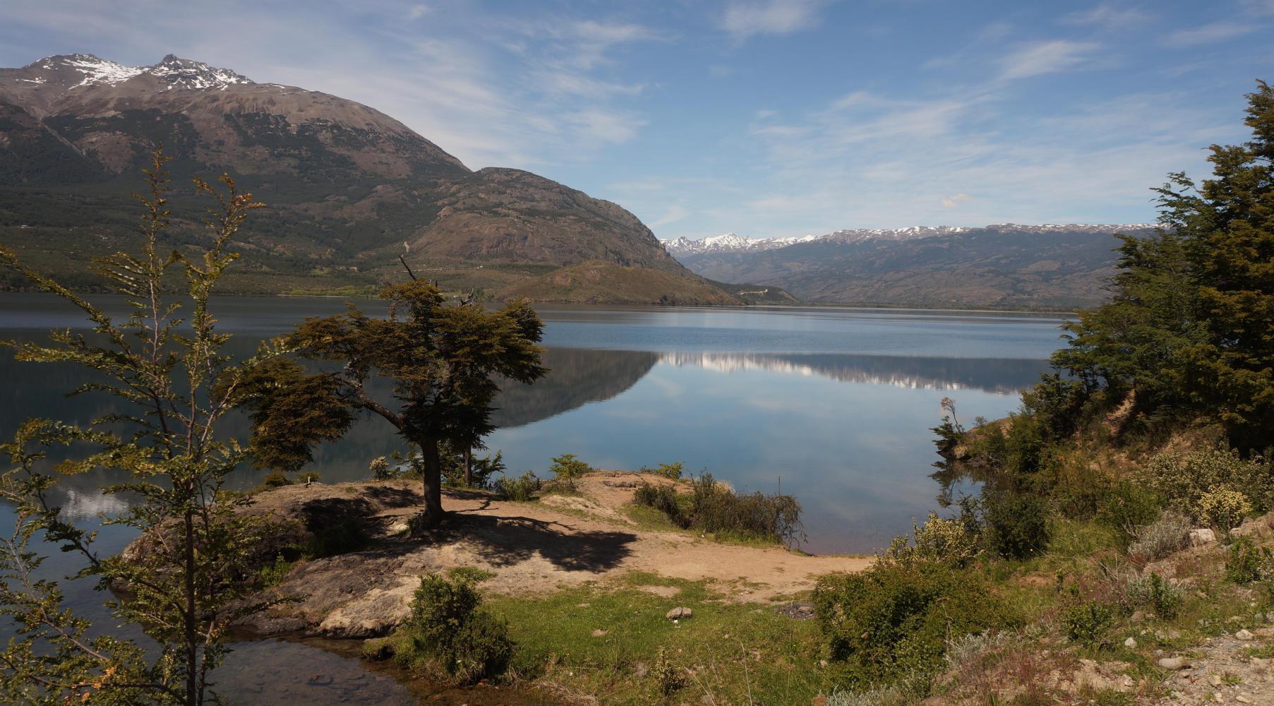
Eventually, I get up and find my way out to the southbound Caretera Austral. The way on climbs a fair bit, leaving Cochrane behind at the bottom of the valley, and levels out alongside Lago Esmeralda, a fabulous sheet of translucent blue reflecting wooded hills and snowy peaked mountains along it's far side.
Once pass the lake, the road follows a narrow Andean wooded valley, fine old beech trees with a splash of bright red firebush in places. Further on I arrive at at a place with open meadow on my left, with a view east through the immediate mountains up a valley to grey granite pinnacle mountain peaks, a mini Torres del Paine. I think it's Cerro San Lorenzo, the highest mountain in Southern Patagonia, astride the border with Argentina. On clear days it's visible on the other side from a high point on Route 40.
The day wears on, and I plan on an early stop. Finding a good camp spot well in off the road is looking doubtful, though. I want ideally some place with access to a stream to bathe in. But it's all dry woodland to the side. Four o'clock: as if my prayer is answered, I arrive at the precipice of a great descent with a river at the bottom. It's a five kilometre long switchback descend to a bridge over a surging green glazier river, with amble open to the road riverbank in among beechwood. I find the optimum level place and pitch the tent, then strip off and have a splash wash in a rock pool safely in from the main river flow.
| Rate this entry's writing | Heart | 0 |
| Comment on this entry | Comment | 0 |