Horsetail Falls - Vuelta a Iberia - CycleBlaze

September 4, 2019

Horsetail Falls

Due to a planning error, we have a one night gap between our stay at the Empress and the first night of our four night stay in Bend, our base for the Sisters Folk Festival.  We decide to fill it with a night in Maupin, sandwiched between a pair of day rides.  Maupin, a river town southeast of The Dalles on the Deschutes River, works well for this.  It breaks the ride to Bend nicely in half, and it is in the middle of some fine high desert cycling country.

For today’s ride, we’ve chosen to explore another stretch of the Columbia Gorge - we’ll drive east to Viento State Park, park the car, and start biking back west toward Portland.  We don’t have a specific turnaround destination in mind, but just plan to bike as far as we feel like and see how it goes.  

Segment by segment, the State has been gradually developing  cycling paths to fill in the gaps of the Historical Highway, with the goal of eventually creating an integrated, high quality bike route all the way up the gorge from Portland to The Dalles.  The ride strings together the remaining stretches of the Columbia River Historical Highway (Highway 30) with nonmotorized paved paths and stretches on the shoulder of I-84 where no other alternative exists.  The entire system is known as the Historic Columbia River Highway State Trail.  

The newest segment, just opened early this summer, is a three mile section connecting Wyeth State Park and Lindsey Creek.  this is an important addition, because it connects to the segment that already exists from Starvation Creek to Viento Park.  Now, only five miles remain until the trail reaches all the way to Hood River (and beyond that, to The Dalles because those thirty miles are already complete).  Work on the final section, around Mitchell Point, is scheduled to begin next year.

Years ago we on occasion would bike to Hood River from Portland and then back again the next day.   We did this three or four times if I remember correctly, but it’s probably been a decade since the last time.  The trail system wasn’t nearly as developed then, and we spent the last ten or twelve miles on the shoulder of I-84.  

There have been huge changes since then, and today the ride is brilliant.  The 25 mile stretch we rode today, between Viento Creek and Horsetail Falls, is really beautiful, and except for passing through Cascade Locks is very quiet.  Nearly 15 miles were on smooth, paved nonmotorized trail; About ten were on quiet Highway 30 or other local side roads; and a few miles were on the commercial streets of Cascade Locks.

This is a ride I’d recommend to anyone, even those with grandkids whose safety they’re anxious about.  There are two features to be aware of though.  The ride is generally pretty easy - flat or easy rollers - but there is one moderate climb of about 600 feet.  A bigger concern is the steep staircase near Eagle Creek.  It’s got a narrow grooved track on the side to roll your bike along, but it’s not easy.  Some will want to just carry their bike up and down, possibly with a helping hand.

Otherwise, this is a totally great ride.

Starting out from the trailhead by Viento State Park, currently the easternmost point of the trail before Hood River. If you drive over, park at the trailhead, not (as we did) within the state park. Parking is free at the trailhead, but $5 inside the park.
Heart 4 Comment 0
On the trail between Viento and Starvation Creek.
Heart 4 Comment 0
Image not found :(
Impressive Starvation Creek Falls is new to us. In fact, this whole seven mile stretch of the gorge is new to us really. We’ve never seen it other than zipping past on the freeway.
Heart 3 Comment 0
It’s quite impressive how much information is presented on the information boards standing beside the trailheads. Very effectively organized.
Heart 1 Comment 0
Image not found :(
Columnar basalt, west of Starvation Creek.
Heart 1 Comment 0
Looking across the Columbia to the Washington side - one spectacular formation after another. It was solidly overcast when we set out this morning but the sun is just beginning to break through.
Heart 3 Comment 0
Looking east across Lindsey Lake from a trail viewpoint.
Heart 3 Comment 0
On the new section of the trail, opened just this summer.
Heart 5 Comment 0
This is a multimodal corridor, with the trail, the freeway and the train line all squeezing in between the cliffs and the river.
Heart 2 Comment 1
Ron SuchanekIt's nice to see how much has been completed. I've only ridden on sections but that looks enticing.
Reply to this comment
4 years ago
On Wyeth Road, just before starting the only significant climb of the day.
Heart 1 Comment 0
These colorful cliffs across the river from Cascade Locks are apparently a new feature of the gorge. I don’t think Rachael and I have noticed them before, so they must be a recent addition.
Heart 5 Comment 0
The Bridge of the Gods crosses the Columbia River at Cascade Locks. With its see through deck and occasional high winds, it’s more than a bit unnerving to bike across.
Heart 4 Comment 2
Ron SuchanekI haven't bicycled across but rode across on a motorcycle once or twice. It's harrowing.
Reply to this comment
4 years ago
Scott AndersonTo Ron SuchanekI think a motorcycle would be way worse, but on a bike was plenty scary. Twice is enough.
Reply to this comment
4 years ago
Bonneville Dam
Heart 2 Comment 0
This staircase just west of Eagle Creek is by far the most challenging part of the ride. At about a 45% pitch, it takes a fair amount of strength and control. And this is only the top half of the staircase.
Heart 3 Comment 0
The railings along the system are really attractive, and quite varied. I think these concrete railings are part of the original highway, dating back to the 1930’s.
Heart 5 Comment 0
Heart 1 Comment 0
Your tax dollars at work, constructing new fence along the trail. I love Oregon!
Heart 3 Comment 2
Ron SuchanekI can't wait to get back!
Reply to this comment
4 years ago
Scott AndersonTo Ron SuchanekI can understand. At times I wonder why we don’t just hang out here full time. There’s enough great riding for a lifetime.
Reply to this comment
4 years ago
Heart 1 Comment 0
Heart 2 Comment 2
Bruce LellmanMuch of this was on fire exactly two years ago.
Reply to this comment
4 years ago
Scott AndersonTo Bruce LellmanYou can see evidence of the fire everywhere, of course; but it’s gratifying to see so much green in it already. At the time, I imagined the area being ruined for years.
Reply to this comment
4 years ago
The southeast face of Beacon Rock.
Heart 4 Comment 2
Bruce LellmanIt's hard to believe there is a trail to the top.
Reply to this comment
4 years ago
Scott AndersonTo Bruce LellmanYes, it is. I’ve walked up once and thought it circled around on this side but I can’t see any evidence of it.
Reply to this comment
4 years ago
Table Mountain, I think.
Heart 2 Comment 0
Delicate Horsetail Falls is one of the best loved of the many impressive falls in the gorge.
Heart 3 Comment 0
The plunge pool, Horsetail Falls
Heart 4 Comment 0
Down the staircase again. Physically easier, but scarier.
Heart 3 Comment 0

Video sound track: Tanglewood Tree, by Dave Carter and Tracy Grammer

We’re staying in Maupin at the Imperial River Company, an outdoors-oriented lodge right on the Deschutes. This is the view from our outdoor table.
Heart 4 Comment 0
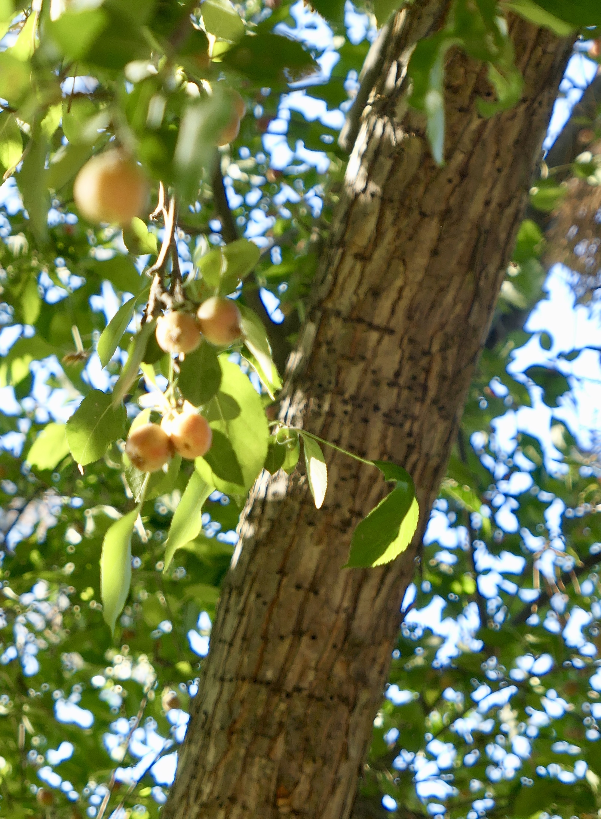
This guy bombarded us from time to time while we waited for our meal. A crabapple?
Heart 2 Comment 5
Bruce LellmanAnd you can clearly see Sapsucker evidence on the trunk of the tree.
Reply to this comment
4 years ago
Scott AndersonTo Bruce LellmanOh, of course. I didn’t notice that at the time. Idled with bullet holes.
Reply to this comment
4 years ago
Bill ShaneyfeltTo Scott AndersonProbably not bullet holes... Too regularly placed and in lines. Bullet holes would be all over the place.
Reply to this comment
4 years ago
Scott AndersonTo Bill ShaneyfeltWell, no of course not. I didn’t mean that literally though. I’m going with Bruce’s explanation.
Reply to this comment
4 years ago
Bill ShaneyfeltTo Scott AndersonYeah, I should have realized that.

But I was an Explosives Safety Manager for 27 years and sometimes I take things literally out of habit. All is good!
Reply to this comment
4 years ago

No map for today’s ride.  I couldn’t draw it because the newest section of the trail was completed so recently that Ridewithgps doesn’t know about it yet.

Ride stats today: 49 miles, 3,400’

Rate this entry's writing Heart 8
Comment on this entry Comment 2
Jen RahnBeautiful ride! We might have to check out part of it on our way back to Colorado.
Reply to this comment
4 years ago
Scott AndersonI’m sure you’d enjoy it. The stretch between Viento Park and Cascade Locks is especially great. If you haven’t ridden it before, you should also ride the trail that starts just east of Hood River.
Reply to this comment
4 years ago