October 2, 2019
Astorga
Rachael and I are both a bit apprehensive about today’s ride to Astorga. At 32 miles, it’s a short one; but it’s the first significant climb of the tour as it climbs 3000’ into the Mountains of León in roughly ten miles. the climb is one thing, but our health is the other. My cold is steadily improving day over day but is still with me, and Rachael’s own seems to be holding steady as well. Will the exertion of the climb set us back?
The route we have mapped out is the obvious best choice - along quiet minor roads the whole way, following the French Camino, and reputedly through one of its prettiest stretches. Nevertheless I played around with the map last night looking for easier alternatives before convincing myself that nothing better exists.
So, a challenge lies ahead that hopefully we’ll be up to. The weather is with us today, fortunately - fair skies, a modest but favoring breeze, and a comfortably coolish temperature when we start out.

| Heart | 3 | Comment | 0 | Link |


Leaving our room, we first stop in at the nearest market to pick up the day’s lunch, and then leave town eastbound on LE-142, the minor highway that we’ll follow for much of the day’s ride.
Rachael still has her Garmin, but I’m using the RideWithGPS app on my cellphone, with the cheap handlebar mount I picked up yesterday. It’s taken me a bit to figure out some of the quirks of the app, but I’m gradually coming to the opinion that I prefer it to the Garmin. There’s one significant drawback though - it chews through the camera’s battery at a good clip, and a full charge won’t come close to holding for a full day’s outing. Since Rachael can keep us on track though, I don’t need it most of the time anyway, especially on days like today where we’ll follow the same road for the next fifteen miles.
The first four miles are a lazy introduction to the ride, just enough to loosen us up as we approach the base of the climb. After dropping a bit to the Boeza River, a small tributary of the Sil that it joins just downstream in Ponferrada, we roll along on the level for a few miles before stopping to admire the graceful stone bridge at Molinaseca, its origins dating back to Roman times.

| Heart | 3 | Comment | 0 | Link |


| Heart | 3 | Comment | 0 | Link |

Immediately beyond the bridge we begin climbing, at first following the course of the Meruelo River as it gradually recedes below us into a deep, narrow canyon. After a few miles of this we break away and continue climbing into the Mountains of León. It’s a rather relentless climb, rising 2,700 feet in about 9 miles. It unfortunately is not uniform - some stretches are a more modest grade, but toward the top they’re awful in spots, leaving us both straining in our lowest gear to keep moving forward for just-a-few-more-agonizing-spins. But we make it! We both feel a real sense of accomplishment after finally cresting the final rise.

| Heart | 2 | Comment | 0 | Link |

| Heart | 4 | Comment | 0 | Link |

| Heart | 1 | Comment | 0 | Link |


| Heart | 1 | Comment | 0 | Link |


| Heart | 1 | Comment | 0 | Link |

| Heart | 8 | Comment | 0 | Link |

| Heart | 4 | Comment | 0 | Link |

| Heart | 2 | Comment | 0 | Link |


| Heart | 2 | Comment | 0 | Link |

| Heart | 2 | Comment | 0 | Link |

| Heart | 2 | Comment | 0 | Link |
Over the top now, our work for the day is done. It’s a long, gradual descent east into the open plains of central Spain, with inspiring views that extend seemingly forever. It’s an easy grade on this side - the pass is much harder the direction we’ve come - so we can relax, freewheel, and absorb the views on the empty, smooth roads.
It feels like we’ve crossed into a new region here, and our home for the next few weeks as we turn south through toward Extramadura, hopping through a series of two night stays at historical towns. It should be great, with a forecast for near perfect weather in the days ahead. It feels like our spin through Galicia and into Northern Portugal was a small pre-tour to the main event, which starts here.
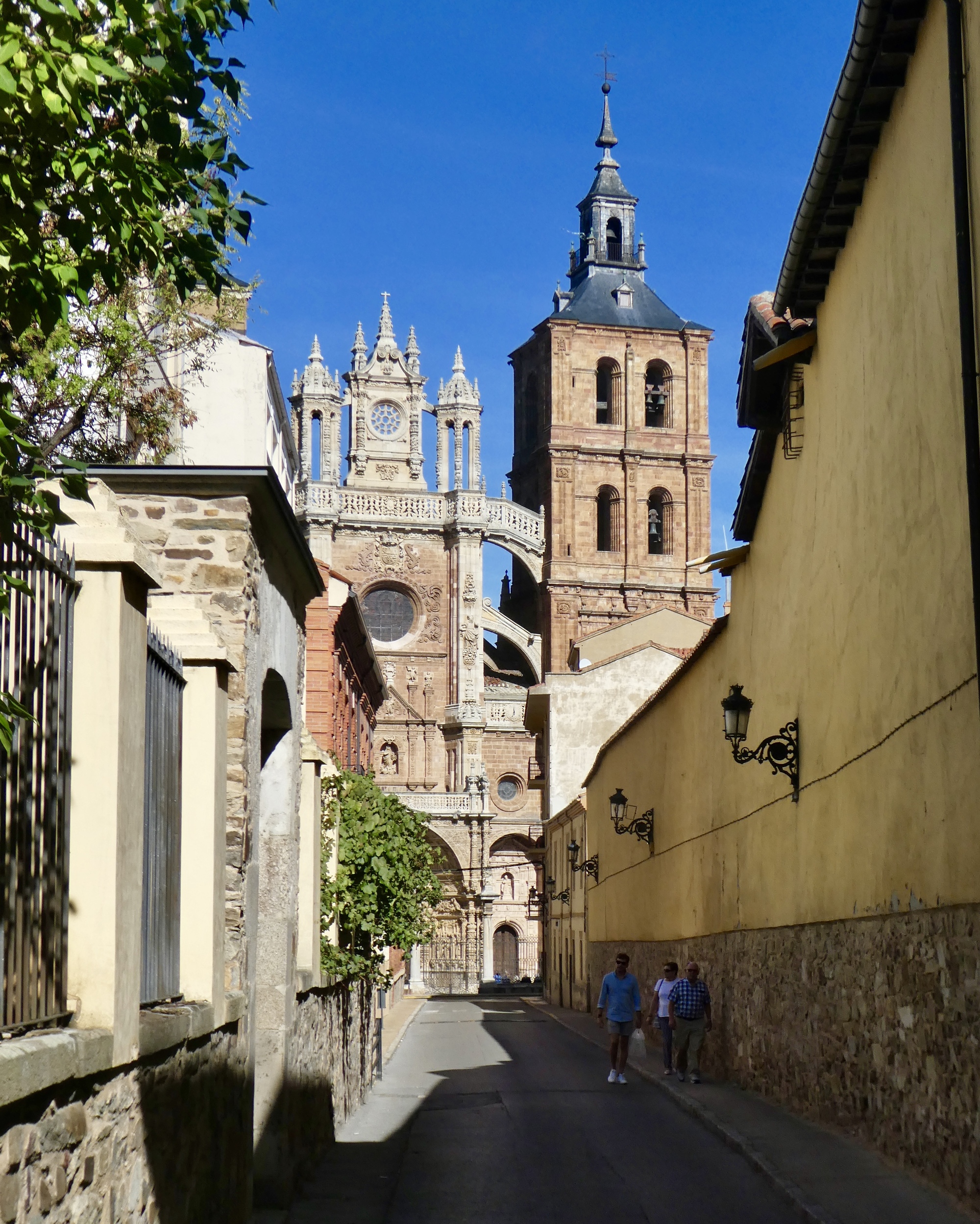
Good news greets us when we check in at our hotel, just a few blocks from Astorga’s most important monuments - a small package from Amazon. Rachael’s new camera mount arrived, as planned. Video tomorrow!
And, to end on a technical note. We observe with pride that we didn’t lose anything or encounter any next adversities today or yesterday. Two adversity-free days, and counting!

| Heart | 1 | Comment | 0 | Link |

| Heart | 3 | Comment | 0 | Link |

| Heart | 1 | Comment | 0 | Link |
| Heart | 4 | Comment | 0 | Link |
Ride stats today: 34 miles, 3,900’; for the tour: 258 miles, 15,100’
Today's ride: 34 miles (55 km)
Total: 258 miles (415 km)
| Rate this entry's writing | Heart | 8 |
| Comment on this entry | Comment | 10 |
5 years ago
5 years ago
Battery drain is why I bought my Garmin after trying my phone as an activity tracker for a (rather long) day ride.
5 years ago
5 years ago
5 years ago
5 years ago
5 years ago
5 years ago