Route planning & Mapping [extreme geekery]
Since there's been some interesting discussion of the merits of different platforms for route planning and mapping - and I've got quite a few unusual approaches working well for me for this Spanish trip - I thought I'd note down what I'm using. Some of this will be extremely geeky - you have been warned! It makes a good aid memoire for my own purposes too.
1. Paper maps. A good paper map is, in my opinion, probably the best way to get high-level idea of a route - and to discover unusual ways which might be quite hidden in many electronic maps. For this trip I've bought 4 IGN 1:200K provincial Spanish maps from Stanfords. At £9 each this is a bit of an outlay, but they're lovely things to have. I've been using them to plan at home and will take them with me, and primarily navigate using them.

| Heart | 1 | Comment | 0 | Link |
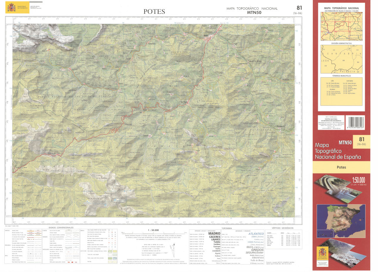
2. Amazingly, CNIG have scanned a huge number of their maps and made them freely available online at http://centrodedescargas.cnig.es/CentroDescargas. The web portal is a little weird, but it is quite possible to get JPG versions of the entire country [of Spain], at 1:200K, 1:50K or even 1:25K. So I've downloaded a lot of 1:50K maps, especially for any regions where I'll likely go off road and in the Picos. The quality is pretty good, although some of them are a little (e.g. 15 years) out of date and don't show newly-built expressways. To get the maps, click on Mapas impresos escaneados, then on the product you want (e.g. the MTN50 50K maps) click todos to search. You can search by locality name, or (more reliably) you can use the map index here and search using the four digit ID (e.g. 0058). Then click on the decarga download symbol for the most recent map - they have maps dating back to the 30s - continue with continuar and download.
| Heart | 0 | Comment | 0 | Link |
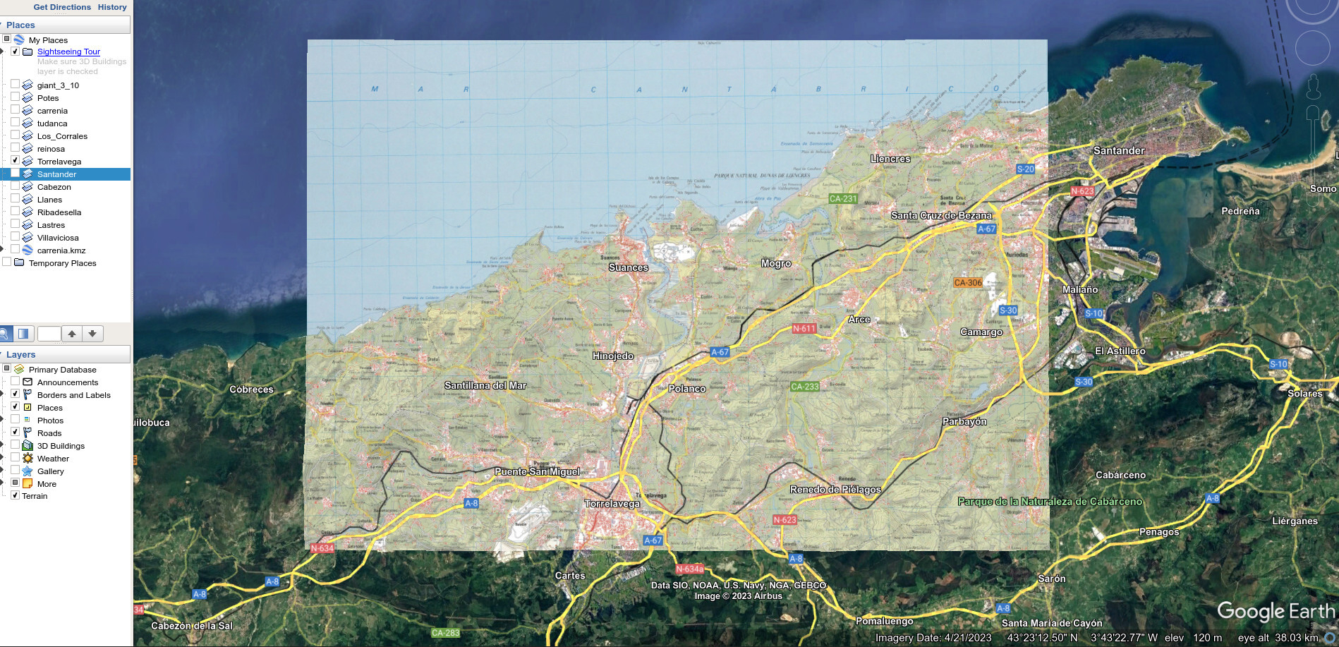
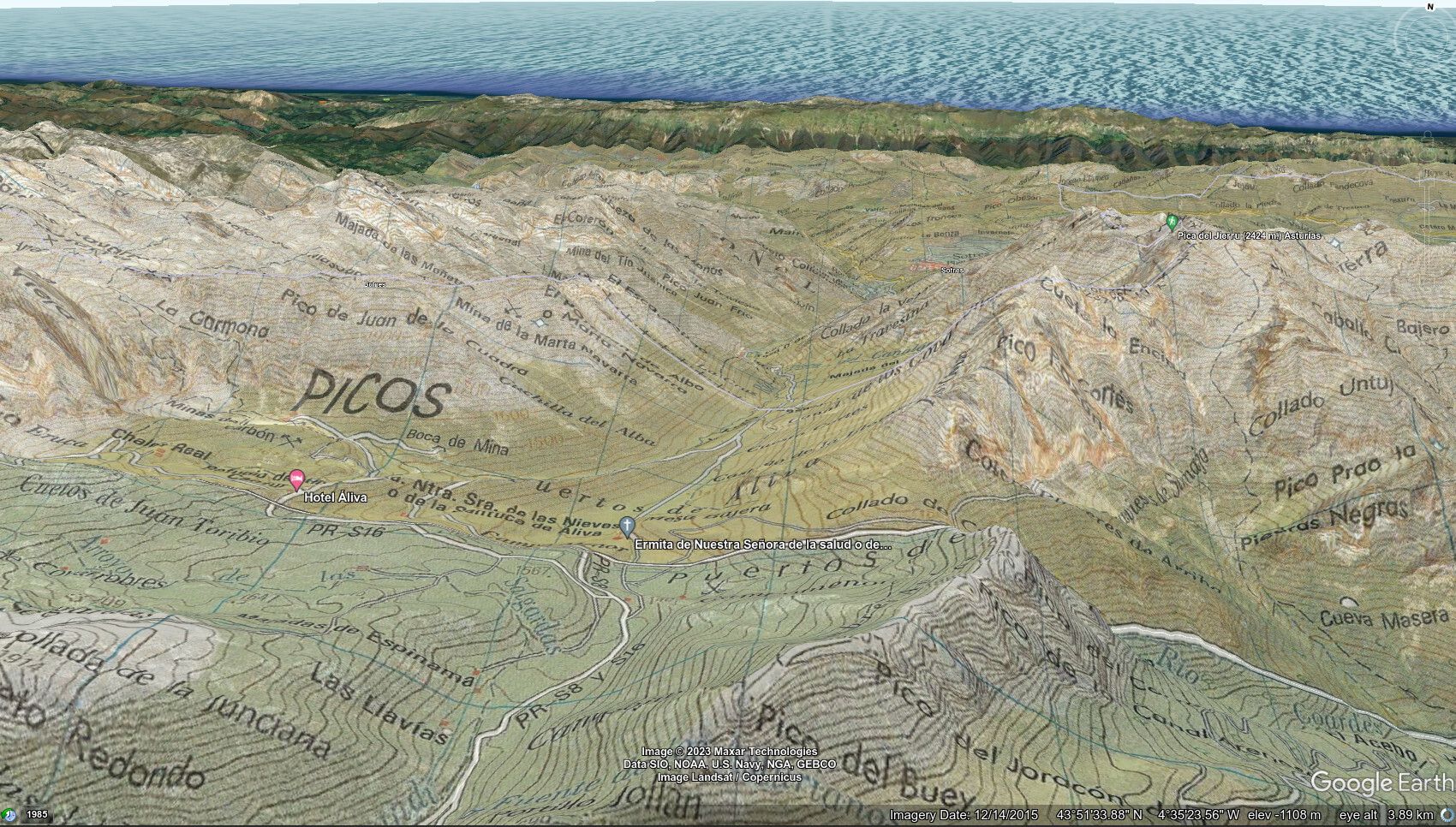
3. Now we get technical. Obviously it's impractical to print these 1:50K maps. However, there is a little-known Garmin feature whereby you can create your own raster (i.e. bitmap, rather than vector) maps completely freely and have them display on many Garmin devices - including my Fenix 6X watch. To do this, you'll need to create a Google Earth format .kmz file - this is just a zipped directory containing a .kml file (a simple XML format that defines the position of the image "overlay" in latitude and longitude) and the images themselves. To work on Garmin, these images must be jpeg files, without progressive compression, under 2MB. This is quite a limitation - however, I have discovered there is no real practical limit to how many jpeg files each KMZ can contain. I'm currently currently running KMZs containing 15-20 tiled jpegs and this renders fine.
How do you create the KMZs? To do this, you'll need Google Earth "Pro", which is freely available. The idea is to load each image as an "image overlay", and then to align it against Google's mapping. You can do this manually or by entering coordinates. Ordnance Survey maps are aligned to grid (not true) north, so there's you need to rotate them and this can make placement tricky. But IGN's maps are mercifully aligned to true north, so making perfect placement easier.
| Heart | 1 | Comment | 0 | Link |
Once aligned, you'll need to set the transparency to 0% and change the draw order to >50. Then they can be saved as .kmz files. These can be copied to a CustomMaps folder on any compatible Garmin device, and will appear superimposed when navigating if you're reasonably zoomed in.
For IGN 50K maps, these are (much) too large to render as a single jpeg. Instead, I wrote a number of scripts that can break up and tile each map, then automatically generate the KMZ file based upon coordinates already determined in Google Earth. Each generated KMZ covers a complete 20x25 km 50K map.
| Heart | 1 | Comment | 2 | Link |
1 year ago
4. There are also good vector maps already in Garmin format, some of which are freely available. A great range of routable (primarily) road maps for Europe is available at freizeitkarte. These are based on OpenStreetMap and you can just download them. Put the .img file in the root of the Garmin device and it should be detected. These are the maps I use for road navigation when I'm driving, or I want to see large swathes of a country.

5. For detailed and reliable maps it's worth spending the £11 or so and buying whole-country maps from talkytoaster.me.uk. These are also based off OpenStreetMap and other public data, but the supplier puts a lot of work into developing them and they're really useful and reliable. These are the maps I primarily use in my Garmin devices when I'm cycling - they reliably show cycleways, bridleways, footpaths, contours, and have lots of "points of interest" like restaurants and campsites. That provides a .img file which you can easily copy to any Garmin device.
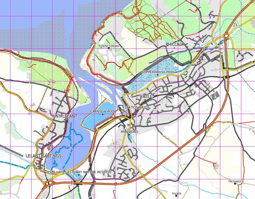
6. What about building our own maps? Well, there is a really excellent source of mapping information available for cycling at OpenMtbMap and OpenVeloMap. I've concentrated on MTB, as I really want details of off-road sections. OpenMTBmap includes curated mapping, with rating of tracks according to difficulty. However they don't provide this pre-compiled unless you're a paying member.
Fortunately it isn't too hard to compile up maps yourself, and to view them locally. You'll need to install the following dependencies:
a. Java 11+
b. 7zip
c. mkgmap
d. gmaptool
and use these scripts . Then download the MTB map data for free as an .exe file. You can build the data contained (7-zipped) in this exe file into a Garmin .img map using the command line:
create_omtb_garmin_img.sh mtbgreat-britain.exe clas
You can view and manipulate these Garmin img files, even if you don't have a Garmin device, using QMapShack. This provides a pretty good interface for viewing e.g. the detailed MTB map:
| Heart | 1 | Comment | 0 | Link |
7. Once you know where you're going, for planning the route out I still find RideWithGPS very good, especially to get a feel for grades. In general, I am a bit cautious about using the algorithm to plan the route - many maps may have routes that either don't exist on the ground (Google maps cough) or not include interesting but viable routes. I export any planned routes to .gpx files, which can copied to the Garmin (on the Fenix into /NewFiles). I also view these routes in Viking offline.

8. Finally, there's no substitution for expertise on the ground. These fellows have made an amazing website at cantabriaenbici.es giving detailed accounts and photos of dozens of off-road routes around Cantabria. It really is focused though - there's nothing in Asturias!
| Rate this entry's writing | Heart | 7 |
| Comment on this entry | Comment | 0 |