I slept undisturbed in the store room, awakening at 6am to ensure I was out my sleeping bag before any of the few fellow campers disturbed (or were disturbed by) me. Within a few minutes I'd bundled away my sleeping bag and matt, and then got washed and went and sat outside the sanitary block on a bench and made some coffee. Several residents did pass me, and gave me a friendly nod, so I was obviously fitting in despite my unofficial status.
Fortunately the rain had passed over, and while it was a bit hazy and overcast, it was perfectly dry and still. Other than the restaurant, Hainfeld hadn't enormously endeared itself to me so I was glad conditions were good for making real progress today: my plan was to leave the last foothills of the Alps behind entirely, cross the remarkably flat basin south of Vienna around Wiener Neustadt, and make it all the way across Burgenland to the big lake of the Neusiedlersee. I had to particular desire to stay around the suburbs of Vienna - it didn't seem particularly attractive and camping would be harder - but the Neusiedlersee looked intriguing and seemed to have dozens of campsites, apparently mostly operating.
Apart from a stiff section near the beginning, I would mostly be descending, but it would still be the longest day I'd done in a while. So I was glad to get the early start, and headed to get the tent - which was completely soaked, and fortunately empty of any kit - taken down. Shoving it rather unceremoniously into a pannier I then headed back to the reception villa/mansion to attempt to pay for my night's rest.
The reception mansion in camping Auwerk in the morning. Still deserted - though the car outside suggests someone is around...
I continued to have no luck in raising anyone at reception - ringing the bell and knocking at the door yielded no response. The abandoned tea cup was still there, no mostly full of rainwater. After a few minutes I gave up, folded a €10 note in a piece of paper (on which I wrote, ungrammatically, Danke für Camping!) and stuck it in the letter box.
Then I pedalled off with some relief, heading straight back onto the excellent Gösental cycleway, which was dotted with puddles. I got to see Hainfeld proper in the daytime - when it certainly made a better impression.
I had seen these odd "speed limit" signs attached to various places - it was only in combination with the banner I realised they were to announce birthdays!
One of the reasons - other than the incessant rain - I decided to call it a day in Hainfeld the day before was the next stretch of the cycleway would take me a considerable way away from the river, in a broad loop south and over my last significant climb of around 300m through the hills of the Vienna Wald. The Alps as a range was petering out - these were their last foothills at the eastern edge of the crescent of mountains beginning over 1000km away in France. Three capitals - Vienna, Bratislava, and Budapest - all nestle in the relatively small gap between them, and the rising of the Carpathians, through which the Danube break through on its way to the Black Sea.
I had great conditions for some climbing - it was cool, still and once I peeled out of Hainfeld very quiet. The gradient was mild as I stuck to the cycleway, paralleling a minor road heading back into the mountains. At Ramsau the route left even this behind, and became purely country roads climbing now steeply into really attractive green and wooded hills. It was deserted and a fitting end to my mountainous experiences.
The climb was actually pretty challenging - at one point the grades went over 20% - though I had the legs to keep going and it was soon over. Reaching the top, the mist listed and I had great views over the Wiener Wald. Compared to the soaking I'd got yesterday this was great riding.
Climbing out of Hainfeld on the separate cycleway and past some big factories. Nobody about at this time.
Taking a breather after the very steep bit, the mist and landscape opened up and I got some great views over the hilly and wooded Wald. The shiny ribbon of road just visible in the centre is where I was headed.
Coming over the top, there was a was a fast and brake-testing descent over tiny farm roads into the final valley, the Triestingtal. My brakes had performed really well but had got a hell of a lot of use, and I suspected they'd got rather worn. I passed one other cyclists (going up) and no cars.
At Kraumberg I rejoined the main road and the final river, the Triesting. I'd crossed the watershed now - which I'd been hacking upstream along the Gölsen, which emptied into the Traisen, this I would follow downstream into the Danube basin.
The cycleway was excellent and off road - which was fortunate, as it was now busy with Monday-morning traffic heading towards Vienna. I made as fast a progress as I could through the series of increasingly prosperous-looking towns strung along the valley: Thenneburg, Altenmarkt, Wiessenbach and Pottenstein. Along the way I stopped at a bakery and picked up a load of rolls and cakes - my supplies were running a bit low again.
A lot of the cycleway looked like this, by the main route 18. Only an "orange" (B) road, this was by far the busiest I'd seen yet. The proximity of the capital was becoming clear.
Lots of evidence of the forestry industry down the developed valley. This grabber was, rather roughly, loading logs onto the railway carriages - presumably for transport to the lowlands.
The next settlement, Berndorf, turned out to be something of a bigger town, and was prosperous and attractive. To my delight, the sun came out as I was passing through - I continued to follow the cycleway and found it lead up through a rather nice nature reserve (albeit with some silly steep short climbs - some of which were ~15% or so, and which I saw pensioners riding their non-ebikes up. Respect).
Lots of townsfolk were out on their bikes, and said hello as they passed. In the middle of the reserve I found a great bench - and seeing as it was midday and I was pretty hungry, sat down for a pretty extensive lunch.
During lunch, I got chatting to a friendly Indian couple who were passing by. They'd lived all over Europe, including in London, which they had fond memories of. They were gratifyingly impressed by my progress on the bike - in truth, I hadn't covered that much ground, but it's always fun to talk to non-bike people about the distances involved.
Curious information board indicating forest coverage in Berndorf, Lower Austria and Austria as a whole. 40-50% is so crazily high compared to the UK that I'm not sure I got the distinction it was trying to make!
Then I continued on my way, following the easy cycleway in dappled sunshine. There was no real way to go wrong now - I just needed to follow the valley and railway east and down into the lowland, where I'd meet the great Vienna-Graz-Solvenia highway near Leobersdorf. From there my plan was to use what appeared to be a network of cycleways, including EuroVelo9, to circumnavigate Wiener Neustadt and head out of the developed corridor and into the final state in Austria: Burgenland.
The last 8km descent of the foothills flew by, and before I knew it I was crossing under the great highway and in the midst of a maze of industrial streets and busy flyovers of Leobersdorf. A little navigation and I was over the Vienna mainline railway and back out into the - disconcertingly flat - countryside.
My plan was to first take the Thermenradweg towards, but not all the way to, Wr. Neustadt. Near Sollenau I would then leave the radweg, as I'd spotted what looked like a very minor road along the edge of the extensive milatiry area that would take me east to Zillingdorf near the Burgenland border. From there, sensible radwegs would take me to the capital of that state, Eisenstadt. In this way I would cut off a major diversion through Wiener Neustadt, which looked to be slow and not particularly rewarding.
Leaving Leobersdorf I was just overwhelmed by how different the landscape was. Suddenly I could have been in the Netherlands - cycling alongside a perfectly straight canal through a perfectly flat plain.
A heavy gnome enthusiast by the cycleway near Berndorf
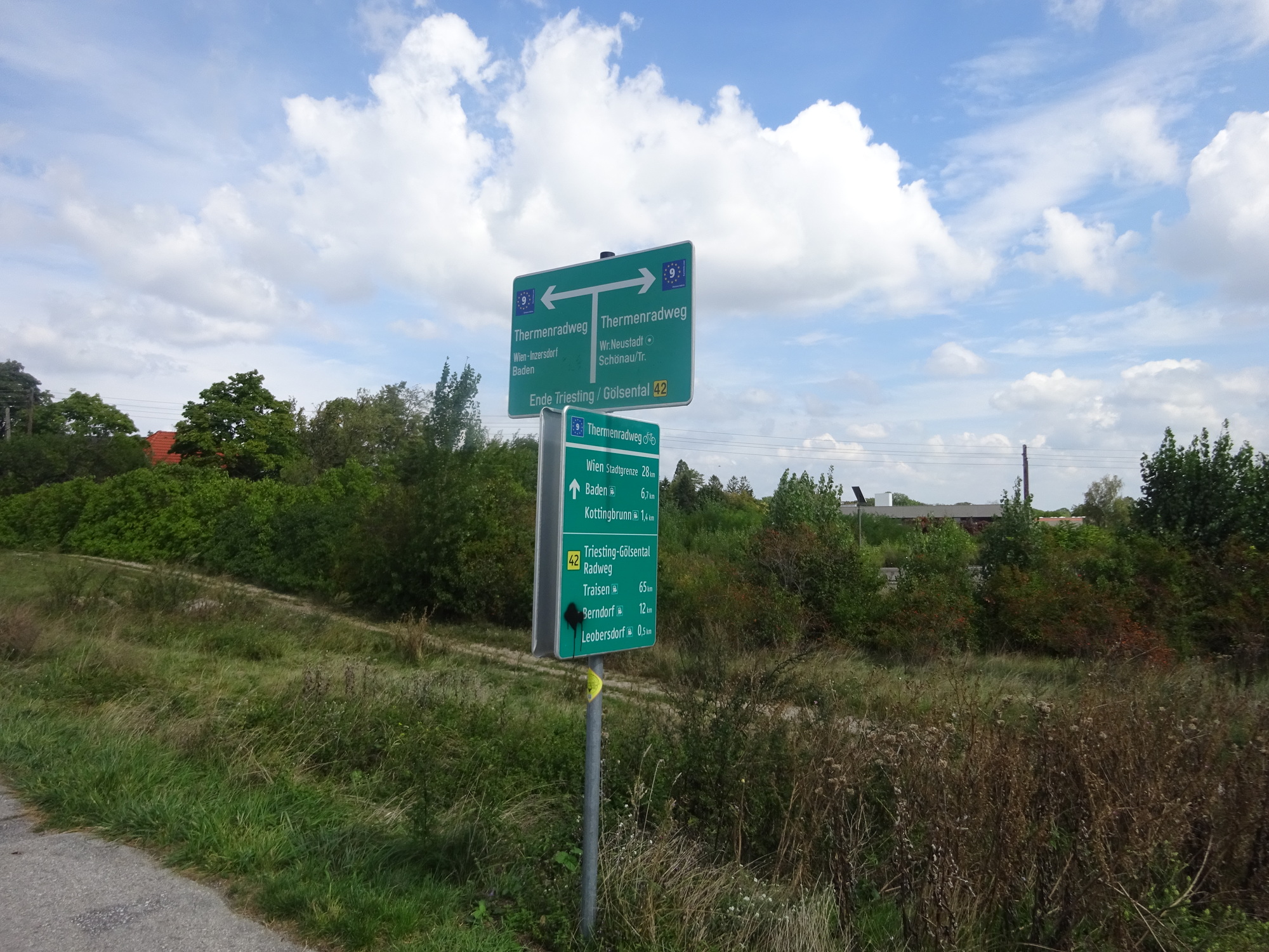
Picking up the Thermenradweg (and EuroVelo 9) towards Wr. Neustadt. Vienna appearing on the cycleway signs for the first time - I was within striking distance of the capital now. I presume it's called the Thermenradweg because of thermal baths in Baden?
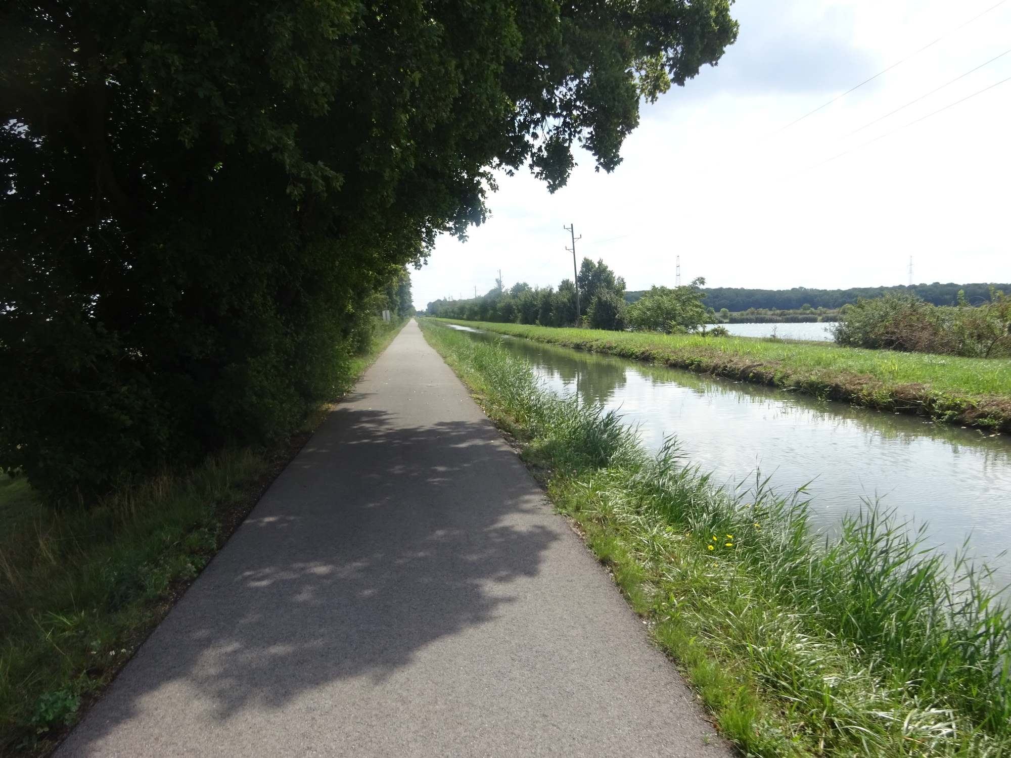
Alongside the canal on the Thermenradweg. Straight, flat and watery - it could be Flanders. Surprisingly few other cyclists about, considering it was now a nice sunny afternoon.
After Solenau, some of the secondary roads had been expanded and the cycleway had been re-rerouted away from the canal. I followed the "red" 17 for a while - this turned out to be a busy dual-carriageway carrying lots of Vienna-bound traffic. I could stay off the road, but when I saw an opportunity to go back to the east and pick up the canal again, I took it.
The next stretch along the canal and next to the military zone was signed as a cycleway, but looked much less official. And you know what? It was charming. A rough gravel path, fringed with shady pine trees, ran along the canal for a hidden couple of kilometres. The signs for the military zone (including the injunction "No photography, no painting" - sadly I don't have a photo of this) began about 100m away from the canal. I mentally logged it as a secluded place for a wild camp, should the need arise if I needed to stay a cycleable distance outside Vienna.
Towards the edge of the military zone, the canal crossed a wide gravel service road. It didn't quite look like part of the public road system, but also didn't look closed up or part of the base, so figured I could ride it to the east. In 5km I didn't see another vehicle, but access for fine - I soon popped out in Zillingdorf.
The re-routed cycleway next to major road 17. Busy and hot, now.
The slightly less formal (but signed) cycleway squeezed between the canal and the military zone. With the solitude, the sunshine and the pines, it looked like a very promising place to crash for a wild camp
The service road took me through the military zone. All the "no painting" signs were on the outside pointing towards the road, so I figured I wasn't trespassing on the base itself.
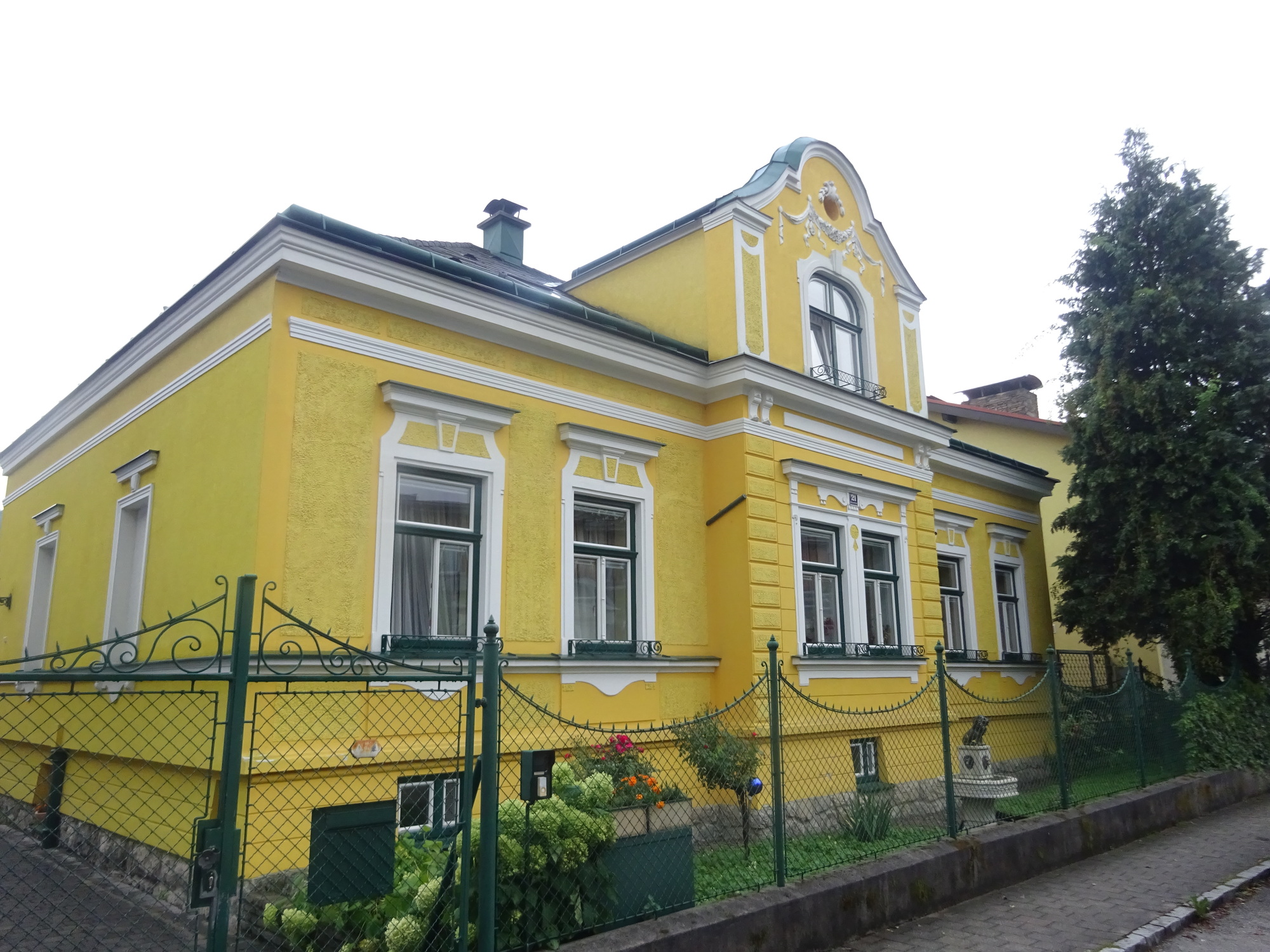
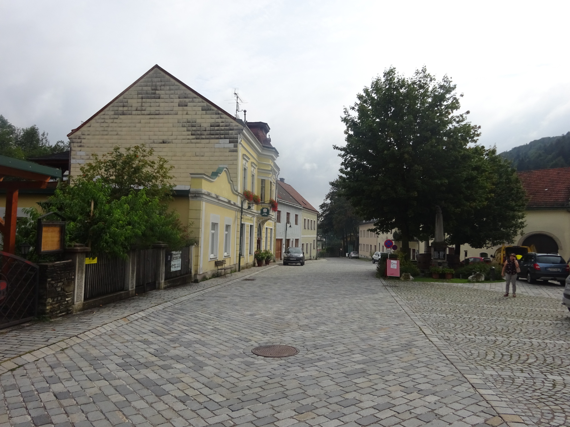
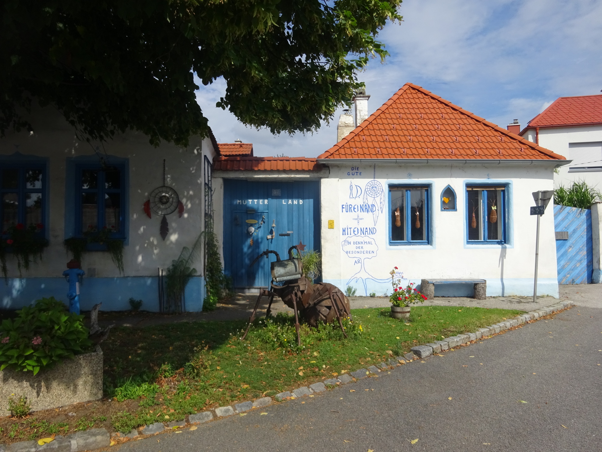
The little village of Zillingdorf, last for me in Lower Austria. The character of the villages is already changing - the buildings becoming lower and more pastel-coloured (and, to my mind, more Hungarian looking).
On the outskirts of Zillingdorf I picked up more signed cycleways - but on country road. There was significant traffic now, but the drivers were courteous as always and passed me wide. I crossed the state border - with a sign! - near Steinbrunn. Then followed some slightly complicated navigation, to pick up the radweg that would give me an easy crossing of another autobahn highway leading to Eisenstadt.
This section turned into a bit of a trial, as by now a wind had risen up from the north, and the cycleway took me significantly out the way in that direction I had a considerable headwind. In the flattish and open country my speed ground into single digits, and I began to feel pretty fatigued.
Crossing over the highway, I gratefully turned back to the south and followed the cycleway through a series of pretty villages into Eisenstadt, the capital (and only real city) in Burgenland.
Then I was doing battle with the traffic of Eisenstadt. Eisendstadt is an ancient town, and as Kismarton was the seat of the powerful Hungarian Eszterházy family. So I'm sure it has an attractive old town - unfortunately, the bit I saw was a hellaciously busy set of approaching highways, and surprisingly grim strip of industry. I also got lost a couple of times, requiring tracking back against the wind.
In general, I was very happy to leave Eisenstadt behind and pick up the festival radweg again towards the lake.
Approaching Eisenstadt. Good cycle infrastructure, terrible traffic.
My main impression of Eisenstadt was this huge industrial strip, seemingly going on forever. I had to cycle through most of this on the road as well, jousting with the trucks.
I'd had some time to think about the exact destination I wanted to aim for on the Neusiedlersee. There were several promising places, all of which had camping symbols - Purbach, Oggau, Mörbisch - but I settled on Rust, which seemed the best sort of town and where the campsite had the best reviews.
The festival radweg would take me directly there, over the low range of vine-covered hills that surround the lake. I was no longer going into the wind, and the sun was bright, so made good progess through the little villages. Many of these had bilingual names on the welcome signs, in German and Hungarian - further emphasising that for centuries this had been part of the ill-defined borderlands between Austria and Hungary. I saw more and more cars with H numberplates, and to my eyes the villages took on a more Hungarian aspect - being much lower slung and rambling.
Bilingual sign at Trausdorf (or Trajštof in Hungarian).
As I climbed up the hills ringing the lake, the sun came out, the wind dropped, and I really did have fantastic cycling conditions. The hills were covered with vines, and in this climate the vibe was positively Mediterranean. I followed the radweg up, and then between the vines - again noticing that there were some excellent and secluded wild camping opportunities should the need take me.
Then I was over the top, and the large, shallow, reedy lake appeared - with Rust clustered attractively below. As I descended down to the talk, I passed dozens of holidaymaking cyclists - it was quite disconcerting to see so many after the solitude of most of my day.
Riding alongside the vineyards as the Neuseidlersee just about becomes visible
Even on my map I could see Rust had a curious geography: the main part of the town was on the shore, but the ferry dock and campsite were at the end of a long causeway that extended almost a kilometre out into the lake, through the gigantic field of reeds which fill a rather large part of the lake.
I'd covered over 100km now, and the day was getting on - I wanted to waste no time securing a camping spot (I was worried it might be full up!) and to get an opportunity to dry out my tent. I spun down the causeway, and immediately spotted the entrance to the Storchencamp. The reception was open - did they have a place for me? They certainly did, in fact there was only one other tent. The very friendly lady booked me in - and it looked like such a lovely place - I was very happy at €12 a night.
The causeway through the reeds, to the ferry port and campsite, in Rust
I had a bench, a view over the reeds to the town, and a nice dry and grassy spot for my tent. I got out all the various parts, and spread them on the grass to dry off, suitably weighted down against the mild breeze. I sat and basked in the warm sun, reading and munching the last of my supplies, and feeling very content. I had reached the edge of Austria, and a great place to spend a rest day.
After an hour or so I got the tent up, and let it dry further in the breeze - even starting saturated pretty soon it was bone dry. I took a shower in the truly excellent shower block and the fatigue really hit me. I just didn't think I could stay awake for a proper restaurant meal.
I could see there was a supermarket in town, but had dozed for so long that it was now quarter to 8, and it closed at 8. Making a sudden decision, I threw one pannier on the Shift and went speeding out down the causeway towards the town. I knew the Billa was somewhere to the south on the main road out of town, I wasn't exactly sure where but I somehow found it and made it in the door five minutes before it closed.
Picking up Halloumi, beer, crisps and other not enormously healthy food, I emerged from the Billa significantly slower than when I went in.
My pitch in the Storchencamp in Rust. Yes, my sunglasses are still taped together.
It was a very satisfying feeling to be weighed down with food and only having to get back to camp to eat it. I pootled slowly down through the town itself, which looked fantastic in the sunset (photos on the next page).
Today's ride: 108 km (67 miles) Total: 835 km (519 miles)