April 24, 2020
Long Creek
The day begins with a trip back to the home care center for a chat with my favorite wound nurse, Angie. She’s all smiles when she unwraps my leg this morning. It’s continuing to look better - the wound is shallower and narrower across, and the tissue looks healthy. She scrapes off a few bits of unwanted dead flesh, wraps me up again, and schedules me for another visit in three days. She also discusses our upcoming move to Pullman and has no concerns with it. She says they can just electronically transfer our records to a clinic up there if follow-up is still needed.
It’s great that we’ve bent the curve and I’m steadily improving now, but I’m impatient by nature. Citing a well-known treatment currently in vogue, I ask her if it might speed things up to just pour bleach on the wound or inject some, but she advises against it.
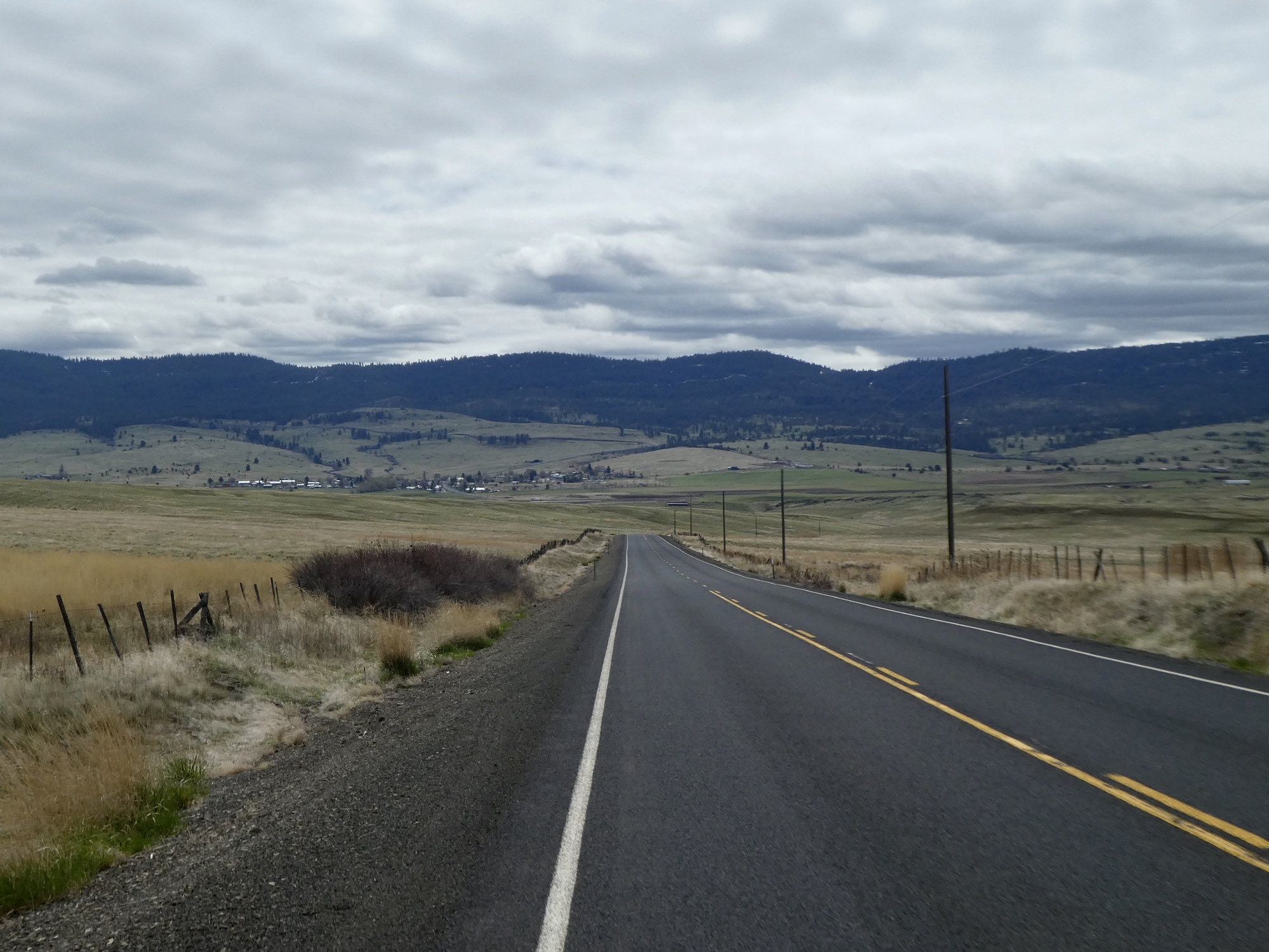
Today we’re driving north to Long Creek, the small town we passed through on our way to the Middle Fork ride to Galena we took a few days back. That was such a beautiful drive, and I came away wanting to return and explore some of it by bike. The town of Long Creek is situated at the bottom of a high elevation basin, surrounded by ridges and buttes on all sides. I’ve come up with another strange shaped route for today - an inverted T, with three out and backs north, east, and west from Long Creek. The idea is to explore the territory and get our miles in without straying too far beyond the basin into higher or steeper country.

| Heart | 2 | Comment | 0 | Link |
We park the car at the highway crossroads in the center of town, stare down a pair of yipping Pomeranians threatening us from safely behind their low mesh fence, and then start biking north. We’re going this direction first, I tell Rachael, because it’s the hardest of the three legs. Let’s get it out of the way while we’re feeling fresh. She agrees that this is good thinking.
Actually though, it isn’t a particularly difficult ride at all. For nine miles we cross a series of rollers and gradually gain elevation as we climb toward the summit of Ritter Butte, but it’s never steep. We have a bit of a tail wind, which of course helps. Until the end when we near Ritter Butte and enter its thinned out juniper woods, the ride is mostly through very wide open, treeless country that in places reminds me of the broad wheat fields further to the north above the Columbia River.

| Heart | 4 | Comment | 0 | Link |

| Heart | 3 | Comment | 0 | Link |
| Heart | 2 | Comment | 0 | Link |

| Heart | 1 | Comment | 0 | Link |

| Heart | 2 | Comment | 0 | Link |
It’s too cold and windy at the top to stop for lunch, so Rachael decides to wait until someplace lower and more sheltered. She drops off the ridge and heads back toward Long Creek while I lag behind with the camera for a bit. A few miles later I find her huddled low to the earth by the side of the road, quickly downing her lunch.

| Heart | 1 | Comment | 0 | Link |

| Heart | 2 | Comment | 0 | Link |

| Heart | 1 | Comment | 0 | Link |

| Heart | 1 | Comment | 0 | Link |

Back in Long Creek again, I tell Rachael that I erred in not bringing a lunch for myself today. In spite of my protein-heavy sausage and egg breakfast, I’m starting to feel low on gas. I dash in to the surprisingly well stocked country store and re-emerge with a large bag of mixed nuts and a banana. While inside, I wait in line behind another shaggy, gruff-looking character and listen as he alerts the cashier to some threatening activity in town. Be careful, he said. There’s a biker gang in town. Two of them, pretty fierce looking crowd, just outside the door. And then he flashes me a gapped-tooth grin and leaves the store.
Leaving town to the west now, we bike along Route 402 - the road to Monument, Kimberly and beyond. We’ve ridden a lower stretch of this road before where it follows the John Day, but up here it’s much more contoured. We’re going as far as the last divide before the road drops steeply toward Hamilton, the next settlement to the west.
As we leave town, I look at the ride profile and realize I erred earlier today. This is the most challenging section, and the one we should have ridden first. We’ve got a five or six hundred foot climb ahead, into a headwind. I relate this sad news to Rachael, who is not amused. You get an F, she unkindly shouts at me. Ingrate. Let her pick the routes next time!

| Heart | 2 | Comment | 0 | Link |

| Heart | 1 | Comment | 0 | Link |

| Heart | 2 | Comment | 0 | Link |

| Heart | 1 | Comment | 1 | Link |
http://biology.burke.washington.edu/herbarium/imagecollection/taxon.php?Taxon=Balsamorhiza%20serrata
5 years ago

At the top, I stop to break out my bag of mixed nuts and take in the views, while Rachael heads back toward Long Creek again. Her plan is to get ahead a ways and then double back again to pick up a few extra miles. I sit long enough to give her a good head start and then follow her downhill and downwind.
The ride back goes quickly, and gives us maybe the best miles of the day. It’s finally feeling warmer - the wind is with us now, and the sun is finally starting to break through. We’re out of time though - when we get back to town it’s after four already, and we’ve had enough. Even though we’re shy of 42 miles, Rachael’s thoughts are drifting toward dinner now. We drop the third leg of our inverted T, settling for a reverse L instead, and load the bikes back in the car for the long drive back.
We experience an alarming moment on the way home, descending from Beech Creek Summit.rounding a corner, we’re shocked to see a family of four mule deer standing still in the middle of the road. I barely have time to brake for them, and we’re lucky that no one was coming behind us. They quickly exit stage left, leaping over a low fence one at a time - hop, hop, hop, hop. A near catastrophe that resolved as just a charming scene.

| Heart | 1 | Comment | 0 | Link |

| Heart | 2 | Comment | 2 | Link |
https://en.wikipedia.org/wiki/Delphinium
5 years ago
5 years ago

| Heart | 2 | Comment | 3 | Link |
https://en.wikipedia.org/wiki/Letharia_vulpina
5 years ago

| Heart | 1 | Comment | 0 | Link |

| Heart | 1 | Comment | 0 | Link |
Video sound track: Bolero Sonambulo, by Ry Cooder and Manuel Galban
Ride stats today: 40 miles, 2,900’
| Rate this entry's writing | Heart | 6 |
| Comment on this entry | Comment | 2 |
Being a wound care center, I'm sure they have a few tanning beds.
Just be sure to spray the wound with Lysol before you lie down.
5 years ago
5 years ago