August 14, 2022
Newell to Weirton and the Panhandle Trail
Along the Ohio River and Back to Pennsylvania
"Up with sun, gone with the wind..." Bob Seger, Travelin' Man
August 14, 2022 - 43 Miles
Grabbed a cup of joe, a quick breakfast, and headed down the road again on a beautiful morning. A hot spell had ended a couple of days ago. Although the humidity was rising, it was not anywhere near what it had been last week when the dewpoint was in the mid-70s. Gotta love August in the Ohio River Valley. It comes complete with air you can wear. But not today!
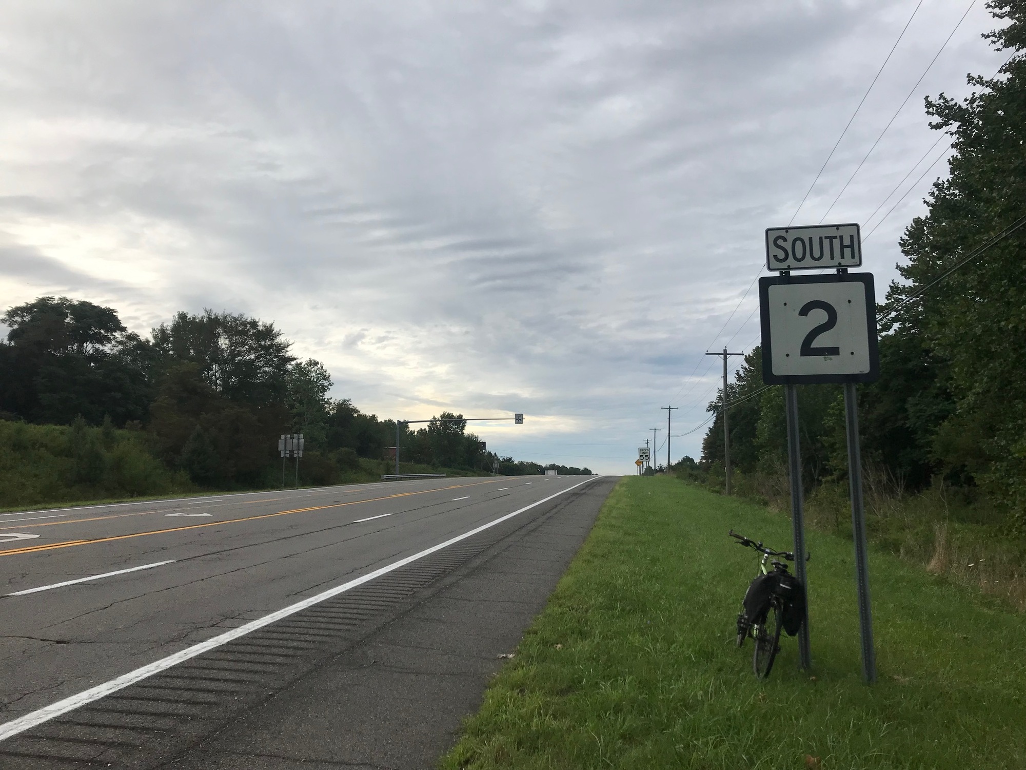
The sun was up, the temperature was cool, and no rain was in sight until the afternoon. It was a perfect day to ride. I headed south on West Virginia Highway 2, also known as Ohio River Boulevard (ORB). Traffic was very light on this weekend morning and unlike rides I had taken in the past (15-40 years ago) on this road, the shoulder seemed a lot wider. I felt very safe and was able to enjoy my surroundings.
Back in July of 1983, I rode from Pittsburgh to Cincinnati, staying as close to the Ohio River as was possible. Highway 2 had very little shoulder back then, as I remember. What it had was a lot of truck traffic that did not appreciate me being there. At New Martinsville, I remember crossing over the river to take Ohio Route 7 because it had more room for a cyclist.
For this trip, I had an exit strategy if a similar circumstance was encountered. Since the goal is to see West Virginia, the plan involved climbing into the hills to the East. Thankfully, the ORB has been improved and I was able to stay put... and flat!
Occasional sprawling industrial plants are located along ORB. South of Newell, I passed the Ergon oil refinery that was mildly humming on this otherwise peaceful morning.

| Heart | 0 | Comment | 0 | Link |
I had about 20 miles to get to Weirton and then make my way over to the Panhandle Trailhead. Those turned out to be very relaxed miles, except when one vehicle that sounded a horn. It wasn't a blare but I couldn't quite say it was a friendly toot either. In any event, it was not going to ruin this ride. My escape valve was the turn off to Tomlinson Run State Park, which I passed a few miles further to the South. To reach the park, some climbing would have been involved but necessary if traffic on Route 2 has been unpleasant. The park has about 1400 acres with all of the usual activities of boating, fishing, swimming, hiking trails, cabins, and tent camping. I was intrigued by its yurts that are available by reservation. On a hot humid night, that yurt could become a sweat lodge but on a night like the last one, it would have been perfect.
Route 2 rambled along, mostly following the Ohio River bends. Occasionally, the road would leave the river valley and climb above it for a time. The grades were not too difficult and the views up there were nice. Homes along the river road were few and far between but sometimes there was a nice spread that someone had acquired and maintained. Since a lot of this land was industrial, I would imagine that private land had been secured a long time ago. At one spot, a replica of a horse and an old buggy graced the scene.

| Heart | 0 | Comment | 0 | Link |
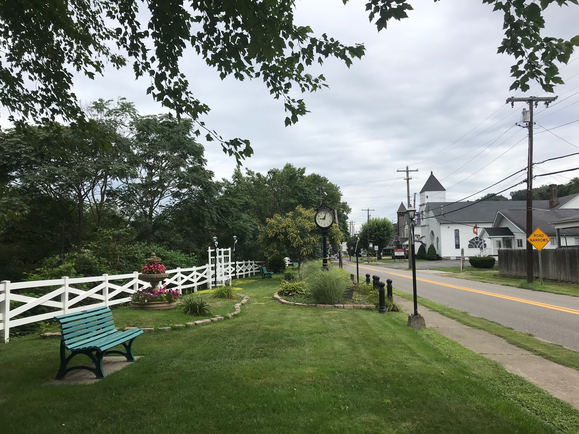
At the top of one climb, a sign told me I had entered the city limits of New Cumberland. Another sign reminded travelers this had been the Hancock County Seat since 1885. Route 2 turned left, narrowed, and climbed up into the town proper. New Cumberland was a tidy place by all appearances. The long and narrow Pride Park, honoring military veterans, was to my right and overlooked the river below. Not much was open on this still early morning but if it had been, I could have been persuaded to enjoy another cup of coffee and this pleasant little town.
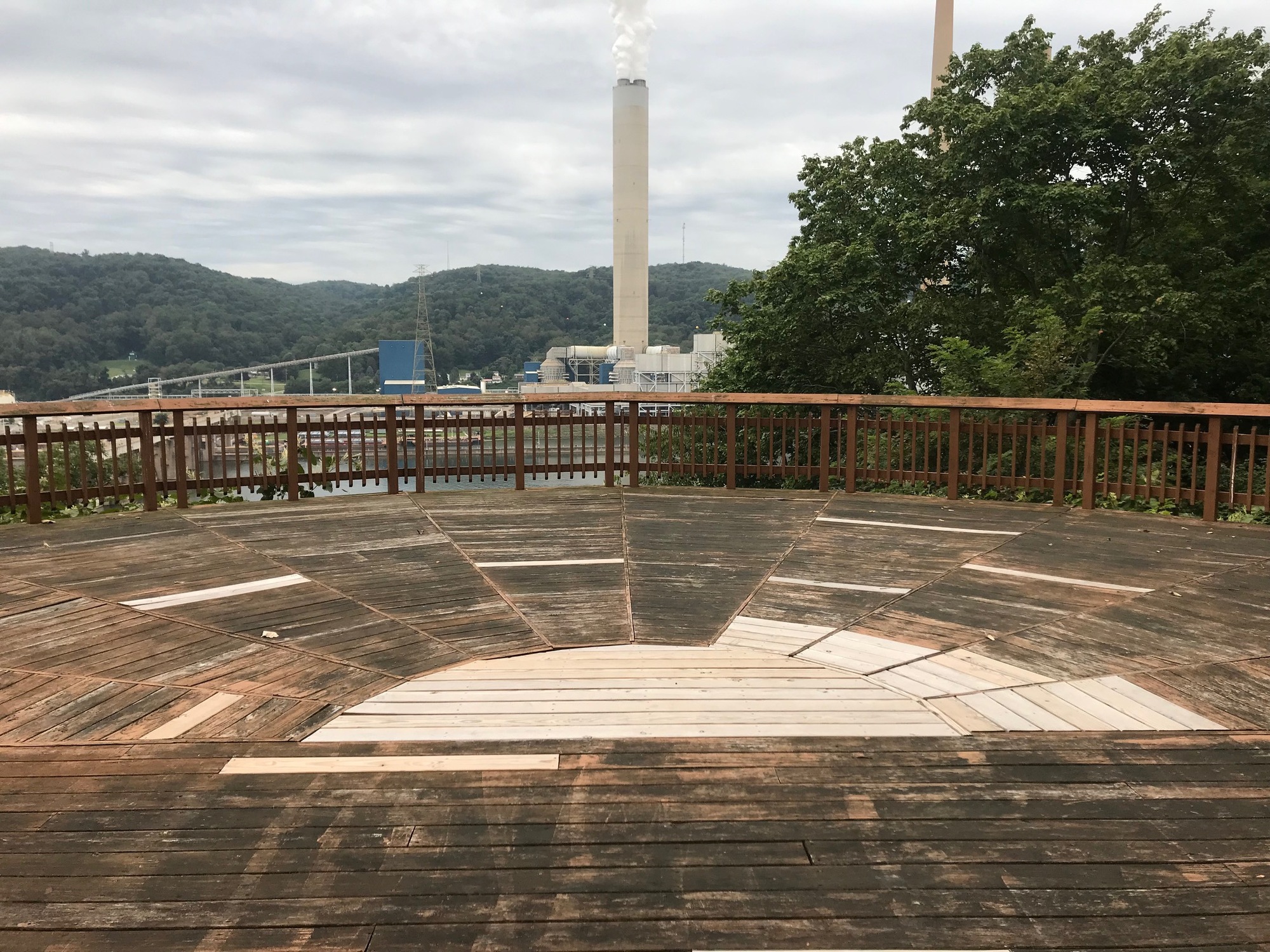
After riding out of town, the road dropped down to the river valley again. But a little bit further, a fairly long and gradual climb led to a high spot above the river and another New Cumberland park. This one, called Crestview, consisted of a small piece of cleared land and a huge wooden deck that hung out over the cliff, affording a tremendous view of the Ohio River and surroundings. Visible were the locks and dam complex and the Sammis Power Plant on the other side of the river in Stratton, Ohio. This was another good spot for a cup of coffee but since none was available, I had to settle for G-Zero at ambient temperature.

| Heart | 0 | Comment | 0 | Link |
As I was closing in on Weirton, the road began to wind around curves more frequently than it had before. It was on one of those curves that I got a horn warning from an approaching pickup truck. I had seen it in my rearview mirror but the noise still startled me a bit. To a motorist, the horn seems appropriate but even to an aware cyclist, the horn makes you feel like something more is happening than you thought. The heart instinctively jumps a bit and then you realize what it is but it takes a little while to calm back down. A green sign reminds you this is Second Amendment country, so controlling the emotions is paramount.

| Heart | 0 | Comment | 0 | Link |
After going around one of the many bends in the road, I found myself perched at the top of a long drop down into Weirton. I paused briefly to stretch, swallow some G-Zero, and then head downward. Near the bottom was a rusted industrial operation that was next to and perhaps part of, the Bidell Gas Compression Company. The morning was still peaceful, save for the hum of the plant, which was at an appropriate level for the scene on this day.
After a brief pause there, it was onward to Weirton. The steel mill there has fared better than many others in the region. After experiencing the same economic misfortunes that affected the industry, the employees organized and bought the plant from National Steel. The company enjoyed some good years but since that time there have been some ups and downs. Despite that, the mill still dominates the town, people are working, and some peripheral businesses are still operating. Perhaps it was nostalgia, but upon riding into town, a smile came to my face because the mill buildings and infrastructure reminded me of how things used to be in my younger days. The steel mills were rough, dangerous, and polluters but they breathed life into these towns like nothing else ever has. In Weirton, one can still get a sense of what it was once like around here.

| Heart | 0 | Comment | 0 | Link |
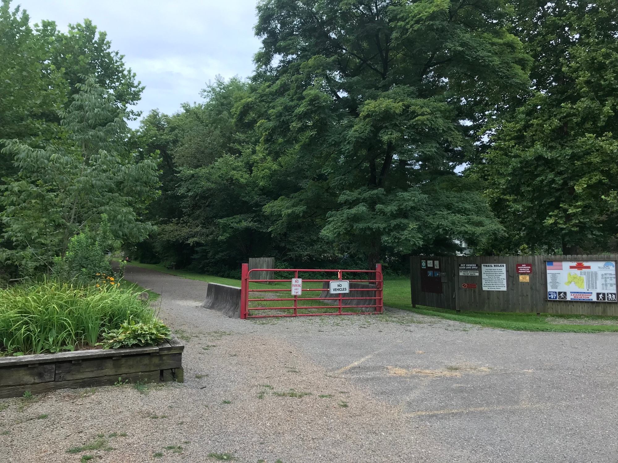
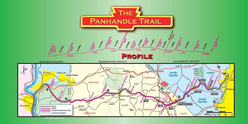
I rode through town and then it was time to leave ORB for a while. A left and right jog through some back streets took me to Cove Road and a ride through the part of town that ascends the hillsides flanking the river valley. The climb was gradual to Harmon Creek Road, a pass under US-22, and a turn onto the small road leading to the Panhandle Trailhead. To get there, Weirton is left behind and the unincorporated community of Colliers is entered. The trailhead sits next to a few trailers and a small self storage facility. There is a parking lot, a couple of benches, and a few trees. I took a short break before heading east on the rail trail and back to Pennsylvania.
The trail runs for about 29 miles to a spot called Walkers Mill, along Noblestown Road, in Collier Township, Pennsylvania. There are plans to take it all the way into Pittsburgh but those seem to be a few years off into the future. The western 4-5 miles are unpaved and lie in West Virginia.
Although there were occasional users out riding already on this morning, the overall feel was of serenity. Upon reaching the state line, the gravel turned to asphalt. As the day was advancing, more trail users were about but I continued to have long stretches of time by myself on the trail. This rail trail also has some dedicated volunteers who keep it in good condition.

| Heart | 0 | Comment | 0 | Link |
UPDATE: By 1/1/23, some of the trail had been asphalted from the state line to a point approximately 2.75 miles from the Harmon Creek Trailhead. So, at that time, there remained approximately 2.75 miles of unpaved Panhandle Trail in West Virginia.
I had about 20 more miles to go to meet my wife, who hadn't seen me for a couple of days. The agreed upon spot was the Helicon Brewing Company, in Oakdale, Pennsylvania. She was waiting there for me and so was one of Helicon's quality beverages. This ride was approximately 43 miles, half of which was in the Mountaineer State. Thanks to ORB and the trail, the climbing was a lot less, at approximately 1500 feet.
For the next stage of this tour, I'll return to the Panhandle Trailhead in Weirton and then continue on Northern Panhandle roadways toward more Mountain State adventures.
Today's ride: 43 miles (69 km)
Total: 105 miles (169 km)
| Rate this entry's writing | Heart | 1 |
| Comment on this entry | Comment | 0 |