August 13, 2022
The Northern Panhandle
Hancock County and a Brief Visit to the Buckeye State
"When the world is running down, we'll make the best of what's still around." The Police, Zenyatta Mondatta, 1980
August 13, 2022 - 62 Miles
Some parts of West Virginia are actually within an hour's drive from Pittsburgh. The Northern Panhandle (one of two in the state, the other is the Eastern Panhandle) extends narrowly and Northward between the Ohio River and the Western Pennsylvania border. It is comprised of 4 counties, Hancock, Brooke, Ohio, and Marshall. The cities of Weirton, Wheeling, and Moundsville are the larger population centers. The smaller municipalities of Chester, Newell, Follansbee, and Wellsburg (to name a few) are also located in the Northern Panhandle. Across the river, in Ohio lie the closely related cities of East Liverpool and Steubenville. All of these places share a common past of frontier life and early Ohio River commerce. Later came an industrial age that involved river transport, timber production, glass making, coal mining, steel, energy production, railroads, and trucking. In recent times, fracking or gas extraction has emerged in the region.
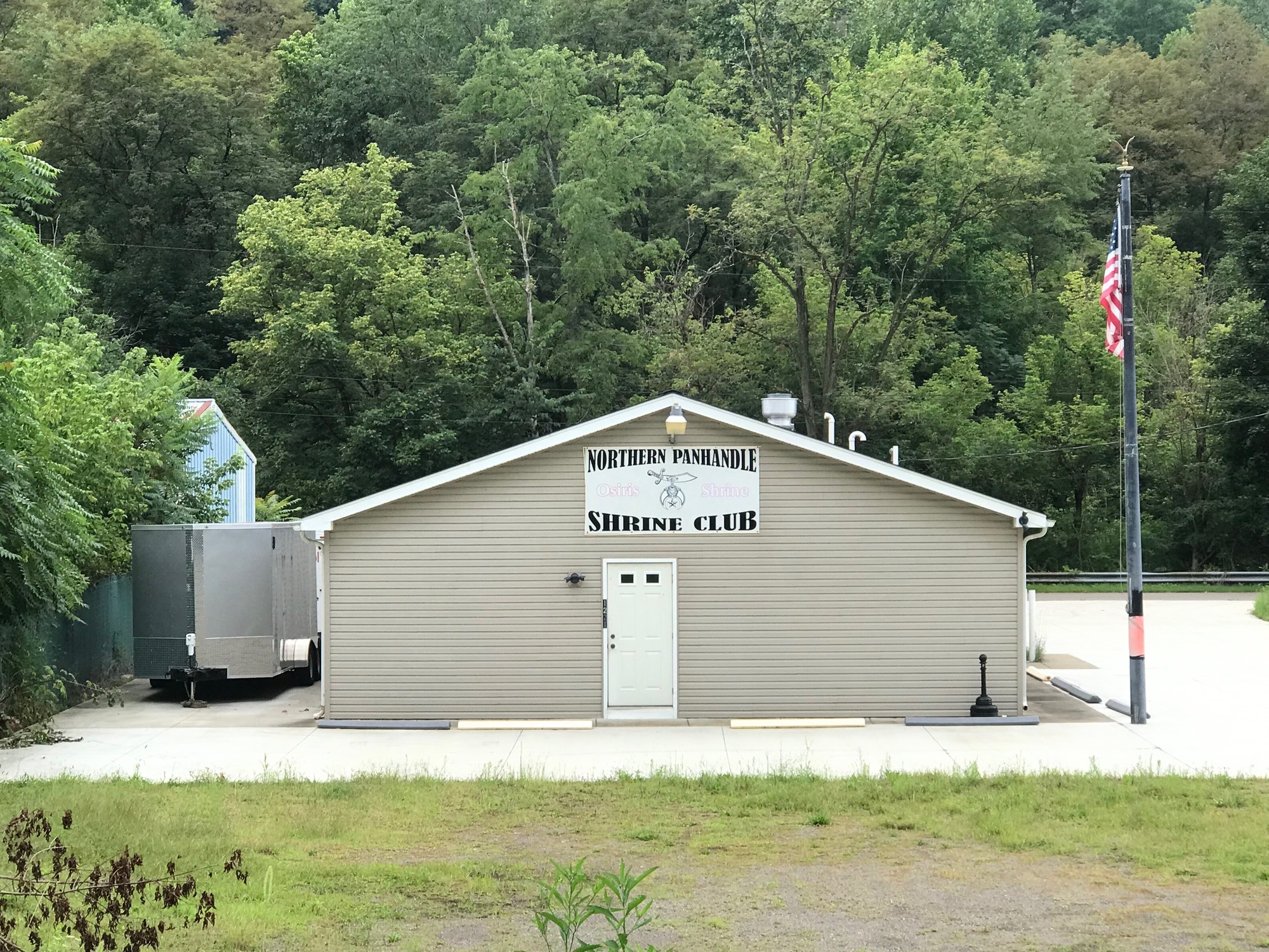
In the 1970s, these industries began to decline. The once mighty factories and mills along the river were idled and so were the communities that depended upon them. People left the Rust Belt for the Sun Belt. Remaining residents were ushered into an era of depression and despair. Those tough times began more than 45 years ago and persist in some areas to the present day. A few river communities have come back from the collapse but many others remain down. Since this part of the state is relatively close to where I live, it is a logical choice for the first few destinations of this tour. We'll head there and see what is going on in some of those Ohio River towns and in their surroundings. But first we have to get there, so the initial part of this chapter will be a description of the ride from the Pittsburgh Area to the Northern Panhandle of West Virginia.
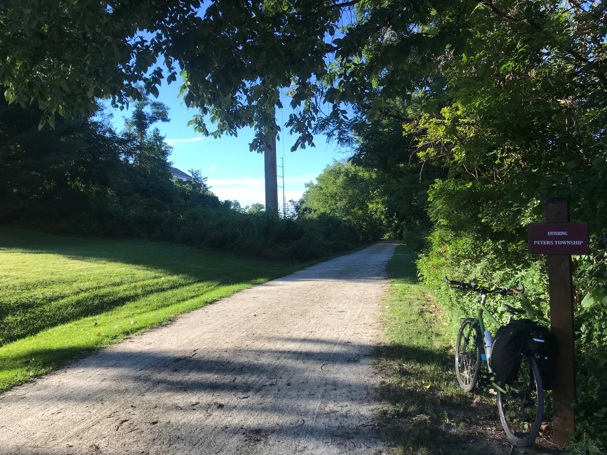
Since I left from my house, in Pennsylvania, I headed to the Northern Panhandle by way of the Montour Trail. The first 30 miles of the ride were on one of the best maintained rail trails in this part of the world. The Montour Railroad (MRR) was primarily a coal and freight hauling line that made an arc and ran to the South of Pittsburgh. It had its heyday in the first three quarters of the 20th century. In the mid 1970s, the MRR was owned by the Pittsburgh and Lake Erie (P&LE) Railroad Company. Its decline mirrored that of the coal and steel industry. Eventually, the railroad line was abandoned and some of it was sold off. Fortunately, the lions' share of it remained intact, or in what they call fee-simple status. In 1989, a group of citizens pursued a vision of turning the old rail line into a rail trail. They organized and were able to purchase most of the right-of-way from the P&LE Company, in 1991. In the ensuing 31 years, the roughly 50-mile long trail has been developed and has become a very popular regional recreational facility. The Montour Trail is meticulously maintained by a dedicated group of volunteers who live all along its path. I got on in Bethel Park, where a branch line once ran. Upon reaching the main line, I rode to the Boggs Trailhead, in Imperial. There, I exited the Montour Trail and took to the roads.
Rail trails are relatively flat but when exited, the reality of the terrain in this area hits home. Comparatively speaking, the undulating nature of Potato Garden Run Road was not the toughest ride ever taken but it was a lot different from the Montour Trail. I followed it to US-30 (aka Lincoln Highway), where I headed West.
Janoski's Farm Market, Bakery, and Greenhouse complex is located near that intersection in what is called Clinton, Pennsylvania. The Adirondack Chairs on their covered front porch made for a good spot to take break before continuing onward. While sitting there, an older woman asked for directions to Raccoon Creek State Park, which is located nearby, off of Route 30. I did my best to direct her but ended up seeing she and her husband again about 45 minutes later, still lost. I'm not sure if they ever got there but I did my best to be their GPS proxy.
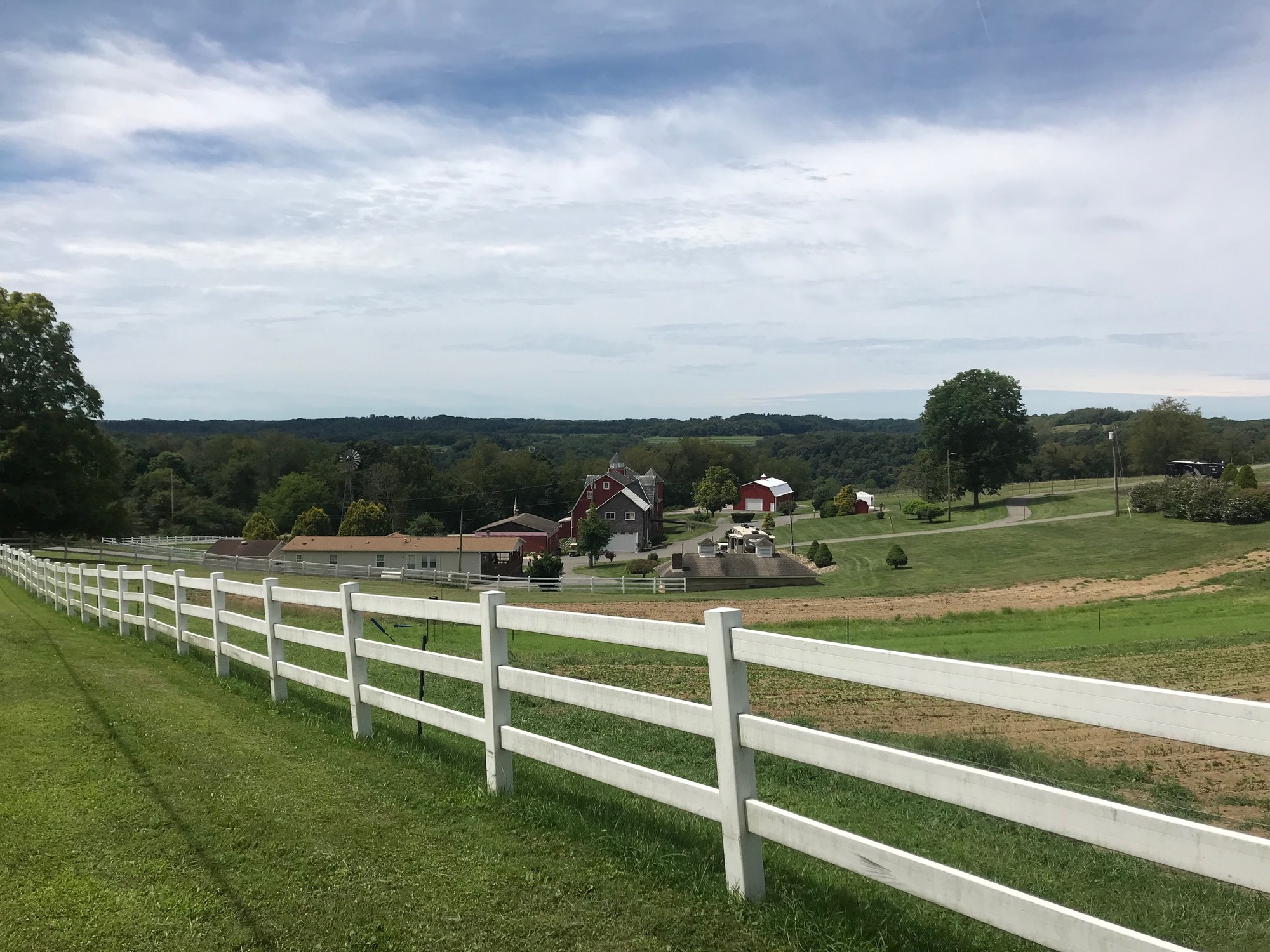
I've been out to Janoski's stores many times but had never known where the family homestead was located. A little further north and west, I entered Independence Township, in Beaver County, and there it sat, spread out along a rolling hillside. They've been in business for a long time and it looks like the farm is well kept. When heading in that direction, Beaver County becomes very rural. There was some traffic but I never felt intruded upon or in danger.
There were some dirt roads leading into the properties of several fracking companies but I didn't see much activity going on. The only town of any significance that I passed through was Frankfort Springs. This small "burgh," has a hashtag of short streets and a cluster of homes. It is bisected by State Route (SR) 18, which intersects with the Lincoln Highway (US-30) while still in town. Further along but still within the "city limits," I got onto SR-168 to continue on my Northwestern path.

| Heart | 0 | Comment | 0 | Link |
I followed SR-168, for a little more than 5 miles, to a left onto Pumpkin Hollow Road and another left onto Gas Valley Road. I had arrived to West Virginia! The state line crossing was observed only by the change in road surface composition. There used to be a sign that said Hancock County but it was not there on this day. I had to wait until the turn off for Patterson Road to get a signage photo.
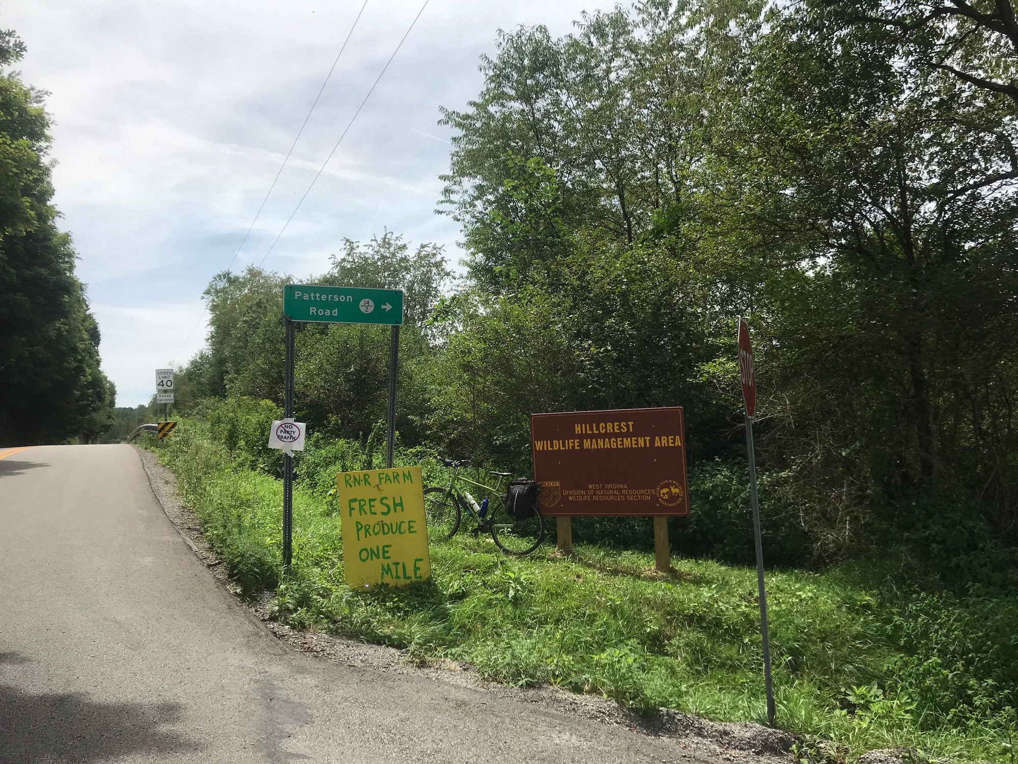
The roughly paved Patterson Road dropped down to a stream bed and then climbed back up and out of it. This would turn out to be the terrain pattern for this area, i.e., multiple demanding ascents and descents for the rest of the ride into Chester.
Patterson subsequently became Middle Run Road. It emerged from a wooded ravine, crossed a main road with traffic, and then dove back down into another narrow and forested little valley. The pattern of climb, dive, and repeat made for a challenging ride into Chester, especially after having ridden for nearly 50 miles already.
Some good bug repellent is essential when climbing out of one of those ravines. At my slow pace, I could see the bugs looking for an opening to bite me. Thankfully, my repellent provided enough protection.

| Heart | 0 | Comment | 0 | Link |
After crossing Allison Road and diving back down on Middle Run, some homes began to appear closer together on the sides of the road. The Chester town limits must be close, I remember thinking. My mapping program called for a right turn onto Alaska Street but there was no such turn to be made. I looked for an alleyway between the houses but nothing of the sort seemed to exist. After passing the area and then doubling back, an overgrown pathway that used to be a road came into focus. It was not Alaska but Maxwell Street. I walked my bike along the path and through the Japanese Knotweed that would completely overtake the road, if given a few more years unchecked. The path opened up, became a road again, and was now lined with homes. At the intersection with Louisiana Street, I stopped to get my bearings.

| Heart | 0 | Comment | 0 | Link |
The world's largest teapot was my first Mountain State destination. I was expecting a quick photo-op, but during my approach I heard music playing from a distance. Upon arriving, the Teapot Festival was in full swing. There were vendors with their tents, a band was playing, and a fair number of people were milling about. The Teapot itself was a concession stand with hot dogs, fries, and drinks for sale. This was pretty good excuse for a longer than planned break. While sitting there, I conversed with the concession staff and some patrons. Good information is often obtained that way. Among other things, I was advised that wedding ceremonies are held inside the Teapot. One fellow thought that was a dumb idea... getting married in the first place, that is.

| Heart | 0 | Comment | 0 | Link |
My next planned stop was the Museum of Ceramics, across the Ohio River, and in the Buckeye State town of East Liverpool. The folks at the Teapot told me there was construction on the bridge but they were pretty sure I could ride to the right where the construction workers go. As it turned out, nobody was working on this fine Saturday afternoon and I had an entire traffic lane, newly surfaced, completely to myself. The bridge is named after Jennings Randolph, a Senator from West Virginia who served in that capacity for nearly 30 years. He was involved in many historic events such as serving during FDR's Presidency, World War 2, and the Civil Rights Act to name a few. Apparently, he was liked well enough to have this bridge named after him. He lived for 96 years.

| Heart | 0 | Comment | 0 | Link |
Because of the construction barriers, I couldn't exit onto Route 7. Instead, I had to follow Route 39 to a place where I could safely make a U-Turn and head back to East Liverpool. It ended up being about a 2-mile detour but it really wasn't all that bad. The highway had wide shoulders and the traffic was subdued on this day. I took the exit to downtown and to my right was the historic C. C. Thompson House.
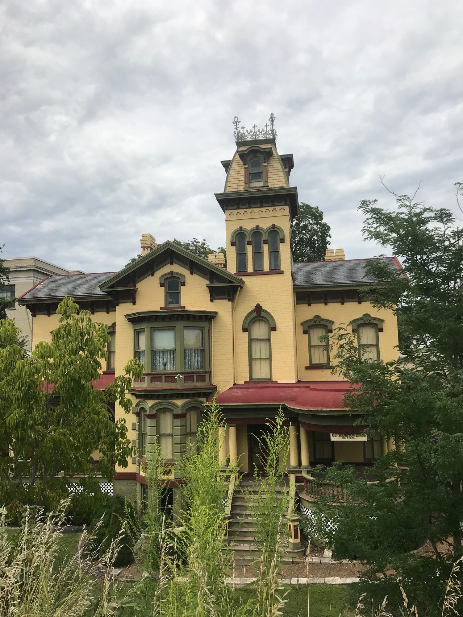
Cassius Clark Thompson was a businessman in the pottery industry that flourished in the area during the late 19th Century. He built the house for his family on a hill that overlooked the Ohio River at the time. Today, his pottery business is gone and his view would be blocked by the highway but his house still stands roughly 150 years later.
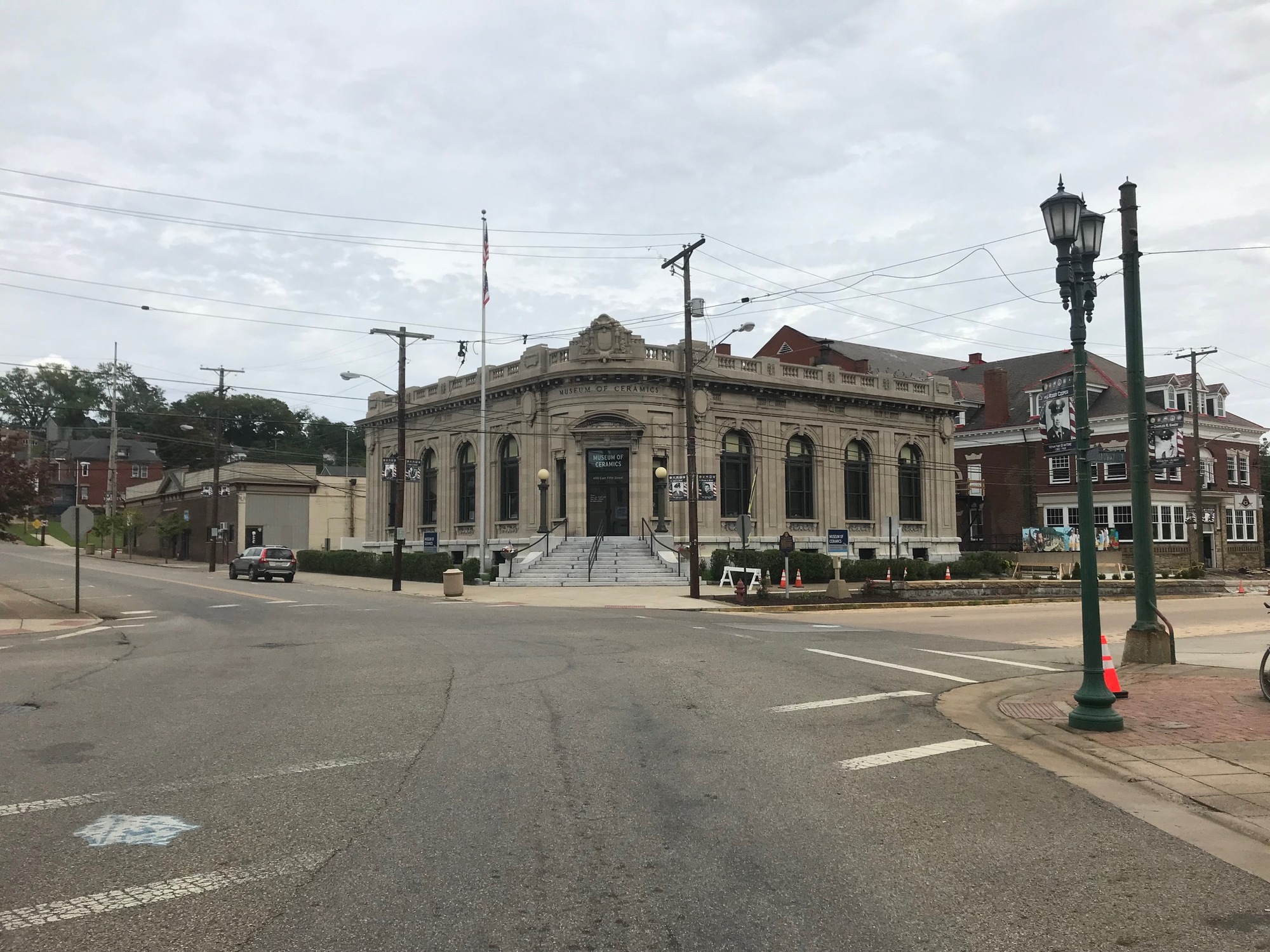
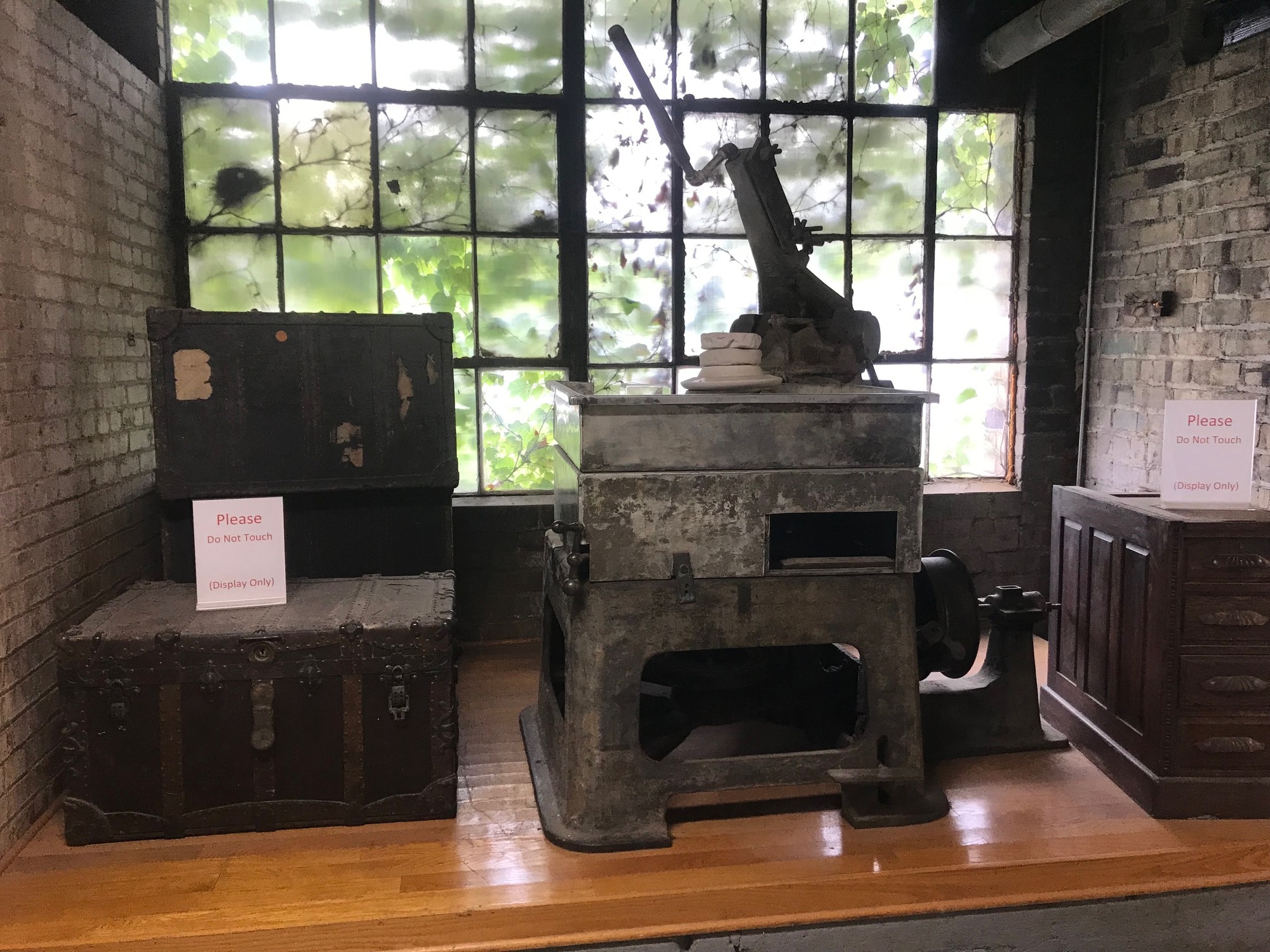
Once in town, I headed on Broadway to the Museum of Ceramics. From the outside, the beautiful building occupies a wedge-shaped corner and flanks out to the sides on either direction from its front entrance apex. Unfortunately, it was closed by the time I got there. I'll have to go back someday for the tour. At one time, East Liverpool was considered to be the pottery capital of the United States. The museum houses an old potter's wheel, some distinctive pieces, and even jewelry made from the glass. The tour gives a good look at some of the industrial history of the area. This whole area along the Ohio River had furnaces and shops where glass and ceramics production were a big industry in the late 19th and early 20th centuries.
From the museum, I headed west across town and toward another bridge across the Ohio River. On the way there, the East Liverpool High School Alumni Clock Tower and a distinctive mural for The East Liverpool Branch, of Kent State University, grace the city skyline. You may remember the Vietnam War protests in May of 1970 that led to the infamous shootings of Kent State students by Ohio National Guardsmen. That incident occurred at the main campus, not at the branch campus in East Liverpool.

| Heart | 0 | Comment | 0 | Link |

| Heart | 0 | Comment | 0 | Link |
I passed the East Liverpool City Hospital and turned left onto 5th Street and headed for the Newell Toll Bridge. It is an old narrow bridge with a toll house, a wooden sidewalk, an iron grate decking, and a rusted railing. There was no toll for the passing cyclist, as the toll house attendant waved me on. Only a little bit of vibration was felt while crossing. On the other side, a sign welcomed me back to Wild Wonderful West Virginia!

| Heart | 0 | Comment | 0 | Link |

| Heart | 0 | Comment | 0 | Link |

| Heart | 0 | Comment | 0 | Link |
On the other side, I headed for Newell and the Fiesta Tableware shop, factory, and museum. Founded by Homer Laughlin and originally called the China Company, this factory produced and still makes glassware that is shipped all over the world. The museum and factory tours are normally given during the week, when the workers are actually making the products. I looked around a bit and was able to see some of its history and a lot of brightly colored tableware. No purchases were made because transporting glassware on a bicycle is not an option.

| Heart | 0 | Comment | 0 | Link |

| Heart | 0 | Comment | 0 | Link |
By this time of day, I had been traveling for about 10 hours and was ready to get off the bike. So, I passed through the quiet center of Newell and grabbed a room for the night, at the Holiday Inn, South of town.
This was a challenging and good ride in 3 states, 62 miles and 4000 feet of climbing. It had a nice variety of terrain, scenery, local attractions, good people, and some history. The time and effort expended to complete it were well worth the investments.
Today's ride: 62 miles (100 km)
Total: 62 miles (100 km)
| Rate this entry's writing | Heart | 1 |
| Comment on this entry | Comment | 0 |