March 27, 2024
Moundsville II
Rail Trail and Grand Vue Park
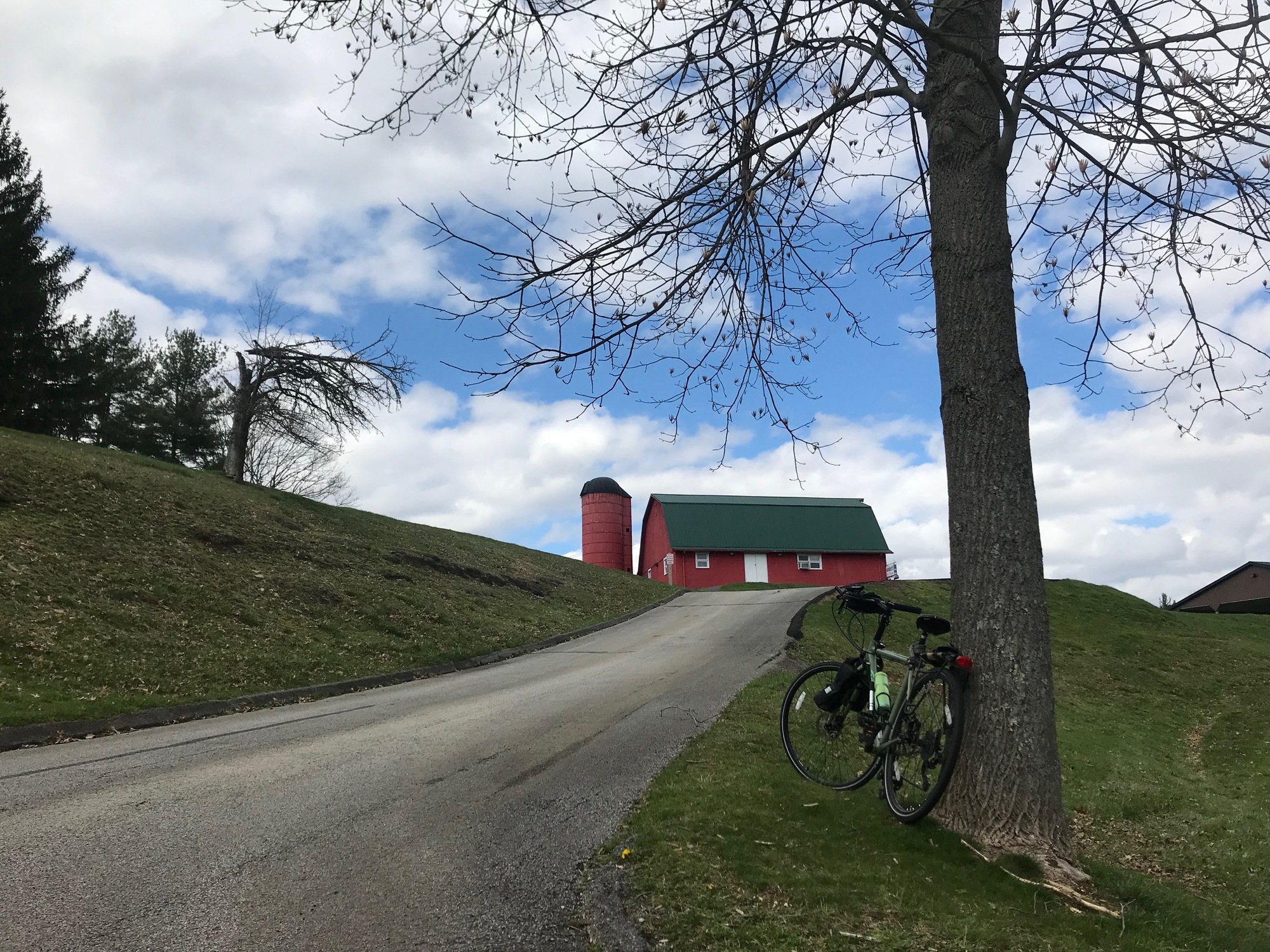
Moundsville is a unique little "burgh" that warranted a return trip. As Winter receded and Spring emerged, an opportunity to do a little more exploring presented itself, so I went. I started from the Southern reaches of town and worked my way over to the river (The Ohio River, that is). The first goal was to try and find the Moundsville-to-Glen Dale Trail that eluded me during my last visit. About a quarter mile after crossing SR-2, via 12th Street, the trailhead appeared on cue.

| Heart | 0 | Comment | 0 | Link |

| Heart | 0 | Comment | 0 | Link |

| Heart | 0 | Comment | 0 | Link |
The trail is paved with neatly maintained adjacent grounds on both sides. Its age shows, courtesy of faded asphalt and many wide horizontal cracks that eliminate the possibility of a completely smooth ride. The trail surroundings alternate between a woodsy feel to broad views of the Ohio River Valley and the hills to the west. At one spot, there were some wetlands being visited by a large gathering of geese, likely returning to the area after a long Winter hiatus. After passing another more open area, the trail followed a rise in the land but then came to an abrupt end because several truck trailers were parked where the trail would normally have continued.
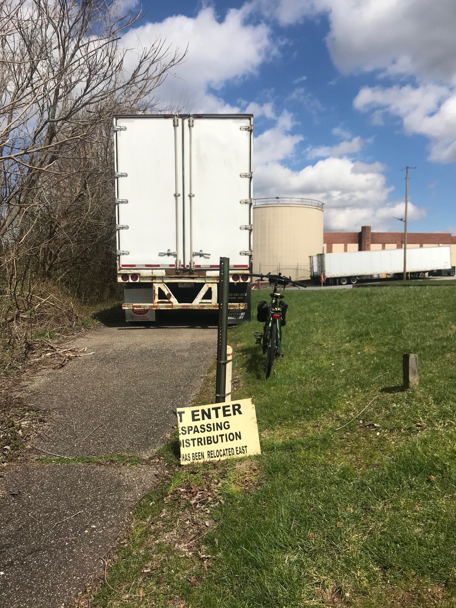
This is roughly where I got skunked, during my last visit, while attempting to find the trail in Glen Dale. There were some private property warnings and no trespassing signs that forbade my exploration at that time.
This time, I ignored the old and broken sign and pushed on past the parked trailers to see if I could find where I was, back on that beautiful afternoon in late October 2023.
Coming up into the main part of the trucking company grounds, I saw the neighborhood park where I had been before. In order to get to it, I had to shoulder the bike and cross the railroad tracks. Since nothing was coming and nobody was around to tell me otherwise, it was no problem.
Now I was on Baltimore Street and in a residential area of Glen Dale. A little more exploration took me to the end of the houses and out to SR-2, where the Haven Inn is located. I took note of it for future reference.

| Heart | 0 | Comment | 0 | Link |
Heading back Southward, the route called for a right turn on 7th Street, followed by another right down a short ramp, and there it was... the trail! Completely missed it last Fall. It is essentially a sidewalk as it passes through the trucking company property. Too obvious, I suppose.
When I got back to the main line of the trail, there was a fenced-off small concrete block building that I had passed earlier. If coming through, when this little building comes into view, bear right and up the the little ramp to reach the "sidewalk" mentioned (and pictured) above. Currently, there are no directional signs for the trail user. So, keep an eye peeled for the little block building and the ramp.
My next objective was Grand Vue Park. The hilltop perch affords a tremendous view of the city and the Ohio River Valley below. To get there, I went back through town and took Jefferson Street toward Route 250. While the main road (250) would go to the park, it wasn't very wide and it had a fair volume of traffic.
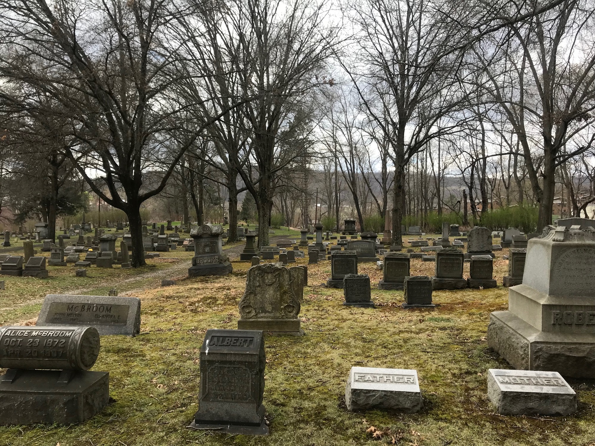
To avoid that scene, I went to Cemetery Road and turned right. A sign told me I was passing through the Mount Rose Cemetery. Someone actually lives in a house on the grounds of the graveyard. Maybe after digging graves all day, they sleep very well. Otherwise, the nights might be a little interesting.

| Heart | 0 | Comment | 0 | Link |
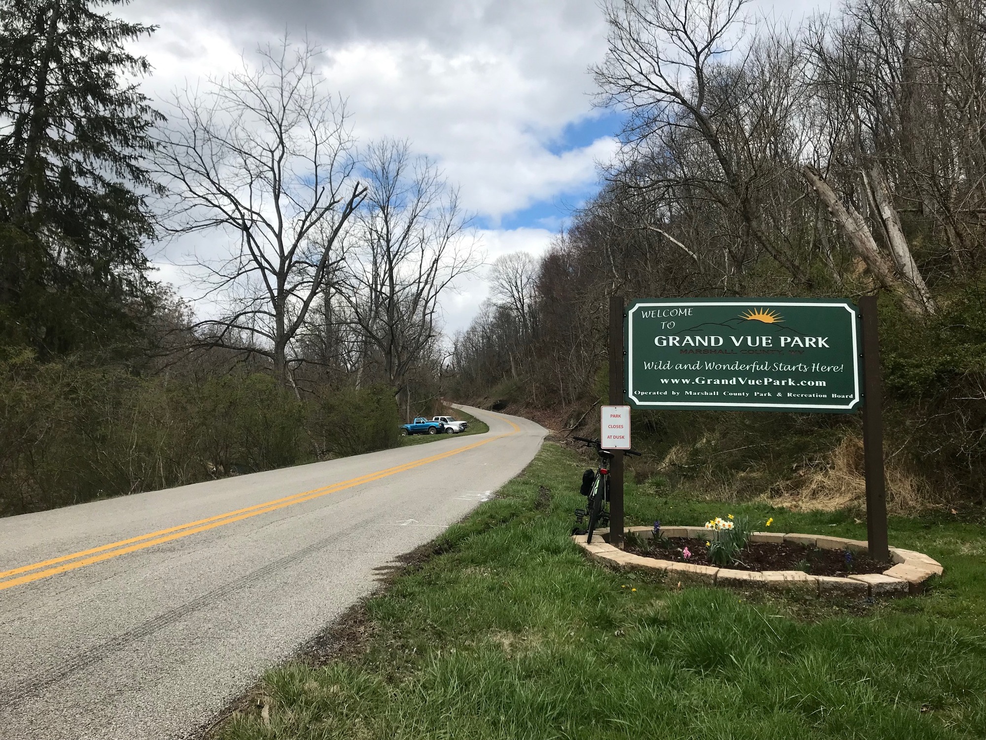
The map showed an outlet road but when I got to where it should have been, there were only the private yards of several homes. A fellow came out of his house, so I was going to ask permission to cross his yard to get to the road. Then he seemed to disappear. I decided to cut between his and the adjacent home. As I got to the front, he was working in his driveway and looked up, seeming a bit surprised to see the apparition and his bicycle coming from the graveyard. Fortunately, he was a friendly guy and we chatted for a bit. He directed me out of the little neighborhood and I was on my way to the park. En route, Grandview Road climbed steadily and sometimes steeply (20% grade, at times) into Grand Vue Park. Once inside the park boundaries, there was plenty of signage directing me to the overlook.
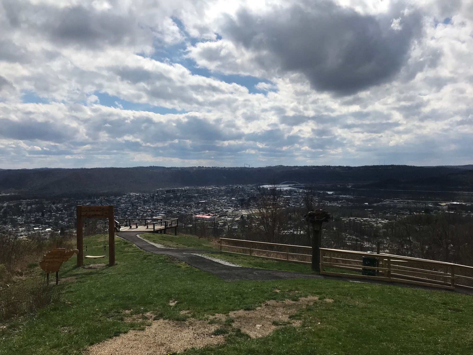
A picnic shelter above the actual overlook deck gave a pretty good vista of the valley below. A relatively new attraction in West Virginia these days are the "Almost Heaven" swings. The tourism department has installed several of these at different sites around the state. They make for a nice spot to sit with your sweetie, if you can convince (insert appropriate pronoun) to come along.
On the way back, it is a nice and long downhill ride into town. Taking it easy affords time to enjoy the view and savor the benefits of another great ride. As the saying goes, "you're one bike ride away from a good mood." That was quite true for me today.
Today's ride: 17 miles (27 km)
Total: 388 miles (624 km)
| Rate this entry's writing | Heart | 1 |
| Comment on this entry | Comment | 0 |