July 13, 2023
Monongalia Trails
Sheepskin, Caperton, and Deckers Creek
The ride today began in Point Marion, Pennsylvania. In the previous chapter, the significance and history of this unique little borough was discussed. Since it is essentially on the Mason and Dixon Line, it makes for a good spot to jump off to West Virginia. This time, my friend John-F went along as we headed South on the Sheepskin Trail to the Mountaineer State.
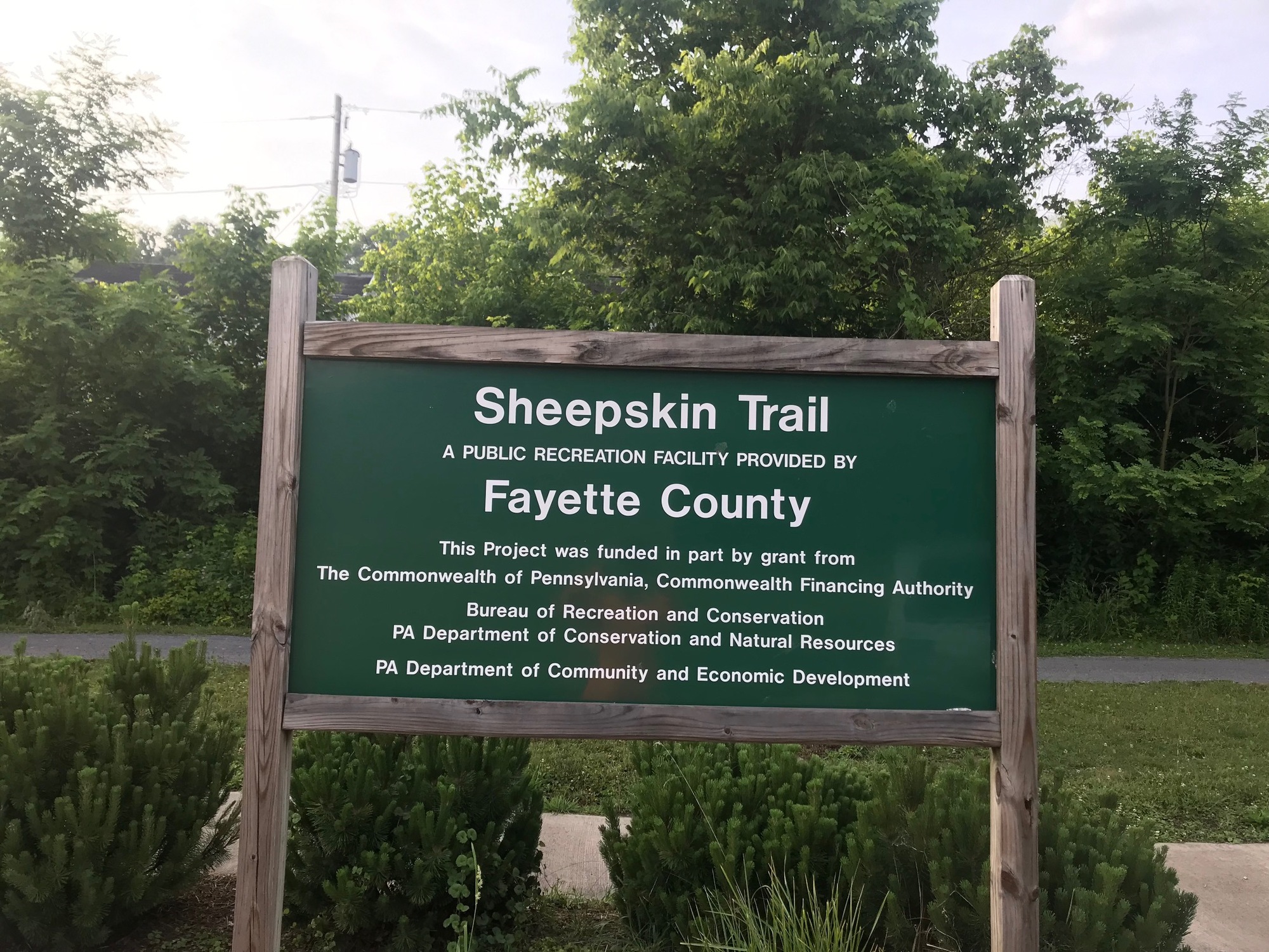
Since the trailhead is in the Southern reaches of town, it was only about three quarters of a mile further South to the state line. A couple of wooden posts and some Pennsylvania-placed signage marked the border but there was nothing for West Virginia, except the satisfaction of having reached it. A county line is also crossed, from Fayette (PA) to Monongalia (WV).
Apparently, signs are not needed because the locals know where they are. See also in the previous chapter for discussion of the similar characteristics of communities lying close to each other but on opposite sides of the Mason and Dixon Line.

| Heart | 0 | Comment | 0 | Link |
Along the way to the South, glimpses of the Monongahela River, the locks and dam, and the power plant can be had through the trees that line the trail. That canopy keeps the trail shady and cool, which was much appreciated during the return trip on what became a very warm afternoon.

| Heart | 0 | Comment | 0 | Link |
In West Virginia, the initial part of the trail is still called the Sheepskin. Approximately 6 miles from the border, the trail enters Morgantown and is paved. Within city limits, it is called the Caperton Trail in honor of former Governor, Gaston Caperton, who served from 1989-1997. The Van Voorhis trailhead, a couple of parks, the Core Arboretum, and the WVU monorail system are visible along the way to Morgantown.

| Heart | 0 | Comment | 0 | Link |

| Heart | 0 | Comment | 0 | Link |
The hub of the city trails network is Hazel Ruby McQuain (aka Ruby) Park. Located on the shore of the Monongahela River is a complex where trails go off in three directions and a beautiful outdoor amphitheater hosts an impressive series of Summer concerts. Since I was last here, larger and more modern restroom facilities have been built. The park is clean, people are about, and it is patrolled.

| Heart | 0 | Comment | 0 | Link |
Knowing we would be coming back through, we didn't dawdle too long in the park. A very short distance South of the amphitheater, there is an old railroad bridge that is part of the Caperton Trail. Immediately before reaching it is a left turn onto Deckers Creek Trail. I give this description because we did not see a sign that specifically demarcated the trail but the creek to the right makes it fairly certain that it is the right way to go.
I had ridden Deckers Creek Trail once before, back in 2008, with my friend Stan. Memories are of a lot of uphill riding through some beautiful wooded backcountry. But starting out of Morgantown, the trail is flat, paved, and winding. There are some murals on various buildings and structures along the way that caught my eye. They were not there back in '08.

| Heart | 0 | Comment | 0 | Link |

| Heart | 0 | Comment | 0 | Link |
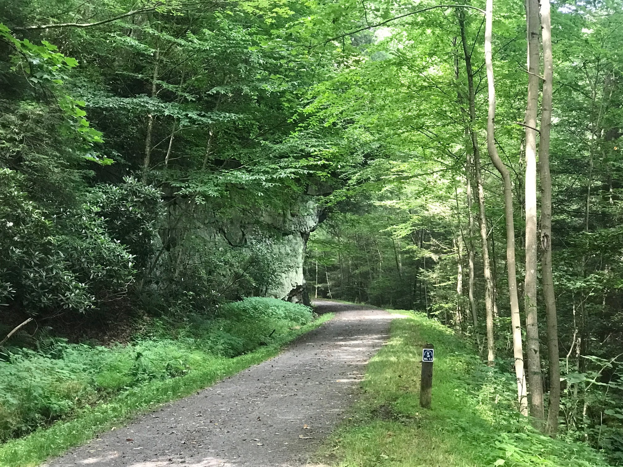
Within city limits, the trails are paved but upon leaving, they revert to crushed limestone, which is largely smooth and well-maintained. In the case of Deckers Creek Trail (DCT), the climbing coincided with the surface change.
A fact of life with rail trails is that most seem to have sections where a steady upgrade of 2-4% requires a sustained output of pedaling. The DCT has that and sometimes higher grades of climbing for most of the 16-17 miles from the city line to the end of the trail, near Reedsville.

| Heart | 0 | Comment | 0 | Link |
I suppose because it was a weekday, once leaving Morgantown, there seemed to be fewer trail users. John and I were able to ride, side-by-side and shooting the breeze, for significant distances.
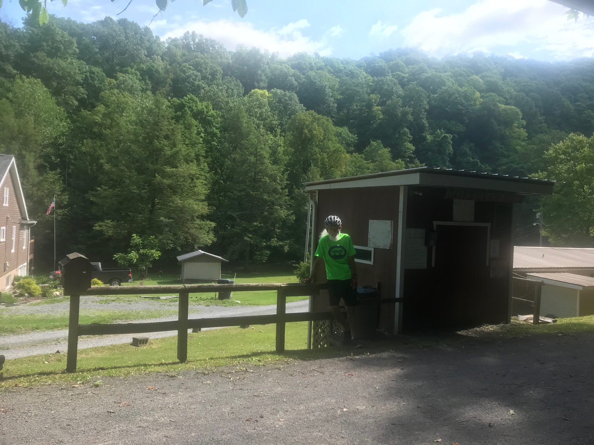
Around the 9-mile mark there is a makeshift concession stand and a covered area with chairs. The concession stand was not open. Since we had food and drink with us, the area was a good spot for a rest. A few houses and properties border the trail but not a single soul was around and none of their dogs were barking. No trail users passed by while we were there. It was very peaceful and quiet.

| Heart | 0 | Comment | 0 | Link |

| Heart | 0 | Comment | 0 | Link |
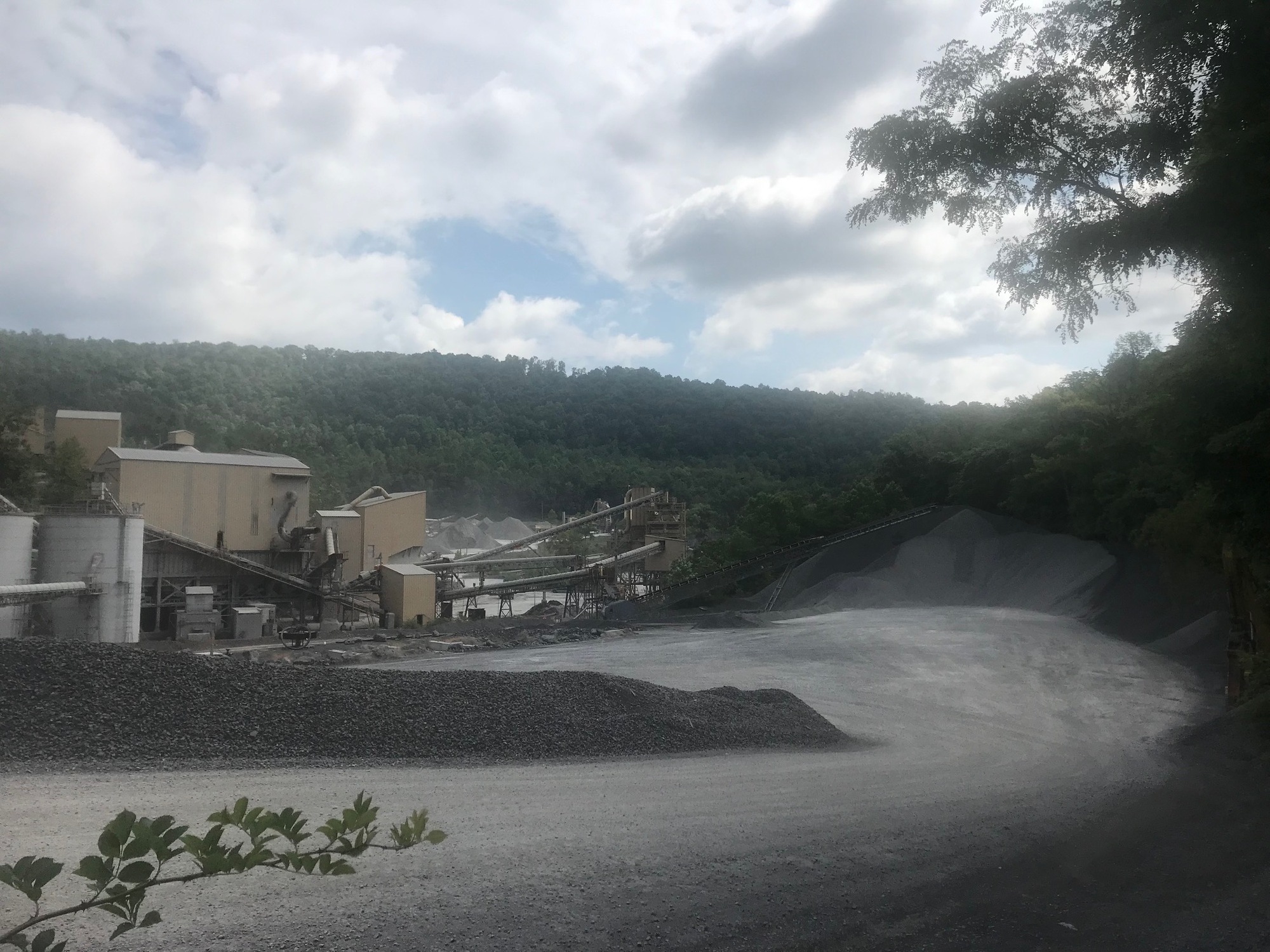
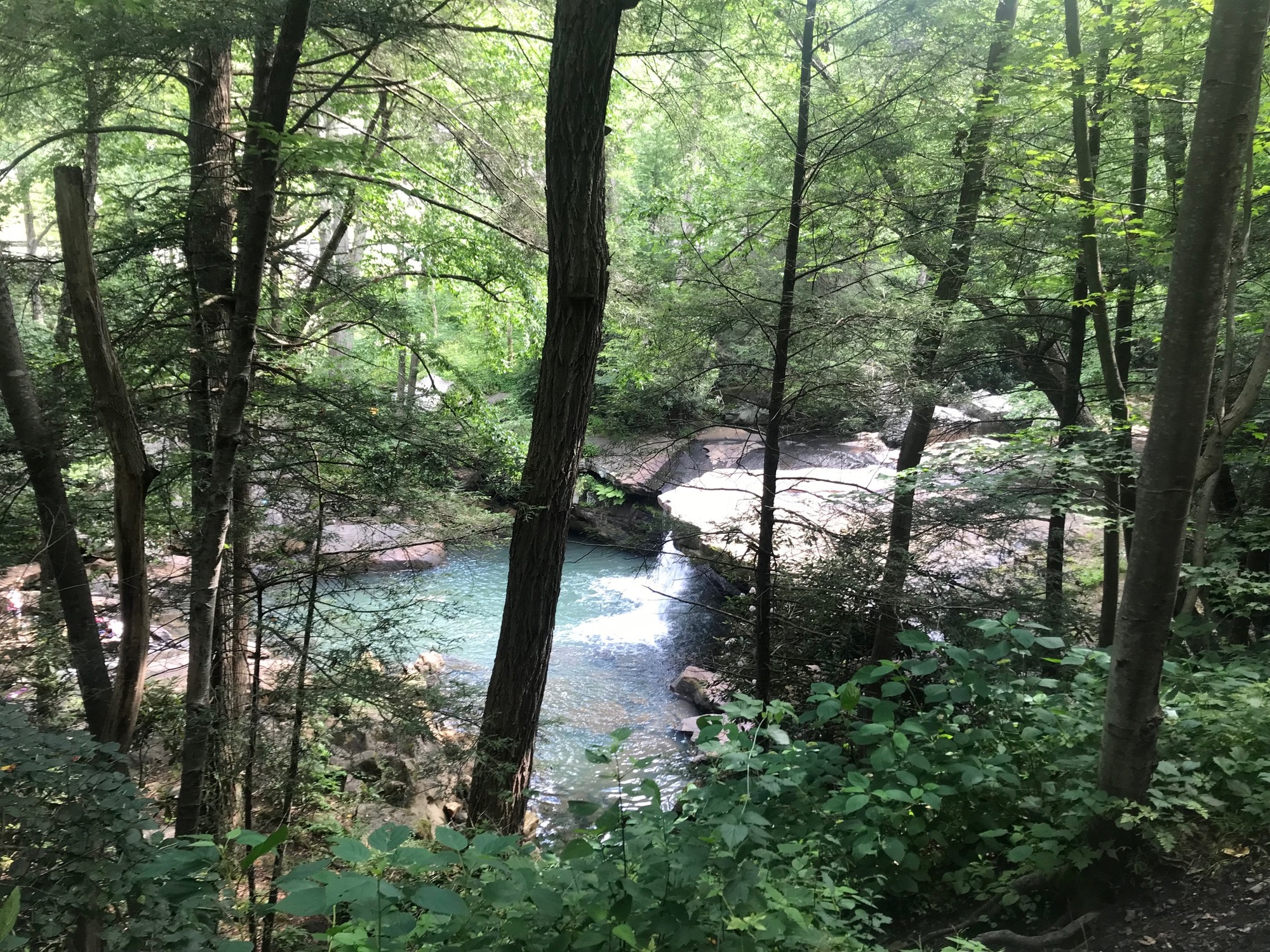
Roughly between miles 9 and 15 there is some notable scenery. Because the DCT is climbing a mountain, some larger rocks and rocky outcroppings appear. Deckers Creek sits deeper in a ravine, off to the left, when going away from Morgantown. Large rocks are visible in the stream. There is a waterfall and a swimming hole, which is where a few people were gathered on this quickly warming day. An extensive quarrying operation flanked the trail near a place called Greer.

| Heart | 0 | Comment | 0 | Link |
| Heart | 0 | Comment | 0 | Link |
Around mile 16, the Masontown "intersection" is reached. It is an open area with signage for a gravel road and another trail that go off in different directions. While there may be services nearby, it isn't very obvious from any information gleaned along the trail. The DCT continues on by bearing slightly to the right. A look at a map shows that taking County Road 7/1 to the East will get you to a "T" with Bridgeway Street. Going in either direction from there, will lead into the town of Masontown, where services are available. We did not do this but if needed, the distance is less than 2 miles. The DCT crosses into Preston County near the Masontown intersection.

| Heart | 0 | Comment | 0 | Link |
From Masontown, it is about 4 miles of trail to the Reedsville Trailhead. The trail crosses Highway 92, which can have some traffic. The Superior Fibers Plant is located there and much of its sprawling mill operations can be seen for a quarter mile or so when riding along the trail. On the way out, we took a break at the trailhead, where nary a motor vehicle passed by on Route 92. On the way back, I had to wait to cross, surprisingly longer than expected while a steady stream of trucks and cars came from both directions. Shift change at the plant? I suppose I'll not know for sure.

| Heart | 0 | Comment | 0 | Link |
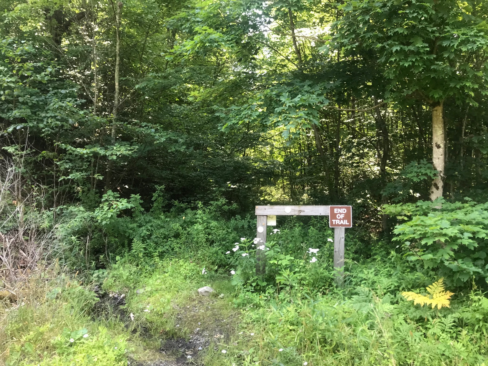
From Reedsville, the DCT goes on for about 2 more miles before coming to ab abrupt end at a woods line. A nondescript sign advises that one cannot go any further. This area sits on an overlook down toward what appears to be a reservoir that is fed by Kanes Creek. Once again, services are not available on the trail. If needed, one could brave Route 92 for a brief ride into Reedsville from the aforementioned trailhead. Since we had the essentials with us, there was not a need to go into town.

| Heart | 0 | Comment | 0 | Link |
We headed back the way we came, down the mountain toward Morgantown. It might be tempting to think the return trip will be a breeze. On the 2008 Fall ride, with Stan, my son also came along. Since he was (and still is) an avid college football fan, I have an old memory of us flying down the DCT with him talking my legs off about college football. On the 2023 ride, there seemed to be a lot more areas requiring pedaling than I had remembered. Of course, I am now 15 years older than I was back then. However, it is generally true that when going toward Morgantown, one can expect a downhill trajectory and an easier pedal to reach the city.
By the time we had returned to the city, the canopy of trees was gone and temperatures had warmed considerably. The sun was was quite strong in the more open urban areas. We paused briefly in Ruby Park before heading out on the Caperton Trail toward Point Marion. Luckily, the canopy of trees situation resumed there and provided protection from the sun. The trail ride was cooler than any adjacent road might have been.
| Heart | 0 | Comment | 0 | Link |
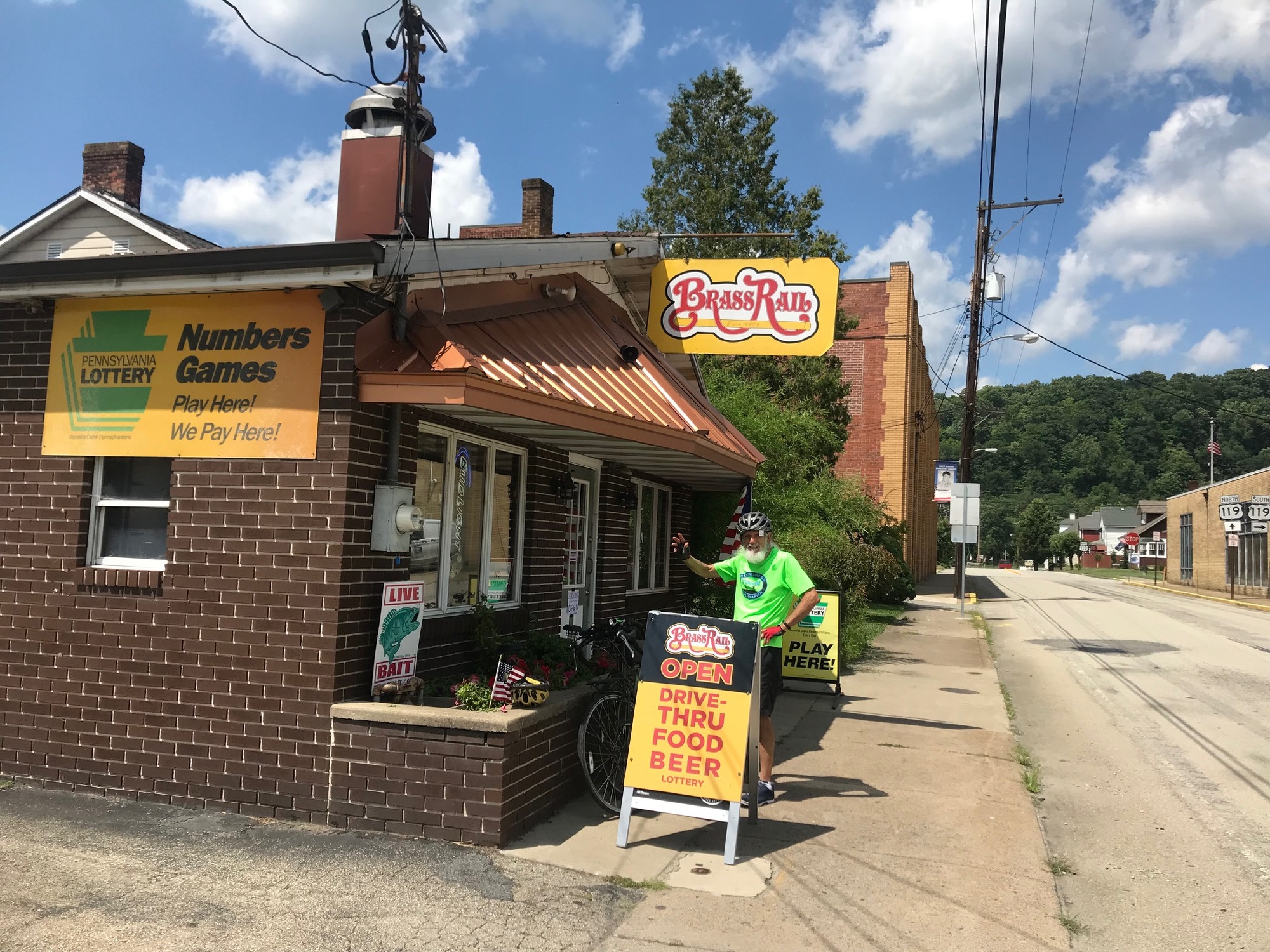
When we reached Point Marion, we headed a little further into town for a visit to the Brass Rail Restaurant and Bar. From the previous chapter, you may remember I promised myself, on the advice of Anthony Bourdain, that I would check out the place on my next visit to town. The diversion turned out to have been worth the time and effort to make it happen.

| Heart | 1 | Comment | 0 | Link |
Although a sign out front said the place was open, the door was locked. We looked around the side of the place. A fellow on a backhoe hollered at us that he would be over in minute. His name was Jim and he was the owner of the place. He told us he had lived in Point Marion since 1954 and has operated the bar since 1976. At age 80, he is still going strong. We ordered a cold beer and chatted for a while before getting back on our bikes. The Brass Rail is the only restaurant/bar in town that is still open to the public. If Jim ever decides to retire, all that might be left is the VFW Club. I hope that doesn't happen... the Brass Rail closing, not ol' Jim being able to retire.
In summary, this is a good ride with services potentially available at several points along the way. It does have some significant mileage and gradual climbing. There are some very remote areas but the scenery along the way is beautiful... as well as being wild and wonderful, like they say!
Today's ride: 60 miles (97 km)
Total: 339 miles (546 km)
| Rate this entry's writing | Heart | 1 |
| Comment on this entry | Comment | 0 |