September 12, 2014
Day 17: Lassen National Forest to Chico, CA
I only sleep a few hours during the night. In part it's because of the gallon of soda I drank yesterday afternoon, but mostly I worry about the highways we're traveling today. So far I've been able to find low-traffic country and mountain roads on which we can ride, and we've been in such remote parts of Oregon and California that even when our route takes us between two cities, the cities are so small that traffic isn't a factor.
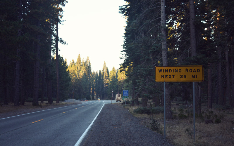
But there's only one way between where we're camped and Chico, and that's Highway 32. A look at the map alone shows that it's a winding road with a lot of elevation gain and no shoulders, but because I want to know more I do some searching on Crazy Guy on a Bike. Even though the site includes almost 10,000 journals from the past fifteen years, written by people of all ability levels, who have traveled in Somalia and Mongolia and even Alabama, the only record I can find of anyone crossing Highway 32 and living to tell about it comes from a journal of a brief trip that happened almost thirty-five years ago. That's it. There are a few mentions in forum postings, but they vary in tone from Just make sure you have a mirror and you'll be fine, to In my opinion it is a SUICIDAL ROUTE for bikes.
Nice.
The lack of information, combined with the are-you-fucking-nuts tone of the information I do find, leads to me spending hours looking at regional motorcycle blogs and creating arcane Google searches and looking through 300-page PDF files created by the State of California's department of transportation in an effort to figure out how many cars travel that stretch of road on a typical day.
The upshot of all of this: when you find yourself trying to calculate the probability of your own death on a stretch of road that you're about to travel by bicycle, your ability to fall asleep and stay asleep kind of takes a hit.
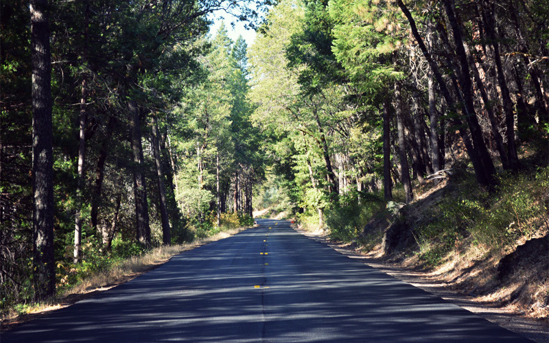
To help keep the number of passing cars to a minimum, we're up at 5:45 a.m. and return to the road at first light by 6:15. It only takes two miles before we hit our first descent, which pushes us to thirty miles per hour. Because it's forty degrees and still more or less dark, the drop freezes our hands and feet and within seconds helps my nuts get familiar with the size, shape, and exact location of my gallbladder. And because today's the day we head out of the mountains, there's no climbing on the horizon that will warm us back up. Added to all of this, and against what we expect, the air temperature becomes colder as we make our way down, which means that by the time we reach the turnoff to Highway 32 after seven miles we're pretty sure we still have faces and ears but can no longer tell by feel alone. At the side of the road near the junction we shiver and laugh in this semi-insane kind of way and start to dream of living in a world that includes nothing but warm beds and forty-minute showers.
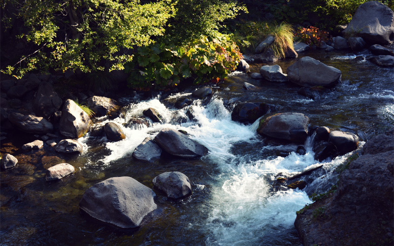
It only gets worse the farther we drop. Even though the laws of our universe mean the sun must be coming up, we're down so deep in a steep-sided canyon that it's impossible for us to confirm this. We stop at a picnic area and make tea and soup to help warm our insides, and then do all kinds of jumping jacks and punch the air and even unleash some Lord of the Dance moves, which we do with great energy and passion and mighty facial expressions until a car approaches and then we stand straight and unmoving and look around absently like we're admiring the ripples in Deer Creek.
But we can't stay stopped and wait for the sun that may or may not exist anymore, because we still have another fifty miles to Chico. So halfway frozen we hop back on our bikes and return to the descent. If you ignore the cold, the twists and turns that follow the bends of the creek make for some of the most exhilarating riding we've had. On our left, huge pine trees grasp on to rocky ground that seems to go up at a forty-five degree angle, while on our right we pass huge rock formations and little waterfalls and start to see deciduous trees for the first time in weeks.
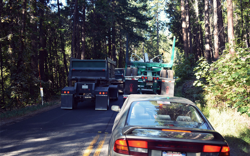
Soon we stop again, but this time it's because the road has been reduced to one lane for repaving. It's the best thing that could have happened to us. Although traffic is light on this Friday morning, and everyone who passes us gives a lot of room, Highway 32 is still a dangerous place for bicycles that requires constant attention. But the construction delay does two things. One, it lets us travel down the last five miles of the massive descent all alone, while the dozen cars that reached the flagman before us go ahead behind a pilot truck. And two, after we bottom out and start to go up, all of the cars and the vans and the dozens of logging trucks driven by bearded men on speed that are headed our way get bottled up in the work zone for fifteen to twenty minutes at a time. That sends them all past in one exhaust-filled rush, which allows us to pull off for thirty seconds, let them all go, and then ride on in peace and quiet among the sights and sounds of the woods without having to check our rearview mirrors every eight seconds.
It's so wonderful. We're beyond lucky.
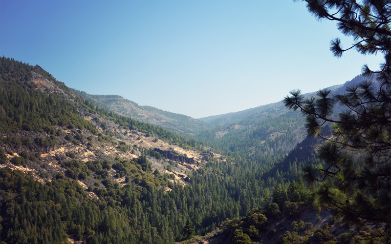
Well, sort of. Once we cross the creek the highway goes back up a thousand feet. Along the way we look down into a canyon, where a line of trees snakes along a creek we can hear but no longer see, and the sides of the canyon fold into one another like the fingers of two fists being pushed together. Far below, narrow towers of rock reach toward the sky. Swallowed up by tree shadows, we talk to one another, ride side by side if we feel like it, watch deer bounce into the forest like their legs are spring loaded, and see tiny lizards — some only an inch wide — scuttle off the pavement and into the underbrush.
On the back side of the climb we head down at a five percent grade, which is the perfect downhill angle because it lets us coast at a steady twenty-five miles per hour without using the brakes, even as the road swings left and right with the curves of a creek. That's what the pattern for most of the afternoon that follows looks like: go up five-hundred feet, drop almost a thousand, then climb back up five-hundred again. But with traffic calm and controlled, and strong motivation to reach Chico, we crawl up the hills like it's our job and savor every mile of effortless downhill.
The last push takes us back to 3,500 feet. We stand at the top of the rise, dripping with sweat from a long climb under the blazing sun, looking at the start of a descent that will see us give back a chunk of elevation of more than 3,000 feet that we've banked since our push up McKenzie Pass in Oregon almost two weeks ago.
Traffic blows by at sixty-five miles per hour or more, we bang over poorly patched ruts that spread across the full width of the shoulder, and we look out through thick haze on the Central Valley that's still thousands of feet below. It feels like riding into a furnace as the winds blow up from the floor of the valley where it's almost a hundred degrees. But when you're given 3,000 feet of downhill you don't complain.
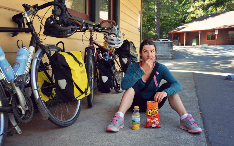
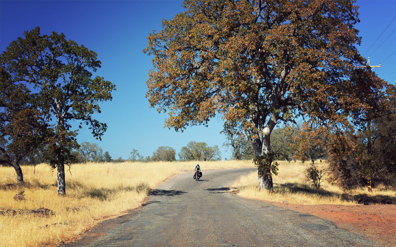
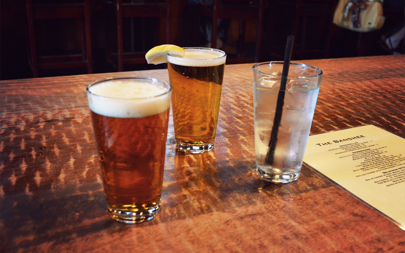
Five miles from town we head off Highway 32 and down Humboldt Road, all alone, past fields of dry yellow grass that crinkle in the breeze and in the shadows of some variety of tree that we can't identify but whose branches sag down so far they almost touch the ground. Judging from its narrow width and the fact that it rattles loose every bolt on our bicycles (and actually disconnects one of the stabilizing arms of the front rack on Kristen's bike), it might have been the first road ever built in this state, and then never worked on again. But it doesn't matter, because even though it's a rough ride it means that we made it, that the section of road I dreaded more than any other on this trip stands in our dust. We reward ourselves with beers at the first bar we find in downtown Chico, which we reach by passing through the first stop lights we've seen since Bend, Oregon eight days ago.
Living in national forests for the past eight nights has turned us a little feral, but we still know well enough to pick up good beer when someone invites us to stay in their home, so loaded down with an IPA and an Orange Wheat we ride across town to Amy's house. She's a longtime friend of Kristen's sister who welcomes us for the evening, and by way of showers and pizza helps transform us from a couple of dirty tent dwellers back in the kind of semi-civilized adults we were when we set out from Portland. But the tough riding of the last several days soon catches up with us. Kristen and I don't even make it until 8:30 before we collapse onto a giant air mattress and lose ourselves to sleep in seconds.
Today's ride: 66 miles (106 km)
Total: 803 miles (1,292 km)
| Rate this entry's writing | Heart | 2 |
| Comment on this entry | Comment | 0 |