May 3, 2025
In Menton: day two
We're up early in the morning, in time to catch a fleeting sunrise.

| Heart | 3 | Comment | 0 | Link |
Weather conditions are considerably different today. The heat wave passed in the night and today's high will be ten degrees cooler than yesterday with partly overcast skies. It looks like much more pleasant conditions for the hike and ride up into the hills we have planned. Rachael found what looks like an excellent hike on Kormoot, an eight mile loop north to an allegedly stunning viewpoint at Saint Agnes; and I'm headed for the high corniche again, the route not taken yesterday because of a minor short circuit in the CPU.
We're getting this departure planning thing down finally, and find ourselves on the sidewalk in perfect shape this time. Nothing missing, we can call each other on the phone, we can locate each other on the Garmins. Well done, Team Anderson! It's around 9, and we've got a waterfront restaurant booked for 2 PM to get back for so we congratulate ourselves and get on to it. Rachael heads up, I head down, and we're off.
Rachael's walk starts out just as planned, and looks destined to continue that way when she's just coming to what looks like will be the best part - the trail up above the A4, the autobahn that follows the coast high up in the hills
as it alternates between soaring viaducts and tunnels plowing through the next ridge. After that though she's thwarted by a loose, insistent little pest of a dog that just won't leave her alone and won't let her pass by on his trail! Even little dogs have sharp teeth though, and Rachael's not the sort to kick them backwards and be done with it so she reluctantly turns back. She'll phone me once she's out of harms way to let me know of her change of plans, which unfortunately comes to me just as I'm in the middle of the steepest part of my day.


| Heart | 1 | Comment | 0 | Link |


I've ridden the famous stretch between Nice and Menton three times now, once more than Rachael. On our ride from Nice to Lisbon back in 1997 we arrived in Nice and were biking to the train station for the short ride to Les Arcs that we planned to start the tour with when I flattened on a nail. Taking the train was out so we found a hotel, I repaired the flat, and while Rachael crashed for the afternoon I took an out and back up to Èze on the middle corniche - a ride that still has powerful memories for me. One of the strongest is of a conversation I struck up at a viewpoint, with a fit American woman cycling up solo. I was impressed that she was out here on her own, and when she let on that she was 55 years old; but I was really impressed when she told me that her partner taking a rest day back in their hotel was a decade older. Sixty-five and still cycling the hills of France! Amazing.

| Heart | 1 | Comment | 0 | Link |
All three times though we've ridden the middle corniche through Èze so I've never ridden the high corniche, the road that rises another 500' above the village before topping out at Èze Pass. This is the route the EV8 follows, and it's one I've long wanted to see for myself. I'll ride its eastern half as an out and back today, and if I'm lucky with the weather I'll ride the western half when we stay in Nice.
I take my time with the first two miles though as I follow the curve of the bay as it bends toward Cap Martin. After these two leisurely flat miles though the route doubles back sharply and starts up the spine of the cape. With little warning I'm suddenly climbing steeply at 13-15% - a discouraging start to the ride that makes me wonder if I'm up to the day's challenge until I check the gradient on the garmin and realize why I'm struggling.
It's in here that Rachael calls to let me know that she's turning back.


| Heart | 2 | Comment | 0 | Link |
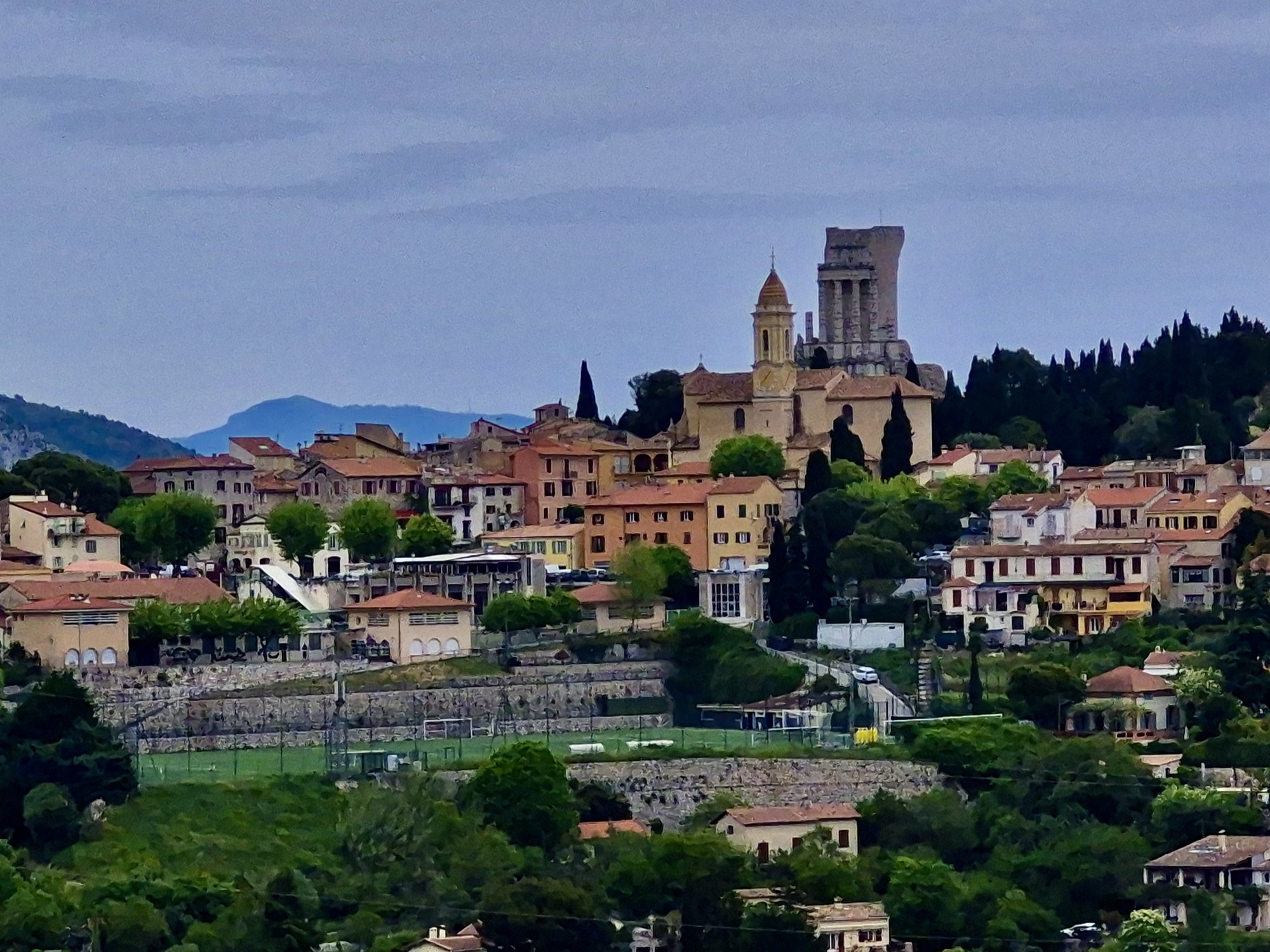
After that scare though the climb really isn't bad at all. It's steadily uphill to the high point of the pass ten miles away but the grade is never severe again. The first half stick in the 5-7% range, which is manageable but enough of a workout to earn me the right to stop for a photo here and there. And once I pass La Turbie the grade backs off two or three percent and it's a comfortable climb the rest of the way to the top.


| Heart | 0 | Comment | 0 | Link |

| Heart | 0 | Comment | 0 | Link |

| Heart | 1 | Comment | 0 | Link |


| Heart | 0 | Comment | 0 | Link |
The final five miles are the best, as the gradient levels out enough to make for relaxed riding as the views just keep getting more impressive. It's along in here that I mentally kick myself for not thinking to bring the GoPro along for the ride. The views down are mind-bending, the cliffs are dramatic, and it's an added treat to see all the wallflowers clinging to them with their long stems thrusting their blossoms to the sun.


| Heart | 0 | Comment | 0 | Link |


I reach the summit around 11:30. With only fifteen downhill miles to go, call Rachael suggest that we meet for lunch at one instead of two. I should have no trouble getting back by then, and actually most of the time on the descent I'm keeping a 17-20 mph pace, which listed fast at I'm comfortable with now. But I'm still about five minutes late because now that I'm on the right side of the road I can safely stop at the best viewpoints - something I couldn't do on the way up because it was too dangerous to stop and cross the road with its many blind curves.


| Heart | 0 | Comment | 0 | Link |

| Heart | 3 | Comment | 1 | Link |

| Heart | 1 | Comment | 0 | Link |

| Heart | 0 | Comment | 0 | Link |
| Heart | 1 | Comment | 0 | Link |


| Heart | 1 | Comment | 2 | Link |
3 months ago
3 months ago
Today's ride: 26 miles (42 km)
Total: 480 miles (772 km)
| Rate this entry's writing | Heart | 12 |
| Comment on this entry | Comment | 2 |
3 months ago
3 months ago