September 2, 2016 to September 5, 2016
Seattle to Portland
September, 2016
The STP is one of the premier organized rides in the Pacific Northwest. It's a massive event, a virtual moving city - only the first 10,000 applicants each year can participate. Roughly 200 miles, most riders complete it in two days, and some charge down in one. Rachael have only done the organized ride once, staying over in Centralia.
This isn't that ride. We're taking our time, following a longer and more interesting route, smelling the roses (or in my case, just looking at them since I can't smell). There were only just the two of us in our STP, so it was much more peaceful.
Day 1: To Tacoma (39 miles)
It is a bit hard to believe that Rachael and I have only ridden once from Seattle to Portland, one of the iconic rides in the Pacific Northwest. Over twenty years ago now, we participated in the organized annual STP, a huge cycling event. I don't recall how large the event was at the time, but now it has 10,000 participants - virtually a city on wheels. We had a great time, but we aren't really drawn to cycling in crowds and haven't been tempted to repeat the experience.
Amtrak is gradually becoming more bike friendly. On this line the baggage car has racks for roll-on bike service. For $5, you can reserve a space online when you book your ticket. Pretty straight forward and satisfactory - now, if they just served a few more destinations.
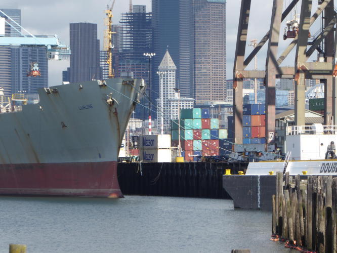
We weren't sure where we would be getting off today. We were ticketed for Seattle, but a foul weather front is moving across the region and rain and thunder storms were in store for Puget Sound this morning. We thought we might just get off at Tacoma and skip the first day's ride, but the worst of it passed by before we arrived.

| Heart | 0 | Comment | 0 | Link |

| Heart | 0 | Comment | 0 | Link |
Our ride began with a trip southwest to West Seattle and the Fauntleroy Ferry to Vashon Island. We could have biked south to Tacoma along the Duwamish River instead, following of the route the organized STP, but Vashon is much quieter and more scenic. I was a bit apprehensive about biking to West Seattle, but there is a perfectly safe, well marked bicycle route that we picked up just a block from the station.
Cycling on Vashon is much like the other major islands in Puget Sound - a bit busy on the main drag but quiet on the side roads; hilly, often quite steeply so; a mix of stylish or eccentric residences and holiday homes; roads often walled with unbroken stands of mixed hemlock/maple/alder woods; and occasional spectacular views across the water.
The highlight of the ride was the detour to Point Robinson and it's fine lighthouse. This is a beautiful spot on a point jutting into the East Passage (the channel separating Vashon and Seattle/Tacoma). We loitered a bit too long there though, misgauging how long it would take us to reach the ferry to Point Defiance at the south end of the island. Frustratingly we just missed it, arriving just as it was backing away from the dock.
We waited at the dock for an hour until the next boat arrived, and after the short crossing biked along the waterfront a short six miles to Tacoma, just in time to start scouting around for a meal.

| Heart | 0 | Comment | 0 | Link |

| Heart | 0 | Comment | 0 | Link |


| Heart | 0 | Comment | 0 | Link |

| Heart | 0 | Comment | 0 | Link |


| Heart | 0 | Comment | 0 | Link |

| Heart | 0 | Comment | 0 | Link |

| Heart | 0 | Comment | 0 | Link |

| Heart | 0 | Comment | 0 | Link |

| Heart | 0 | Comment | 0 | Link |

| Heart | 0 | Comment | 0 | Link |
Day 2: To Centralia (59 miles)
I have never stayed overnight in Tacoma. As a child we drove through it regularly on our way over to Bremerton to visit my grandparents, but we generally treated it as a place to sped through. I recall it as being quite dark and dirty then, with its industrial district polluting the skies, capped by the now departed 670 foot tall stack of the ASARCO copper smelter at Ruston, arguably the worst industrial pollution point source in the Pacific Northwest. It finally closed down thirty years ago, but over its lifetime it spewed arsenic and lead over 1000 square miles downwind. Environmental cleanup activities are still ongoing, and it has only been in recent years that Ruston has come back to life.
Passing through Tacoma back then wasn't all bad though. This was the midpoint in the long, 2 hour drive; and on good days dad would stop in at the Brown & Haley broken bars outlet to pick up a bag of damaged Almond Roca bars. Researching it now I see that this store still exists, just a few blocks from where we spent the night last night. I'll have to swing by it the next time through to see if it triggers any memories.
Back to today though. Today, downtown (and the Ruston waterfront, which we biked past yesterday) has undergone a significant renovation, and is quite attractive. We left the room early to seek out breakfast at a nearby cafe, and then took a delightful walk through the area, past the attractive vintage brick buildings lining Commerce Street, and then crossing over to the promenade alongside Foss Waterway. We'll be watching for an excuse to stop over here again before long, I'm sure.

| Heart | 0 | Comment | 0 | Link |

| Heart | 0 | Comment | 0 | Link |

| Heart | 0 | Comment | 0 | Link |

| Heart | 0 | Comment | 0 | Link |

| Heart | 0 | Comment | 0 | Link |

| Heart | 0 | Comment | 0 | Link |

| Heart | 0 | Comment | 0 | Link |

| Heart | 0 | Comment | 0 | Link |
Today's ride begins with a traverse south through central Tacoma, beginning with about a mile-long steepish climb away from the commercial district. After that it tops out and continues along a pleasant, more or less flat route through residential neighborhoods before ending at Highway 7 in Spanaway.
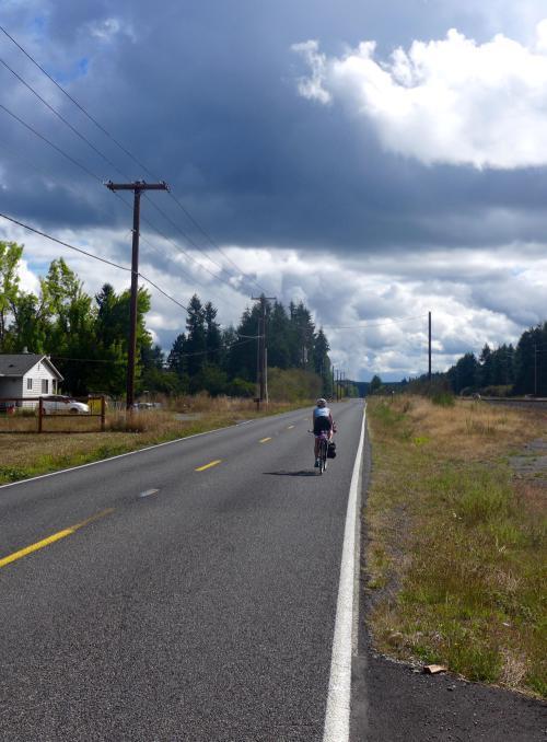
The next 17 miles aren't much fun though, as we follow Highway 7 and then 507 as it skirts the eastern edge of Fort Lewis/McCord, through the small, uninspiring towns of McKenna, Roy and Yelm. It is a monotonous road - flat, essentially straight, lined with unbroken stands of second growth conifer broken only by the occasional military vehicle or train crossing. It is a two lane highway that carries a fair volume of fast moving traffic. It's safe enough, because there is a 3-4 foot shoulder the whole way - and today at least there are no tank convoys tho dodge - but it's all a bit dreary.
And, it doesn't evoke such great memories for me. I spent two years stationed here when I was drafted into the army during the Vietnam era. I was unbelievably lucky in that I stayed on base for the whole two years working as a file clerk while most members of my company went to Asia as infantry soldiers. Lucky as I was though, it didn't prevent me from having a pretty miserable two years, worrying constantly when or whether my shipment orders would come down.
So, nothing inspired me to stop with the camera. Just get through it and move on.
We broke for lunch in Yelm. After making a complete pass through town, we couldn't find anything that looked more attractive than a Safeway so we stopped there. While Rachael was inside scouting around, I sat at a bench outside and watched with bemusement as an elderly, hardened looking woman sat down at the next bench over and pulled about a 12 ounce bottle of chocolate milk out of her plastic bag, and methodically drained it. Then, reached into the sack and pulled out and polished off a second. Then, a third. Finally, either sated or just out of chocolate milk, she lit up a cigarette and strolled off.

| Heart | 0 | Comment | 0 | Link |


| Heart | 0 | Comment | 0 | Link |

| Heart | 0 | Comment | 0 | Link |

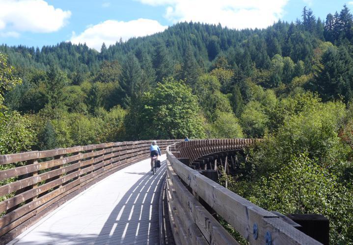
With the highway behind us, the rest of the day's ride was great. First up was the 14 mile Yelm-Tenino Trail, a rail to trail conversion. After the slog from Spanaway to Yelm it was especially pleasant to enjoy a relaxed, flat, carfree ride through the woods for the next hour. At Tenino we turned south for the final leg to Centralia, following the modest Skookumchuck River. We're back in Highway 107 again (here named the Bucoda Highway), but there is much less traffic than alongside Fort Lewis and the cycling is quite enjoyable.
We're staying tonight at the Lakeside Inn, which sounds more elegant than it is - it's basically just a budget motel with rather poor wifi, a toilet that doesn't flush all that well, and a badly placed forehead-height wall shelf that I brained myself on (twice!) when leaving the bathroom. It does have a very nice view over Plummer Lake though. I'd never even noticed that Centralia had a lake!
The day ended well, with a very satisfying meal at nearby La Tarasca, a casual Mexican restaurant run by a multigenerational Michoacan family. I had pork carnitas, the specialty of the house. Terrific.
| Heart | 0 | Comment | 0 | Link |

| Heart | 0 | Comment | 0 | Link |

| Heart | 0 | Comment | 0 | Link |

| Heart | 0 | Comment | 0 | Link |

Day 3: to Longview (53 miles)
We weren't too enthusiastic about the breakfast offerings at the Lakeside Inn (a choice between Frosted Flakes and Cheerios? Really?) so we walked over to the nearby Fiddlers Coffee for a few pastries and coffee. It's a fairly short, easy ride today so that should tide us over until our planned lunch stop in Vader. Fiddlers is a place to feel good about supporting: a small chain (there is a second store a few miles south in Chehalis), it is run by a local family of country music artists. There are I think 10 siblings, many of them regional champion fiddlers. They have a stack of albums at the counter, with a photo of the whole troupe on the jacket. It was fun to stare at it and then stare at today's staff, speculating about which they were.
Sorry - I didn't think to take my camera along so I've got no celebrity shots to share. Next time.
The beginning of today's ride feels like a continuation of yesterday's. Yesterday, we followed the flat, meandering Skookumchuck downstream to its end at the Chehalis River; and today we continue south, following the flat, meandering Chehalis River upstream. A few miles on, the Chehalis forks again and we follow the flat, meandering Newaukum. It is all lovely country, and just a short distance from the Interstate. As often happens, I'm startled to see how attractive country I've just raced through in a car is if you slow down and get off the main drag.

| Heart | 0 | Comment | 0 | Link |


| Heart | 0 | Comment | 0 | Link |


Finally, we leave the lowlands and take on the day's big challenge - a 200' lift out of the valley onto a low plateau. That's about it for hills for the day though. Once on top, we continue south on a gently rolling road through second growth forest until we come to the turnoff for Vader, our lunch stop for the day.
Vader used to be a place of significance, but there's not much to see here now - about 60 residents, the old town jail preserved as a historical monument, and the Little Crane Cafe. The cafe is enough though, and quite satisfying. It's a friendly place - everyone here knows each other, and half look related; and they're all warm and open with us too. The walls are lined with old black and white photos from the town - from where I sit, I see a lot of loggers and steam engines. I'd like to walk around and look more closely at them, but most of the booths are full so it feels too intrusive. The place is worn and rustic too, and looks like it's been sitting by the tracks since the days when there was a real town here.

| Heart | 0 | Comment | 0 | Link |

| Heart | 0 | Comment | 0 | Link |
A few miles past Vader and we drop out of the high country down to the Cowlitz River, on its way from Mount Saint Helens to the sea. We follow it a ways and hop off in Longview, just before it gets swallowed up by the mighty Columbia. After checking in to our motel and freshening up a bit, we head out for a filling pizza blowout at nearby Pie@Trios.
Afterwards, we have just enough energy left for a walk along beautiful Sacajawea Lake. I was completely unaware of this park, even though we've biked just a few blocks from it several times. Several times during the years when we lived in Salem we took the morning train from Salem to Kelso, and then biked home over the next two days. We always just passed through Longview on our way to the bridge, and never really looked around.
Then, at dusk, back to the motel. Fortunately we decided to check the time, and discovered that we were missing our iPhone; so back to Pie@Trios first. Fortunately, they were still open and taking good care of it until we returned for it. And fortunately, all this delayed us just enough so that we were outside to enjoy a spectacular sunset.


| Heart | 0 | Comment | 0 | Link |


| Heart | 0 | Comment | 0 | Link |


Day 4: To Hillsboro (70 miles)
We have a fairly long ride ahead of us and tomorrow is a work day we need to prepare for, so we get an early start. Breakfast at the motel is much more serviceable today, so we eat there and are on the road shortly after 8. A mile or so later, and we're climbing up the Lewis and Clark Bridge toward the Oregon border, weaving our way through a minefield of bark chips on the shoulder. There is a huge lumber mill at the base of the bridge in Longview, and I imagine departing logging trucks shed the residue of their emptied load when they return to Oregon. Fortunately, by the time we reach the border and crest the summit the shoulder is mostly clear for our descent.
I haven't biked over this bridge in about the last ten years, and I'd forgotten what it's like. I've been bit apprehensive, hoping it wouldn't be too stressful. It's just fine though, with a decent shoulder and railing the whole way. It's one of the better Columbia crossings.
Once across the river, we start the gradual climb on Highway 30 up to the summit of Rainier Hill. It's not a bad climb at all, and has a couple of scenic turn offs to stop and admire the river, the bridge, and the industrial highlights of Longview. At the top we pull off into Hudson Percher County Park to use the facilities.
I suddenly recall that I've camped in this park before, about 30 years ago on a bike tour from Portland to Astoria and back with my ex-wife Jean, her son Michael, and our friend Pat from the office. The whole trip has a lot of bittersweet memories for me, but I like thinking of this park and the climb up Rainier Hill that preceded it. Two things: Michael was a trumpet player, and for some reason he brought along his mouthpiece. Halfway up the long climb he pulled it out and started playing revilie as he cycled along, to raise the morale of the troops I suppose. Then, once we were on top and at the park we were disappointed to see that there was no store around. Who knows why I thought there would be one, but it was a big disappointment to me at least to not have a celebratory beer at the end of the day. No worries - Pat and I hopped back on our bikes, coasted down to the market at the base of the hill, provisioned ourselves, and biked back up again.

| Heart | 0 | Comment | 0 | Link |


| Heart | 0 | Comment | 0 | Link |
From the park it's 30 miles to Vernonia, our lunch stop for the day. There's nothing in between but beautiful, quiet road, miles of forest, and an occasional remote homestead. The first 20 miles, on Apiary Market Road, are especially nice - there's a bit of a climb involved, but we scarcely see a car. After that we join Highway 47 and pick up some traffic, but it's not bad. We keep a steady pace, partly because we want to get home at a reasonable hour, and partly because it is surprisingly cold. It was today also. It is really hard to believe that two weeks ago it was 100 degrees in Portland - it is like Autumn arrived overnight and abruptly brought down the curtain on summer.
We pull into Vernonia around noon, and after stopping to admire Vernonia Lake for a few minutes we head for the Black Iron Grill for a hot lunch. Earlier in the morning we thought w might just swing by the store for a snack when we got here, but by the time we arrive were gotten quite chilled and are ready for shelter.

| Heart | 0 | Comment | 0 | Link |


From Vernonia it's an easy 35 miles to Hillsboro and the MAX station for our train home. The first 20 miles are on the Vernonia-Banks State Trail, a rail trail conversion along he old train route that transported Vernonia's lumber to Portland half a century ago. It's a very popular, family friendly route; and it's in heavy use today.
From its end in Banks we zigzag a bit through pretty farm country, mostly on roads I've never traveled before. It makes a satisfying way to wind up our exclusion - even in country I'm pretty familiar with, there Ben a lot of new discoveries for us. Great way to tie off the summer and usher in the fall.

| Heart | 0 | Comment | 0 | Link |

| Heart | 0 | Comment | 0 | Link |
| Heart | 0 | Comment | 0 | Link |

| Heart | 0 | Comment | 0 | Link |


Today's ride: 218 miles (351 km)
Total: 1,517 miles (2,441 km)
| Rate this entry's writing | Heart | 1 |
| Comment on this entry | Comment | 0 |