December 13, 2016
Tue 13th Dec: approx 10km north of Bajo Caracoles to Lago Buenos Aires
| Heart | 0 | Comment | 0 | Link |
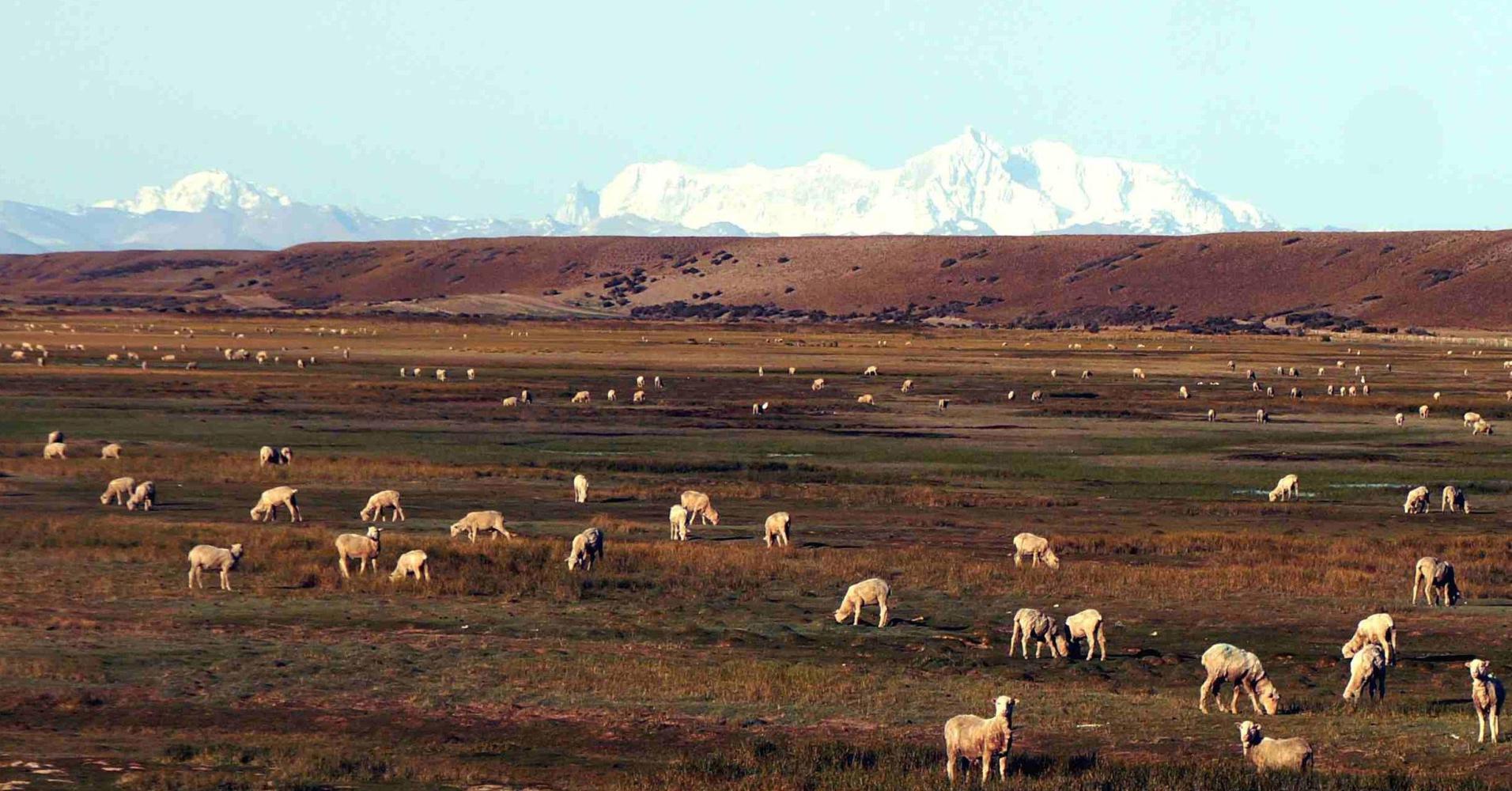
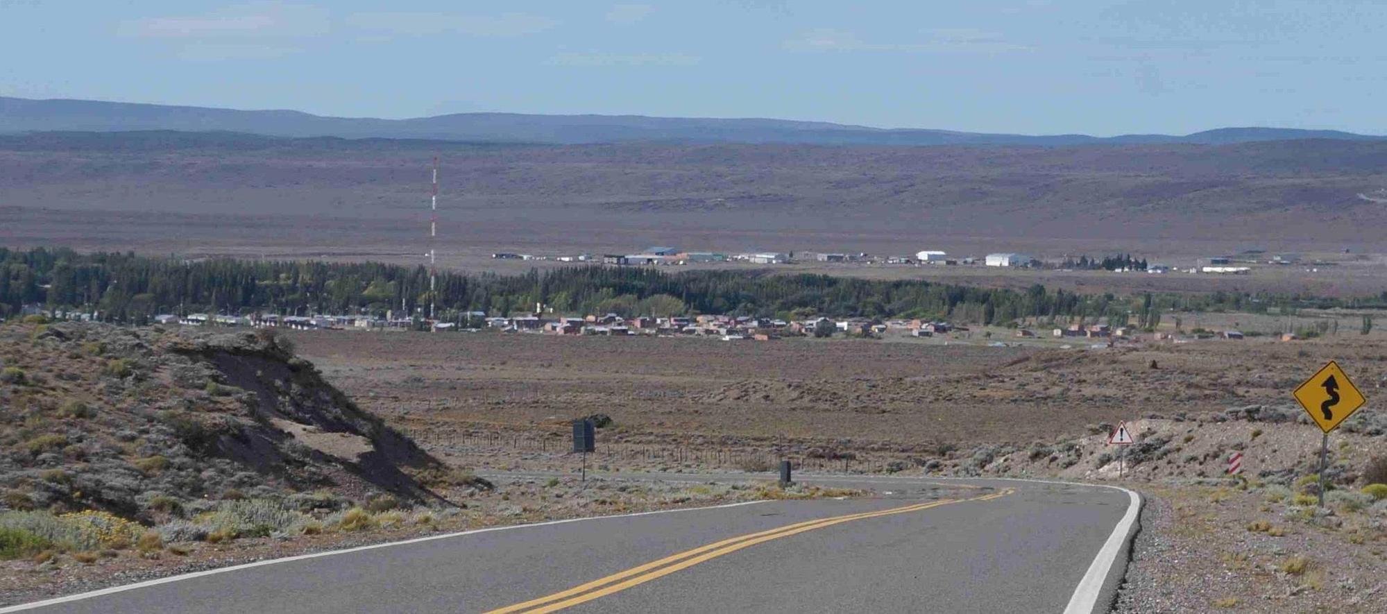
There's a change in the weather this morning. Bright sunshine, clear blue sky and not a breath of wind. It's freezing cold first thing though as I set off from my road cutting in the hillside campsite: a predicament not helped by the first few kilometres being all downhill. Then when the road levels out it swings right and into the shadow of the barrancas for the next kilometre: the sun still low at this early hour. I'm cycling across the immence hollow Bajo Caracoles with a small roadside settlement of that name ten kilometres back. The vista open for miles around with barrancas, a row of level topped hills both on the south side and to the north, just ahead. To the west is open, with a snow blanketted hulk of Cero San Lorenzo, the highest mountain in Patagonia peaking over the horizon.
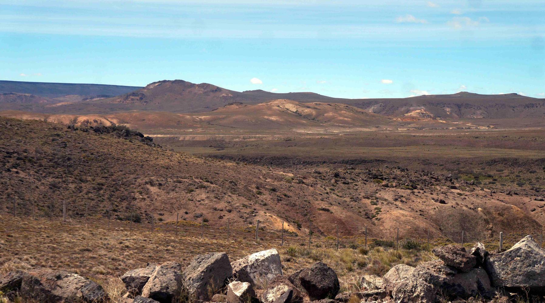
The road crosses green pastoral wetland with small streams that continue east into a valley. The whole low hollow is I estimate 25km across. Soon though I begin the steep climb up the northern slope, and pass a road turning off on the left: Route 41, "Paso Raballos 91" the sign reads. The road climbs on for a couple of kilometres before levelling out with a second bank of barrancas hills ahead. Once I've climbed those, there's yet a third barranca bank to be climbed after a level shelf; like steps out of the great deep. Indeed, I'm climbing most of the morning.
About 40km north of Bajo Caracoles, they've built a new access road to the "Cueva de Los Manos" the prehistoric hand-print and guanaca prints in a cave in the Rio Pinturas canyon, 28km in on stony compressed gravel road. I'm tempted, but the weather is warming up, and it remains windless; it's a day for cycling. Besides, I visited Los Manos upon the old road back in 2004.
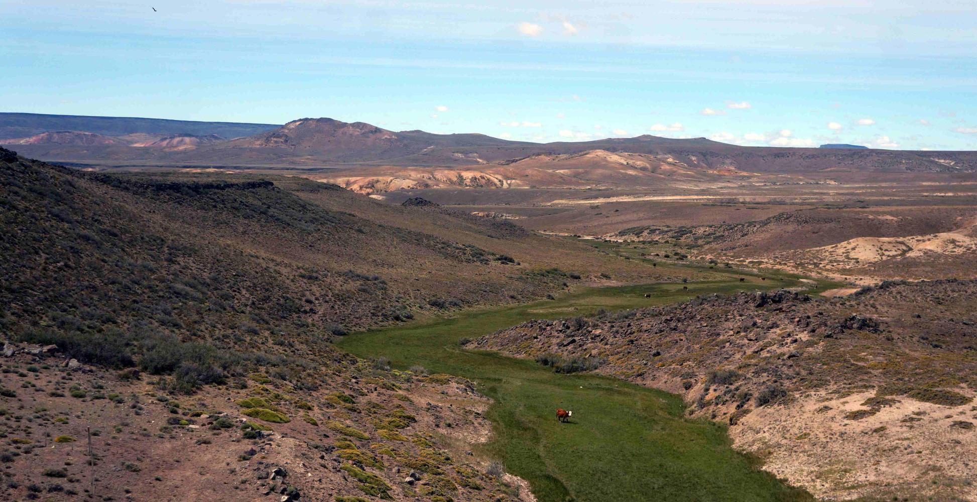
And anyway, it's fine now I've climbed the last uphill section and there's a sharp descent to the green Rio Ecker valley. Green due to its river, contrasting with the arid hills on either side.
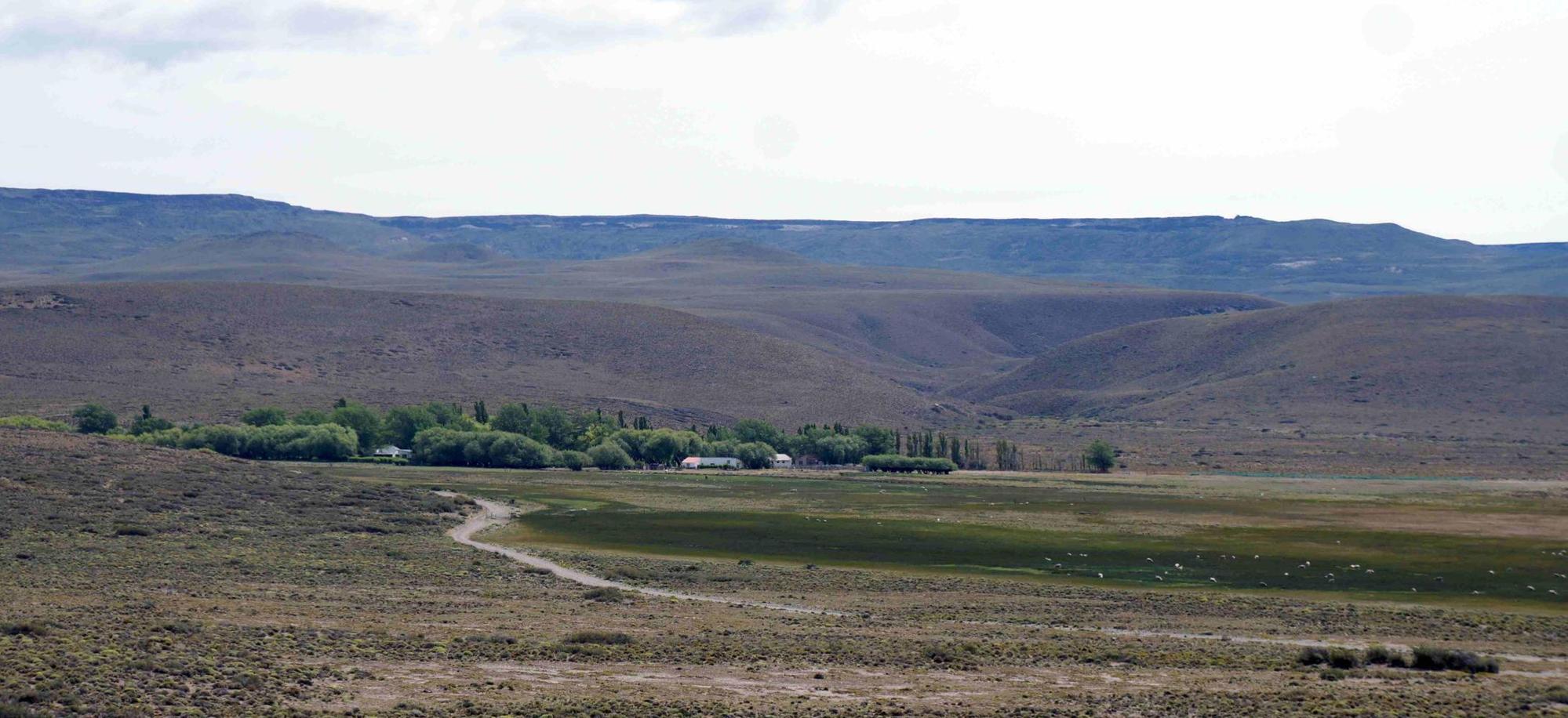
The new road here at the bottom of the descent does a great horseshoe bend, coming down the hill into the valley bridging the river and back around to follow the bottom of the hillside opposite. Whilst the old clay and stone or ripio road I rode in 2004, shadowing the new all morning, tales a much more precarious steeper route, directly across, pass the farm Casa Piedra, or Stone House in it's clump of river willows before climbing the steep valley side back up. The old road is now the access road to the farm that provides camping and a base for excursion to Cueva de Los Manos.
I stop for late morning tea, bread and cheese, cake; early lunch on the riverbank. Unfortunately, roadworkers are filling a hole on the approach to the bridge and their truck stereo flares out Chilean according folk music, spoiling the ambience. There's young guy and older guy, workers, they're more like standing still. The older will say something intended to be funny and launch into a deep guttural laugh against the blend of Mexican mariachi sounding accordions blaring. They had a bit of a laugh when I had to climb over the fence to the river in order to fill my water bottles.
The hole is filled about the same time I've had my half hour relaxation, when I cycle back up from the riverbank, I see a newly tarmacked patch as they drive off.
| Heart | 0 | Comment | 0 | Link |
7
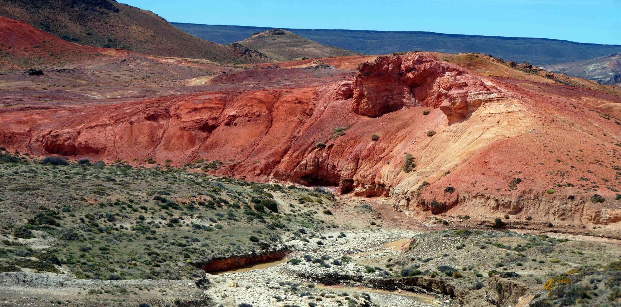
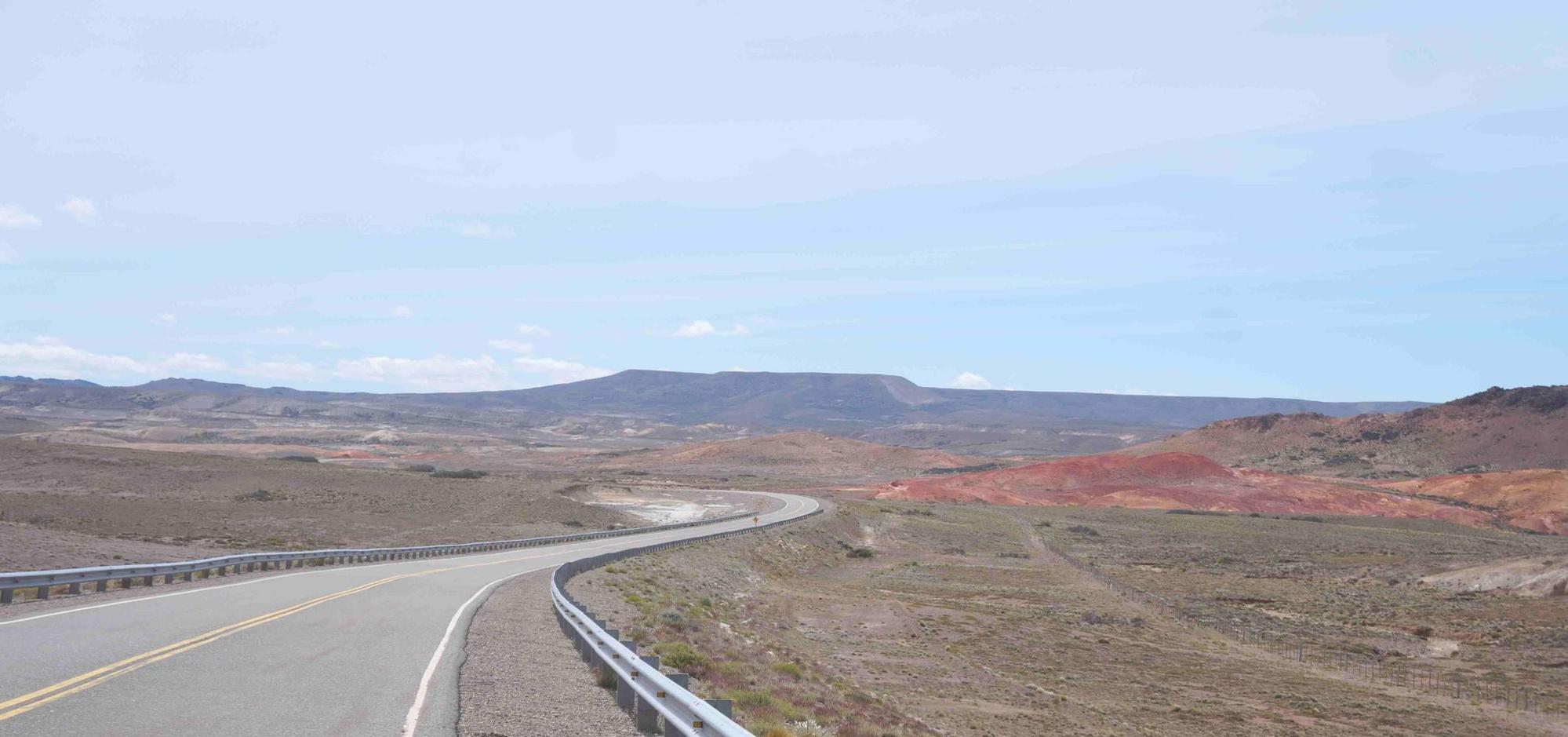
Once out of the pleasant Rio Ecker valley, the way ahead is the most surreal lunar landscape of bright pink, orange and brown rock strata, with whale back like hills. This goes on for a good ten or more kilometres as I sing Baker Street through from start to finish.
| Heart | 0 | Comment | 0 | Link |
| Rate this entry's writing | Heart | 0 |
| Comment on this entry | Comment | 0 |