May 20, 2018
Day 12: Mexican Hat to Bluff
The direct route from Mexican Hat to Bluff is only 25 miles. But I have two detours in mind. For sure I will detour to Goosenecks State Park. 9 miles round trip, 613 feet of climbing, all paved. I was hoping to have the energy for a hilly 17 mile gravel detour called Valley of the Gods. I decided that today has plenty of climbing without the second detour. I don't want to get too exhausted because tomorrow will be even more difficult.
I had breakfast at the restaurant and was on the road before 8 AM. Uphill through the tiny town of Mexican Hat, climbing away from the San Juan river. The town has a few other small motels but none with the up close canyon view of San Juan Inn.
A mile north of town I turned right on the gravel road that goes 1 mile to the Mexican Hat trailhead. I went 1/4 mile up the steep road and decided that was close enough. The low morning sun was directly behind the base of the Mexican Hat.

| Heart | 1 | Comment | 0 | Link |
2 miles past the Mexican Hat I turned left onto UT 261, then after a mile I turned left again onto UT 316 which dead-ends at Goosenecks State Park. Both roads are mostly uphill. Mexican Hat is near the river. Goosenecks State Park is 1000 feet (300 m) above the river.

| Heart | 1 | Comment | 0 | Link |
The entry fee is $2 for cyclists. The park has campsites, vault toilets, shaded tables, and awesome views. But no water. Usually a camping cyclist could get water from a motor home's large water tank.

The sun angle is best earlier in the morning. I wish I could arrive 2 hours earlier. If it was cloudy I could see more of the river but colors would be muted.

| Heart | 0 | Comment | 0 | Link |
It was mostly downhill from Goosenecks back to US 163. Straight ahead are multi-colored sandstone mountains towering above the San Juan river. The same mountains I saw while descending to Mexican Hat yesterday, but now I'm looking straight into the sun.

| Heart | 0 | Comment | 0 | Link |
To my left in the hazy distance are many red hoodoos. The 17 mile gravel road threads through those monuments. I'll have to see them from a distance instead.

| Heart | 0 | Comment | 0 | Link |
The route from Mexican Hat to Bluff is very hilly. The hilltops are the reddest. The valleys are more yellow, pink, or orange sand. Sparse brown grass with green bushes only in the washes.

To the south are flat-topped multi-colored cliffs on the opposite side of the distant San Juan river. It was hard to get a good view of the cliffs looking into the sun.

| Heart | 0 | Comment | 0 | Link |
To the north, much closer, are highly eroded cliffs and hoodoos that are more uniformly red. I was feeling hot early in the afternoon. 88F/31C, no shade, with a light wind that didn't give much cooling. It felt good to take a break in perpetual shade under a bridge. Much cooler there, and it was the rare under-bridge rest stop with an awesome view of red cliffs.

| Heart | 0 | Comment | 0 | Link |
Today had a gentle south wind and I mostly traveled east. A crosswind most of the time. The terrain was so hilly that wind wasn't much of a factor.

I passed the intersection that is the south end of the Valley of the Gods scenic loop. It looks tantalizing, going hundreds of feet higher into the red zone. But the dust plume from a vehicle reminded me of what it would be like to share 17 miles of gravel with passing cars.

| Heart | 0 | Comment | 0 | Link |
Today is extremely hilly but the biggest and steepest hill is yet to come. Comb Ridge.

| Heart | 0 | Comment | 0 | Link |
Comb Ridge was the most difficult of many obstacles that 250 Mormon settlers crossed in 1880 to get from Escalante to Bluff on the Hole in the Rock trail. It's a famous part of Mormon pioneer history. They endured the most difficult journey of all the many groups that Brigham Young dispatched to colonize the remote valleys of Utah.

| Heart | 0 | Comment | 0 | Link |
US 163 climbs only 500 feet (150 m) on Comb Ridge but most of it is 10% grade.

It's hard to complain about the steep grade when it comes with a panoramic view of a multi-colored red wonderland.

| Heart | 0 | Comment | 0 | Link |

| Heart | 0 | Comment | 0 | Link |
The final climb is in deep rock cuts with no view. I entered the rock cut in a red world and emerged from the rock cut into a mostly yellow world. A dramatic change.

| Heart | 0 | Comment | 0 | Link |
After Comb Ridge it was rolling hills with a downhill trend to Bluff. Today's route is never flat.

| Heart | 0 | Comment | 0 | Link |
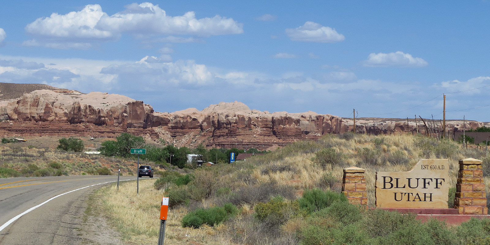
Bluff is in the San Juan river valley but the river is south of town. I never saw the river while coming into Bluff. I arrived at Mokee motel at 3:15 PM and got my $95 reserved room. The motel is old and rustic but well maintained, with beautiful landscaping. The stereotypical motel in a small Mormon town.
| Heart | 0 | Comment | 0 | Link |
The woman at the motel strongly recommended a visit to the fort so I promptly continued a mile down the road to the Fort Bluff historic site, a large and elaborate historic site built and maintained by a nonprofit called Hole in the Rock Association. Admission is free but the visitor center was closed today, Sunday. Hole in the Rock Association is a historic non-profit funded and operated by devout Mormons.

Fort Bluff is part historic ruins and mostly recent reconstructions of the original Mormon pioneer settlement that was founded in 1880. I counted 14 reconstructed cabins. Nearly all of them are furnished with period furnishings. And each cabin has a sign with names and details of the couple that lived in the original cabin. I presume that most visitors are Mormon and some visitors are descendants of the 250 settlers.

| Heart | 0 | Comment | 0 | Link |
The village also has a big exhibit about irrigation. Settlers started building an irrigation canal immediately after arriving. It took several years to dig the canal by hand and they had to work extensively after that to keep the canal functioning. This area did not turn out to be very fruitful for irrigation farming. Much of the time the river was too low for gravity-feed irrigation, but occasionally the river flooded and damaged the irrigation canals.

| Heart | 0 | Comment | 0 | Link |
The cabins in Fort Bluff are one room, always with the name of the husband and one wife. It appears that polygamists weren't welcome to live in the confines of Fort Bluff. Outside the fort other settlers built large 2-story sandstone homes with a separate entrance for each wife. Bluff was a polygamist hotbed in the late 19th century, one of the last communities in Utah to renounce polygamy. Congress required the Utah Territory to ban polygamy in order to gain statehood. But that wasn't enough incentive. The Mormon church only banned new "plural marriages" in 1890 after the U.S. government declared the church illegal and began confiscating the church's property.

| Heart | 0 | Comment | 0 | Link |
The encounter with Mormon pioneer history was a delightful surprise. One of many unique cultural experiences during this tour. Aborting the Valley of the Gods loop gave me time to enjoy Bluff Fort instead.
For dinner I walked 500 feet to the steakhouse which is the only nearby restaurant. Bluff is a very small town. Population about 200. Fewer people now than when the settlers arrived.
Today I didn't move very far across the map but I had a strenuous and rewarding detour to Goosenecks State Park and learned about Mormon pioneer history in Bluff. No regrets.
Distance: 36.7 mi. (58.7 km)
Ascent/Descent: +2487/-2160 ft (+754/-655 m)
Average Speed: 7.9 mph (12.6 km/h)
Today's ride: 37 miles (60 km)
Total: 523 miles (842 km)
| Rate this entry's writing | Heart | 1 |
| Comment on this entry | Comment | 3 |
Bluff and Mexican Hat are both in sad shape, post COVID. In Mexican Hat, the only motel/restaurant open is the San Juan. The gas station is open.
In Bluff, the little convenience store and neighboring motel are open. The fancy Desert Rose was open. Everything between those two was closed. The excellent steak house has been closed a couple of years. There's a big, fancy motel (?) condos (?) that they've been actively building for several years, right at the base of the big climb out of town. It will be very interesting to see what that develops into. Guess, what? It is open. I'd include a link if it were possible. Bluff Dwelling Spa. I'm not sure how relaxing it would be with all of the construction, but all of the reviews are excellent and no mention of noise. Ammenities include a restaurant. Lodging prices are $149. for November, and $219. in June. Totally worth the price. Especially opposed to the tiny, depressing room we stayed in next to the convenience store.
3 years ago
Sad to hear that the steakhouse is closed, along with the motel where I stayed. For motorized tourists, Bluff is just one stop on a day trip from Monument Valley to Blanding, and not as interesting as the Goosenecks or the ruins at Hovenweep. Part of the Utah Parks/Grand Canyon/Monument Valley loop driven by a million rental motor homes every year. It must be worse for Mexican Hat. Most tourists don't even stop there.
Utah lodging caters to upscale families. Not much demand for old, small, and rustic rooms. Many 3-star motels. Not so many 2-star motels. It's inevitable that the old small places go away and are replaced with fancy resorts.
3 years ago
3 years ago