May 19, 2018
Day 11: Monument Valley to Mexican Hat, Utah
Today is a short and mostly downhill day. A moving rest day with outstanding scenery.
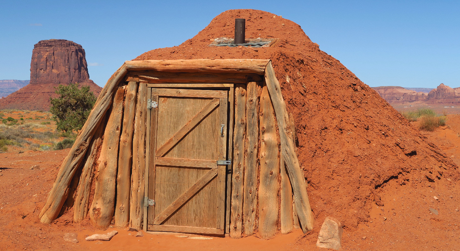
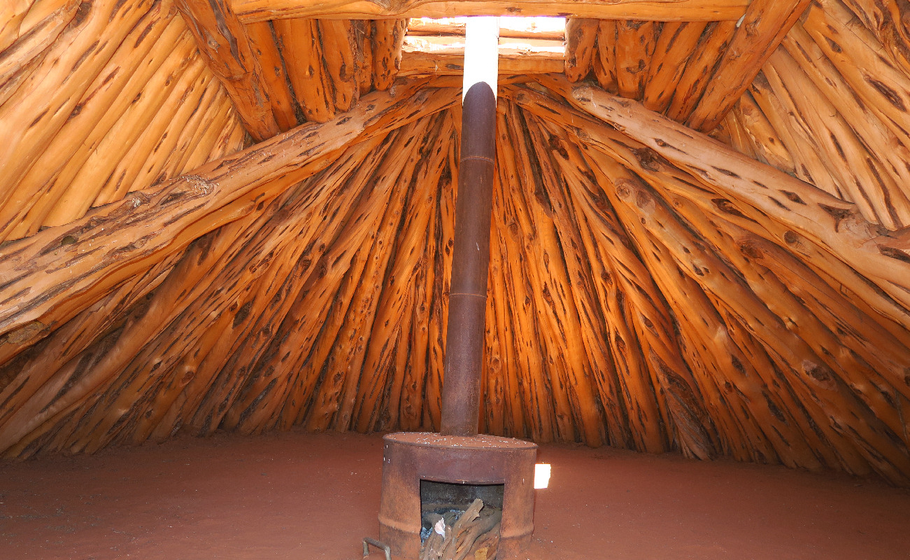
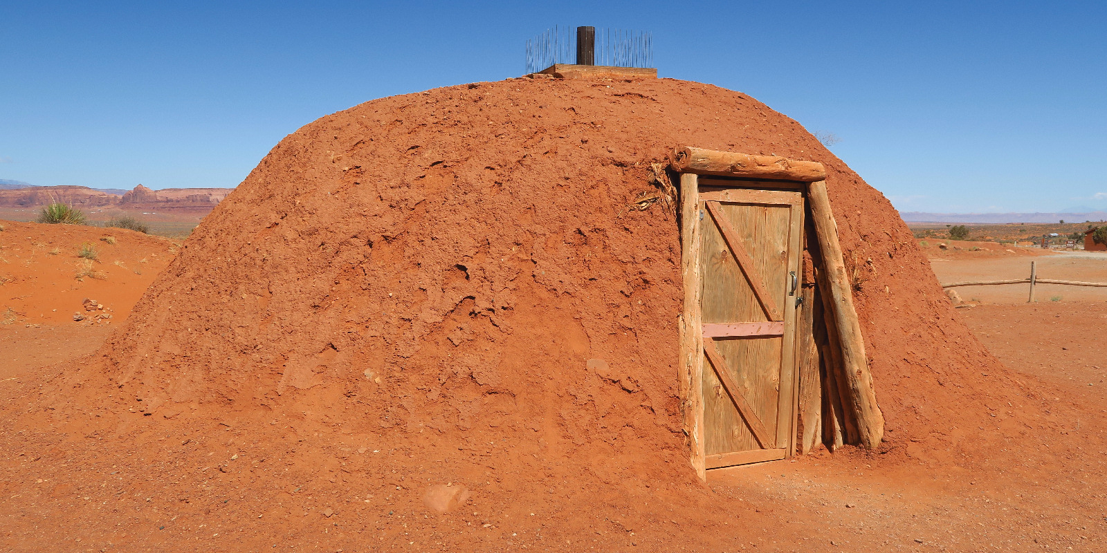
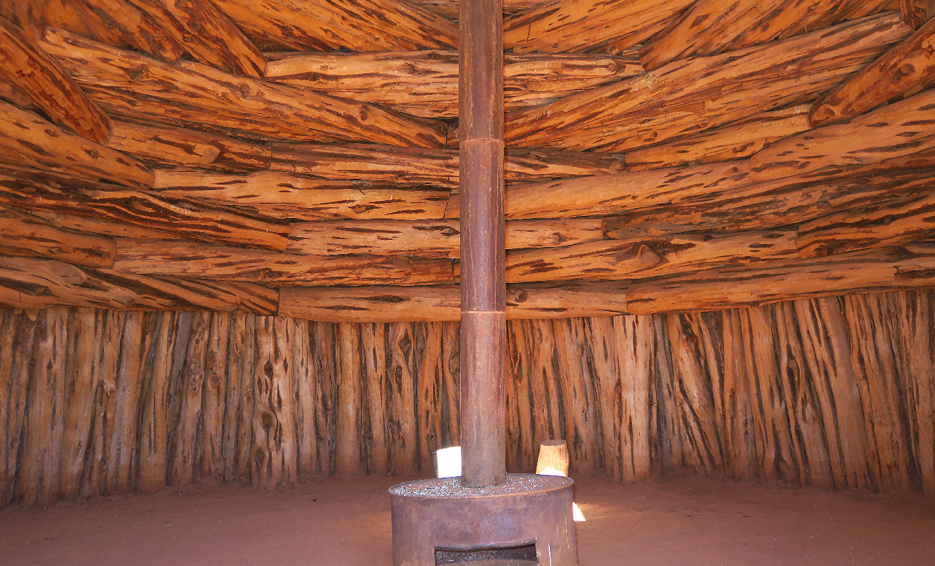
I slept late and went to the breakfast buffet at 9:45. Departed The View hotel at about 11 AM. My first stop was two Navajo hogans just across the parking lot. Visitors can walk around and go inside. I was amazed how small they seem from the outside but how big they seem on the inside.
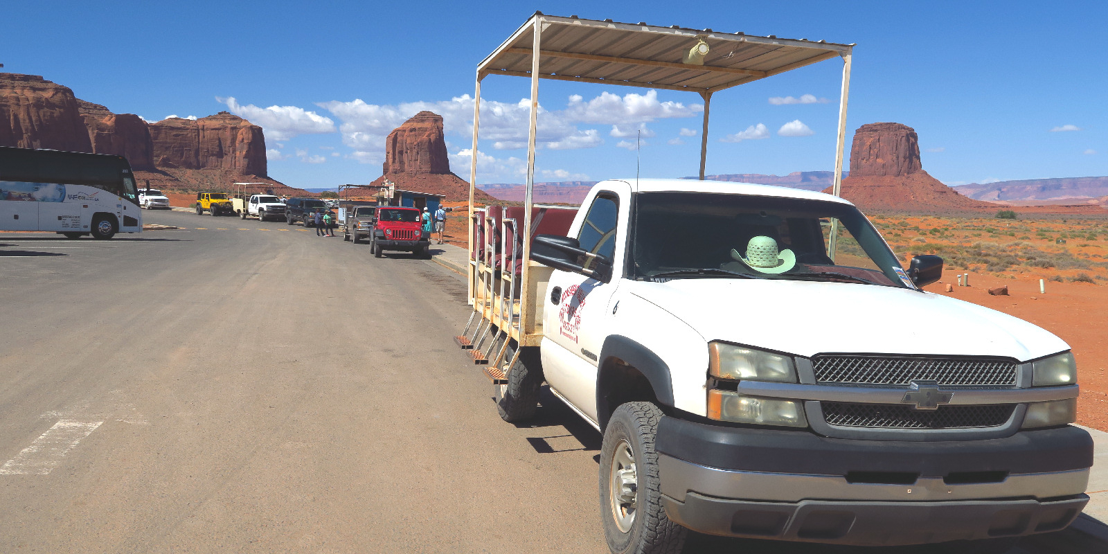
When I went to look at the Hogans there was a line of 6 or 7 chariot trucks waiting to take visitors on backcountry tours. By the time I finished looking at the Hogans, a tour bus had arrived and most of the trucks had departed with tour bus passengers. So there was only one waiting chariot truck when I took a picture. Each truck carries up to 9 passengers on 3 covered bench seats.
| Heart | 0 | Comment | 0 | Link |
My original plan for this morning was to do a 3.3 mile hike on the tribal park's only hiking trail. Unfortunately I have two cuts on the bottom of my feet that make a long walk unadvisable. I did put bandages over the cuts to keep them from splitting open and becoming even more sore.
The park road is downhill all the way for 4 miles to US 163. I enjoyed seeing the cliffs in the morning sun. Morning sun and evening sun illuminate the cliffs so differently!
I didn't go in to the Welcome Center at the intersection of the park road and US 163. It appears that most visitors go straight to the view area without stopping at the Welcome Center.

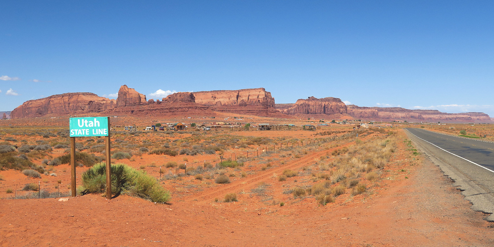
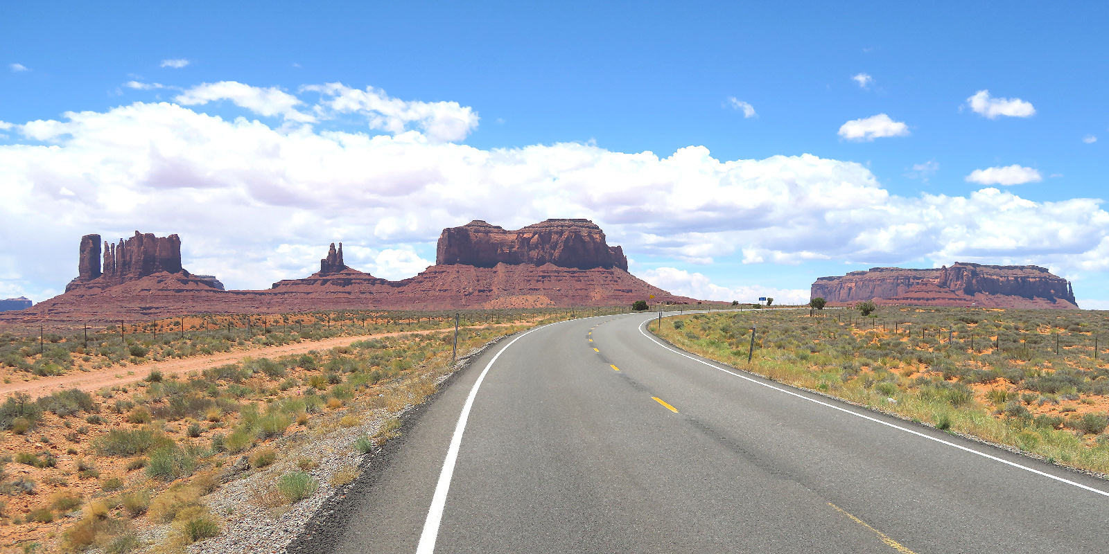
I turned right on US 163 and began a gentle 500 foot climb to Monument Pass. 6000 feet elevation. US 163 in Utah has newer smoother pavement and the shoulder is a few inches wider than in Arizona.
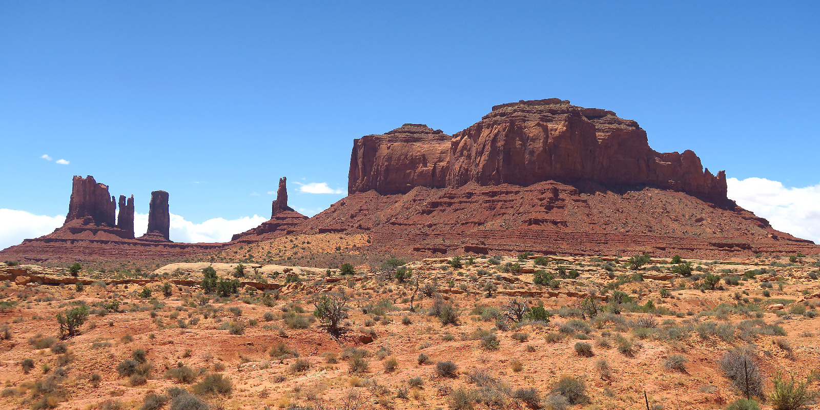
Monument Pass is the closest approach to the "highway monuments". Unfortunately it was mid-day and I was looking directly into the sun. Neither the east-facing or west-facing side looks good at mid day.
| Heart | 1 | Comment | 0 | Link |
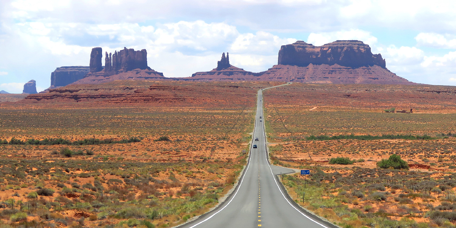
After Monument Pass is a short descent, then a small climb to a minor hilltop that is now widely known as "Forrest Gump point". The view west toward the monuments is spectacular in early morning. Not so spectacular at 1 PM.
Several people had fancy cameras and tripods set up to take pictures from the middle of the road. Of course they had to move now and then when traffic passed by. US 163 has no shoulder but is still decent for cycling. The traffic is mostly tourists. Basically no trucks.
| Heart | 0 | Comment | 0 | Link |
I didn't see anybody stop at the designated viewpoint visible in the picture. Everybody seems to know the view is best from the hilltop. It would be interesting to know how many movies feature this famous view.
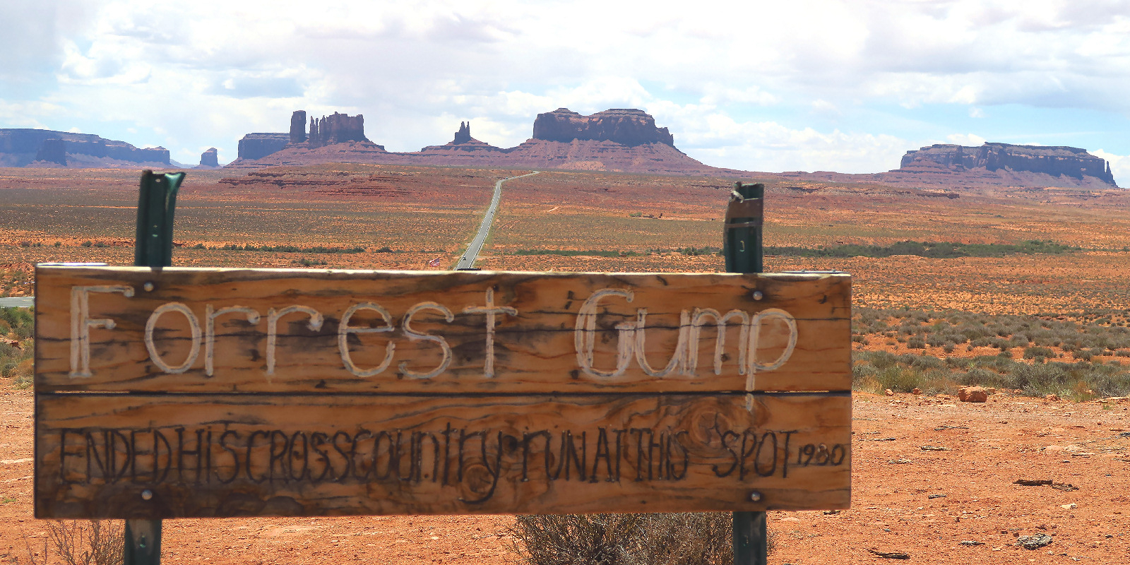
I stopped to take a picture of the Forrest Gump Point sign. It's small and 50 yards away from the highway. You have to know it's there to see it. I think it's amusing that there is so much sentimental attraction to a fictional character. Forrest Gump is the new Tom Sawyer (beloved 19th century fictional character in Mark Twain novels).
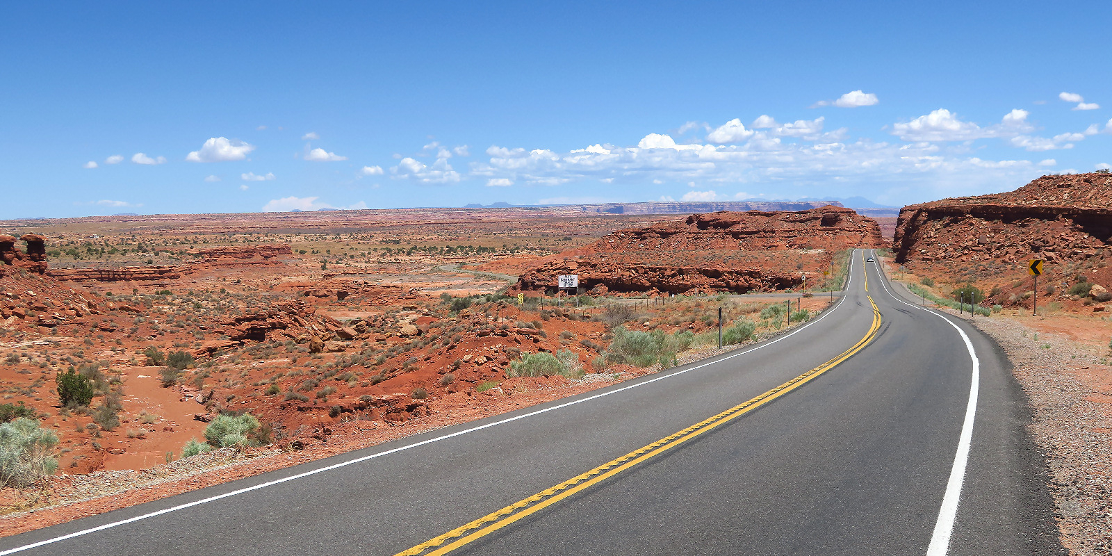
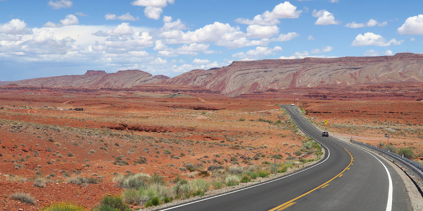
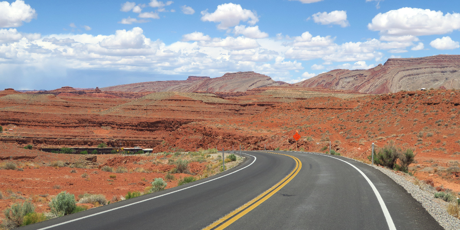
It's mostly downhill from Forrest Gump point (5700 feet elevation) to the town of Mexican Hat (4200 feet elevation). Very red, the second biggest descent of the tour.
| Heart | 0 | Comment | 0 | Link |
| Heart | 0 | Comment | 0 | Link |
During the final descent to Mexican Hat I had a distant view of the namesake rock formation.
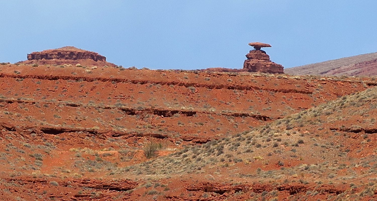
| Heart | 0 | Comment | 0 | Link |
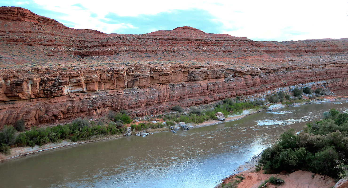
I couldn't see the San Juan river until I was right on top of it. The river is in a deep canyon.
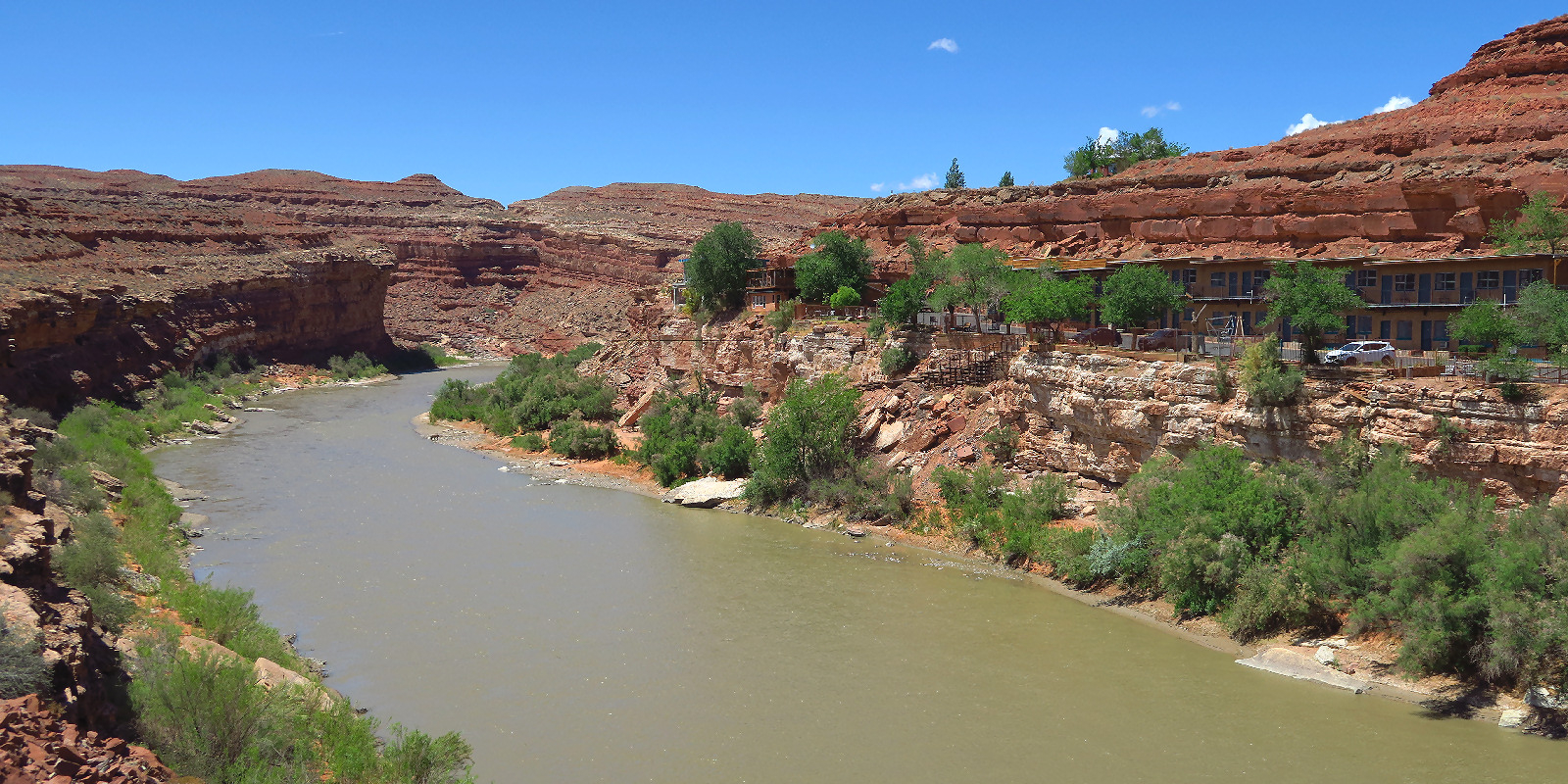
| Heart | 0 | Comment | 0 | Link |
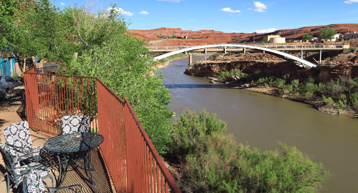
I arrived at San Juan Inn at 2:45 PM and got my reserved $104 ground floor room. Easy access, with a canyon view but no river view. Upstairs rooms have a partial river view.
| Heart | 0 | Comment | 0 | Link |
Because the San Juan river is so far down, you have to go to the very edge of the canyon to get a good view of the river. San Juan Inn has several nice river view sitting areas.
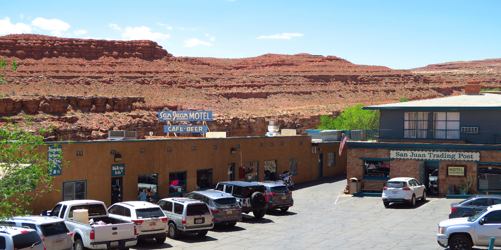
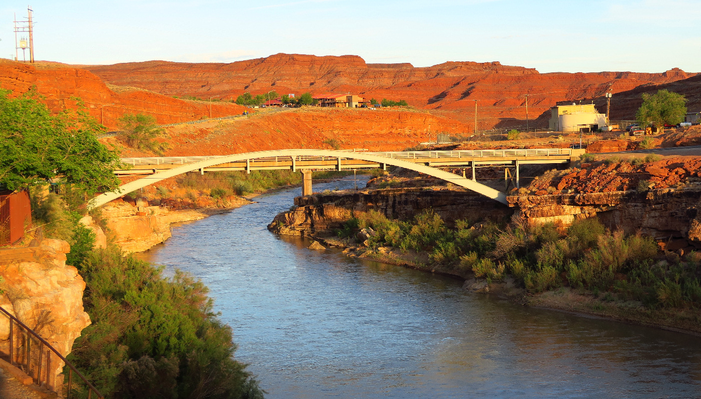
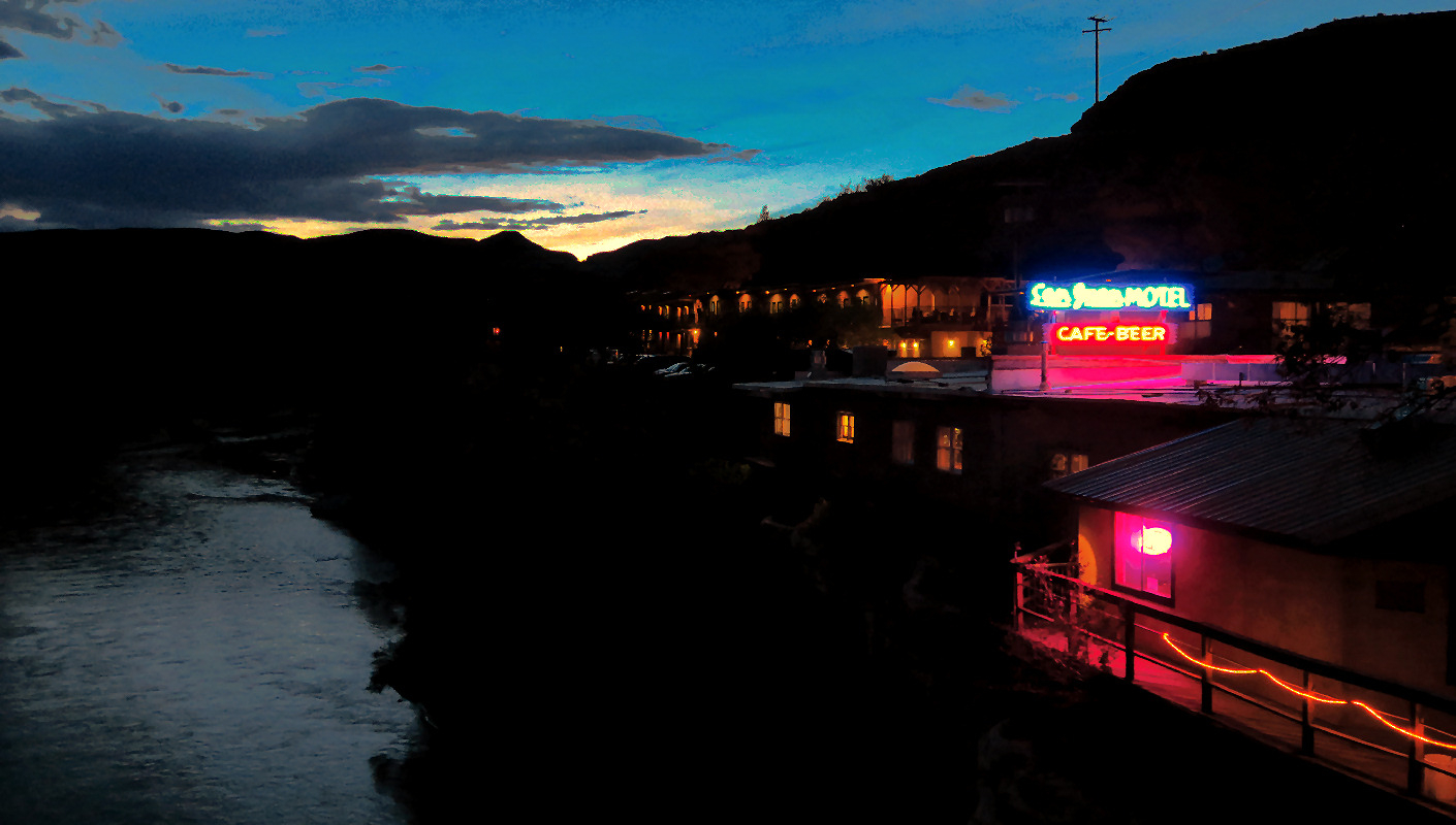
The river looked especially good when looking upstream just before sunset. This afternoon I never continued on to the little town of Mexican Hat, one mile up the road. I just hung out at the San Juan Inn which has a store, gift shop, restaurant, and bar. The temperature was 90F (32C) in late afternoon, so I spent most of the time indoors.
| Heart | 1 | Comment | 0 | Link |
It was great to finally see a river. This tour is mostly in arid deserts, so a river is a rare treat. The San Juan river is a major tributary of the Colorado river. It flows into the Colorado river at Lake Powell. The headwaters are in southern Colorado.
I also saw the San Juan river last September during my Indian Country part 1 tour. That was upstream in New Mexico, below Navajo dam.
The San Juan river is the north boundary of the Navajo nation. My 4-day Navajo nation experience has ended. I celebrated by having a beer at the bar-my first opportunity to have a beer since Grand Canyon Village.
This morning I had the time and energy for a 3 mile hike but my foot didn't cooperate. With no hike, today might as well be called a rest day. It's helpful to be well rested because the final two days of the tour will be challenging.
Today had a high of 90F because of the lower elevation. The southwest wind was not very strong today.
I spent some time thinking about if it was really worthwhile to spend the night in Monument Valley. The cloudy sunset at Monument Valley was a disappointment, but I can't predict that. Today's route is extraordinarily scenic but I did it during mid day when the colors are dull. If I pedaled directly from Kayenta to Mexican Hat I would have seen today's rocks later in the day with more flattering sunlight.
Distance: 25.8 mi. (41.3 km)
Ascent/Descent: +788/-2123 ft (+239/-643 m)
Average Speed: 11 mph (17.6 km/h)
Today's ride: 26 miles (42 km)
Total: 486 miles (782 km)
| Rate this entry's writing | Heart | 1 |
| Comment on this entry | Comment | 2 |
1 year ago
1 year ago