May 28, 2020
Day 1: Sunny Valley to Grants Pass via Galice
This is a motel tour with advance reservations. The schedule is fixed, rain or shine. Today will be unusually hot and day 3 is forecast to be unusually cold and wet.
My wife drove me 70 miles south from Oakland, Oregon to Sunny Valley, Oregon. The start/finish point of the tour is the Grave Creek covered bridge. Built in 1920, the only remaining covered bridge in Josephine county. Conde McCullough was the bridge designer.
Grave creek has a decent flow now. I chose to do this tour in late spring for green grass, water in creeks, and moderate temperatures.

| Heart | 3 | Comment | 0 | Link |
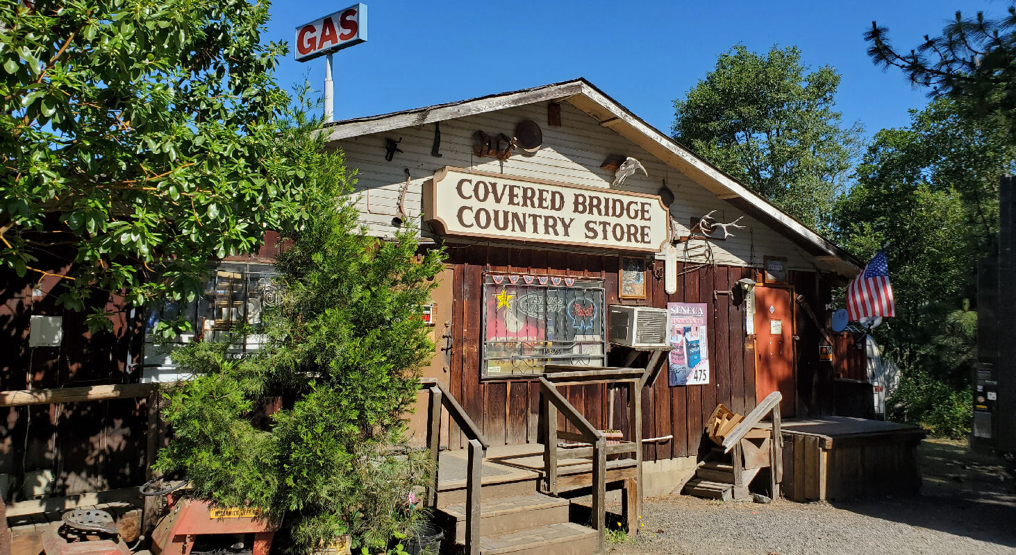
Sunny Valley may have been a town once but it doesn't really look like a town now. The only businesses are a sleepy store/gas station and the Applegate Trail museum which is not yet allowed to reopen. Several hundred people live in the area. There are many country homes and cannabis farms along Grave creek.

| Heart | 0 | Comment | 0 | Link |
After a few exploring stops I finally left Sunny Valley at about 10:30. Later than planned but no worries because the days are long.
Before this tour it didn't occur to me that I would see the old Oregon and California railroad cross Grave creek on a tall trestle. That was a nice surprise.

| Heart | 3 | Comment | 0 | Link |
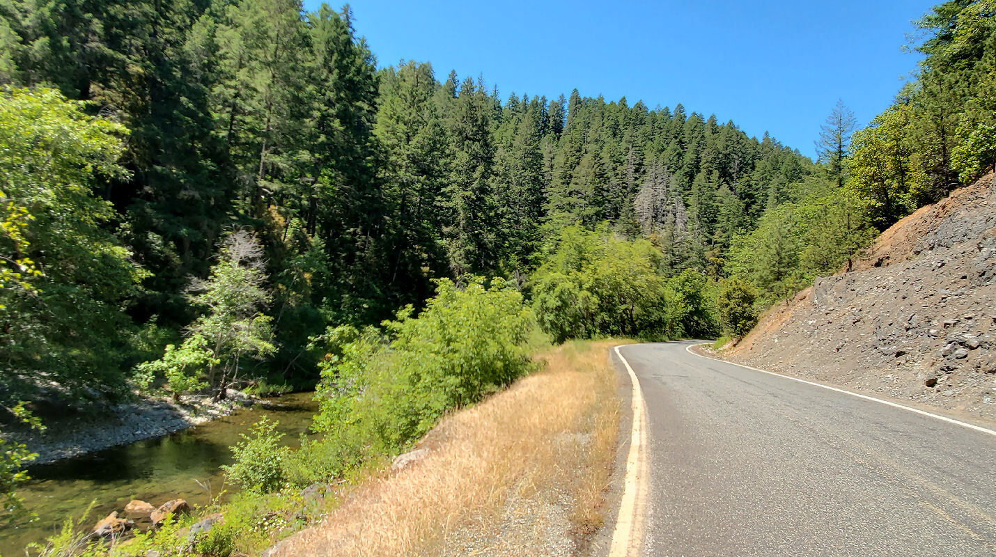
I left Sunny Valley on Leland road, then turned right onto Lower Grave Creek road which I follow all the way to the Rogue river. I go downstream but the road includes two 200+ foot climbs with 7-8% grade. Fortunately there was good shade most of the time.
Closer to the Rogue river the road has more views and access to Grave creek. I saw a few people camping.
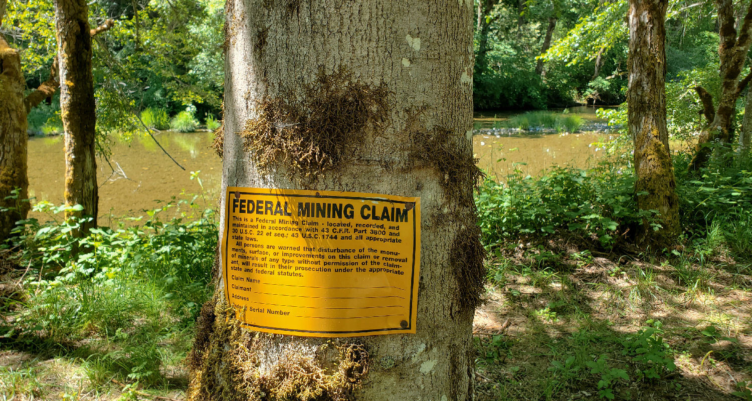
I passed many mining claims along Grave creek. They seem to be hobby mines, a relic of an 1872 mining law which has never been repealed or modified.
Lower Grave creek road is great for cycling. Basically no traffic, maybe one car every 10 minutes. It's all paved but about half of it is one lane. I pedaled the lower half in the opposite direction in 2005.

| Heart | 0 | Comment | 0 | Link |
I stopped to take several pictures where Grave creek flows into the Rogue river. First is a good view of Grave creek just before it flows into the river.
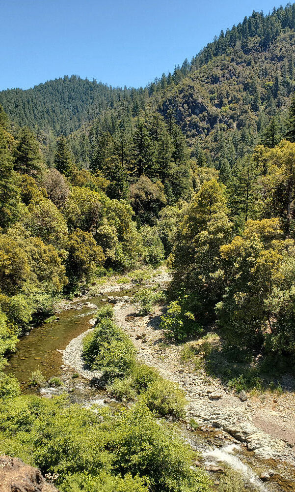
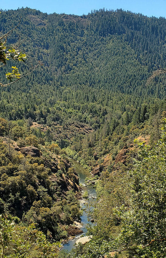
Then a view from the bank looking downstream at the Rogue river, towards the Pacific ocean. There is no road along the river because it flows into the Kalmiopsis wilderness.

| Heart | 2 | Comment | 0 | Link |
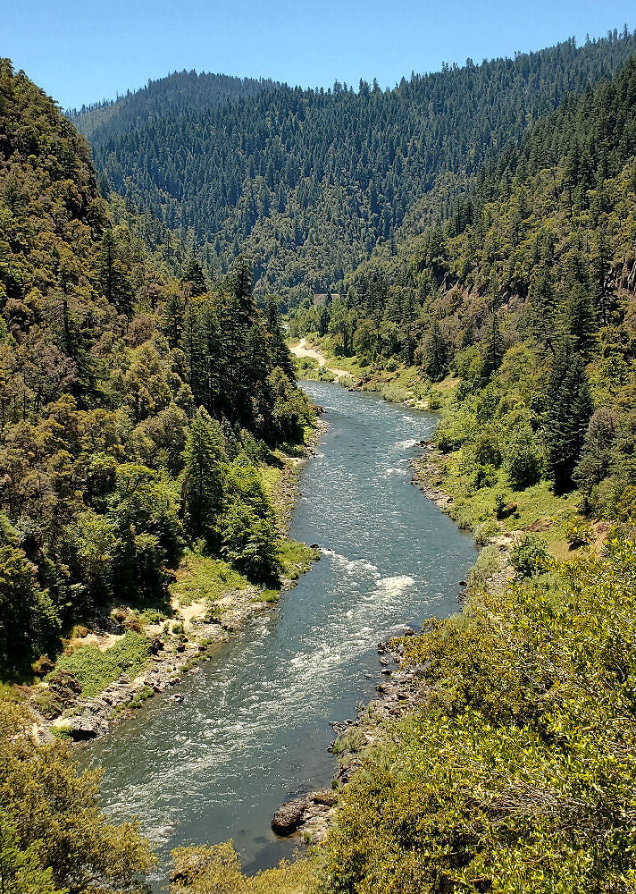
Finally, a view of the Rogue river looking upstream from the Grave creek bridge. The river is in a narrow canyon threading through the Klamath mountains.

| Heart | 2 | Comment | 0 | Link |
Traffic was still very light after I got to the Rogue river. Maybe one car per minute. Traffic increased when I got to the village of Galice and Galice resort.
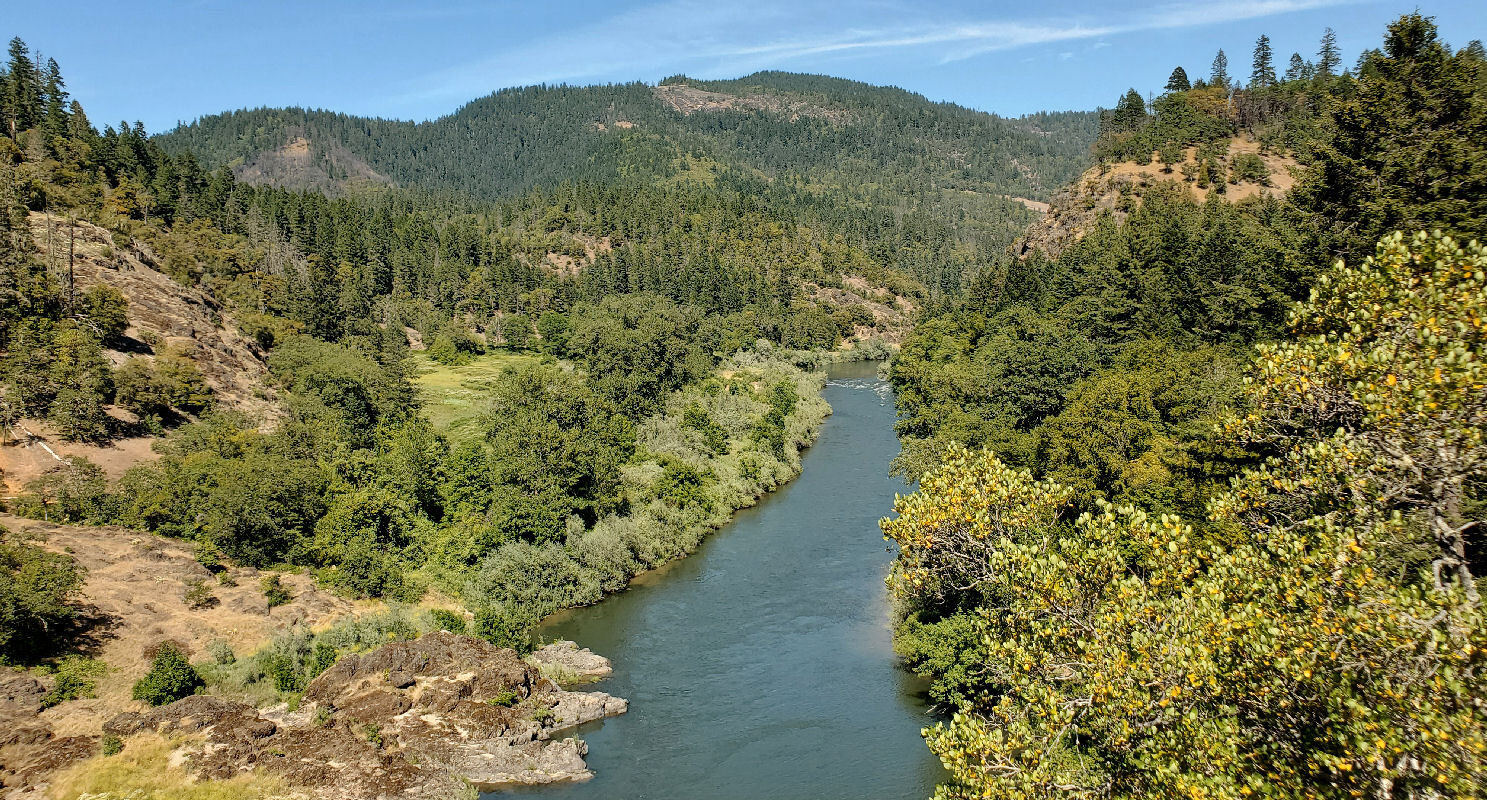
The Galice highway has frequent views of the Rogue river. Also frequent boat ramps, picnic areas, and campgrounds.

| Heart | 2 | Comment | 0 | Link |
I stopped for a late lunch at Galice resort. The long stop caused me to arrive in Grants Pass after 6 PM but I needed to refuel.
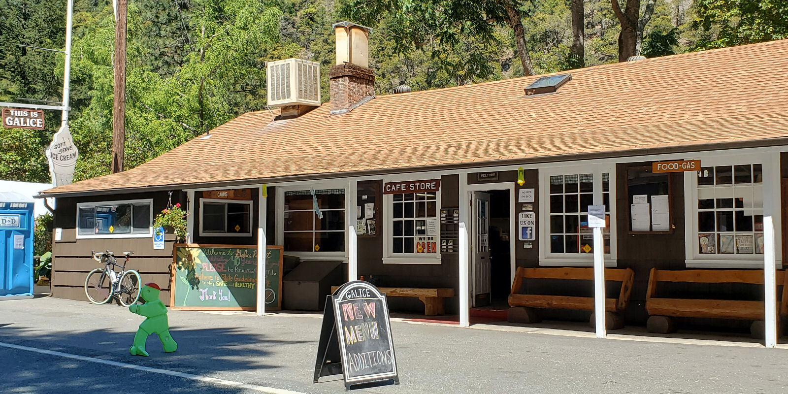
I ate at Galice resort once before during a bike tour in 2005. A big part of their business is 4-day guided raft trips through the Rogue wilderness.

| Heart | 1 | Comment | 0 | Link |
Traffic increased steadily as I pedaled from Galice resort to Grants Pass but it was never dangerous.

| Heart | 1 | Comment | 0 | Link |
The temperature was 95F in late afternoon. Far above normal but the humidity was very low. It could be worse.

| Heart | 1 | Comment | 0 | Link |
East of Hellgate canyon I turned south onto Azalea road which is mostly rural residential with big hills, with a narrow paved shoulder. Traffic was heavy compared to the morning. Eventually I descended into the mostly flat Rogue river valley. The last few miles to Grants Pass were flat and easy.

I entered Grants Pass on Lower River road, then pedaled through downtown on 6th street which is the main commercial street. Downtown Grants Pass was a great contrast to the morning back country experience.
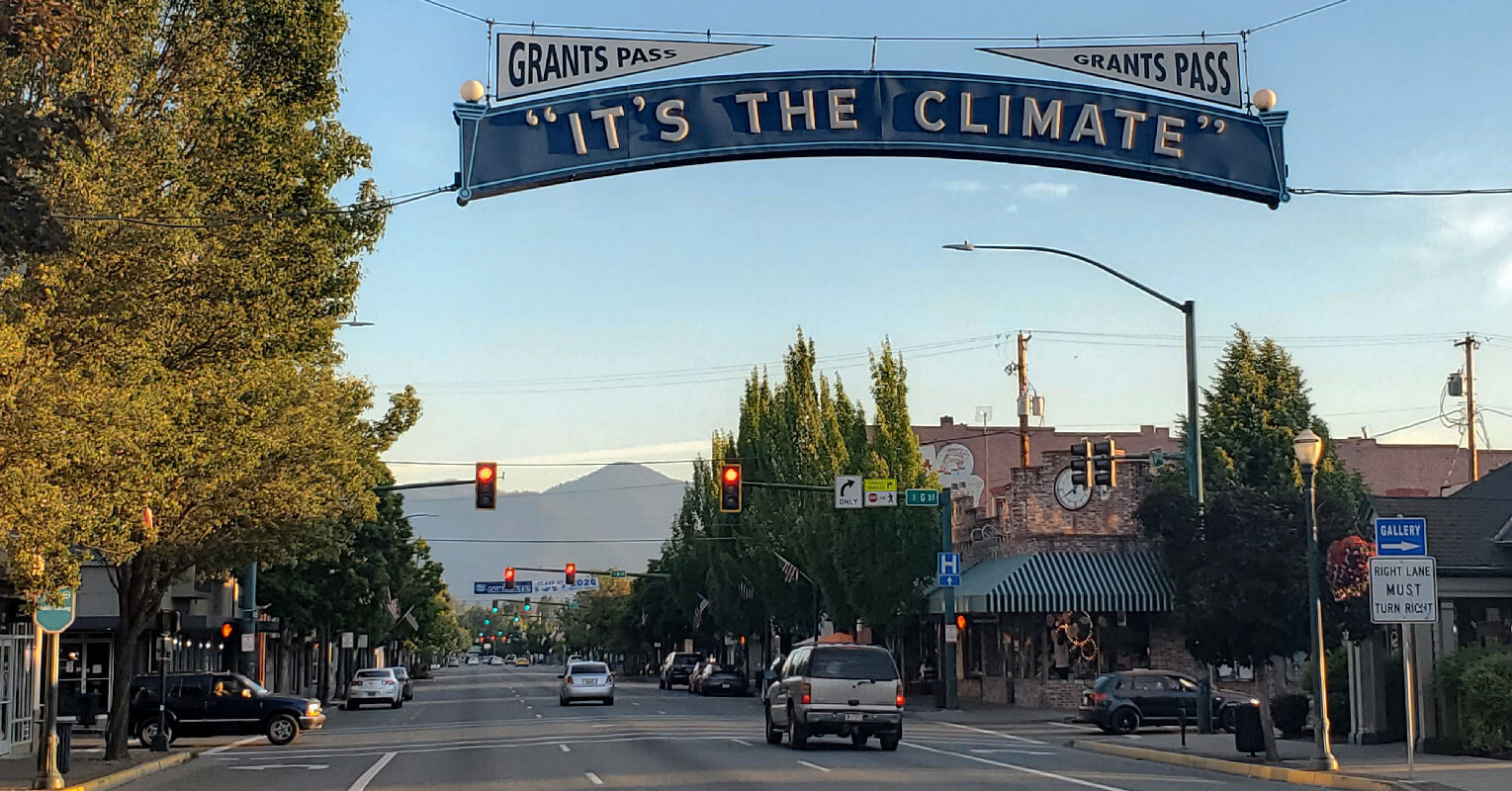
Grants Pass is the county seat of Josephine county, a rapidly growing city of 40,000 people, but it's the "second city" of the Rogue valley. Medford has more than twice as many people. I will avoid Medford for that reason.

| Heart | 0 | Comment | 0 | Link |
I continued south past downtown to Riverside Inn on the bank of the Rogue river, arriving much later than expected at 6:15 PM. It's quite expensive, $154. I booked it for two reasons. First is to experience a riverfront lodge along the Rogue river. Second is because it's next to the jet boat tours. Unfortunately the jet boat can't operate during the phase 1 reopening. My balcony has a great view of the Rogue river and Caveman bridge.

| Heart | 1 | Comment | 0 | Link |
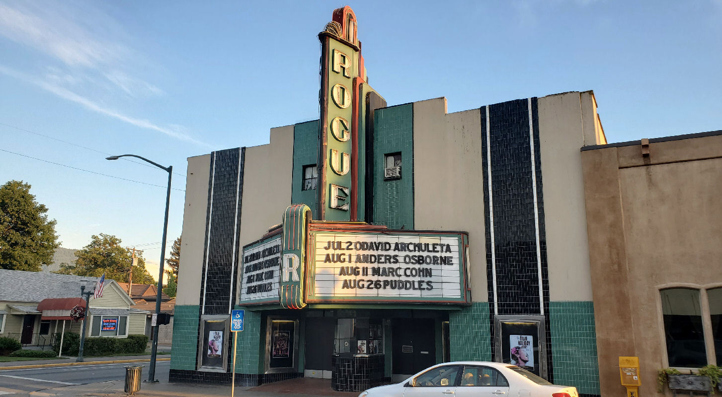
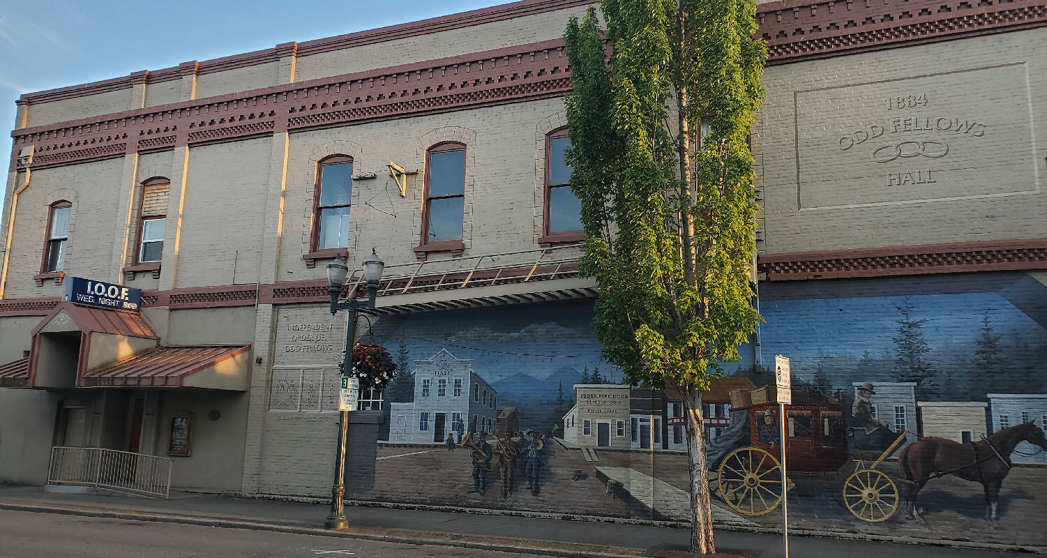
For dinner I walked downtown to a Thai restaurant that was open for dine-in customers. After dinner I walked around downtown and the riverfront, taking many photos during the pleasantly warm evening.

| Heart | 1 | Comment | 0 | Link |
As expected at this price point my room is very big and has a big balcony. It has a big fridge but no microwave. It surely included a sumptuous breakfast buffet in the past. Now they have a room service menu instead. I ordered 2 boiled eggs, raisin bran, bagel, banana, hot tea, and orange juice.
Today was a challenging day with a great diversity of experiences. A back country route along Grave Creek. Awesome views of the Rogue river flowing into the Klamath mountains. Then a charming town experience to end the day. So far so good. My right knee is a little bit sore but the next two days will be much easier.
Distance: 47 mi. (75 km)
Ascent/Descent: +2177/-2378 ft. (+664/-725 m)
Average Speed: 9.1 mph (14.6 km/h)
Today's ride: 47 miles (76 km)
Total: 47 miles (76 km)
| Rate this entry's writing | Heart | 3 |
| Comment on this entry | Comment | 0 |