June 23, 2019
Locmariaquer to Savenay
With a train ride in the middle
When I looked again at the leaflet I'd been given at the Carnac Alignments visitor centre, I realized I'd only seen a small part. I'd taken the road to Carnac but the Kermario and Kerlescan alignments are further east along D196. I decided to take this scenic route to Auray.

| Heart | 0 | Comment | 0 | Link |


| Heart | 0 | Comment | 0 | Link |
My general plan for today, since it wasn't possible to take a boat to Vannes, at least not with my bike, was to ride to Auray and then take the train to Redon, on the Canal de Nantes à Brest. I hadn't mapped out a specific route between Locmariaquer and Nantes, but since I couldn't take a boat to Vannes and there was a direct train from Auray to Redon, I decided to skip Vannes altogether.
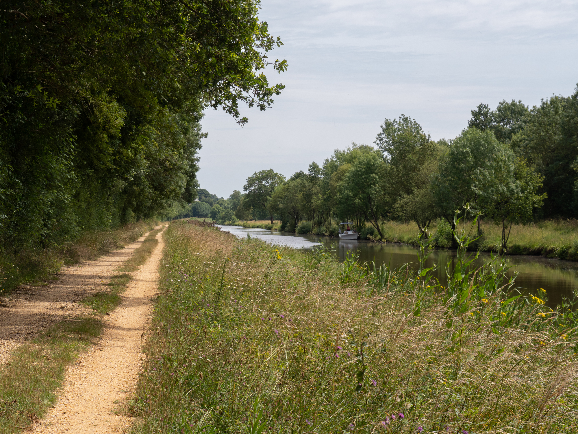
I'd enjoyed my earlier riding on the CNB from Josselin, so thought the ride from Redon to Nantes might be a pleasant last day or two of riding.
The first part of the day went well; the weather had changed and it was cooler, though that came with a few spits of rain. I found my way past the megalith alignments and into Auray. My train wasn't until 1201 so, it being only 1030, I decided I had time to visit the Port de Saint-Goustan. Looking now, I see Rough Guides describes it as “just a couple of minutes’ pleasant stroll down from the centre of Auray”. I, however, was on a bike and followed the road signs. It was further than I thought! When I got there and saw the old stone bridge across the river, I wondered if there was a better route back.
[Update: I should have looked at a map! It would have been possible to ride my bike there through the old town and over the little stone bridge.]

| Heart | 0 | Comment | 0 | Link |

Then I checked the time. Just past 11. How far to the train station? I knew it was on the other side of Auray and had passed the marked turn as I passed through the centre of town on my way to the port. I asked Garmin, hoping there would be a way using that stone bridge. No, it sent me back more or less the way I'd come, with a route distance of almost 15 km and an estimated arrival time of 1153. Yikes!
I got on my bike and pedalled fast back to central Auray. When I came to the roundabout with its arrow pointing to "La Gare", I was surprised that Garmin wasn't sending me that way. I asked a woman who just happened to be unlocking a door nearby which way to the Gare. She pointed the same way as the sign. "Tout droit, puis à gauche. C'est indiqué." I followed her direction, with Garmin continually telling me to go left, go left, to get back on its route.
I arrived at the station at 1115. I don't know where Garmin thought I should go, but it was certainly not the direct route! I had time to go to the bakery across the way and get a lunch to take along, go to the ATM, relax. Then the track was posted and, wouldn't you know it, it was on the other platform, stair access only. I'm glad I wasn't in a rush for this bags-off, multiple-trip portage. When the train arrived, the door with the bike sign was just where I was standing and it was nice and low, roll right on.
I got off in Redon about 45 minutes later and got my bearings. The canal wasn't far, but there were other waterways too and little to no signage. I found a bench and finished my lunch, noting other loaded cyclists at other benches. I asked one of them and he set me on my way.
Unfortunately, the bike path here was rough, not at all like the other sections I'd ridden. I passed the first exit, to Fégréac, hoping things would improve, but they didn't.
| Heart | 0 | Comment | 0 | Link |
At Guenrouet, I'd had enough. It was very hot, over 30°, and there was a nice grassy park with public washrooms (even showers!) across the canal. I headed there and spoke with a couple of French cycle tourers. They were travelling in the same direction as me and didn't know if the canal path would improve. Apparently it had been fine before Redon. They looked at my map for alternate routes to Blain, where they had booked accommodation. They decided to give the path one more chance, but noted the next exit not too far along.
Another fellow came up, same story. He decided to take roads to Blain. I met him again in the village, talking to two young British bikepackers with road bikes. One had had a branch get caught in his rear wheel and break about a quarter of the spokes. He'd duct-taped the spokes so he could roll his bike, but was unsure what to do. Somehow getting the cassette off and respacing the remaining spokes might get him to a bike shop... I think his best bet would be to hitchhike to Redon or Nantes. In any case, they were surprised to hear from me that riding on the roads in France was just fine, and much better than some of the voies vertes. The French cyclist confirmed this. I hope they can find a way to continue. They had hoped to reach Nantes today, but that wasn't going to happen unless they found a ride.
I had decided to squiggle my way along the white roads, but in the first village I came to, I saw a bike route sign pointing to "La Loire à Vélo, 62 km". I followed the signs.
I found a campground near Savenay. Who could resist a place called Camping du Lac on such a hot day? Of course, it's not a swimming lake but the campground is quite nice. It's a basic one with no restaurant, so once again it's the usual Sunday evening problem of where to eat. I rode into the village to the one open restaurant, but it was a fast-food place. Just a couple of doors down, though, was a tiny food shop. I bought picnic supplies and took them back to my campsite.
When I booked in, the campground operator had said the forecast was for the hot weather to continue. It didn't look like that though, and my weather app said heavy rain for tomorrow morning. We shall see.

Today's ride: 92 km (57 miles)
Total: 3,149 km (1,956 miles)
| Rate this entry's writing | Heart | 2 |
| Comment on this entry | Comment | 0 |