June 26, 2013
Day 3: Day trip to Layng Creek waterfalls
Today I finally get to the good stuff. Big waterfalls. Unfortunately it started to rain steadily at 6 AM.
I slept late, hoping the rain would quit. I got up at 8:30 and made breakfast in the rain. I waited around and the rain finally stopped at about 10. I got on the road at 10:15. The trees were still dripping. I didn't have much work to do while waiting because today I leave the campsite set up and do a lightly loaded day trip to 3 waterfalls.
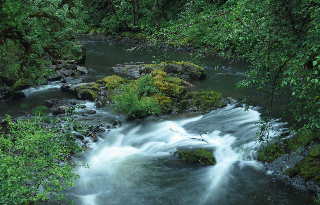
I turned right on FS 17, continuing upstream along Layng creek. The first 7 miles is paved, gently climbing 600 feet. A log truck went by every 10 or 15 minutes.

I was surprised to see a toilet building at the junction where pavement ends. If I continue straight, the gravel road climbs a mountain and descends to the Middle Fork Willamette river west of Oakridge. I don't want to go that way.

| Heart | 0 | Comment | 0 | Link |
At the junction I turned right (east) onto FS 1790, then after a quarter mile I turned left (north) onto FS 1702 which climbs steeply for 3.3 miles to the Moon Falls trailhead. 7-8 percent grade with loose rocks, climbing 1200 feet. I managed to pedal up without reducing tire pressure. The rear tire seldom lost traction.
The Moon Falls trailhead is 3000 feet elevation. 1800 feet higher than the campground. Today the bike has a lighter load, but getting to these waterfalls on a bike is still hard work!

| Heart | 1 | Comment | 0 | Link |

Moon Falls faces south. It's mid-day, so the falls would be in direct sunlight if the weather was sunny. Instead it was in direct "cloudlight". Because of the bright cloudy light, the longest exposure I could get was 0.2 seconds. Longer would be better to achieve a silkier water effect, but I need deep shade to do that.

The 1200 foot descent back to FS 1790 was slow because of my high tire pressure. 10 mph, braking constantly, scouring the dirty rims. I could have descended faster with lower tire pressure. I was alone on the trail and at the falls, and saw no other vehicles during the 6.6 mile round trip to Moon falls.

Back on FS 1790 I turned left to climb another 3.3 miles to the Pinard Falls trailhead. This climb isn't quite as steep or as big. Only 6 percent, and it climbs to only 2850 feet.

| Heart | 0 | Comment | 0 | Link |
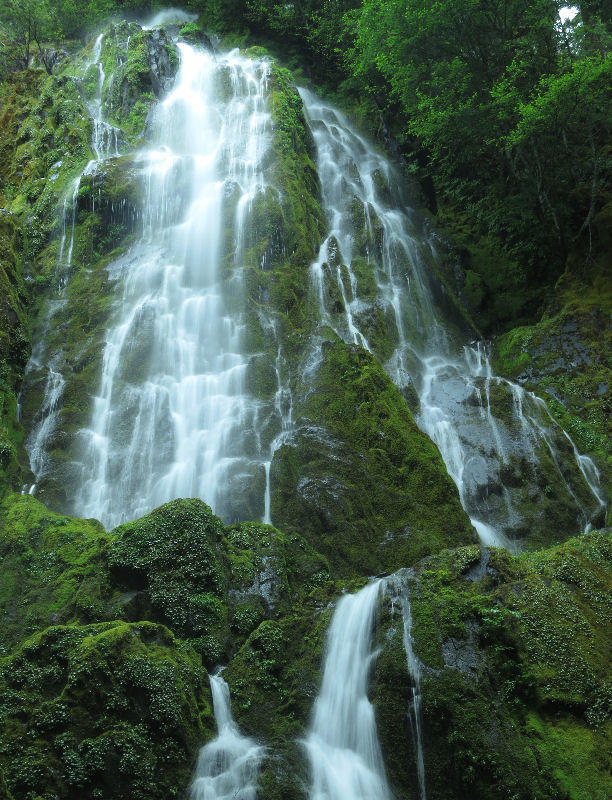
The Pinard Falls trail is steady downhill, descending 300 feet. I was very impressed with Pinard Falls. The deeply eroded cylinder of basalt is awesome. It's in deep shade, allowing multi-second exposures. My photos don't properly convey that above the plunge pool is in a 70-foot high cylinder of basalt.

| Heart | 2 | Comment | 0 | Link |
The Pinard Falls trail opened in 2007 and is not mentioned in the Thundering Waters brochure. The 2016 revision of the brochure still doesn't mention it.

After hiking up to the bike it's all downhill back to the campground. The 6.6 mile round trip to Pinard Falls was somewhat busier. 2 or 3 cars passed by, but once again I had the trail and waterfall to myself.

| Heart | 0 | Comment | 0 | Link |
Just before returning to pavement I stopped at the Spirit Falls trailhead. The Spirit Falls trail also goes downhill to the falls.

| Heart | 0 | Comment | 0 | Link |
Spirit Falls has a nice spread and is in a lush bowl. Very attractive. It was in deep shade, allowing me to get a multi-second exposure for a silkier water effect. It's on the same creek as Moon Falls.


This is the most accessible of today's 3 waterfalls but I still had the trail and falls to myself.

| Heart | 2 | Comment | 1 | Link |
1 year ago
After hiking up to the bike I continued the descent to the campground. Pavement resumes after 0.1 mile, so it was much faster than the two unpaved descents.
The temperature rose to 62F as I descended to the campground. But the temperature was in the upper 50's for most of the day because of the higher elevation.
I returned to the campground at 5:45 PM. I did laundry, made dinner, and hiked a mile on the Swordfern Trail loop near the campground. Still overcast but no rain and no dripping trees.
Today was remote and uncrowded. I saw only a couple dozen vehicles on the road, mostly log trucks. I had all 3 waterfalls and trails to myself, as if I own a private forest and waterfalls.
The weather has been unusually cool, cloudy, and wet for 3 days. This is probably the last rainy spell until late September. Tomorrow should be dry and much warmer.
Distance: 28.3 miles (45.3 km)
Climbing: 2682 feet (813 m)
Average Speed: 7.3 mph (11.7 km/h)
Unpaved roads: 14 miles (22.4 km)
Hiking: 4 miles (6.4 km)
Waterfalls: 3
Covered Bridges: 0
Today's ride: 28 miles (45 km)
Total: 96 miles (154 km)
| Rate this entry's writing | Heart | 3 |
| Comment on this entry | Comment | 0 |