July 6, 2023
Day 64 - July 6 - Jackson, MT to Sula, MT
Summertime
John’s Story
One of our coldest mornings. My Wahoo said it was 37 degrees, and it felt like it. Even with my fingered gloves my hands were frozen. We had an early start at 6:30 AM, about an hour before we expected any of the ACA cyclists to be out. It was a nice ride even in the cold.


| Heart | 3 | Comment | 0 | Link |
Yesterday while screaming down the mountain toward Jackson I saw a strange contraption in the field by the road. Lots of long steel pipes at an angle…hard to describe. No picture. I thought it might have something to do with hay harvesting. We stopped at a historical marker this morning about the Big Hole Valley and I discovered what it was. It’s called a beaverslide and it was used to stack loose hay up to 30’ high. It was invented in the early 1900s in the valley and was originally called the Beaverhead County Slide Stacker. We saw some of them his morning.

| Heart | 0 | Comment | 0 | Link |

| Heart | 3 | Comment | 0 | Link |

| Heart | 5 | Comment | 0 | Link |

| Heart | 2 | Comment | 0 | Link |
Most of the people at the ranger presentation were part of a tour group led by Stephen Ambrose Tours. Stephen Ambrose wrote, among other books, Band of Brothers and Undaunted Courage (about the Lewis and Clark Corps of Discovery).

| Heart | 3 | Comment | 0 | Link |

| Heart | 2 | Comment | 0 | Link |

| Heart | 2 | Comment | 0 | Link |
A day without flowers is a day without sunshine. These flowers were around the Nez Perce National Battlefield parking lot.

| Heart | 1 | Comment | 1 | Link |
https://www.inaturalist.org/taxa/72157-Hackelia
9 months ago

| Heart | 1 | Comment | 1 | Link |
https://www.inaturalist.org/taxa/48230-Ranunculus/browse_photos?place_id=16
9 months ago

| Heart | 2 | Comment | 0 | Link |

| Heart | 1 | Comment | 0 | Link |
| Heart | 3 | Comment | 0 | Link |

| Heart | 3 | Comment | 0 | Link |
Bikers continue to roll in here even though the office closes at 5 PM. Somehow they will all need to find a spot in this now full campground, since the alternative is to turn back to Darby or go on up the mongo climb to Idaho to find that the nearest town from there is 26 miles. 😬
Ed’s Story
Had a relatively good night's sleep even though John snored all night (just kidding). When we got up we had to share the bathroom with 14 other people (boy it got crowded).
I was finally able to have oatmeal again after a few days absence. I’ve had it almost every day on the tour. I will probably end up sick of it and not want to eat it after I get home.
We said goodbye to our hotel sharing cyclist companions and were on road. It was a cool morning. I ended up putting the liners in my gloves (1st time this trip) due to cold hands.
We saw another large nest on top of a pole. One bird was circling and the one in the nest flew away before I could get a picture of him in the nest.

| Heart | 2 | Comment | 0 | Link |
We arrived at Wisdom MT after about 19 miles and found a coffee shop/bakery/gift store. The coffee and the chocolate chip chewy bar hit the spot. I bought a new microfiber face covering for the remainder of the trip. It is supposed to wick moisture, whereas the one I am using is cotton and doesn’t.
As we were getting ready to leave Wisdom, two of the ACA cyclists showed up, looking for a place to eat. Since I am a nice guy, I directed them to the coffee shop and bakery.
Our next stop 9+ miles later was the Nez Perce National Historic Site. This site is in remembrance of the slaughter of the tribe in 1877.


From there we headed west and slowly started increasing elevation. We were approaching the Chief Joseph Pass. When the climb actually began, it was 5 miles long with an elevation gain of 830 ft. It got steeper as we got closer to the top. It took me 56 minutes to climb it.
As we were climbing, I noted the road reflectors on posts on the side of the road. There was an orange post on top of the grey post. My only thought was this helps tell how deep the snow is. There was a location where you should put on snow chains but since I left mine at home, I couldn’t put them on.
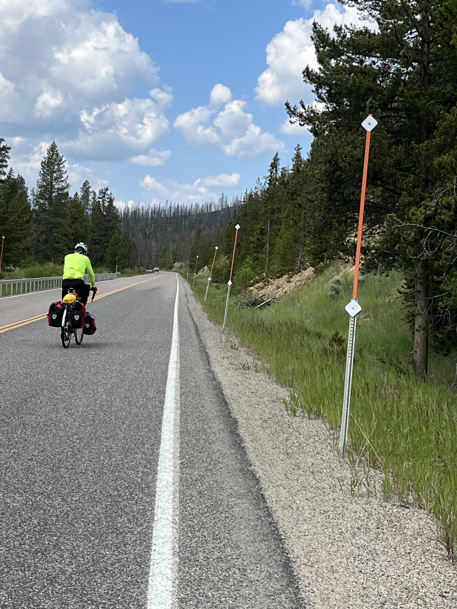
| Heart | 3 | Comment | 1 | Link |
We had lunch at a rest area a mile down from the top. Bean dip, fritos, M&M’s, and OJ. The lunch of champions.
Our route took us into Idaho for about 5 minutes, then back into Montana.

From there it was another screaming downhill with grades at -6%, again with warnings for truckers. It was a near constant pump the brakes evolution. From there to our campsite in Sula, MT, we dropped 2700 ft in elevation.
We checked in at the Camp Sula RV park and only then found out they changed ownership and no longer had a liquor license - darn it, no beer tonight.

| Heart | 4 | Comment | 1 | Link |
The camp store closes at 5 PM. We have been sitting on their patio in the shade working on the journal. Since we have been here, two other touring cyclist have shown up since the store closed. They contacted the manager who said there are no other sites. I believe they will share a site with a third cyclist who showed up after we did.
The temperature definitely got warmer at this lower elevation, currently 82 degrees with a low of 49 tonight. I foresee lots of warmer weather in our future.
We are not sure of our destination tomorrow. It will either be in Florence or Hamilton, MT. Staying in Hamilton will even out the mileage over the next 2 days. We will decide when we get to the potential campground in Hamilton.
It is sort of a good thing we are not trying to make it to Missoula and the Adventure Cycling headquarters tomorrow. The ACA tour group is expected to be there tomorrow by 3 PM for a group photo and catered dinner. I suspect we would be lost in the shuffle.
Well until tomorrow campers, happy biking!
Today's ride: 58 miles (93 km)
Total: 1,045 miles (1,682 km)
| Rate this entry's writing | Heart | 6 |
| Comment on this entry | Comment | 0 |
9 months ago