February 26, 2023
Finding the Exact Routes (or not)
For us, a route is not real until we have its exact gpx (s) in our phone. Some adventurers, from cyclists to mountain climbers, reject exact instructions. They enjoy the challenge of making their own way and dealing with the difficulties and dangers that then result. But we have found ourselves on too many high speed roads, sand traps, dead ends, and giant hills to see any fun in that. Rather, our fun seems to come in collecting high quality, turn by turn, gpx's, and preferably with matching maps!
Our favourites in this realm are the maps and gpx's from the Bikeline series. Bikeline has hundreds of map books with gpx, mostly in Germany.
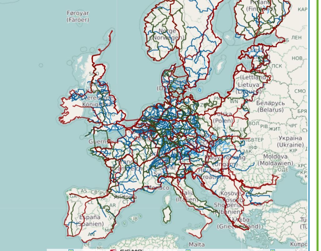
The next major source of directions is the gpx files associated with the Eurovelo routes. For this we like biroto.eu. Biroto is a gpx cyclists candy shop, because they store not only the major international routes but a whole gaggle of country and regional routes. One can wade through these with this handy map! Each route will light up and give access to full details as you mouse over it on their web site. Obviously you need to zoom in to thin out the strands before trying to choose one.
Finally, where there is no Bikeline and no Eurovelo, (and even if there is!), we will ask routing advice from one of many routing engines. Some are easier to use, but we have not yet definitely proven to ourselves which might give the best routes. At least one does take hills into account, and several can upload various alternative gpx's and display them for easy comparison. The ones we seem to be using these days are Ride With GPS (RWGPS), brouter.de, cycle.travel, bikemap.net, and the map engine version of Google Maps : https://www.google.com/maps/d/
Of these, only RWGPS will display a gpx you found somewhere, on a map that includes the "little yellow man" (StreetView). StreetView is important to see if your chosen route is a sand trap or a six lane speedway. With RWGPS you can also display more than one gpx at a time, but that is an extra cost feature. Otherwise, the Google map engine version really is great for loading and then clicking on and off various alternative routes. We are using this, and other web based tools, like gpx.studio, as well as the PC program GPS Track Editor.
A shout out goes to Jacquie Gaudet, who offered a telephone tutorial after reading that I was having difficulty making sense of Ride With GPS (RWGPS). Thanks Jacquie, with your hints, RWGPS has become much more useful for us.
With all these tools, and help from so many other bloggers, you would think we will be following a fabulous, complicated, or at least long, route. But it has been more a process of throwing a big pile of possibilities into the pot and then boiling and boiling them down, until we have ended with an almost ridiculously simple plan.
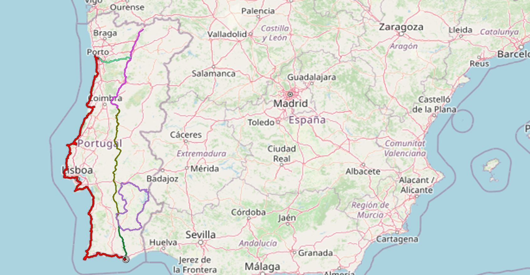
In words, the plan is to start at Porto and to follow the coast south to Faro. From there we will see how the time looks and either head off east into Spain, to Seville or a bit beyond, or more likely to turn around and charge back north in the centre of Portugal, following the famous N2 road, that spans the whole country, from south to north, for about 700 km. But then, about 100 km up the N2, at Castro Verde, we will jump onto the Alentejo circuit, described in that book we got from the Classens. That circuit is a bit over 400 km, and will bring us back to the N2. From there it's straight north again, until we hit the Douro River, at Peso da Regua. The Douro is an east-west affair that runs west from Peso da Regua to the sea, at Porto.
The thing is, to the east of Peso da Regua is the super famous, world heritage, wine growing region of the Douro. At first we planned to thumb our noses at this, and to charge back to the waiting arms of our bike boxes at Porto. But now we have plotted out the route and are looking forward to riding the whole Douro!
If we just do the ride as described, it will be about 2500 km. By some magic, maybe including a bunch of planned stopping off in Montreal, we only ended with 66 days between arriving and leaving at Porto. With time to unpack, decompress, and repack, that probably amounts to only 60 cycling days. But even so, we would only need to average 42 km per day to cover the route. We are approaching this with two opposing frames of mind. On the one hand, when we reach Faro (the most southerly point) we could suddenly charge off to Seville, jump a train, end up in Granada, or go south from Seville to the "white villages", ending with all the other tourists 150 km away at Ronda. All that would add 700 km to the ride and bump the daily tally to 55-60 km. That is not so bad, and more like our usual average.
But in the second frame of mind, it seems rather attractive to not push so hard, and to feel free to hang out in some spots and just chill, or to ride off into the nearby Portuguese countryside. We'll see, but right now the take it easy frame has the upper hand.
| Heart | 0 | Comment | 0 | Link |
| Heart | 0 | Comment | 0 | Link |
Right now we are more into the bonus option of going east on the Douro, on the so called "Port Tour". We plotted it from the guidebook we got from those same amazing Classens. It's just 129 km and looks very picturesque!
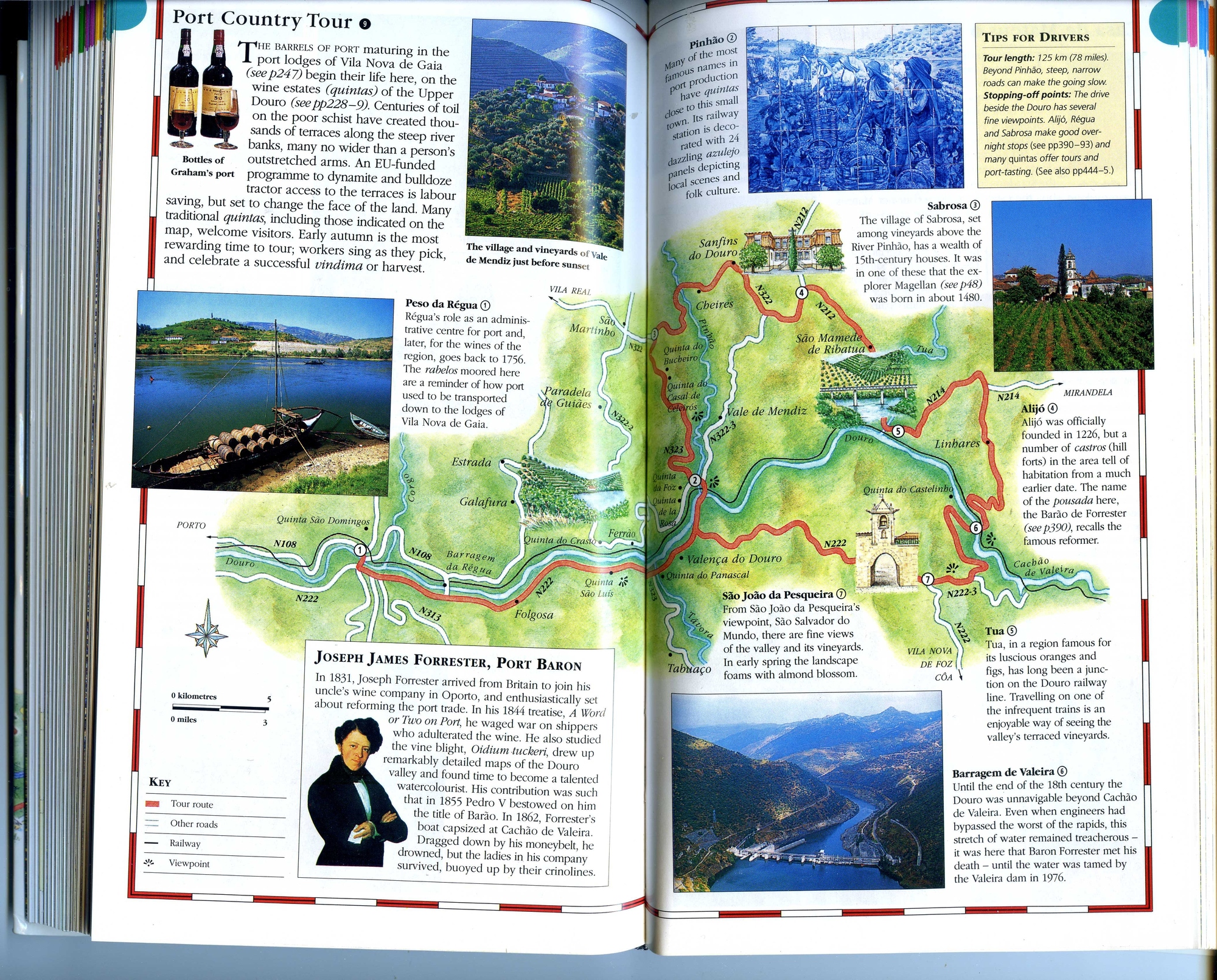
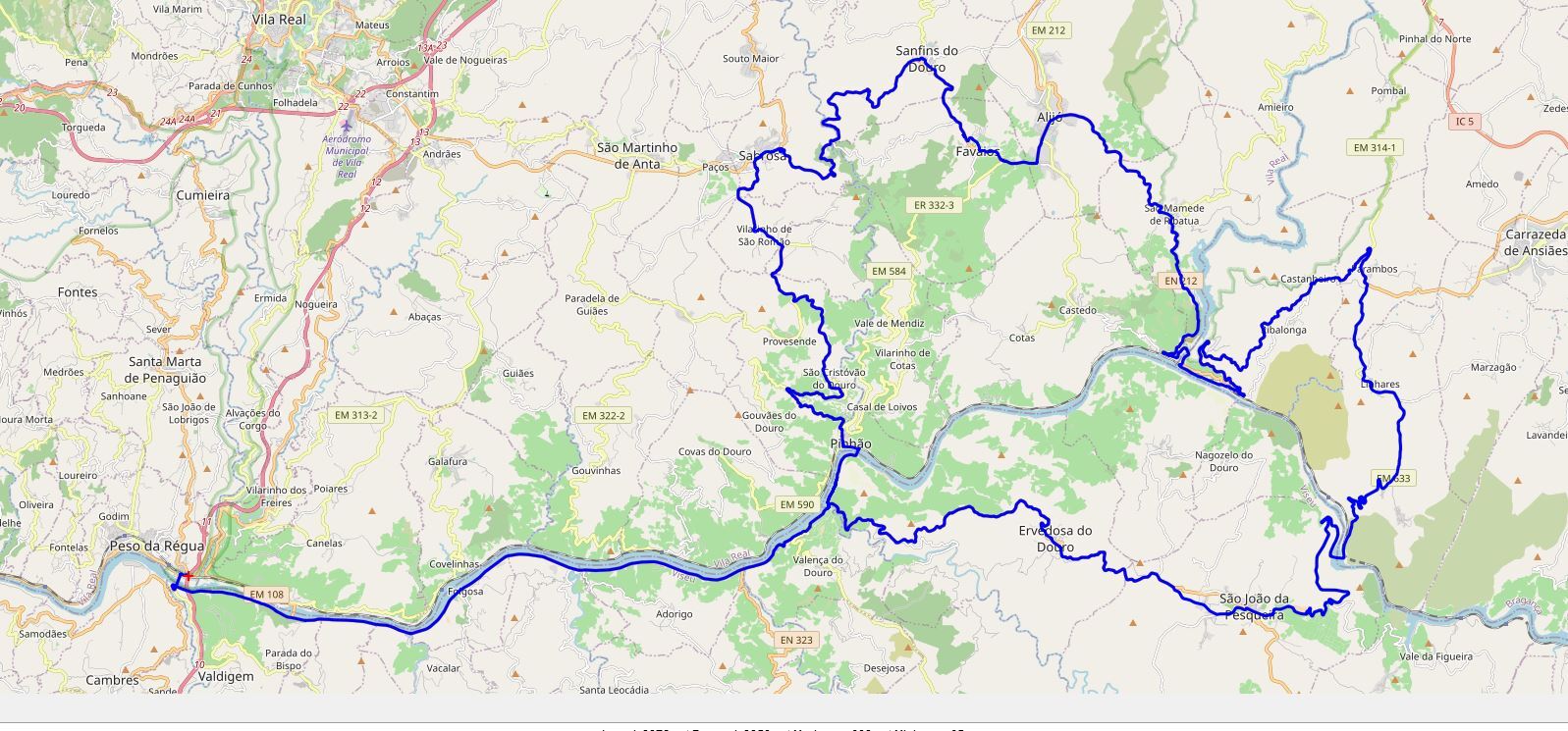
We wrote to Huw Thomas, the author of those two tour books, specifically to ask about the Douro route, and also the N2. He replied quite quickly, which was nice, but he poured cold water on both ideas. For the N2, his position was that the road has been heavily promoted for motorcyclists and sporty drivers, and would not be pleasant for cycling. And of the Douro route, his said it is hilly and curvy and often not by the river - again not great for cycling. Instead Huw mentioned some miscellaneous and remote spots to go cycle near. We could not see how to weave these into our routing. So you know what, we're just going for our original plan. If we get blasted off the roads by traffic or find ourselves grinding up too many hills, we'll think of something!
| Rate this entry's writing | Heart | 9 |
| Comment on this entry | Comment | 4 |
2 years ago
2 years ago
2 years ago