May 19, 2025
Preston County Ramble
The Highlands

| Heart | 0 | Comment | 0 | Link |
Preston County lies in the Northern part of the Mountain State, East of Monongalia County and abutting the Western Border of Garrett County, Maryland. It is considered to be part of the Allegheny Plateau. The term plateau is misleading because the terrain up there is not flat. Riding through this area is formidable because it requires powering up and over many small and some larger hills. To cover the 66 miles I had to climb over 6100 feet.
The county was named for former Virginia Governor James Patton Preston, who served from 1816 to 1819. West Virginia was considered to be part of Virginia at that time, not becoming a separate state until 1863. During his term, the state of Virginia repaid $1.5 Million Dollars of debt incurred during the war of 1812. The University of Virginia was established during his gubernatorial term. The largely rural county was formed in 1818 and named in his honor. Presently, Preston County still remains quite rural.
Since some of the Northern portion of the county was ridden earlier (see previous chapter), this ride began in Hazleton. I rode rode as far South as Rowlesburg before turning Northward and heading back to the starting point, completing an elongated loop. The second half of the ride had the more challenging terrain to conquer.
The morning was rather cool for this time of year with a temperature of 51 degrees Fahrenheit and a brisk wind which created additional chill at times. What started off as threatening and cloudy skies gave way to sunny and blue as the day progressed. However, the wind did not quit all day. At times, especially after a long climb, the cool breeze was nice.

| Heart | 0 | Comment | 0 | Link |
The ride began from the parking lot of the Microtel Inn and Suites Hotel on Casteel Road and directly across the street from the entrance to the Federal Correctional Institution at Hazleton. In the photo, the bike is facing the opposite direction from where I needed to go. After snapping the picture, I headed back to a left on Glade Farm Road, crossed over I-68, and proceeded to a right turn onto Cuzzart Road. The first significant climb was encountered and welcomed because it created bodily warmth which steeled me to the cool wind.

| Heart | 0 | Comment | 0 | Link |
At the top, the small village of Cuzzart lay. As is the case with many of these small locales, nothing much was happening and nobody was out. I paused briefly for a look around before moving on. With the exception of occasional passing vehicles, the roads belonged to the cyclist. The entire state has about 1.8 million people, making it 40th out of 50 in population in the USA. Not many of those folks were out on this day. As of 2023, Preston County had a little more than 34,000 residents. I'm not sure if the roughly 3900 inmates at the Federal Pen are included in the census figures. One thing I do know is that not many of those folks are driving vehicles on the roads. For a few reasons, I was thankful for that.

| Heart | 0 | Comment | 0 | Link |
I followed Brandonville Pike through the small village of Lenox and then to a couple other tertiary roadways. They led to a point where the bottom fell out, resulting in a long and fast descent into the Cheat River Basin and another small village called Albright.

| Heart | 0 | Comment | 0 | Link |
Roughly 40 years ago, a school buddy and I gradually progressed into guiding other students and friends on raft trips down the Cheat and Youghiogheny Rivers. Apparently, we were there so often that we became friendly with some of the paid river guides who suggested that we join their ranks.

| Heart | 0 | Comment | 0 | Link |
"You mean we can actually get paid for doing this stuff?" I would have done it for free or maybe for some food afterwards. The rest was history as we signed on for the 1984 season. After a hard week of school, during which we prayed all week for rain, we would get down there late Friday nights. We sat around campfires laughing with the other guides before hitting the tents for a good nights sleep. At Zero Dark Thirty we were up, dressed, and on the river by 0730 hours. The exhilaration of hitting the first rapids before breakfast is a memory that has not faded much with the passage of time. That was living life at its best and is probably why I keep on pushing myself. I've been blessed and I'm not ever going to take it for granted.
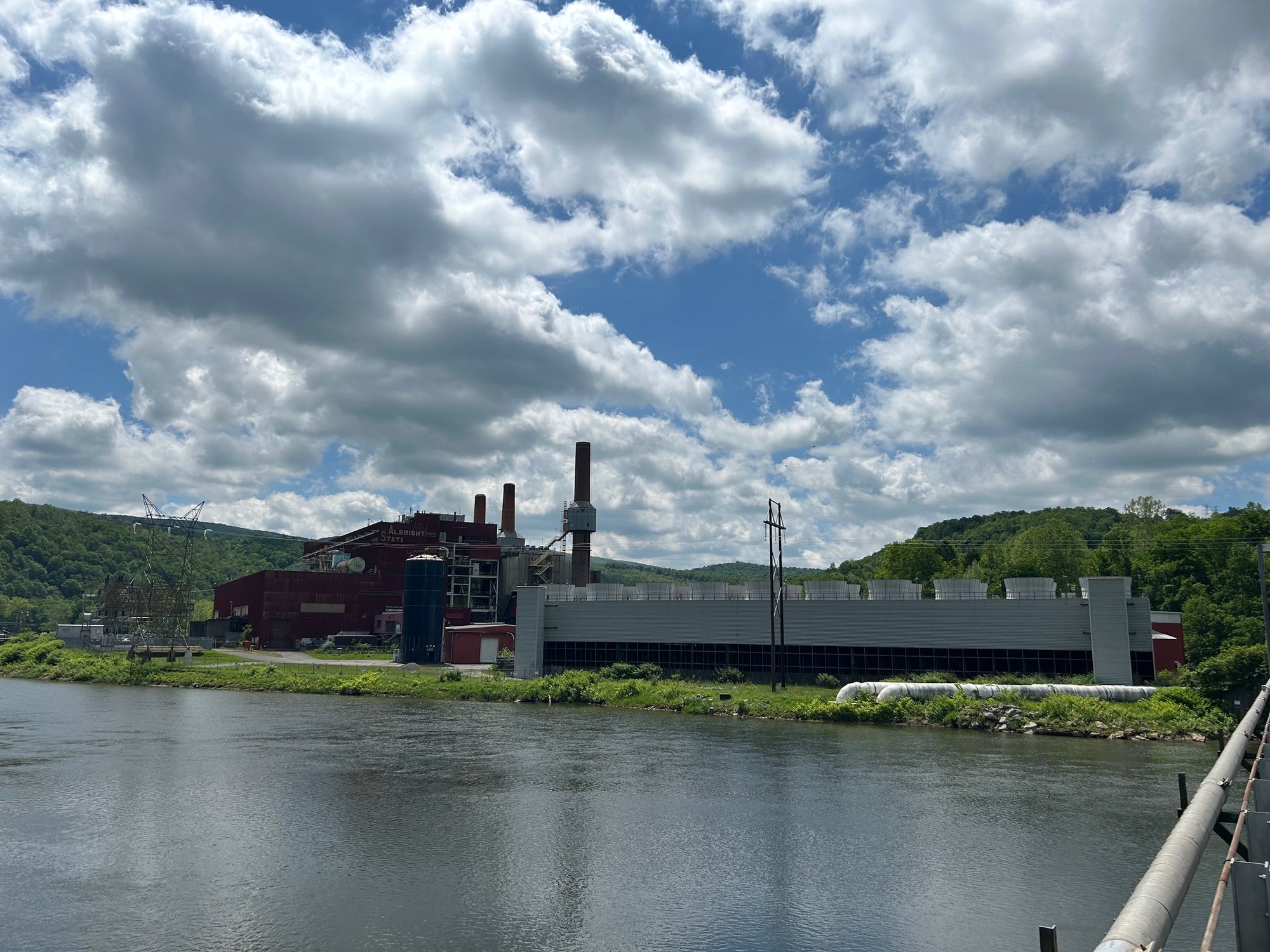
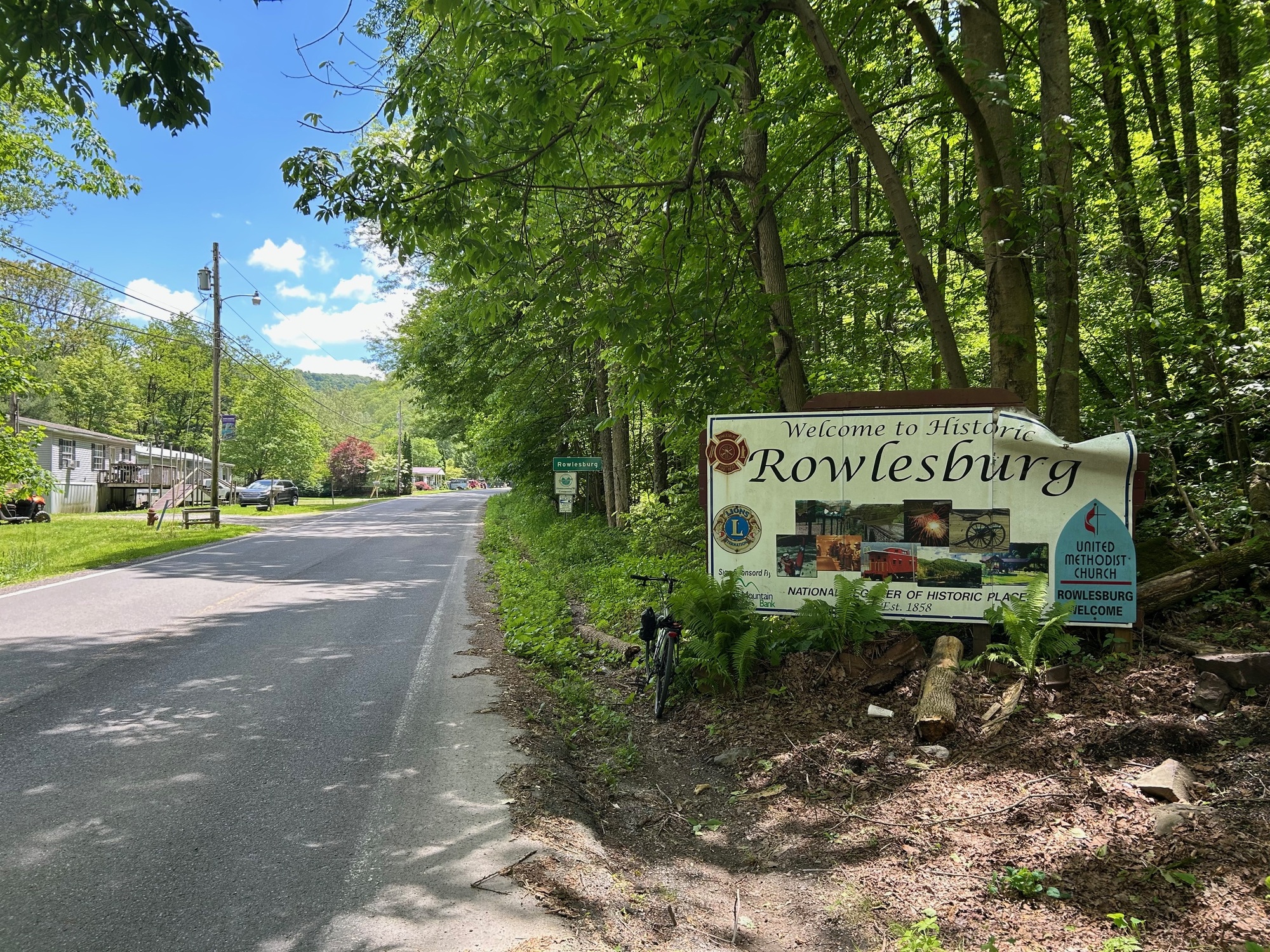
After a break and brief nostalgia trip in Albright, it was time to move on. The big dam and power plant dominated the scene as I left town. A few backroads followed the Cheat and eventually led me to another small village. This one is called Rowlesburg. In the Spring, river levels are higher so the guided trips begin at Albright. As Summer comes on and things dry out, water depths decrease and Rowlesburg becomes the hub for exploring the Cheat by raft and kayak.
I graduated from school in 1985 and did not then choose to continue with my rafting guide career... I'm still not completely sure if that was the right choice or not ;-). In early November of that year, one of my guide buddies (who did continue on with MS&T) called me excitedly to relay a story of life and near death that occurred on the river. A significant rain had occurred and turned the river into a torrent, the likes of which most of the guides had not seen before. With every change in river level, even as small as 6 inches, the character of the river changes. On this day, the change in depth was significantly greater.
For safety, all commercial trips had been cancelled. But a group of guides decided to take a raft trip together, in the same raft, down what was now a truly wild river. I don't fully remember all of the details but survival was in doubt and their demise seemed imminent on a number of occasions during that fateful run. They made it and in the process, gained a great respect for mother nature, the power of the Cheat, and for the fleeting nature of life. Regretfully, my friend passed away a few years back. I can no longer give him a call to recount all of the details from that fateful day.
In "town" was a small convenience store with offerings that consisted of beer, cigarettes, junk food, and fishing supplies. Since I was hungry I stopped and went inside with hopes of securing something to satisfy me and provide some fuel for the second half of this ride. The only sources of protein were pepperoni rolls and bait. Since I was not hungry enough for the latter, I went with the former. While out front on a bench ingesting my food a young lady with no teeth went in and came out with cigarettes. She was pleasant enough but I had to wonder what her future health was going to look like and where the nearest real grocery store might be located.

| Heart | 0 | Comment | 0 | Link |
After my little break, it was time to get on with the adventure and the real climbing for the day. The elevation profile on Ride with GPS looked ridiculous but I was committed by this time. From approximately mile 30 to mile 43, was a continuous climb. On paper it was worse than "in real life." There were a series of small upgrades with no corresponding downward drops. In between these climbs were nice stretches of flatter ground that allowed me to maintain a good pace.

| Heart | 0 | Comment | 0 | Link |
Salt Lick Road was the route for the lions' share of the distance between Rowlesburg and Terra Alta. At one point, there was an option to use Buck Lick Road. But since it was gravel, I stayed on Salt Lick. It was a good choice, remaining paved and with very little traffic. The last two miles were the steepest part of the climb into Terra Alta, which translates as Highlands.
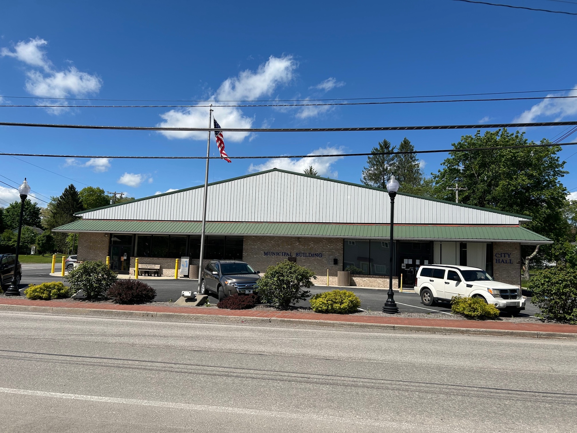
Like many other Mountain State towns, Terra Alta appears to have seen better days but it was not quite as run down as some others. WV-7 runs through the middle of town bringing a steady stream of traffic with it. I only needed to use it long enough to get through town and to see the Municipal Building. From here, around 23 miles remained to complete my loop.
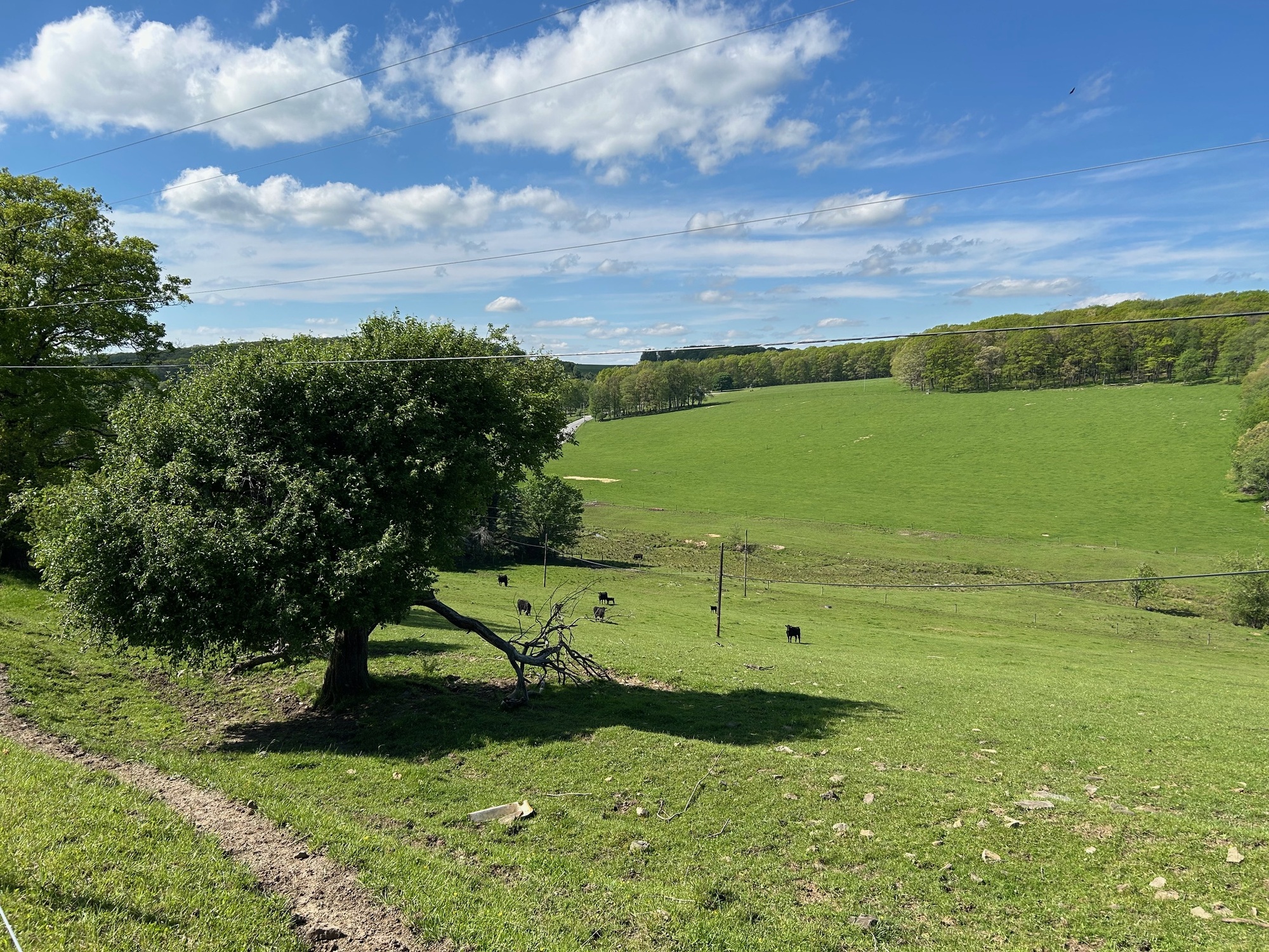
The up and down pattern continued and took me past Terra Alta Lake, Alpine Lake, and the large Cranesville Swamp Preserve, which straddles the border between West Virginia and Maryland. I crossed the border into the Old Line State and remained there for about 7 miles. By this time of day it was sunny, the sky was blue, it was warm, and I was surrounded by fantastic agricultural countryside.

| Heart | 0 | Comment | 0 | Link |
Once back into West Virginia, I traversed a few familiar roads experienced on an earlier ride. My healthy dose of Mountain State gravel road was again provided on my way back to Hazleton. I stopped to talk with a friendly fellow who was doing some weed whacking alongside the gravel road. I felt a little bad when he had trouble starting his machine again but eventually I heard it fire up as he continued his task and I went on my merry way.
After a bit more climbing, there was another long descent on Hazleton-Maryland Line Road. It took me back to Hazleton and my starting point. Despite the higher mileage and challenging terrain, I felt pretty good and was satisfied to have completed this loop. For most of the day, it seemed I had the area entirely to myself. If one has the time, a trip down the river would provide a nice alternative perspective. Either way, a trip through Preston County will not disappoint.
Today's ride: 66 miles (106 km)
Total: 967 miles (1,556 km)
| Rate this entry's writing | Heart | 1 |
| Comment on this entry | Comment | 2 |
Fun for a while, but the old frame kind of wears out after while.
3 weeks ago
3 weeks ago