May 24, 2025
Mineral County
Fort Ashby and the C&O Towpath

| Heart | 1 | Comment | 0 | Link |
Many cyclists ride the GAP from Pittsburgh while others ride the C&O Towpath from Washington and end up in Cumberland, Maryland. The Western Maryland train station and Canal Place are such big attractions that most don't bother to cross the river and head over to the Mountain State that lies so close by. If anyone crosses the Potomac, they will find the Eastern Panhandle (EP) of West Virginia and the County called Mineral, one of eight such jurisdictions in the EP (see the map in Chapter 13).
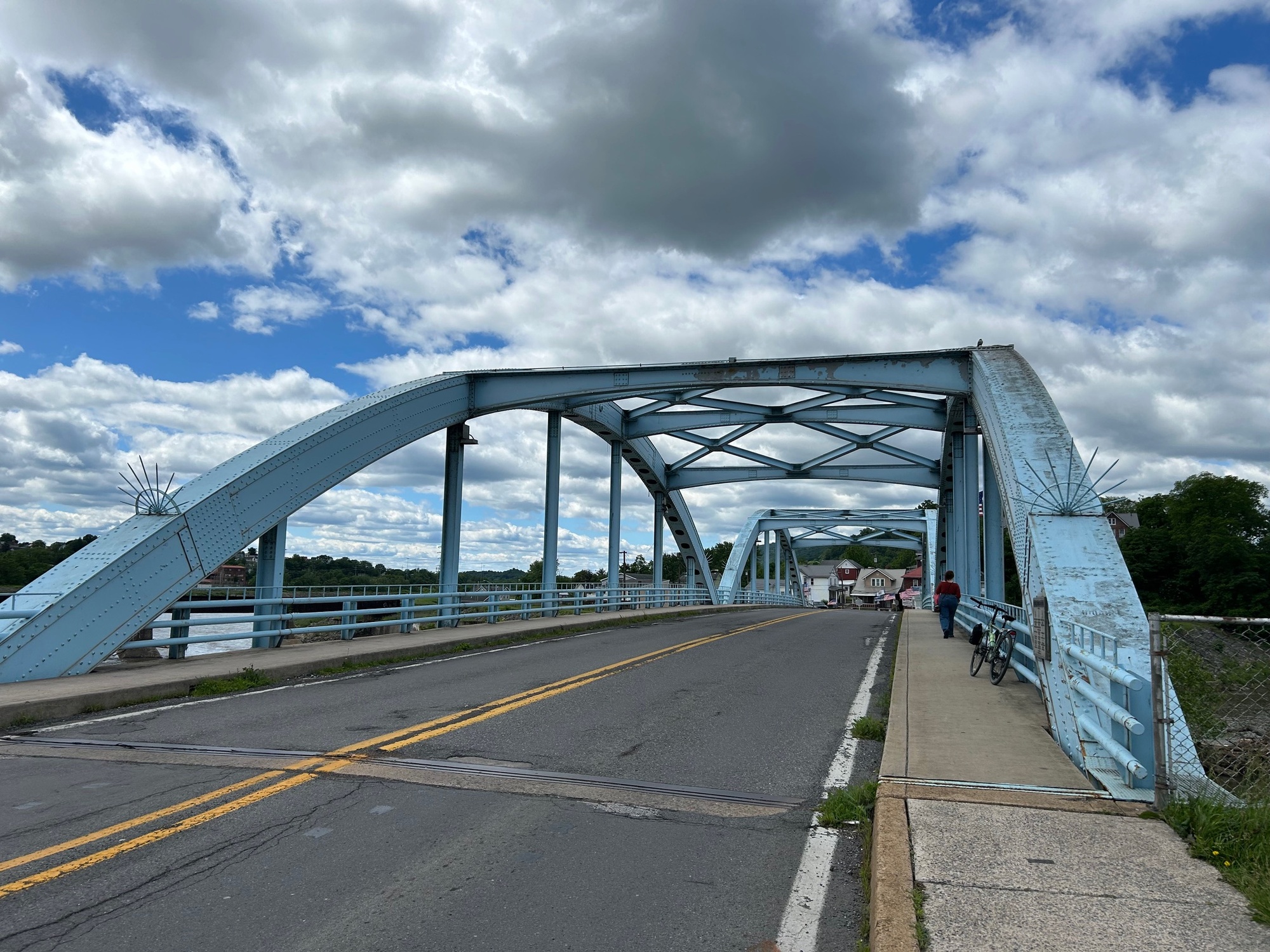
Upon crossing the North Branch of the Potomac, from Green Street in Cumberland, one enters the small city of Ridgeley, West Virginia. Fort Ohio was built here as the first frontier military outpost in an area that was considered to be the westernmost point of civilization in America at the time (1750). Beyond the small settlement, the lands were considered to be a nearly impenetrable wilderness. Today, of course, Ridgeley has roads, homes, and a small business area. I was headed to the Carpendale Trailhead that lies a bit South of town.

| Heart | 0 | Comment | 0 | Link |
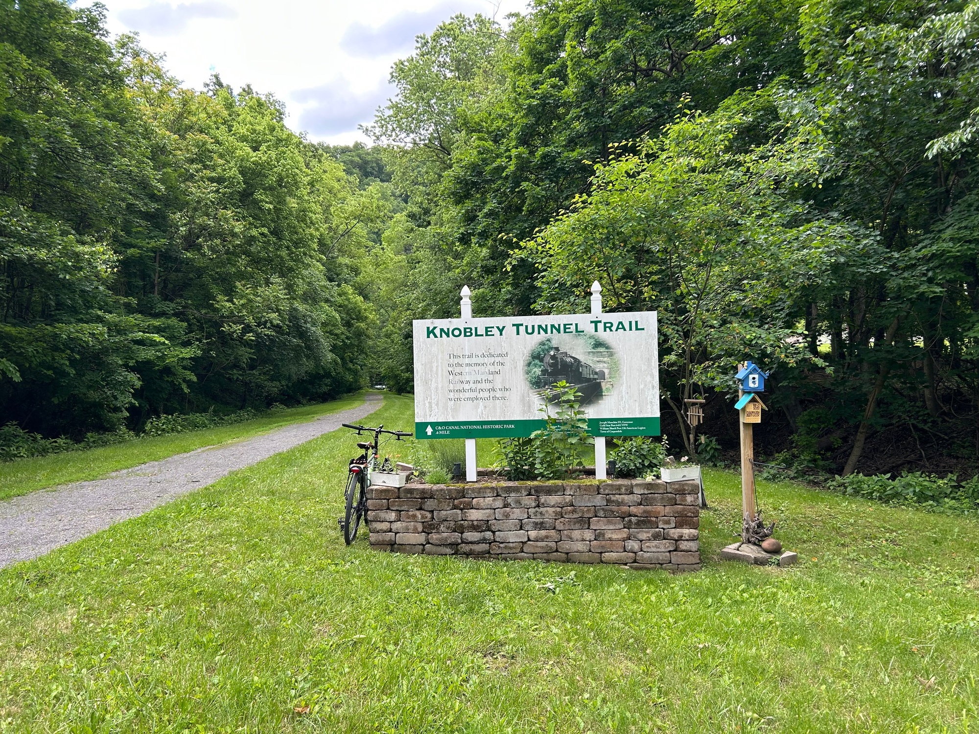
The CT was supposed to take me across the river and to the C&O Towpath but a downed tree and a gate at the tunnel entrance put an end to that part of the plan. Retracing my path, brought me to Knobley Street and eventually to the Veterans Highway (WV-28).
WV-28 is a typical Mountain State Highway with narrow shoulders and some traffic on this holiday weekend. After enduring some lines of speeding vehicles, an "off ramp" appeared. The first brief escape was via the very calm combination of Seymour and John Chaney Roads, near Wiley Ford.
After another "dance" with WV-28 traffic, a longer escape valve came when my planned route called for a left turn onto Old Furnace Road (OFR). It turned out to be a very pleasant backcountry byway through rolling agricultural landscape.
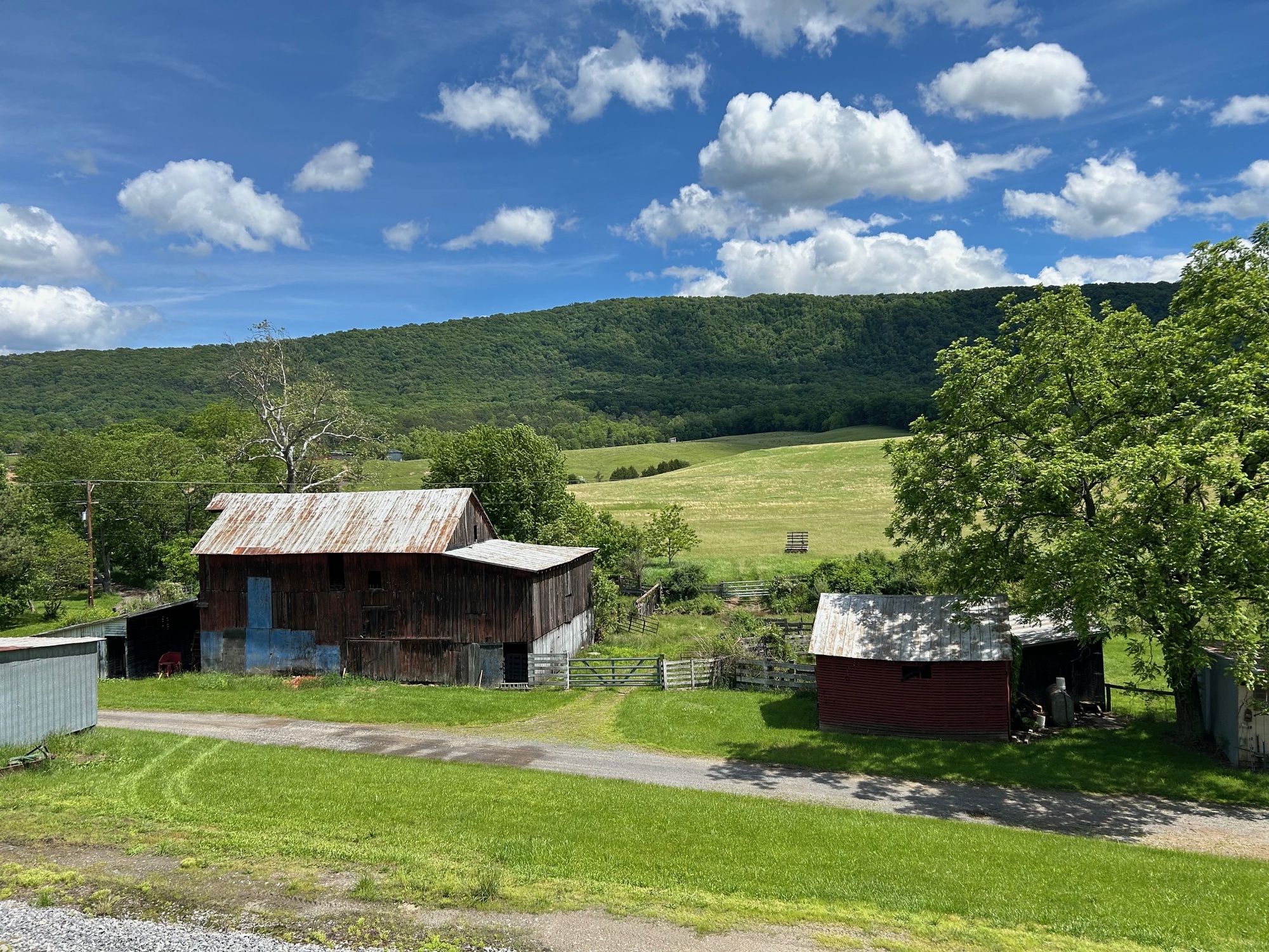
My time on OFR eventually ended with a right turn onto Patterson Creek Valley Pike (PCVP). Since it ran roughly parallel to Patterson Creek, the road was mostly flat on its course that led nearly all the way to Fort Ashby. The creek was on my left. It gave way to a wide field that lies against the long mountain ridge that is the Allegheny Front. The ridge rises abruptly to over 3000 feet of elevation. A farmer was working his fields in a tractor as I passed the peaceful and beautiful scene. The sun was shining and everything was hued in varying shades of green except the for deep blue sky and the billowy white clouds above.

| Heart | 0 | Comment | 0 | Link |

| Heart | 0 | Comment | 4 | Link |
https://www.inaturalist.org/taxa/62211-Potentilla-recta
Tiny yellow ones are black medick
https://www.inaturalist.org/taxa/57056-Medicago-lupulina
3 weeks ago
2 weeks ago
With deteriorating knees, my last cycle tour was in 2011 posted on CGOAB (Heart Attack Comeback). So, following cycle tours and posting nature IDs gives me a chance to engage in 2 of my favorite things. My career as Explosives Safety did not quite match with my Zoology degree!!
2 weeks ago
2 weeks ago
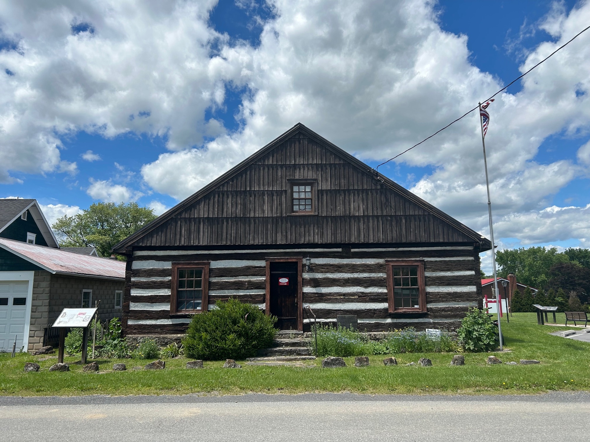
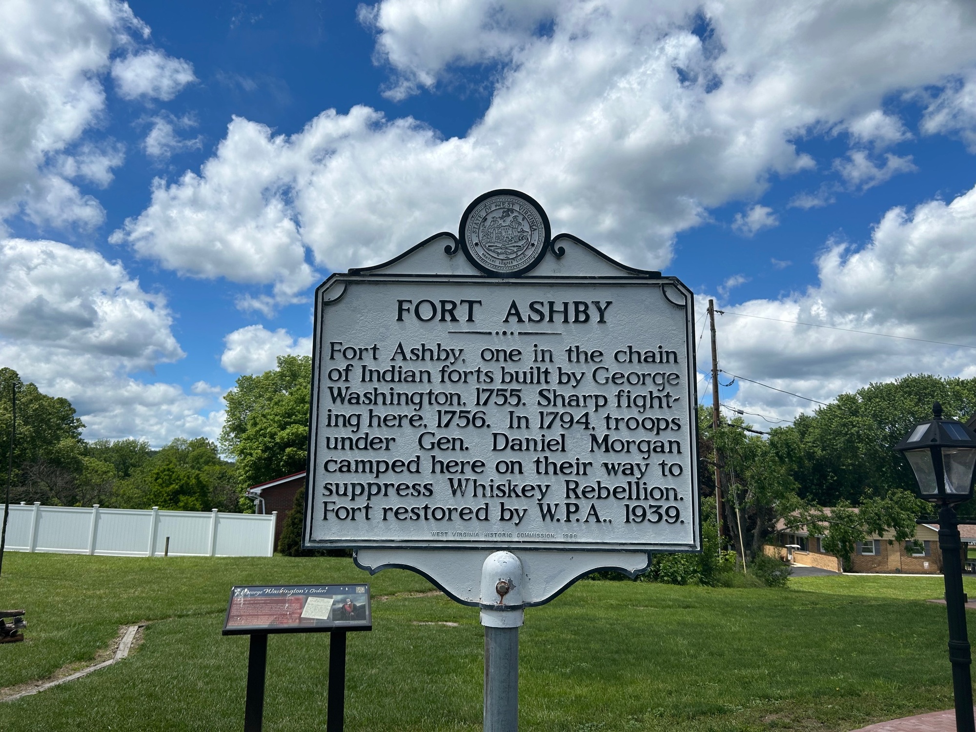
I rejoined WV-28 briefly and for the last time for the short ride into the town of Fort Ashby. George Washington ordered a defensive military fort built here in 1755 due to incursions from the Delaware and Catawba Indian Tribes. Fort Ashby was one of three such forts in the area. The town grew up around the fort, which has been preserved, renovated, and kept open as a museum. Community days and some other local events are held there, as I was told by a very nice waitress who served my lunch at a local cafe in town.

| Heart | 0 | Comment | 2 | Link |
2 weeks ago
After my brief visit to the fort, the latter part of the ride, to loop back to Cumberland, continued. I followed a few Mineral County backroads, all of which were paved, until I reached Green Spring Valley Road (GSVR), which had the markings of a more heavily traveled road. However, traffic was thankfully light on this day. The backroads that led me to GSVR were Dans Run Road, Dennison Hollow Road, Donaldson Loop Road, and Donaldson School Road. All of these were rolling and wooded tertiary and paved backroads. Very few if any vehicles passed me during those pleasant several miles of riding.
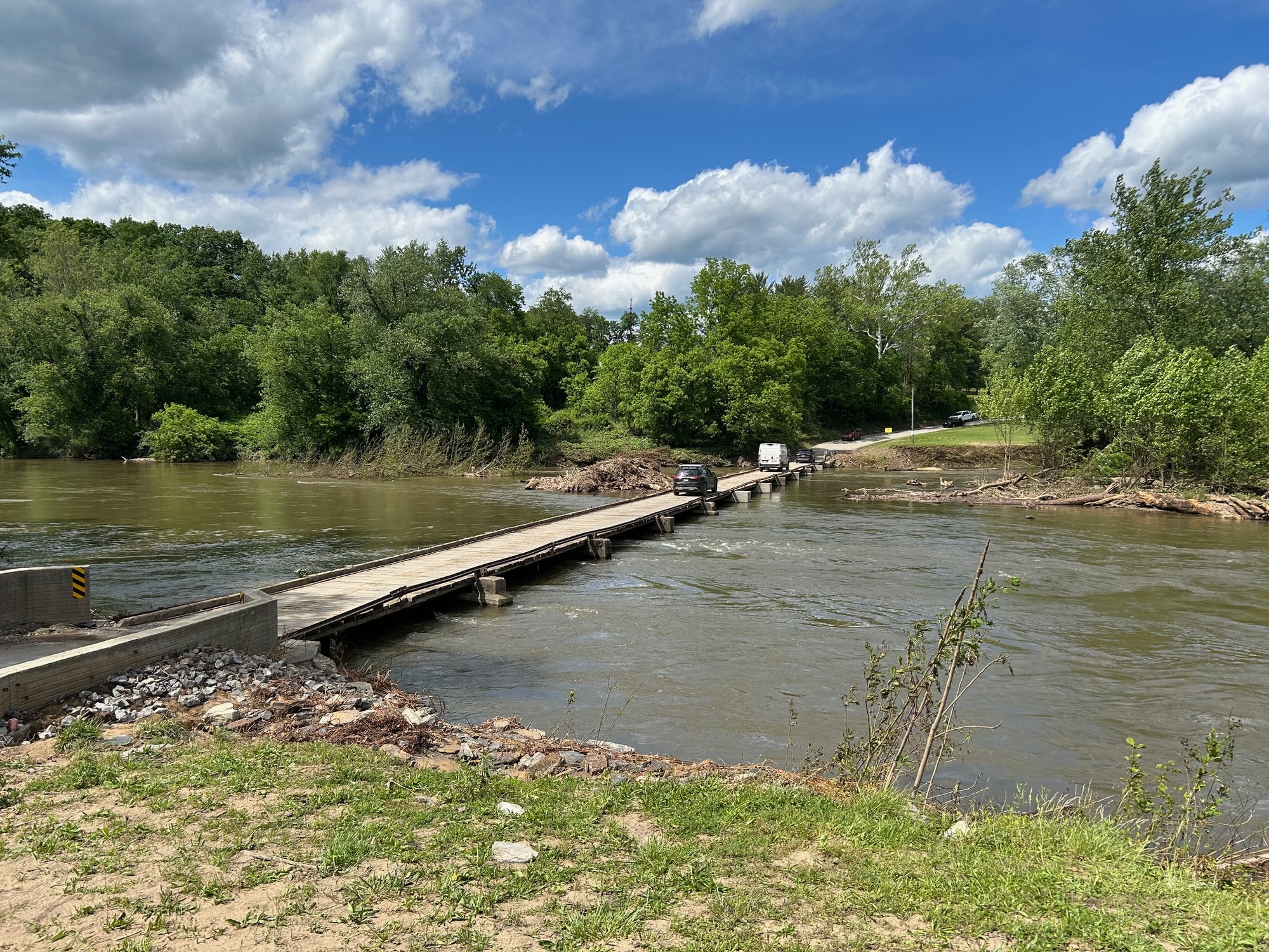
Upon reaching GSVR, the landscape was more open and traffic was light but more frequently encountered than it had been on the backroads. The gently rolling roadway led to the low bridge over the Potomac to Oldtown, Maryland and the C&O Towpath. Some Mineral County highway workers were painting new lines on the road. Although they slowed traffic down, I was thankful for the reduced danger from automobiles that could no longer speed by.

| Heart | 0 | Comment | 0 | Link |
I crossed the wooden bridge into Maryland and got onto the C&O Towpath near milepost 167. Since the end of the line is milepost 185, there were 18 more miles to cover in order to finish. The canal and towpath lie parallel to the Potomac River and very close to the border with West Virginia. The landscape and terrain in both states are very similar. The canal and towpath make up a linear National Park, thanks to some work to preserve it by Supreme Court Justice William O. Douglas back in 1954. Subsequent legislative actions have improved the towpath surface, kept the various locks, lock tender houses, aqueducts, weirs, and parts of the canal itself intact. In many spots, historical markers describe the various structures and significant events from the past for passers by.

| Heart | 0 | Comment | 0 | Link |
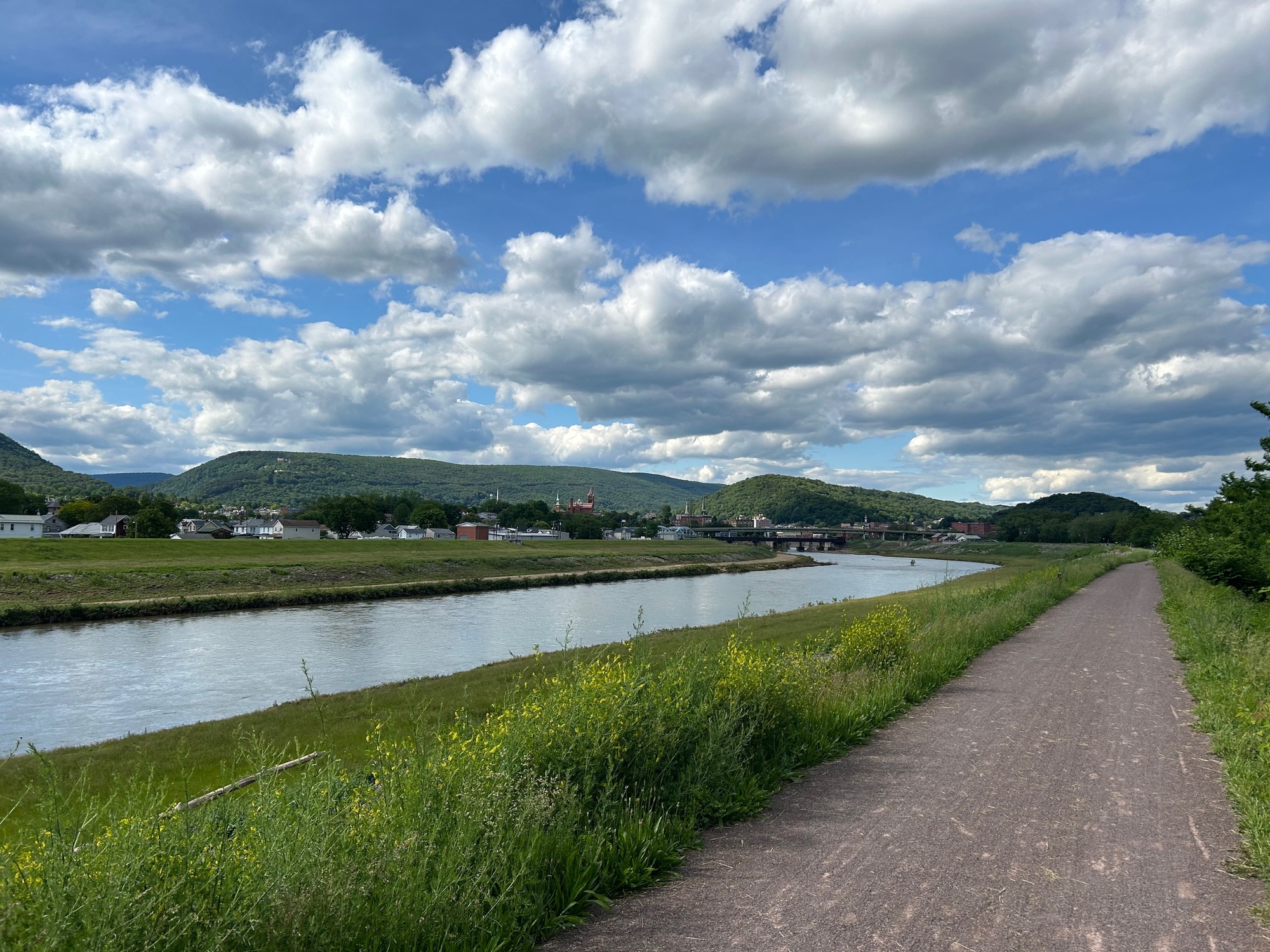
In recent times, the towpath surface has received some much needed attention. I have ridden it in the past when it was very rough with tree roots, potholes, rocks, mud puddles, and very rough gravel... all of which made for a less than pleasant ride. On this day, the surface was very smooth for nearly all of the 18 miles to Cumberland. We've had some recent heavy rains which had roughened the surface in a very few short sections of trail. Other than that, the ride was quite pleasant and scenic. The tree pollen at this time of year is quite heavy. So, if you have an allergy, you may want to proceed with that in mind and take appropriate action(s). The wildflowers are plentiful, colorful, and everything was green. This was a nice way to spend a Saturday afternoon in Mineral County, West Virginia.
Today's ride: 48 miles (77 km)
Total: 1,015 miles (1,633 km)
| Rate this entry's writing | Heart | 1 |
| Comment on this entry | Comment | 0 |