June 30, 2025
Day 19: Shoshone to Twin Falls, Snake river canyon
I pedaled 5 blocks to Manhattan Cafe for breakfast, then back to the room to pack up. On the road early for me, 8:15 AM. For the first time during this tour the weather was warm when I started. Today is a short easy day but I want to beat the heat.
| Heart | 0 | Comment | 0 | Link |

Today's ride starts with 4 miles uphill. That was unexpected because it's generally downhill from Shoshone to Twin Falls. Then the terrain was gently rolling with a downhill trend and the usual south headwind. Farms all the way to Twin Falls, not much undisturbed high desert.

Today I'm back on US 93 from Shoshone to Twin Falls. It has annoyingly heavy traffic but it does have a usable shoulder. As usual the shoulder is mutilated by an improperly placed rumble strip. Many tall triple hay trailers passed by in my direction. They give me a sudden blast of air from behind, then turn the headwind into a tailwind for 15 seconds or more.
US 93 from Shoshone to Twin Falls is not pleasant for cycling. Alternate routes to the west are much longer and hillier. I opted to get to Twin Falls as quickly as possible before it's too hot. The earlier the better for downstream Snake river canyon views in morning sun.
The final 8 miles to the Snake river are all downhill with a gentle grade, a 4 lane divided highway with a wide shoulder and no rumble strip. US 93 crosses over I-84 three miles north of the Snake river. The city of Twin Falls is on the south side of the river.

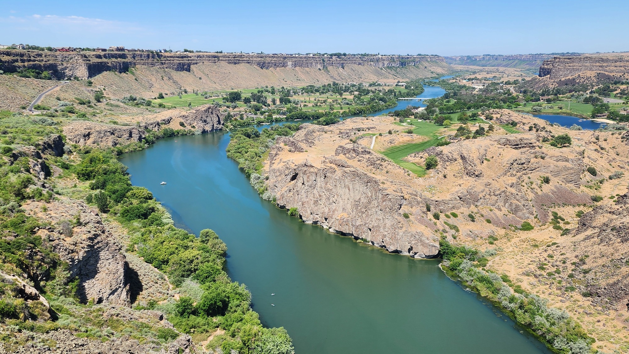
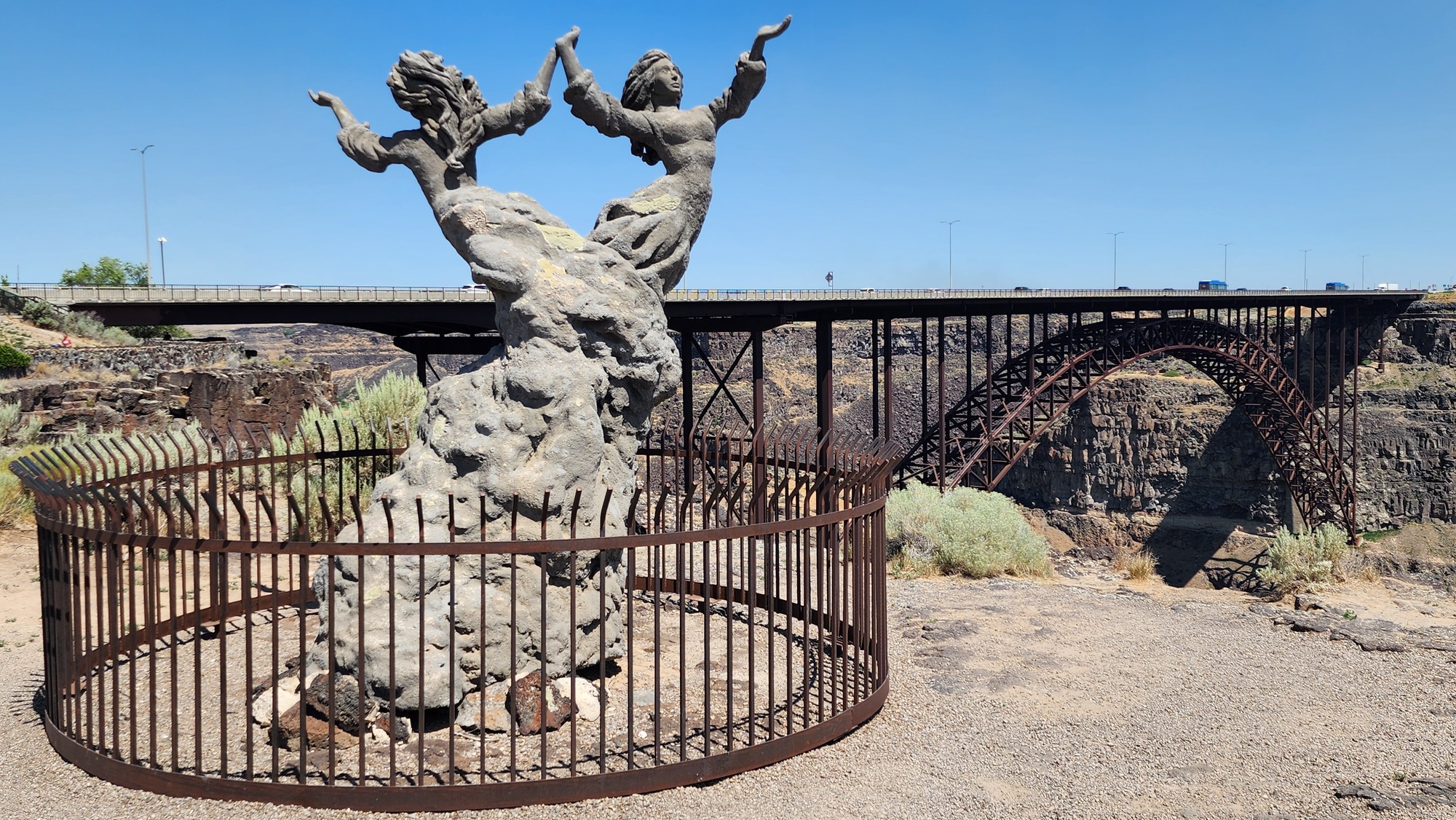
I arrived in Twin Falls just before noon. I turned right after the bridge and got on the Snake river canyon rim trail going downstream. Still a decent sun angle looking downstream. Too early for good views looking upstream.
| Heart | 0 | Comment | 0 | Link |
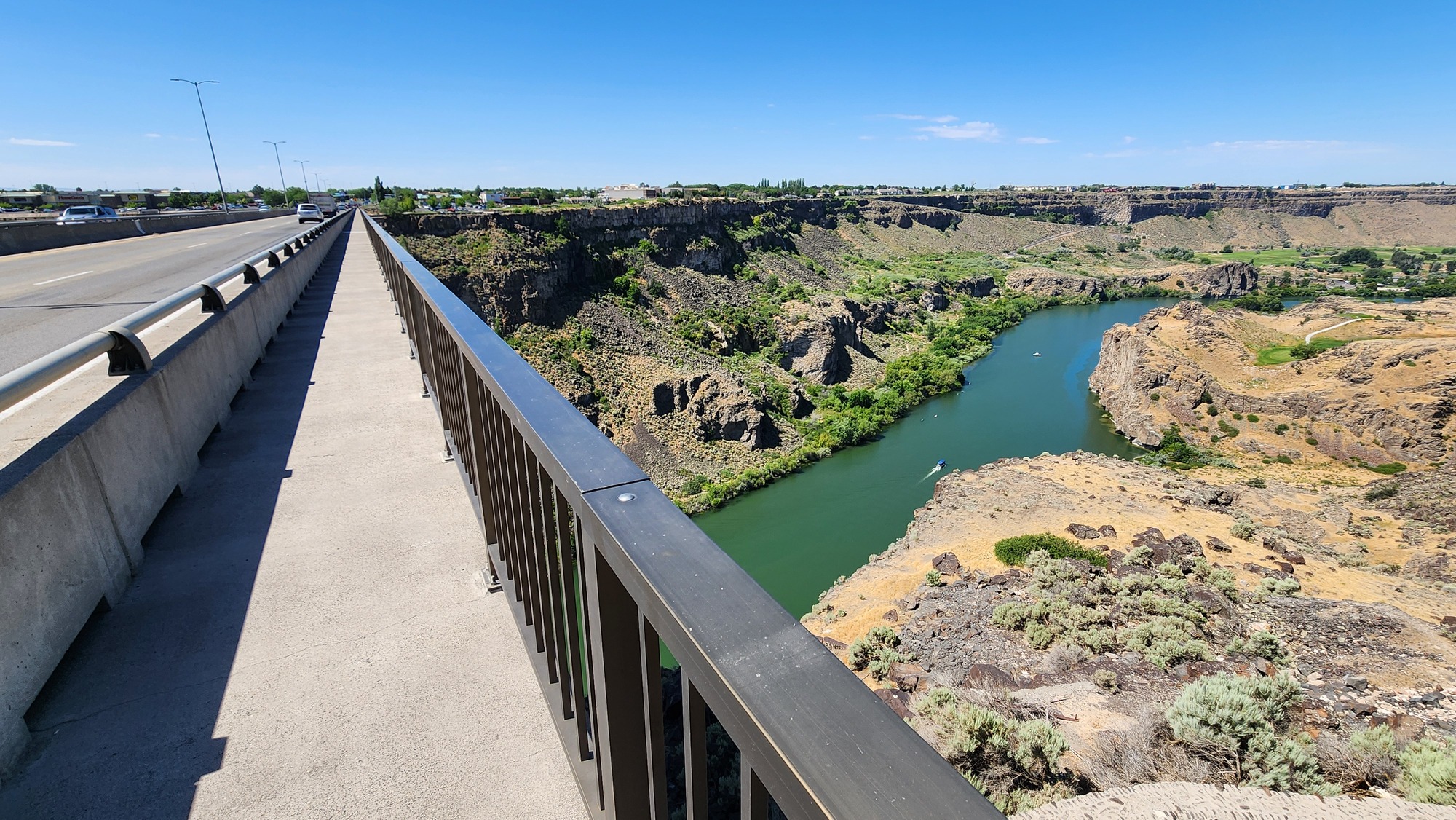
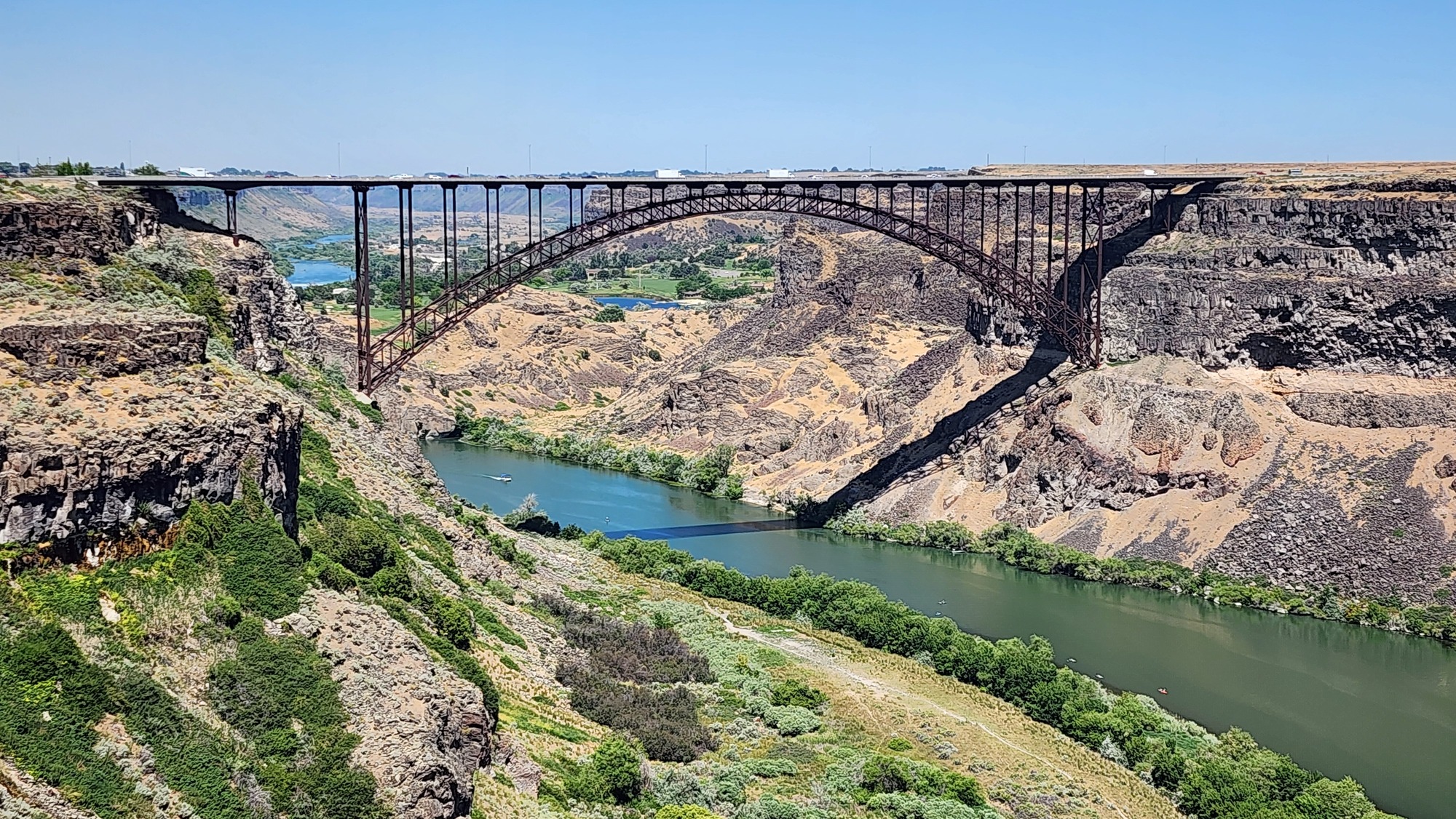
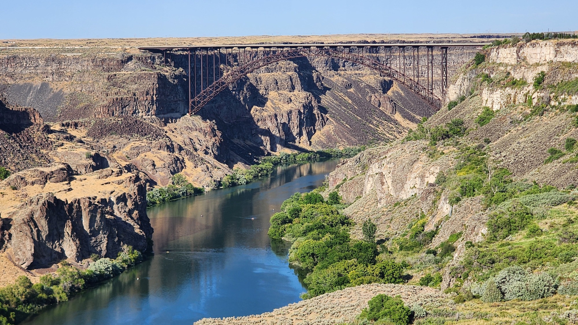
The roadway bounces up and down several inches when heavy trucks drive by. Oscillations continue for a few seconds after the last axle passes. I try to take photos when the bridge isn't shaking.
| Heart | 1 | Comment | 0 | Link |
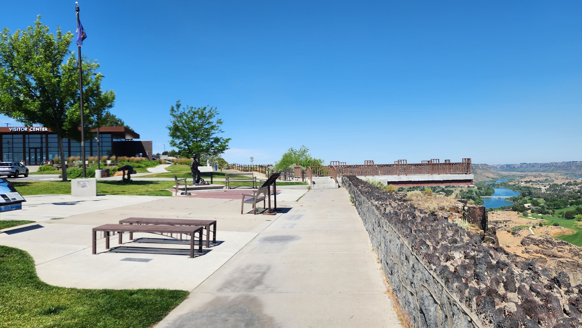
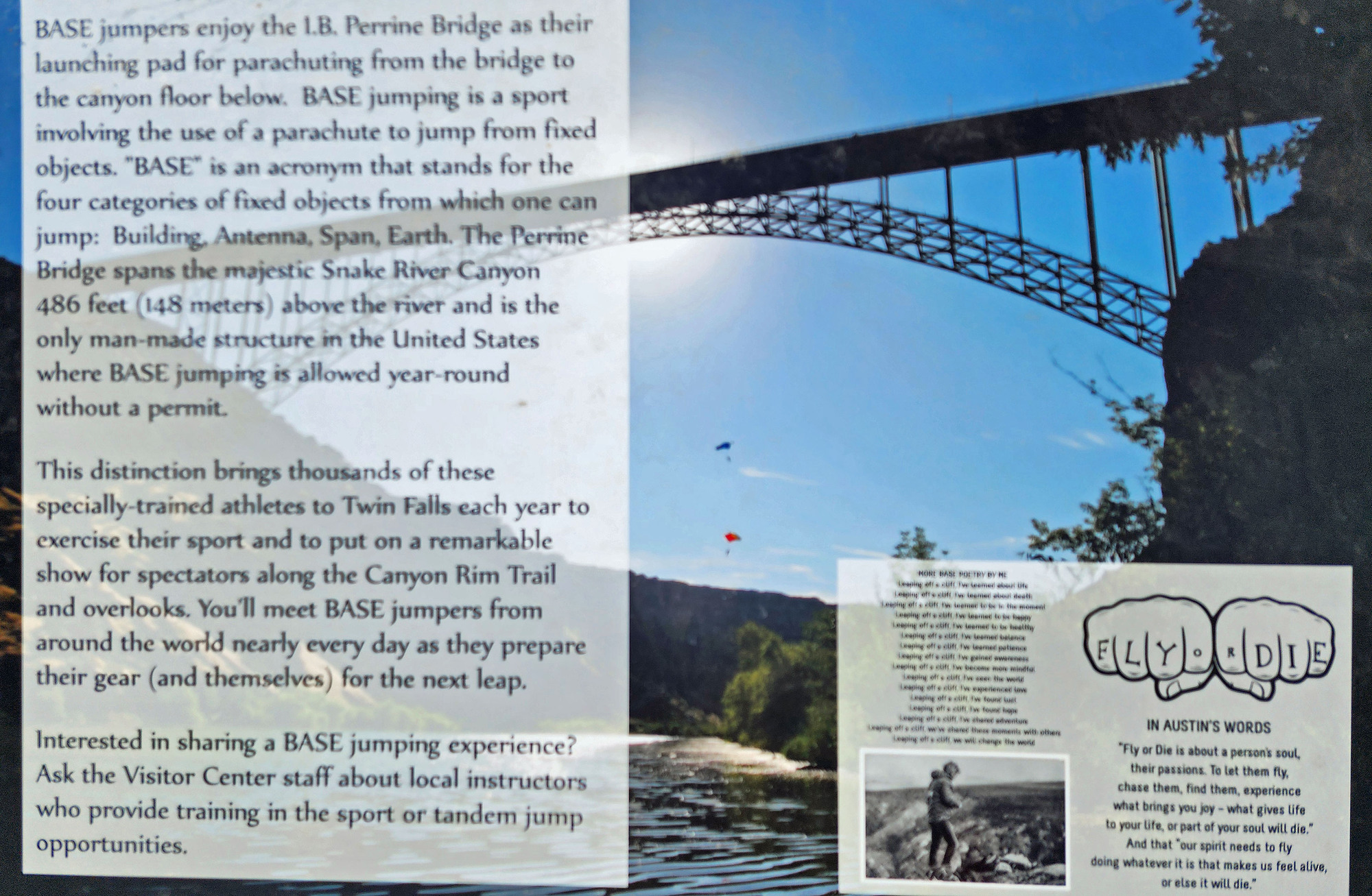
I stopped briefly at the Visitor Center next to the bridge and saw people sitting in the shade packing parachutes. Two years ago I saw people parachuting off the bridge, but not today.
| Heart | 0 | Comment | 0 | Link |
| Heart | 0 | Comment | 0 | Link |
From the visitor center I pedaled the rim trail downstream (west) two miles to the end of the trail. I had a good sun angle looking ahead, downstream. Views into the canyon are unobstructed because there are no railings, walls, or trees to block the view. No litter or graffiti, Mormon clean.

Pedaling the rim trail brings back memories from two years ago when I first visited the Snake river canyon. Then I pedaled the steep grade into the canyon. Today I will stay on the rim.

The bottom of the canyon has parks, golf courses, and a giant wastewater treatment plant, but no houses. The flood risk must be too high for houses.


I turned around at the west end of the rim trail and pedaled east 6 miles on the rim trail. 2 miles back to the bridge, then another 4 miles upstream to the first good views of Shoshone falls.
| Heart | 0 | Comment | 0 | Link |
I stopped a couple times east of the bridge to take photos of the bridge.
| Heart | 1 | Comment | 0 | Link |
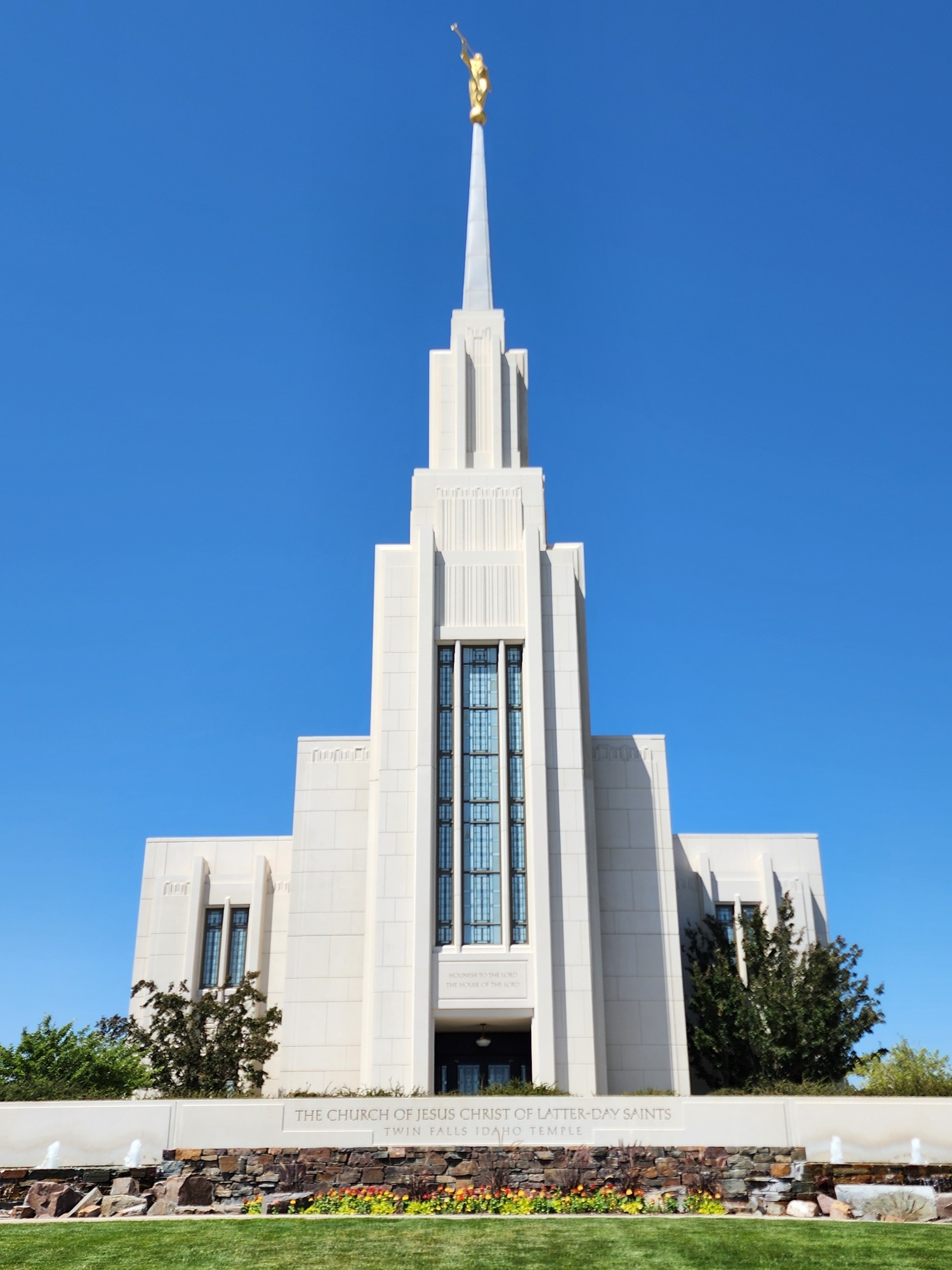
I also pedaled half a mile off the rim trail for a quick look at the Twin Falls LDS temple. I saw it two years ago as well. The spire is visible from miles away.
| Heart | 0 | Comment | 0 | Link |
Back on the trail I continued east past the Evel Knievel launch ramp towards Shoshone falls. Two years ago I walked on top of the ramp. This time I just pedaled the trail underneath the ramp and looked at the sign.


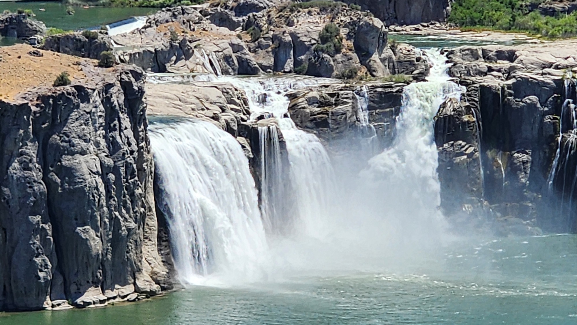
The first view of Shoshone falls is about half a mile past the launch ramp. The trail continues all the way to the falls with many views of the falls along the way.

I turned around at the first unobstructed view of Shoshone falls from the rim trail, still near the top of the rim. Beyond this vantage point the trail steeply descends 300 feet to Shoshone Falls Park. I pedaled there two years ago but not today.
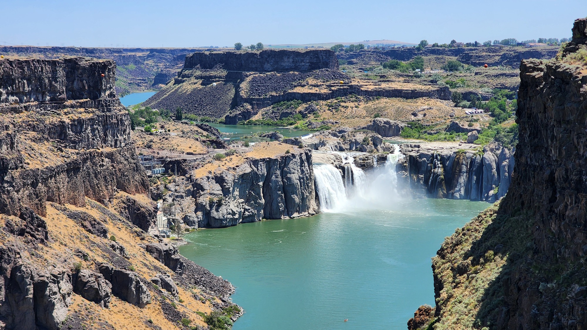
| Heart | 1 | Comment | 0 | Link |

| Heart | 1 | Comment | 0 | Link |
I stopped a few minutes to enjoy the falls view, then turned around to go back to Twin Falls for lunch and air conditioning. It was after 1 PM. I stopped for upstream views weren't totally awful, as good as I can get.


Near the bridge I had a late lunch at a Hawaiian chain that I had never heard of. It was good. Something different. After lunch I pedaled a few blocks to the big Quality Inn. I arrived at 2 PM and they were kind enough to give me a room right away. If the room wasn't ready I would have waited in the air conditioned hotel lobby. I was ready to get out of the heat. In the room I cleaned up and took a nap from 3:30-5 PM.
I walked to dinner at a nearby Thai restaurant that doesn't serve beer. Later I walked next door to have a couple beers at Red Robin. They don't have India Pale Ale, so I had to settle for Fat Tire Amber Ale made in Fort Collins, Colorado. The brewery is mostly powered by renewable energy and is famous for gifting a bicycle to every long term employee.

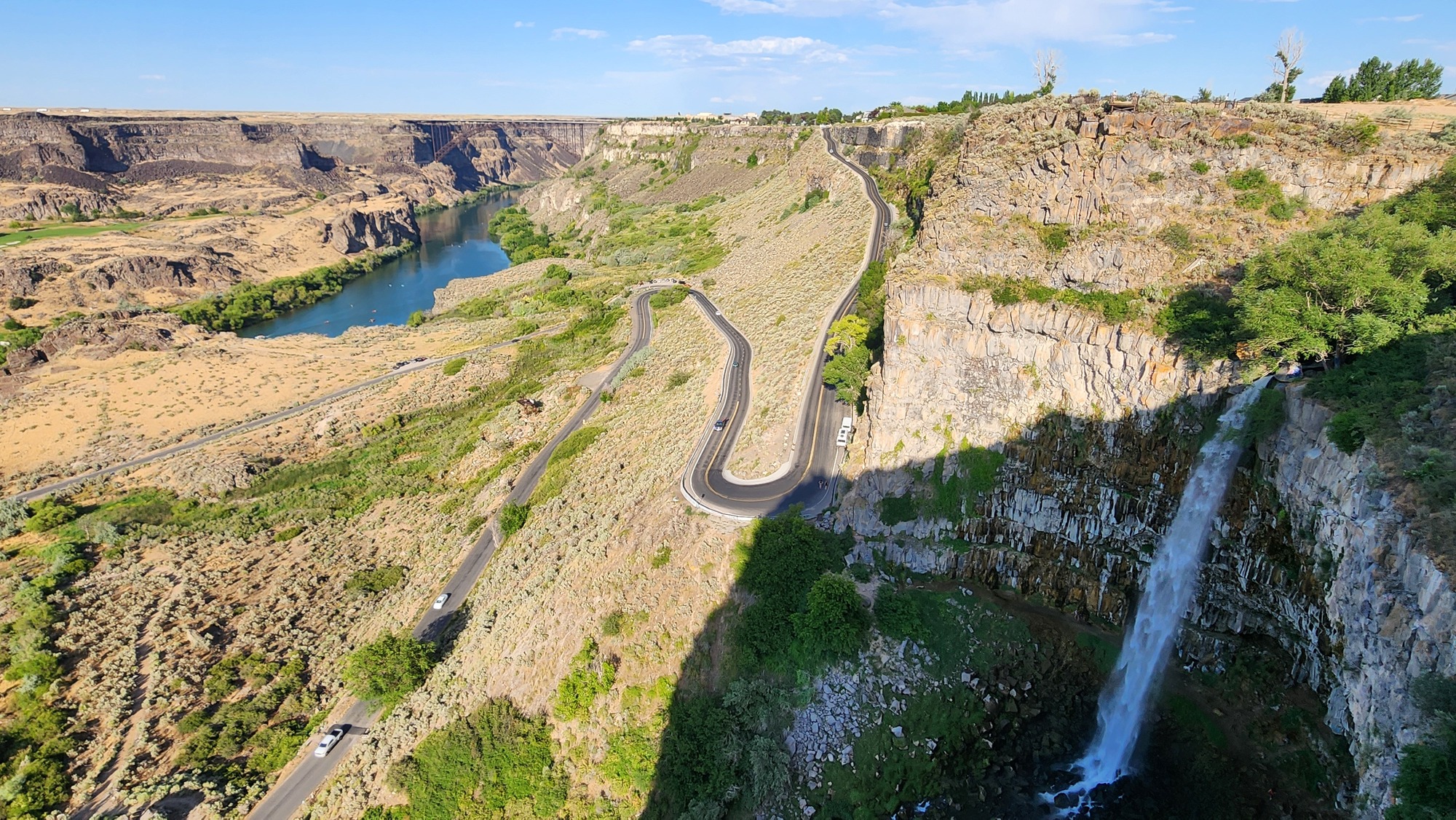
Just before 8 PM I set out from the hotel to see the canyon in evening sun. The temperature was 95F. I pedaled west to the end of the trail to see Perinne falls. I was hoping the plunge might be in sun but it wasn't. Most of the canyon had a good sun angle, though.
| Heart | 0 | Comment | 0 | Link |
It was hot but I enjoyed the views looking upstream towards the bridge.
| Heart | 0 | Comment | 0 | Link |
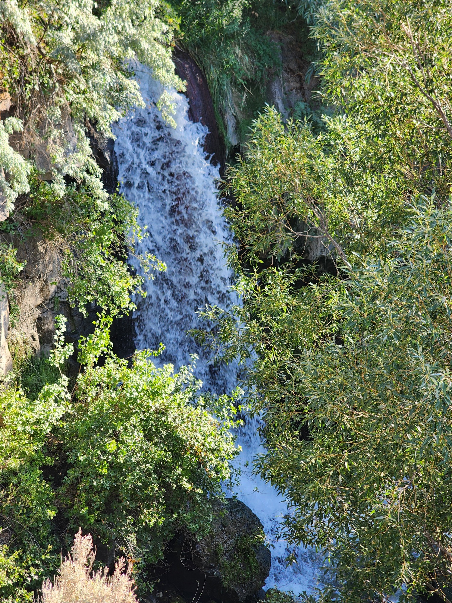
At least the waterfall was entirely in shade. Waterfalls look best in full shade and worst in part sun/part shade.

I wandered around the area above the falls where the trail goes away from the canyon to get around still another waterfall. This creek flows across the city of Twin Falls, then plunges 400+ feet into the Snake river canyon.
| Heart | 0 | Comment | 0 | Link |


I was plenty warm by the time I got to the visitor center next to the bridge. I'm enjoying the view but also need to get out of the 95F heat. The evening temperature isn't cooling down like normal.

Today's canyon exploring brings back fond memories of pedaling the Snake river canyon rim in 2023 at the beginning of my Riding the Snake bike tour. I'm back again after pedaling a giant loop of high desert rivers surrounding the Yellowstone supervolcano. It took 3 bike tours spread out over 3 years, a fun project. The Snake river canyon is a memorable place to start and finish the project.
Today was much warmer than yesterday. High of 95F, and tomorrow will be hotter. The temperature was 84F long after dark at 10:30 PM. That's extremely rare in the desert at 3500 feet elevation. I'm finishing the tour in the nick of time.
I ended the day feeling pretty good. The heat didn't wear me down too much. The Missoula to Twin Falls bike tour was a success, but I'm still car-free until tomorrow morning when I pedal to the Enterprise Rent A Car office.
Distance: 33.5 miles
Average Speed: 9.1 mph
Ascent/Descent: +797/-1023 feet
Today's ride: 34 miles (55 km)
Total: 667 miles (1,073 km)
| Rate this entry's writing | Heart | 5 |
| Comment on this entry | Comment | 4 |
1 week ago
1 week ago
1 week ago