June 27, 2025
Day 16: Stanley to Ketchum, Galena summit
Today is a very long day. Up at 6:45, breakfast in my room, on the road at 8:01 with sunny sky but chilly air.
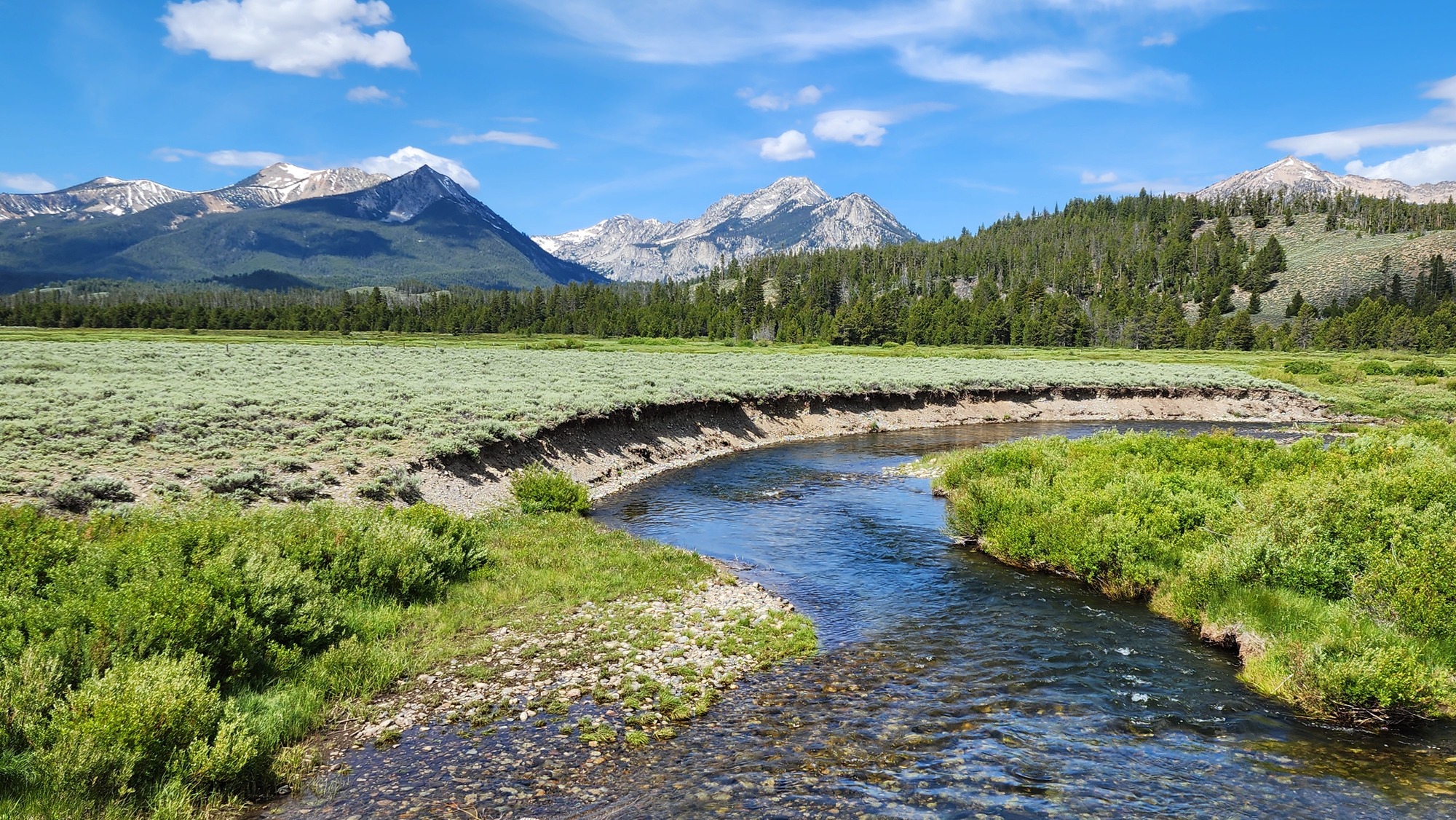
I planned a short detour to Little Redfish Lake for better views of the Sawtooth mountains. It's a flat easy 1.7 mile round trip detour. Well worth the effort for the excellent views.

I know about the view at Little Redfish Lake because I camped at the well-named Mountain View USFS campground in 2008. It was probably the coldest place I ever camped. Below freezing before dark.


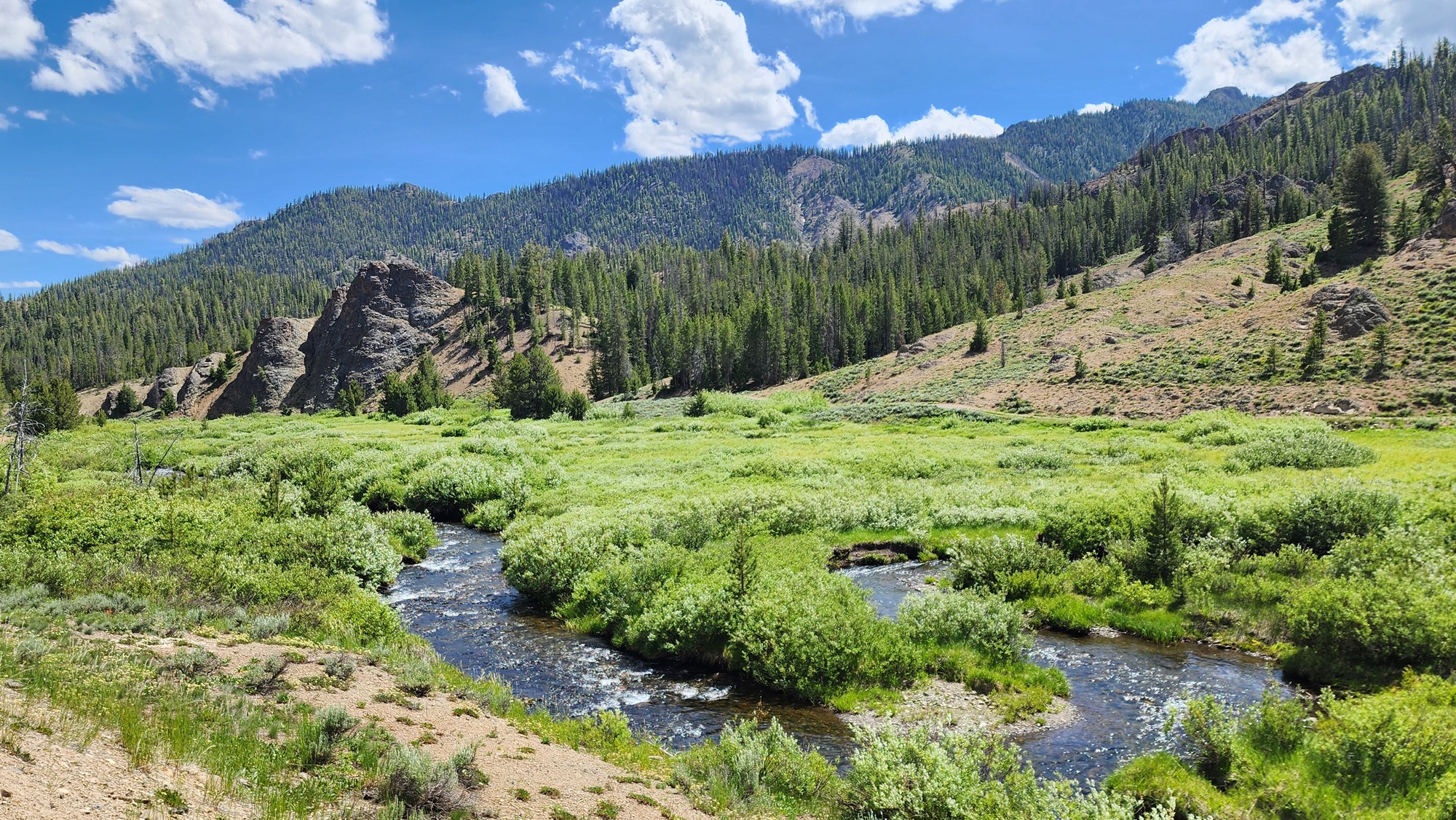
Most of the morning ride was close to the Salmon river. I saw many people fly fishing. The flow is much smaller now than when I joined the Salmon river 6 days ago, and getting steadily smaller as I pedal upstream.

All morning I had good views of the Sawtooth mountains to my right. The view reminds me of seeing the Beaverhead mountains from the Big Hole valley in Montana, but this valley doesn't have mosquitoes.

I also had good views of the mountains to the south that I will cross today. But the morning ride was a gentle uphill grade.

I passed the ruins of a small resort and ruins of a couple pioneer cabins. This high valley attracted mostly miners, not many farmers.

| Heart | 3 | Comment | 0 | Link |
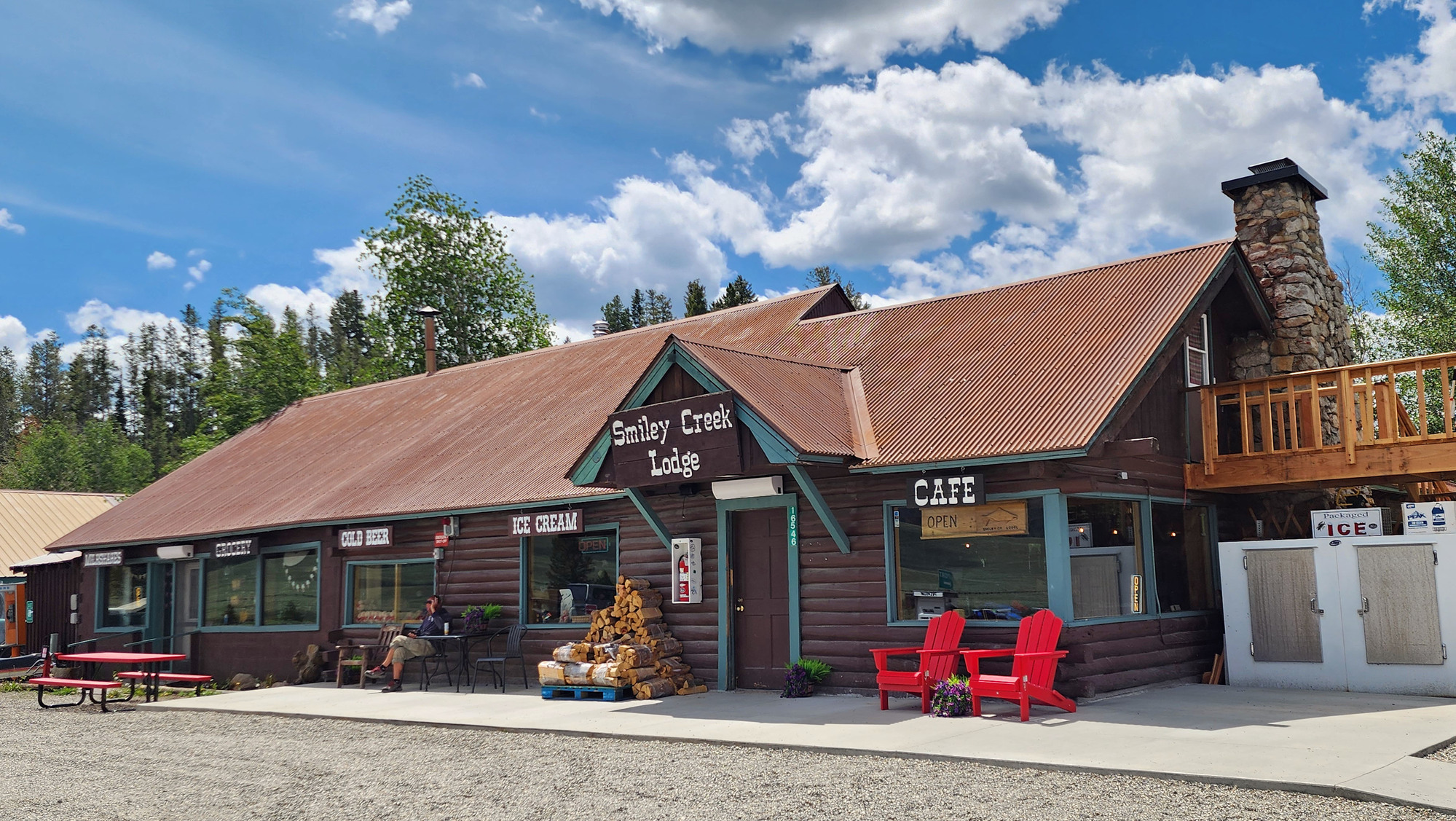
I took a lunch stop at Smiley Creek lodge and enjoyed their unique version of fish tacos. I was very happy to have the lunch stop, the only services on today's long route. I need a substantial lunch on days like this. Smiley Creek lodge has cabins, so it might have been possible to split this long day into two easier days.
| Heart | 2 | Comment | 0 | Link |
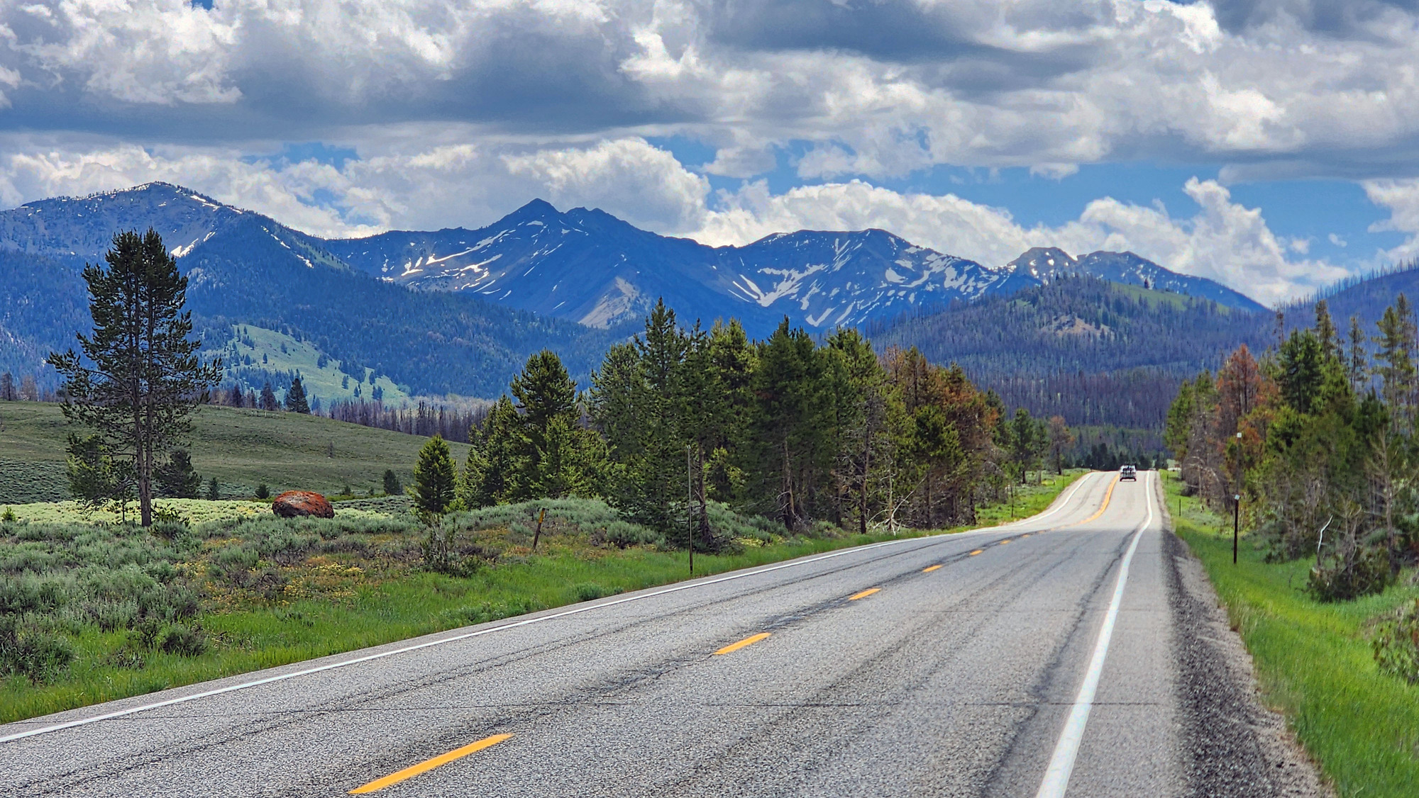
The grade gets steeper after Smiley Creek lodge. The highway makes a giant switchback to the east to start the big mountain climb. The weather was the familiar pattern. Sunny early in the morning, but cloudy by early afternoon. Today the clouds don't look like they will rain.
| Heart | 3 | Comment | 0 | Link |
The climb has very good views of the valley below and the Sawtooth mountains to the northwest. The road has no shoulder and traffic was light and slow moving.

I had a decent sun angle but the sunshine was dappled because of the clouds. The main mountain climb to Galena summit is 4 to 5% grade. Not too punishing, but very long. Temperature was about 70F. I never got hot. Traffic was relatively light but there were occasional RV convoys.

| Heart | 4 | Comment | 0 | Link |

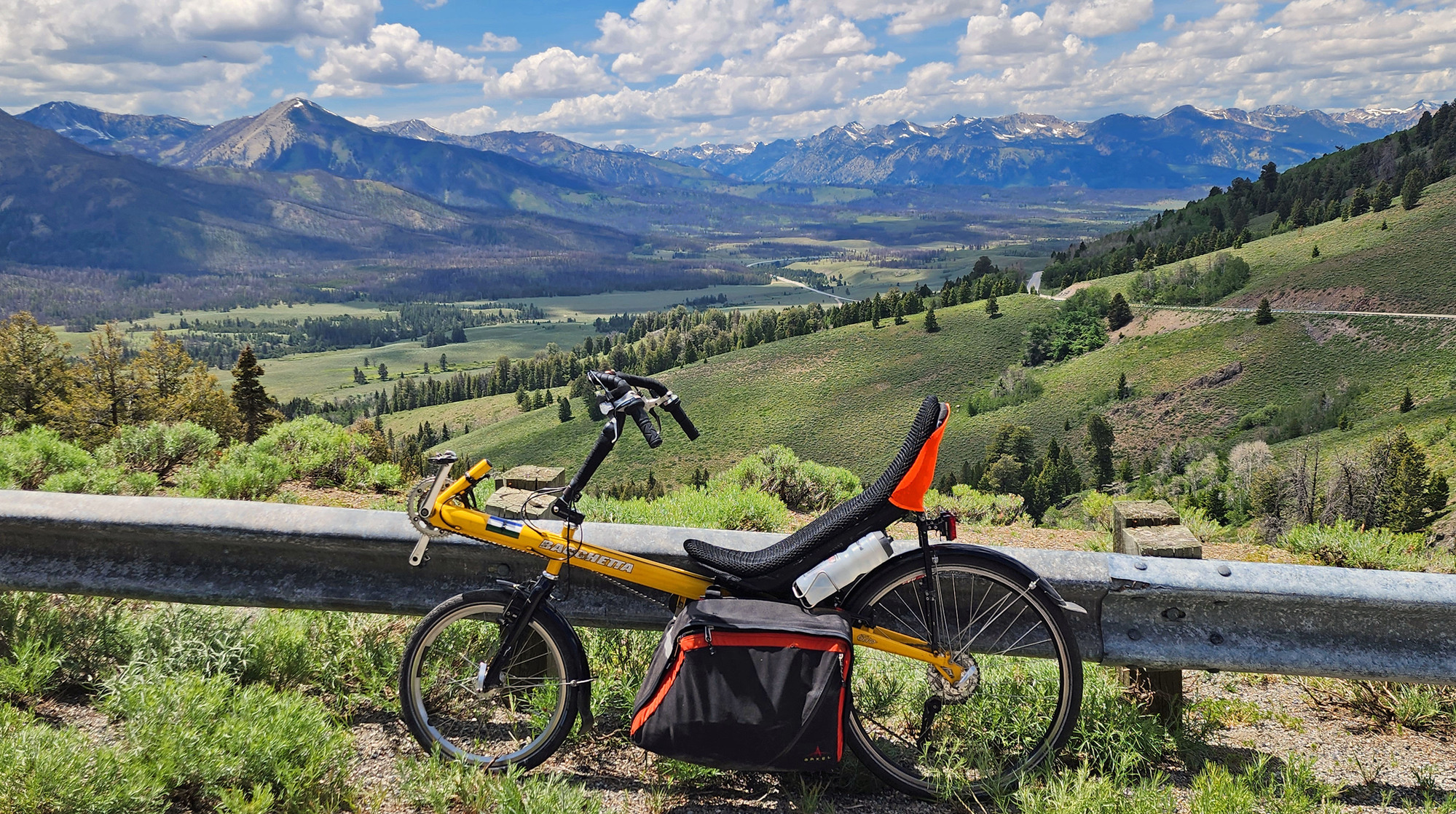
I stopped at the signed overlook. It's the last good view before the highway turns into a notch that has limited views.
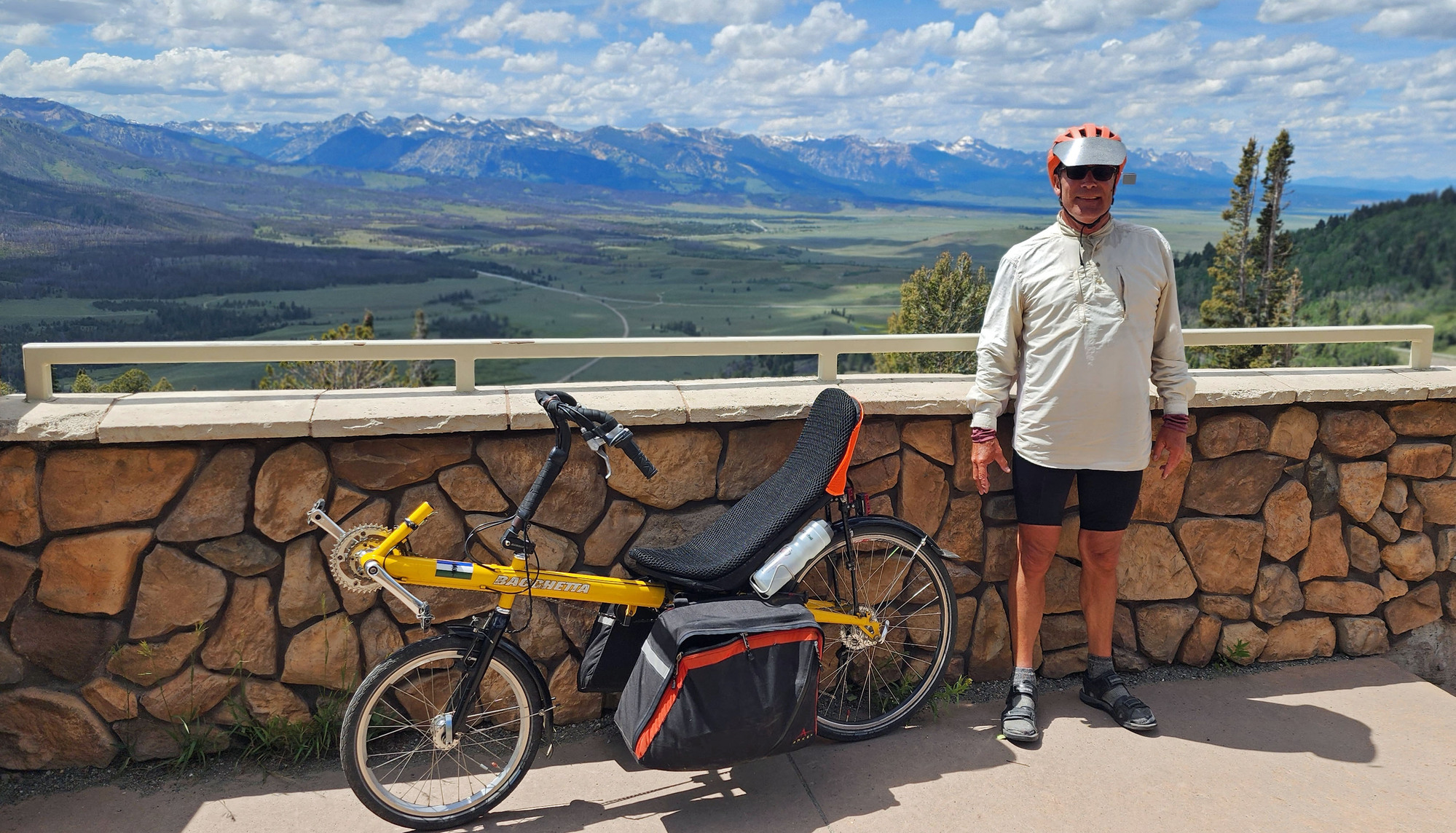
| Heart | 5 | Comment | 0 | Link |
After the overlook the highway climbs another 150 feet in a confined notch to 8701 foot Galena summit, highest elevation of the tour. I looked forward to taking a photo of the summit sign but I couldn't find a sign. I looked carefully and know where to look. I have no idea why there was no sign. Maybe removed because it got covered with stickers?

| Heart | 0 | Comment | 1 | Link |
1 week ago
Galena Summit has no good view to the north, but it has a pretty good view looking south towards Ketchum.
The name Galena summit seems odd to me. Galena is another name for lead. Mines in this area searched for more valuable minerals such as gold. Lead and silver were mined much farther north in Wallace, Idaho which I visited during my Idaho Trails bike tour in 2019.

I reached the summit at 3:05 PM. Today's route is 34 miles uphill from Stanley to Galena summit, a 2400 foot climb. Then 31 miles downhill to Ketchum, a 2900 foot descent. Fortunately the headwind wasn't strong enough to be a major factor.


The descent was fun. I was surprised to see that the south side of the summit is more forested than the north side. Usually the north-facing slopes have more trees.

The descent is less steep after I connect with the Big Wood river. Despite the name it's actually a small river, especially here near its headwaters.
| Heart | 1 | Comment | 0 | Link |
I arrived at Russian John warm spring at 4 PM and stopped for a 45 minute soak. A group of people were just getting ready to leave when I arrived. The pool was 94F when I arrived, just as most of the pool was getting in shade. This pool also needs some solar energy to be a good soak.

The warm spring is in a nice environment except that ID 75 is 200 feet away. Visible below and very audible.

After the soak I continued following the Big Wood river downstream to Ketchum. Temperature warmed up to the upper 70s.


ID 75 is very close to the Big Wood river as it approaches Ketchum in a narrow canyon. I'm still amazed that the Ketchum side has more trees than the higher Stanley side.

I got on a bike trail for the last mile or two to downtown Ketchum. The wealthy town has an extensive network of recreational paths.

Getting through Ketchum was a pain because ID 75, Main Street, is closed for reconstruction in the downtown area. So traffic was diverted onto a confusing maze of city streets. Ketchum isn't extremely charming or historic but it is extremely wealthy. Million dollar condos and multi-million dollar houses. It's the only ultra-wealthy town in Idaho.
Ketchum is the main town for the nearby Sun Valley ski resort which was founded in 1936, the nation's oldest destination ski resort. It was founded by Union Pacific railroad and was very remote and inaccessible in the early years. It became a "secret" destination for movie stars and the ultra-wealthy. It's still sort of a secret destination for people who travel in private jets.

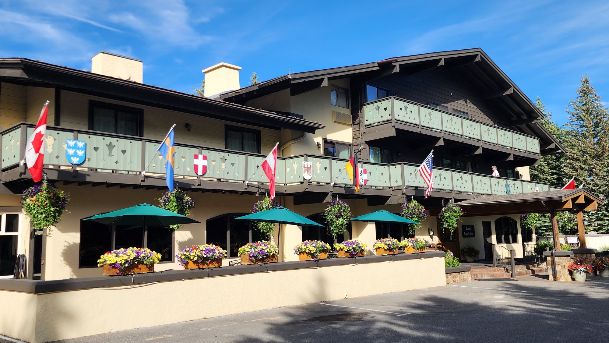
Tonight's home is the Best Western Tyrolean Lodge, one of the oldest lodges in Ketchum, built in the 1940s and 50s. That makes it the cheapest lodge in Ketchum. $289 for one night, non-refundable price. For comparison, the Super 8 motel in Jackson Hole, Wyoming cost even more 2 years ago.
The lodge was built long before the Americans With Disabilities Act became law. It has no elevator and narrow hallways with frequent right angle turns. Getting my bike to the room involved 25 stairs and several tight narrow turns. My room has A/C and a fridge, but no microwave. I'm looking forward to the fancy hotel breakfast tomorrow morning.
| Heart | 1 | Comment | 0 | Link |
I walked to an excellent Thai restaurant for dinner. Getting to the restaurant was a pain because of the road reconstruction. I walked around downtown a bit afterwards. Two blocks of Main Street were barricaded. Ketchum is growing rapidly. It's obvious that the city recently relaxed a 3-story height limit because several 5-story condo developments are under construction.

Today was a very long day. Departed Stanley at 8:01 AM, arrived in Ketchum at 6:10 PM. It didn't feel like a death march because the day included a lunch stop and a 45 minute warm spring soak. Stunning scenery always makes the day seem easier. Today is the last of three super-difficult days. The remainder of the tour will be easy in comparison.
Temperature was in the upper 70s in Ketchum which is about normal. Much warmer than a few days ago. From here I will travel south to lower elevations just as the first heat wave of the season arrives.
Distance: 64.9 miles
Average Speed: 9.1 mph
Ascent/Descent: +2578/-2959 feet
Today's ride: 65 miles (105 km)
Total: 544 miles (875 km)
| Rate this entry's writing | Heart | 5 |
| Comment on this entry | Comment | 0 |