June 21, 2025
Day 10: Gibbonsville to Salmon, join the Salmon river
Apparently I slept very well in the rustic cabin. I woke up at 9 AM. Made oatmeal in my room and finally got on the road at 10:35. No worries because today is short and easy. I was also waiting for the temperature to warm up. Only 52F and overcast when I started.
I pedaled a few more miles through the Gibbonsville community. It's a large area of private land surrounded by National Forest. It was founded near a gold mine in the 1880's. Apparently the owners never got a permit to build a gold mine, so it closed periodically, then closed for good in 1899. Now it's mostly hobby farms.

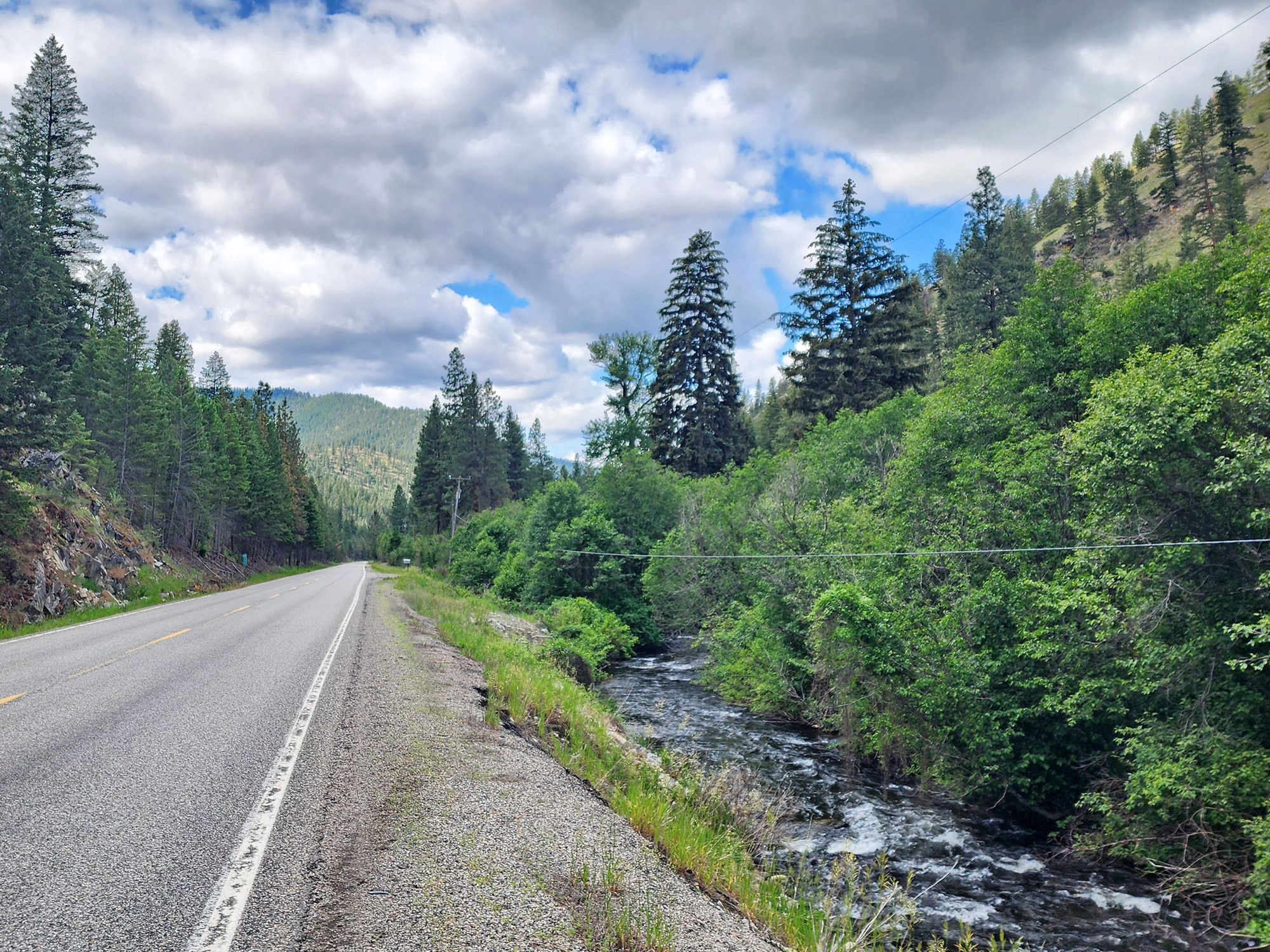
The miles were fast and easy going downstream along the North Fork Salmon river, descending 900 feet between Gibbonsville and the confluence with the Salmon river.
| Heart | 0 | Comment | 0 | Link |
Forest fades away as I descend. I will be in a more arid environment for the next 3 days.

As the forest fades away I have better views of various volcanic features. US 93 goes next to a big cinder cone and many steep volcanic cliffs.
| Heart | 0 | Comment | 0 | Link |

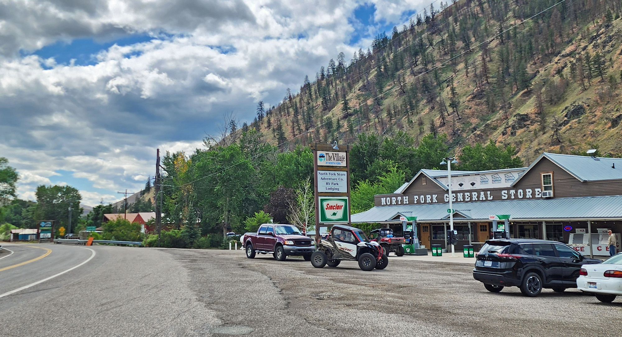
I stopped for a breakfast burrito at the store in North Fork, where the North Fork flows into the Salmon river. The only services on today's route. While waiting for my burrito a bus load of raft trip customers came in and bought an enormous quantity of beverages and snacks. Obviously going on a multi-day float.
| Heart | 1 | Comment | 0 | Link |
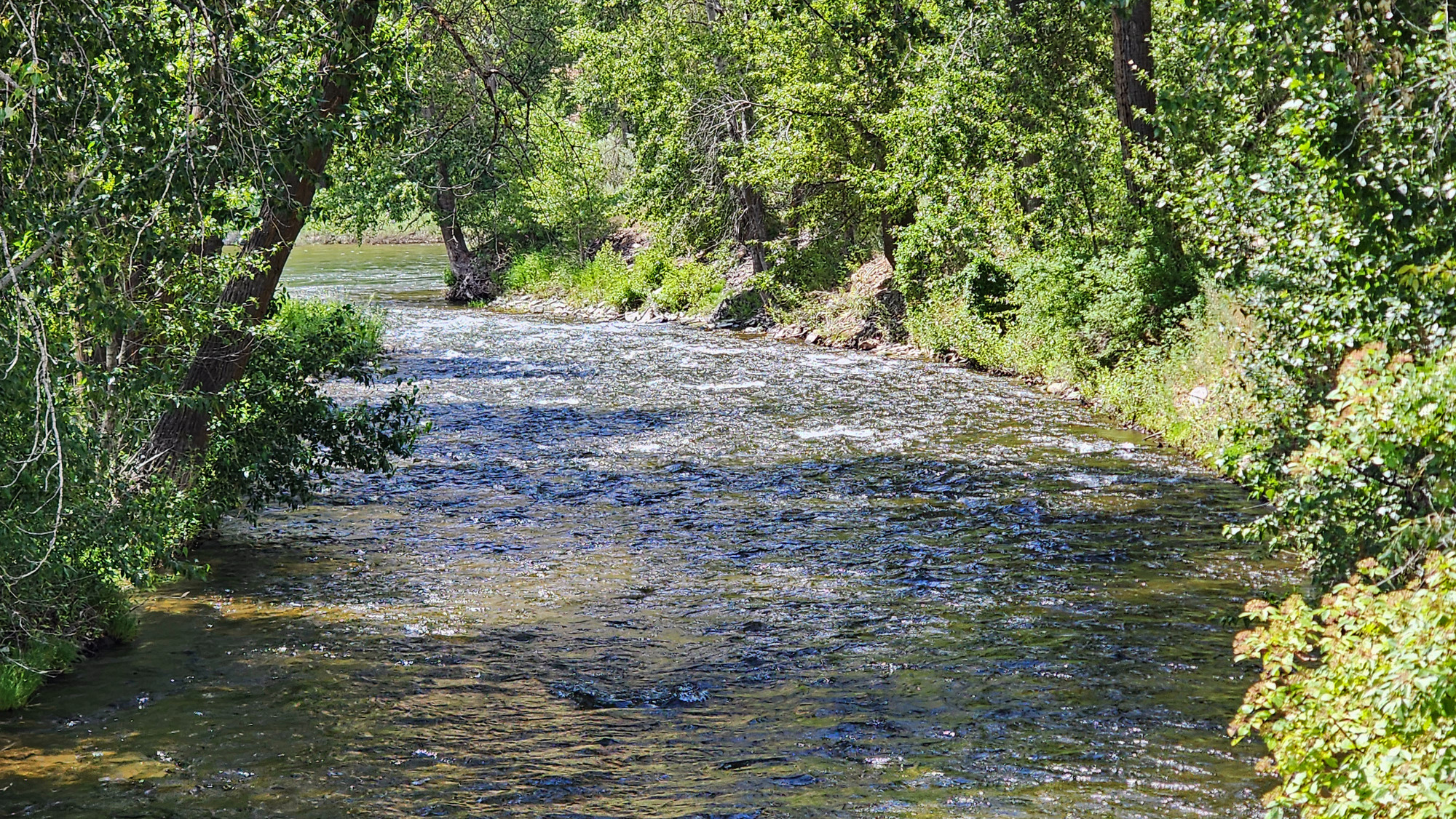
I stopped to take a picture where US 93 crosses the North Fork Salmon river for the last time. Just ahead I could see it flow into the much larger Salmon river.
| Heart | 1 | Comment | 0 | Link |
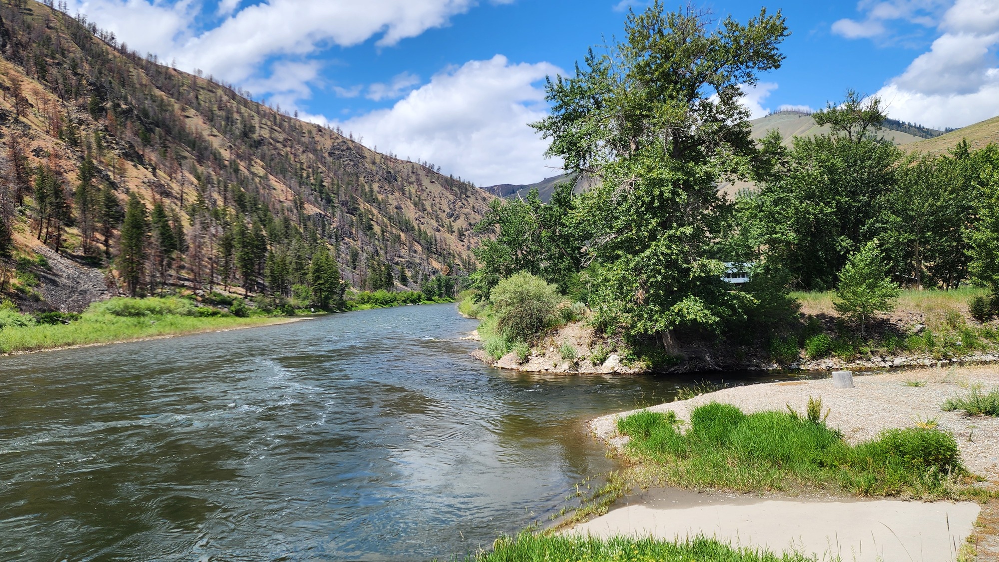
I walked away from the highway a couple hundred feet to see the actual confluence of the North Fork and the Salmon river. I had to stop a few minutes to contemplate that downstream from here the river flows 200 miles through deep roadless canyons that slice through the Clearwater mountains. I've never seen the Salmon river at the other end of the canyons. Someday...
| Heart | 1 | Comment | 0 | Link |
After a very long 3400 foot descent from Chief Joseph pass, now I go up once again. I will follow the Salmon river upstream 160 miles to its headwaters.

I stopped to look at the Wagonhammer picnic area and trailhead. It has picnic tables with a nearby spring for drinking water. Nice.

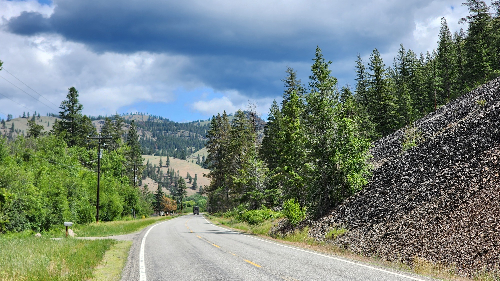
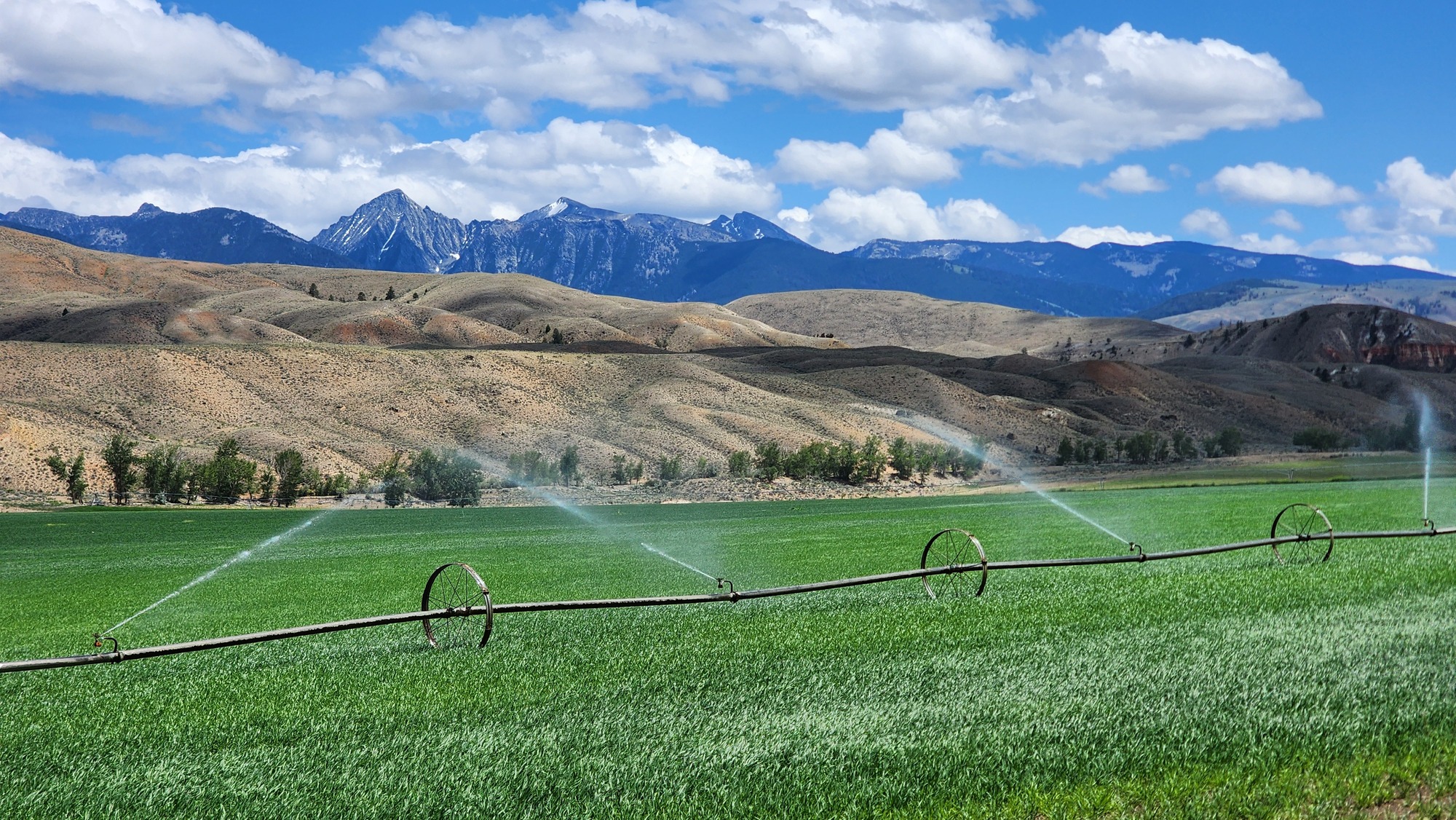
I appreciated how the route along the Salmon river alternates between wide valleys big enough to have irrigated pastures, and narrow canyons with steep cliffs.
| Heart | 1 | Comment | 0 | Link |

Irrigated areas are green. A narrow riparian corridor along the river is green. But the surrounding hills are almost completely barren. I like the contrast. And I like the otherworldly volcanic formations. The Salmon river might be the best of many high desert rivers.

The morning was kind of cloudy but the afternoon was relatively sunny. I haven't seen much blue sky lately. Today had a high temperature of 65F early in the afternoon when it was sunny. Then it became cloudy and the temperature dropped.

Today is Saturday. Recreational traffic was relatively heavy and US 93 has no shoulder. It was a bit of a surprise because my previous memory of biking the Salmon river was in September 2008. September has less recreational traffic than June. I wouldn't consider the traffic unsafe, but it was more serene in September.

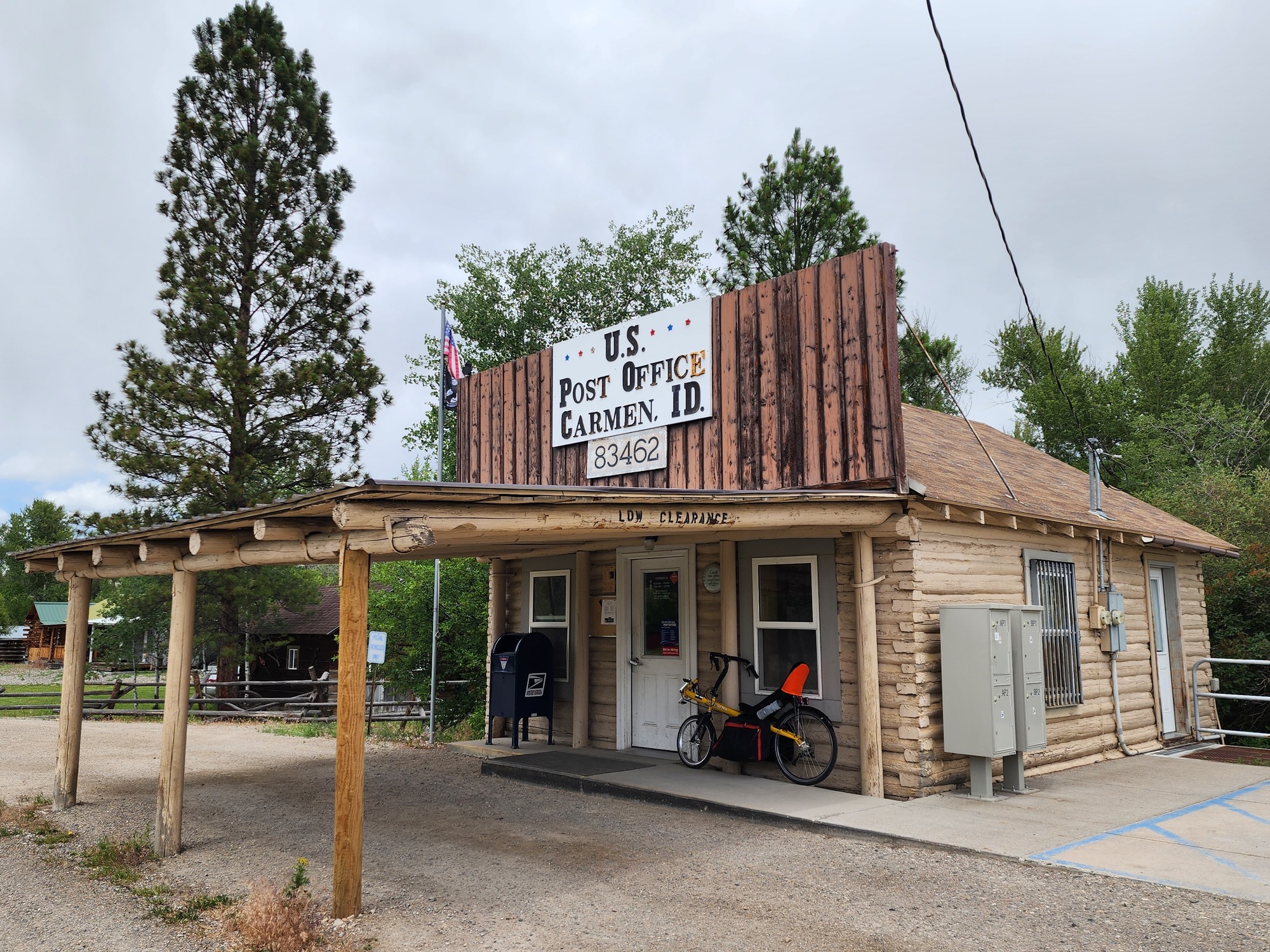
Around 3 PM I pedaled a few minutes in light rain. The rain was almost finished before I found a place to take shelter at the Carmen post office. I don't see many log cabin post offices.
| Heart | 2 | Comment | 0 | Link |
The final few miles to Salmon are quite scenic, in the Lemhi valley with farm views and unobstructed views of the Beaverhead Mountains to the east. The mountains are the Continental Divide and the border between Idaho and Montana.

I didn't know that Salmon is the birthplace of Sacajawea. I knew that she was trafficked from a faraway tribe as a young child. The Internet informed me that Sacajawea was the daughter of a Lemhi Shoshone chief, and was captured at age 12 by the enemy Hidatsa tribe from North Dakota.

Salmon has a population of 3295. Biggest town since Anaconda four days ago. Salmon is a regional center, the county seat of a remote farm valley. Salmon is a tourist town. People come here for rafting, ATV riding, fishing, and hunting depending on the season. Looking at the tourists, I'd say most of them come from the Mormon Belt. Idaho Falls, Pocatello, and the Salt Lake City region. They are very clean cut and conservatively dressed. I won't hear loud drunken parties tonight.

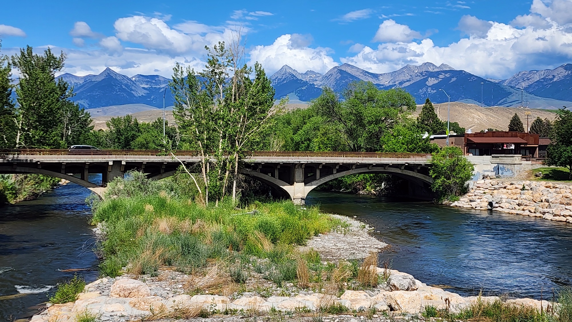
I arrived in Salmon at 3:45. It wasn't raining yet, so I continued past the motel to see the Salmon river while there was still occasional beams of sun.

| Heart | 0 | Comment | 0 | Link |
Downtown Salmon looks nice. Mostly built in the 1890-1920 time frame. It seems prosperous. Few vacant storefronts. Many tourists driving and walking around. It's "town" for a large regional population of farmers and country folks.

I wouldn't consider Salmon to be bike friendly. Drivers are courteous and traffic isn't heavy. But there are no bike lanes and no bike racks. Every sidewalk is conspicuously stenciled No Bicycles.


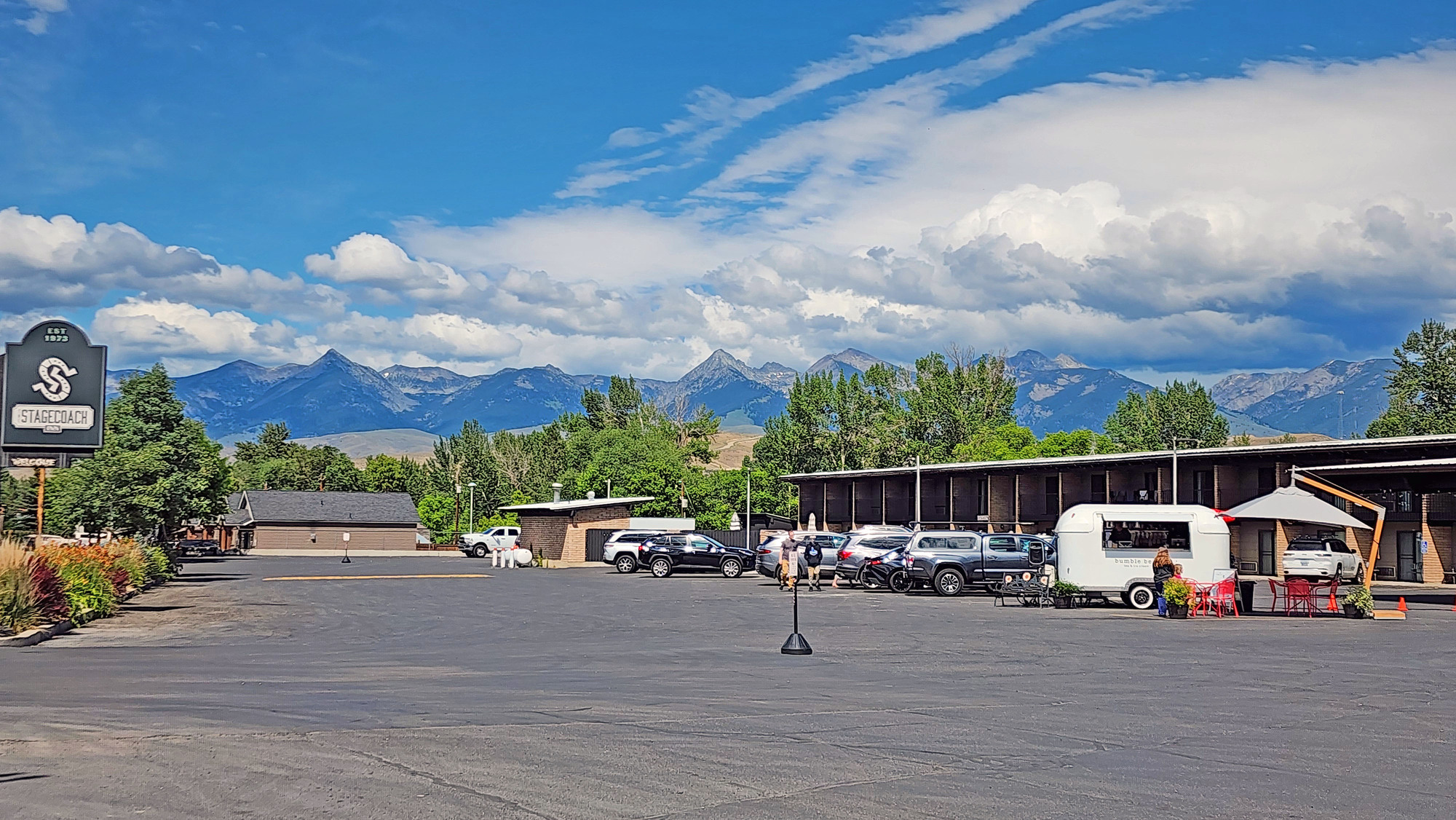
After looking around downtown I backtracked across the river to check into Stagecoach Inn. It's quite large, with 2 levels overlooking the Salmon river. It's Saturday night and the hotel was fully booked. Today most visitors seem to be here for 1-3 day guided raft trips. At check-in they gave me a coupon for free ice cream at the coffee/ice cream trailer visible in the photo.
| Heart | 0 | Comment | 0 | Link |
| Heart | 1 | Comment | 0 | Link |
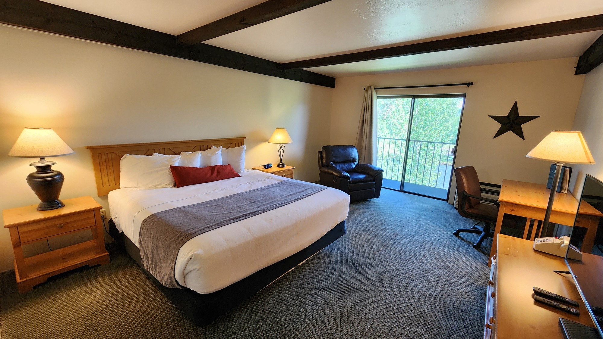
I enjoyed both seeing and hearing the Salmon river from my room. I paid extra to be on the river side. I was surprised that my balcony had no chair. People were sitting at the tables in weak sun at 4 PM. But the tables were empty in the evening when the temperature dropped and it rained intermittently. A cold front has passed through. Temperature is below normal. High of 65F, much cooler in the evening.
In the evening I pedaled to the supermarket on the far side of town to stock up on groceries. I need to haul food for a 2-night stay in Elk Bend with no services. The supermarket is closed tomorrow, Sunday.

In the evening I walked 1/3 mile back to downtown to have dinner at the busy Junkyard Bistro. I sat at the bar.
Today was probably the easiest travel day of the tour. Short distance, minimal ascent, more down than up. Cool weather and mild headwind were not a problem.
Distance: 36.5 miles
Average Speed: 10.2 mph
Ascent/Descent: +503/-1008 feet
Today's ride: 36 miles (58 km)
Total: 339 miles (546 km)
| Rate this entry's writing | Heart | 5 |
| Comment on this entry | Comment | 0 |