June 14, 2022
A Big Hill and a Lot of Water
Silverton to Sublimity via Silver Falls State Park

Today we have the most elevation gain of any day this trip - 2851 ft in just over 30 miles. A short but intense day, broken up by two stops at the North and South Silver Falls. We were looking forward to seeing the falls, which promised to be spectacular after an extremely wet spring.
First though, we needed to fuel for the climb, which started about 2 miles out of town. Fortunately the Main Street Bistro was a couple blocks from our motel, serving an excellent full breakfast.
The weather was cool and cloudy and it did rain overnight. We expected some shower activity but tapering off as the day progressed. As it turned out, it did not rain on us the entire day.
Our start time was 10:00 am. The first 2 miles was an easy roll through town; then the road turned upward. The first “pitch” of roughly 4 miles was a pretty steady 5 to 7% with occasional steeper sections. Then there was a mile or so of flat and rolling terrain, followed by another 3 miles of 3 to 5% grades. We spread out on the climb according to each person’s climbing speed, with stops for photos and rest.
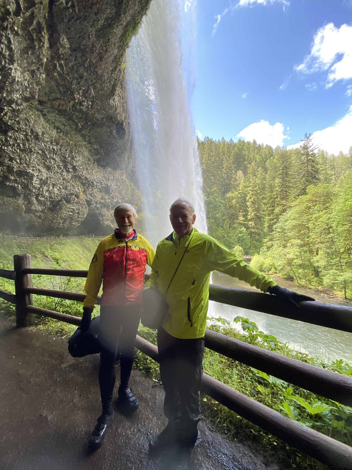
Just beyond the top of the main climb was the entrance to Silver Falls State Park and the trailhead to the North Falls. We regathered there and walked down a muddy trail to view the falls. First we went up a fork to the Upper North Falls, then we walked to see the Lower North falls. There was an additional roughly 2 mile trail to go behind the lower falls but we opted not to do that in our bike shoes since the trail was both muddy and quite slippery. In fact, on the way back to the bikes, I tripped, slipped and fell, landing on my left knee and hand.
The 3 miles to the South Silver Falls trailhead was mostly downhill. Once there, Jim and I got separated from Amber and Rich. The South Falls area is much more developed than the North side and it included a cafe and shop, a theater, and many trails winding around like a maze. It took us awhile to find each other.
As we walked around I realized that when I fell, I aggravated an injury to my left hip, which made walking on it painful. So when the group started out to walk down to view and go behind the lower South Silver falls, I sadly opted to stay behind and instead went to the cafe for coffee and a cookie.
Amber, Rich and Jim hiked down and behind the falls. Jim said it was very wet, similar to the mist trail to Vernal Falls in Yosemite.
Once we reunited, Jim and I continued up the remaining 1 1/2 miles to the very top. The grade on this portion was 5-6%. My Wahoo had recorded 2325 feet of climbing at the summit. Then we had about 4 miles of wonderful, swoopy downhill through forested areas and very large Christmas tree farms.
The remaining 7 miles consisted of rolling terrain-big enough rollers that we climbed an additional 800 feet on the way down the hill. At one point we were stopped by a flag man and then escorted through a repaving project by a pilot car. Since it was just us, the worker asked us if we would be riding fast. I looked him and commented, “Not with all this stuff on the bikes. And we’re old to boot.” Then we both laughed.
We are staying tonight at the Bridgeway Inn and Suites. It was the only motel in both Sublimity and Stayton. The only other accommodations that we could find was a tiny B&B that had only 1 room with 1 bed. The Inn is pretty dated but reasonably clean. Dinner was decent Mexican about a mile down the road.
Tomorrow is the longest day of the trip-56 miles and 6 bridges and minimal climbing. We are going to try for a earlier start since we will be making many stops along the way.


Today's ride: 32 miles (51 km)
Total: 122 miles (196 km)
| Rate this entry's writing | Heart | 7 |
| Comment on this entry | Comment | 4 |
3 years ago
3 years ago
3 years ago