October 13, 2020
Jonestown to Paxinos
Riding the Ridges
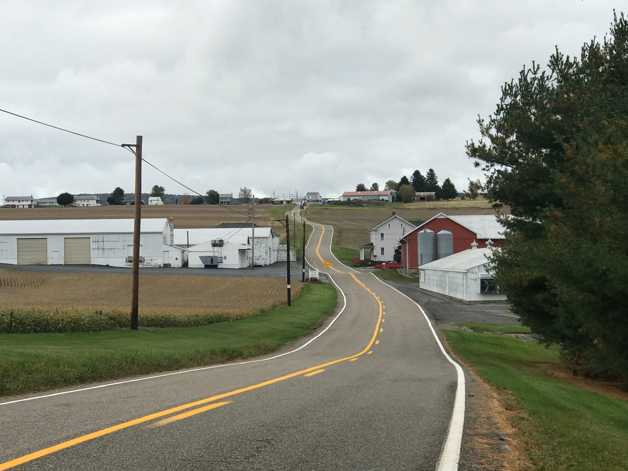
This would be a tough day and I knew that going in. The other route choices would have involved riding on narrow, high speed, and heavily trafficked roads along the Susquehanna River. I opted out of all that but would stop short of recommending that others follow my path. This route involved 46 miles, 5800 feet of climbing over 5 ridges and too many smaller hills to have kept an accurate scorecard. Fortunately, Strava did it for me. Let's simply say that Northern Lebanon, Schuylkill, and Northumberland Counties can be very challenging places to ride. But for me, toiling in peace is preferable to being constantly buzzed by motorists doing 60-70 miles per hour on narrow roads not designed for such speeds.
I got off to another late start because my bike needed a good cleaning and lubing after the ride yesterday. My frame and drivetrain were covered with leaves, grass, grit, road grime, and dirty grease. I spent some time wiping everything down and then applying lubrication. One of my pedals was clicking so I was sure to apply some lube to it, which did get rid of the noise. Also needed was some additional air for the tire that had gone flat late in the previous day. It was all worth it because the Buzz operated flawlessly on the day ahead where wet weather conditions, similar to those experienced on Monday, were repeated on this Tuesday.
Initially, the day was flat, for about the first 10 miles. The rain, mist, drizzle, and gloom continued intermittently until late in the afternoon. At the lower elevation, where I started out, the sky was brightening and the sun appeared to be forcing its way out.
The map seemed to show that the Swatara Creek Trail (SCT) could be accessed from a private park and campground across the road from the hotel. But if you are not patronizing the place, they direct you down the road to another trailhead. So, off I went and found the trail without too much trouble. The SCT looked a lot like the other soggy trailheads I encountered yesterday. I decided to make the best of it because I knew what else lay ahead for me on this day.

| Heart | 0 | Comment | 0 | Link |
The trail was a little rough, being composed of small rocks for the first couple of miles, but then it changed over to a smoother surface composition. Eventually, it became an abandoned blacktop road, which was really nice! Along the way, were the intersection with the Appalachian Trail and a half dozen stocked male Ringneck Pheasants and their female companions. One of them let me get close enough to get a decent photo.

| Heart | 0 | Comment | 0 | Link |
I heard an animal noise that sounded a lot like a male human imitating an animal. Yes, this is hunting season and there are more hunters in the woods this year due to Covid-19, being laid off, and looking for something to do that hopefully doesn't involve shooting a bicyclist. I got the message, moving on quickly and conspicuously. If you ride in Penn's Woods at this time of year, wear blaze orange!

| Heart | 0 | Comment | 0 | Link |
All good things (and flat pathways) must come to an end as this one did. A connecting road led me out to SR-443, aka Suedeberg Road, near Pine Grove. I followed it West to Gold Mine Road, where the "fun" began. At first, there was a little bit of climbing that was frequently offset by some wonderful vistas of the surrounding hills, covered by deciduous trees whose leaves were changing.

| Heart | 0 | Comment | 0 | Link |
But as the road continued into those forested hills, the climbing became very steep, the rain started again, the temperature cooled down, and the gloom enveloped me. After a very steep section, I stopped at the entrance to some state game lands to take a short break. The road ahead seemed to be a wall of asphalt leading further on upward. Eventually, I started out again, crested the summit, stopped, put on my (wonderfully clean) rain jacket and started downhill. I repeated this pattern throughout the day. When climbing, a lot of heat and sweat was generated but the fast descents into the cooler air and rain required some protection from the elements.
This first ridge was actually a double ridge. After screaming downhill for what seemed too short a distance, the climbing began again. This time, it was a long stretch of uphill roadway, gradual at first but then steep in some sections. The 2nd summit was eventually reached and was thankfully followed by a long steep downhill ride into the outskirts of Tower City, in Schuylkill County. The wet leaves on the road made for a potetntial sliding hazard so I was careful when descending.

| Heart | 0 | Comment | 0 | Link |
Several small mining towns seemed to be strung out in this little valley between two Pennsylvania ridges. None of them seemed to have much going on as I passed through. At Muir, I took a small break in a church picnic pavilion before moving on to a 3-4 mile stretch of US-209.
US-209 had a narrow shoulder and intermittent traffic, including a fair number of Semis. All gave me plenty of room and were courteous. In reality, during the entire tour, I only had one rude motorist, the "horn-blarer" of late yesterday afternoon. Maybe people in this state are finally becoming accepting of cyclists on the roadways.
From US-209 I picked-up SR-125, which must be one of the hilliest roads in Pennsylvania. US-209 itself was a long gradual uphill ride but once I got onto SR-125, the hills became repetitive and very steep.

Eventually, I made it to the small community of Hegins and headed off route to look for some warm food. There were small yard signs all over town advertising for pizza but when I got to the address, the building was empty. In fact, there were several places that appeared to have been former restaurants but all were closed. This seems to be the way of these small coal region towns. People are still living there but the mom and pop restaurants and markets that used to be there, no longer exist. I was told there was a gas station/convenience store but after a relatively long side trip to find it, I saw nothing and returned to the intersection of Main Street and SR-125. A sign said, Shamokin, 16 miles. I was headed that way and knew there were services available. No doubt, there would be a few hills to climb along the way, so I got started.

| Heart | 0 | Comment | 0 | Link |
The valley between Hegins and the next ridge had its share of ups and downs, which seemed like mostly up to me. There were some tough little hills in that valley but also some beautiful hillside farms. Some views of the winding road ahead were the appealing stuff of cycling magazines.
| Heart | 0 | Comment | 0 | Link |
Once over the 4th ridge, SR-125 became so quiet that except for a very infrequent pick-up truck, I seemed to be all by myself. There weren't even very many homes around. The pattern of terrain in this valley was similar in character to the previous one, i.e., many rolling and steep bumps in the road. Again, there were some very appealing and winding roads ahead.

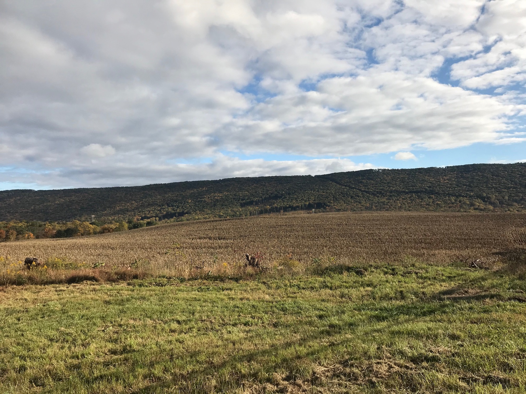
The 5th and final ridge of the day began with a beautiful hillside farm near the small village of Pittman. It wasn't any easier than any of the previous four that I had already come over. These "little" Pennsylvania ridges are not to be underestimated. I had already expended quite a bit of energy and was operating at a caloric deficit but this climb had to be completed. The loaded panniers on my bike certainly added to the workload and I did take a couple of breaks during the last climb.
| Heart | 0 | Comment | 0 | Link |
A cold front had moved in, the clouds had dissipated, the sky was blue and the sun was now shining. It had turned into a beautiful Fall day. Persistence and determination got me to the top and then the last long downhill run of the day began. I was rewarded with some beautiful fall foliage but had to take care once again because the road was still wet and covered with fallen leaves in some places.
I stopped in the middle of a fast downhill ride to capture an especially nice scene (below). Once again, while readying the camera, I heard a human making an animal sound. Hunters were apparently in the adjacent woods. Although they're not supposed to shoot toward a road, Buck Fever has gotten the best of more than one rifleman in the past.

| Heart | 0 | Comment | 2 | Link |
2 months ago
Schuylkill County lay behind me. I was now in Coal Township, Northumberland County, less than 10 miles from my destination, in Paxinos. The route had flattened out so I was able to roll quickly through Shamokin where I left SR-125 for SR-61. The highway was busy because I had arrived to another larger population center during the afternoon rush! My timing on this trip has been impeccable!
The shoulder on 61 was very wide and it had rumble strips at its interface with the traffic lane. The road was flat and surrounded by wooded hills with changing leaves. I rolled along pretty well and reached my destination at sunset. Two colleague-friends were waiting for me with pizza and beer at the ready. They are good guys! It was another great day on the road.


Today's ride: 46 miles (74 km)
Total: 196 miles (315 km)
| Rate this entry's writing | Heart | 1 |
| Comment on this entry | Comment | 0 |