October 10, 2020
Harrisburg to York, PA
Familiar Territory
Amtrak's cross state line, known as The Pennsylvanian, left Pittsburgh at 0730 hours on Saturday morning. Masks were required. The Buzz (my bicycle, sans mask) and I (with mask) were on it, thanks to roll on, roll off service.
The Horseshoe Curve, a place where the train turns nearly back upon itself, was a highlight of this rail excursion. "The Curve" is an engineering feat near Altoona, where the railroad was able to cross the Allegheny Mountains and thus the Keystone State in its entirety. No longer would it be necessary to arduously portage over the ridges, as had been required beforehand. I had been to the site on foot but this was the first time I had ever experienced it from the train.
Aside - The 6-to-10 Trail follows the same path and system of inclines that were used to transport freight, goods, and luggage up and over the Allegheny Front. Eventually the railroad was built, making that system obsolete, but the pathway and the Portage Railroad Center are still there. Nowadays, the railroad bypasses the old incline plane system. The Horseshoe Curve is part of the new transportation network that crosses the Allegheny Mountains.

The train reached the station in Harrisburg at around 1300 hours. These were familiar surroundings for me and so would be the ride for this day. I had been here before and had ridden the route in the past, as well. A relative lives in York, the planned destination for this day. I have been there many times as well. As I left the station, the streets seemed deserted.
After collecting myself and my scant belongings, the tour began. A brief ride from the station to the Market Street Bridge put me on the "J-Trail." There is an elevated sidewalk but since traffic was very light, I used the right hand lane on the bridge. On this particular afternoon, volume was light but there can be quite a few motor vehicles at other times during the day.

| Heart | 1 | Comment | 0 | Link |
The Walnut Street Bridge, located roughly a quarter mile to the North, is restricted to pedestrians and could be used instead. Both go to City Island, a park and the site of a baseball field that is home to the Harrisburg Senators (no games until April of '21), a double-A affiliate of the major league Washington Nationals baseball team.
Not much was happening on the island on this day but in more normal times, there could be a variety of activities in progress. After exploring the island and finding a portajohn, one would then need to pick up the 2nd half of the Market Street Bridge to reach the West Shore. If you opted for the Walnut Street Bridge, it would still be necessary to take the other half of the Market Street Bridge to reach the mainland.
On the West Shore, there is a light and a cyclist should try to stay as far to the right as is possible at the intersection. The right hand lane is a turn lane (to the right only) but if you're close, when the light changes you can dart toward the opposite shoulder as the road curves to the left under an overpass and then climbs a short hill. Near the top of the hill, the Borough of Lemoyne is entered. That is your cue to slide left safely in order to make a left turn at the stop light, onto South 3rd Street.

| Heart | 1 | Comment | 0 | Link |
A healthy dose of care is normally needed until South 3rd Street crosses I-83, enters New Cumberland, and becomes Bridge Street. On this day traffic was pretty light. It can be heavy in the area during "normal" times. During this part of the Pandemic the ride through the community and its business district was very pleasant. At the Southern end of town, a heavy duty green bridge crosses the Yellow Breeches Creek and enters York County. The road is now called Old York Road but we're still on the J-Trail and headed in the right direction. Once past the Capital City Airport, Old York Road starts to make a significant climb. I had trained a bit on my fully loaded bicycle but this would be a significant ascent with front and rear panniers containing gear.
Once atop the hill, Old York Road flattened out and I cruised along nicely until SR-262 merged in from the right. Route J would now follow the numbered state highway (SR-262 is actually a two lane secondary road) as it turned left and continued Southward. I had ridden this route once before, on a Saturday afternoon in June of 2010. Those ten-year old memories are of frequent motor vehicles rushing past me at high rates of speed. On this day, traffic was light but the few vehicles that did pass me were moving along pretty well. SR-262 meandered along through a landscape that was largely of a pleasant agricultural nature and some nice homes.

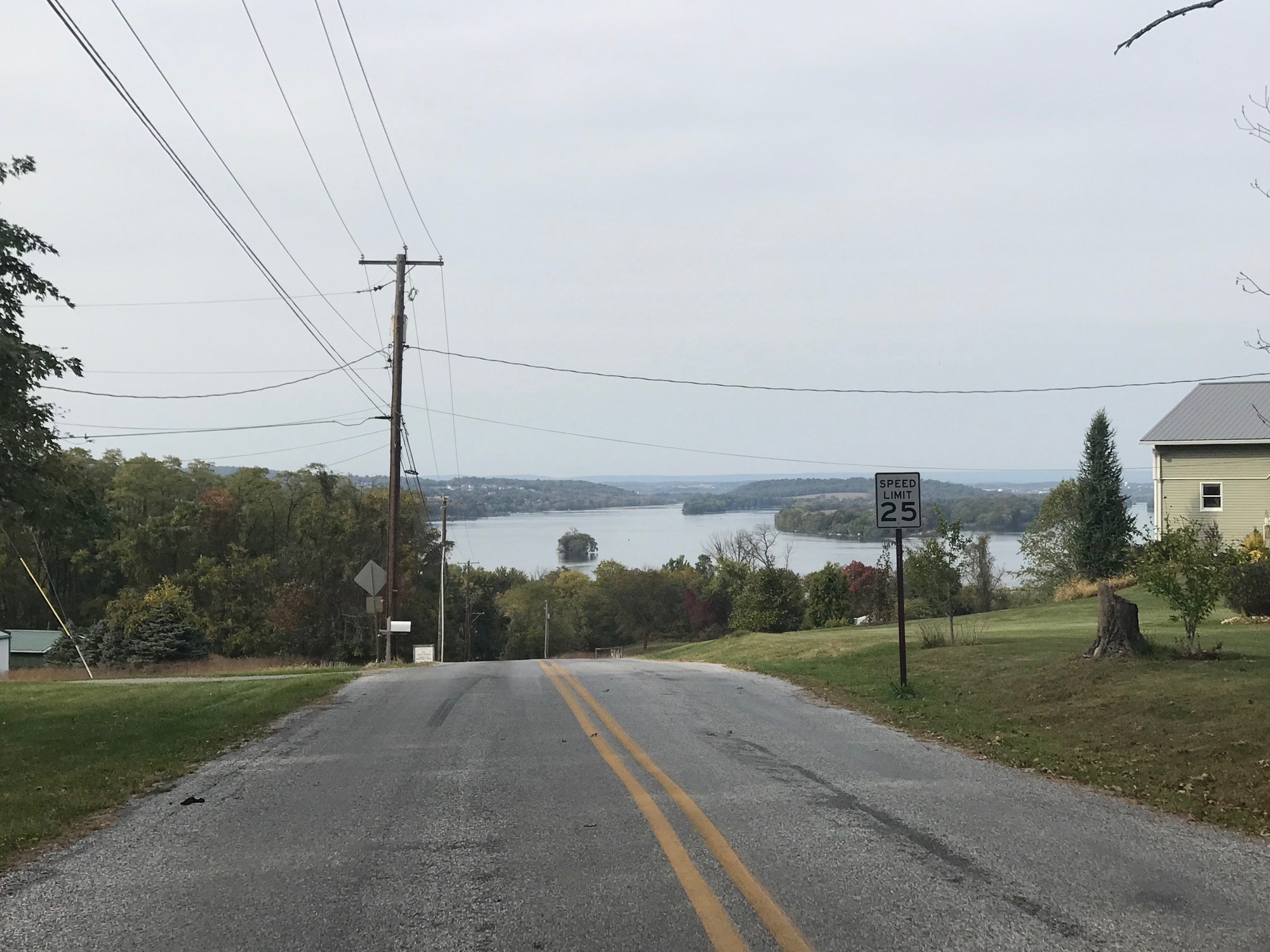
Eventually, SR-262 brought me into Goldsboro. From a small rise at the borough limits, I could see the Susquehanna River and the cooling towers from the infamous (nuclear accident in 1979) and now idle Three Mile Island nuclear power plant. The road comes to a traffic circle where the route peels off to the right and continues South as SR-262, aka York Street. Goldsboro is a relatively small community but the road through town is lined with houses and there is an Italian Restaurant on the left, if you happen to be hungry when passing through.

| Heart | 1 | Comment | 0 | Link |

| Heart | 1 | Comment | 0 | Link |
Continuing Southward, the route passes through the small, unincorporated, and rough looking community of Cly. I rode through there on July 4th (2020) and there was a house that I called Petunia Heaven, at the time. Pink Petunias were everywhere then. But today, they were nowhere to be found. The house, and the whole "town" for that matter appeared rather rundown.

| Heart | 1 | Comment | 0 | Link |
SR-262 continues to a left onto River Drive. This turn is a little tricky because 262 starts to climb a hill as it is curving to the right and there is a less than optimal (understatement) sight line for making the left turn. With care it is accomplished and the cyclist will be on a very peaceful road. Some mapping programs (RWGPS, for one) will indicate that Route J stays on SR-262 but the signage clearly calls for the turn onto River Drive. I recommend River Drive (if safe to make the left turn) because there is essentially zero traffic. As this quiet road reaches the top of a short climb, in Newberry Township, be sure to look behind for a nice view of the Susquehanna River.
| Heart | 1 | Comment | 0 | Link |
There comes a point where the road crosses an intersection with a private company roadway. It can be a little confusing as there are no J Signs, so go diagonally to the left and head downhill on a narrow wooded road, which will lead into the Borough of York Haven. In the borough, I turned left onto Landvale Street and passed mostly downhill, through a portion of the community. At the intersection with Front Street, the sign indicated the J Trail continues straight onto Wago Road.

| Heart | 1 | Comment | 0 | Link |
Wago Road is a largely industrial roadway servicing the Brunner Island Power Plant. It runs along a narrow strip of floodplain between Conewago Creek and the Susquehanna River. Back on July 4th, when I rode through there, the wetlands on the creekside seemed to have plenty of water. But on this October day, they were almost completely dry. Particularly the Duck Pond area was actually a pond in July but today there was not a drop of water to be found in it.

| Heart | 1 | Comment | 0 | Link |
It is clear the power plant complex rules this roadway. There are chain link fencing, railroad tracks, conveyors, imposing structures and piles of coal. On this late Saturday afternoon, the plant was fairly quiet but I can imagine that during the work week, there could be some large trucks, moving trains, other vehicles, and plenty of noise to keep company with any cyclists passing through.
After the power plant complex, the road drops into a wooded vale and eventually emerges at the small Borough of Mount Wolf. There, the signs call for a right turn onto Maple Street to continue on the J Trail and into the Borough of Manchester. At the intersection with SR-921 and SR-181 there is a Rutters Gas Station/Convenience Store on the left and a small parklet on the right. I stopped at the store and then took a short break at the park both times I passed through here, back on July 4th and today. I had the place to myself and was insulated somewhat from the busy intersection.

| Heart | 1 | Comment | 0 | Link |
From Manchester, it is approximately 7 miles on SR-181 to the Colonial Complex Park in Downtown York. The road is also called North George Street and Business I-83. It mostly has a good shoulder but does narrow in spots and can be heavily used. An especially busy intersection is the one with Arsenal Road (US-30). Use care when crossing there.
When I reached the Colonial Complex area, North George Street was blocked off for a pre-gathering of the York Marathon participants. The race was scheduled for Sunday, the 11th. This gathering was for race pack pick-up and appeared to be appropriately socially distanced. I had to detour around the area but still managed to pass by the Golden Plough Tavern and the statue of The Marquis de Lafayette out front.

| Heart | 1 | Comment | 0 | Link |
It is at this spot that my modified route deviated, for a short time, from the main line of the J Trail. I would head East for about 6 miles, to find lodging in East York and meet up with some relatives for dinner. Tomorrow's ride would call for a return to this spot and a Southerly jaunt on the York County Heritage Trail to the Maryland State Line.
Today's ride: 36 miles (58 km)
Total: 36 miles (58 km)
| Rate this entry's writing | Heart | 2 |
| Comment on this entry | Comment | 0 |