November 18, 2014
No Cycling: near Peniche to Leiria.
A bright sunny start. A haranguer of rain by late morning or afternoon. The road north to Peniche a repeat of late yesterday's rushhour. I wish to turnoff on N114 shown in the map. Before I get as far the road becomes a motorway with pie no cycling sign. Though I soon find the alternative minor road and further in a village, I see Caldas Da Rainha signposted, my target for the first part of the day. From there N8 is parallel with A9. Hopefully the former isn't motorway too. I've found in Portugal there's no way of telling just by looking at the Michelin map. Red single-band national roads can be motorways. Even yellow roads can have no cycling, no pedestrians, farm vehicles etcetera signs.
The N114 rolls along with deciduous wooded hills to the side, Autumn golden and red and although hazy cloud is gathering, sunshine lingers. Joining N8 at a tee, the sign says Leiria 55 km. I've already done thirty-seven and should be there early. I stop for coffee in Rainha. A town with a street market and a steep straight onward with ever whitening duller sky. I reach Alcobaca timely for twelve-thirty and see a Lidl 300m turn right at the next roundabout. When I return to the roundabout after shopping and lunch by the trolley bay, I'm shocked to see N8 onward has a no cycling sign. What now? Looking pass the no cycling sign the road remains a single carriageway with a lane-wide shoulder, safer to cycle on than previously where the shoulder was only a thin strip.
| Heart | 0 | Comment | 0 | Link |
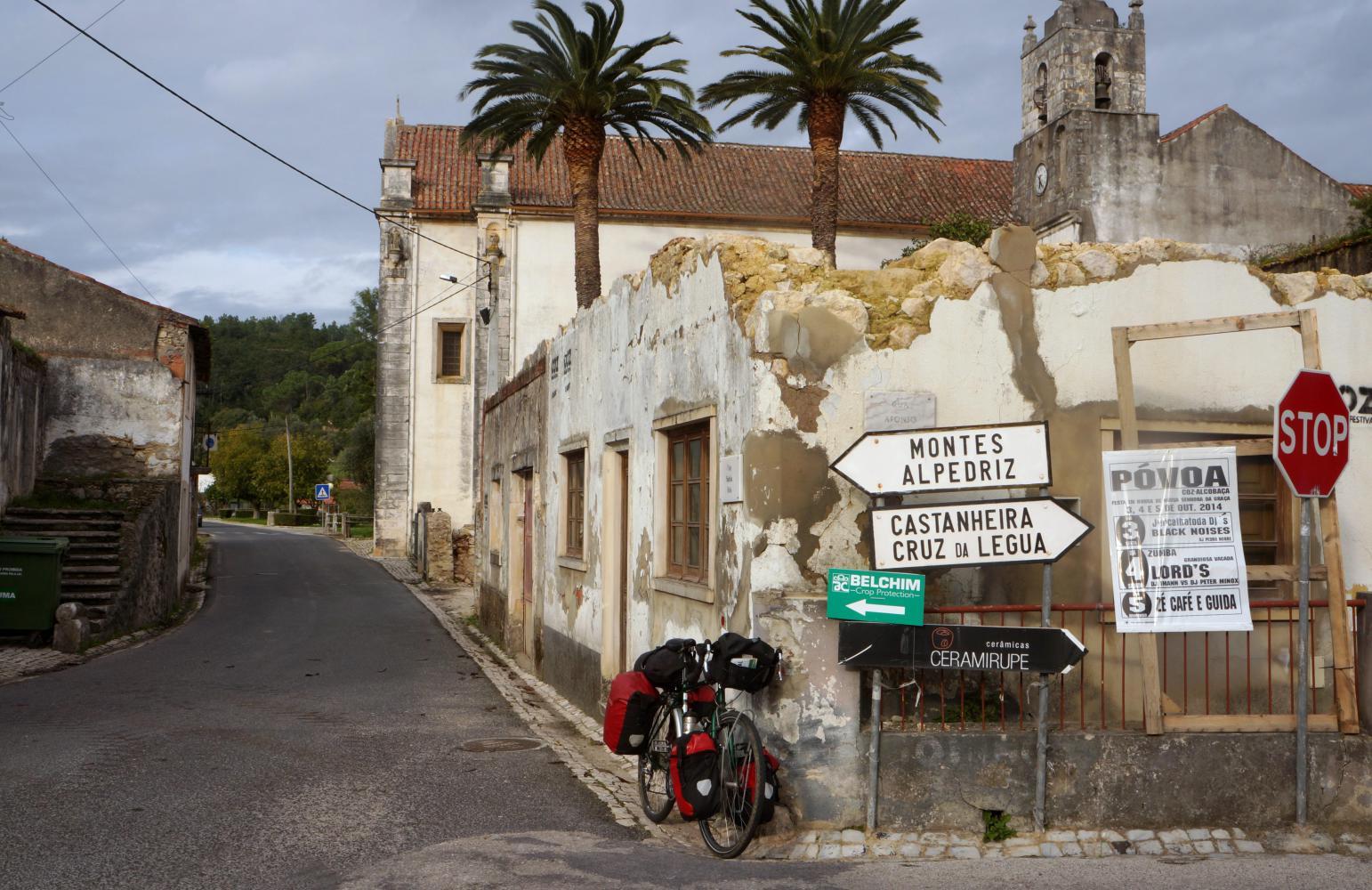
I cycle up a slope to the town centre. There's no alternative without risking a ticket for cycling where I ought not. Down the other side the road on is signposted Nazare, which is out on the coast and counter to my attempt to make progress north. Before leaving town I turn off right on a road by rough reckoning is parallel with N8. It descends into an evergreen wooded valley. The road climbs again and enters a little place with a right turn further uphill with a sign for Cruz Da Legua, which I find on the map. A place back on N8.
Turning back onto national eight, the road sign says Leiria 33 km. Seems the fifty-five kilometre sign seen early was wrong. I continue on the shoulder until something like ten kilometres out from Leiria when eight amalgamates into the main north south motorway with another no cycling sign.
| Heart | 0 | Comment | 0 | Link |
There's a service road for a kilometre, which then goes up and round a scaleletric-like bridge other the motorway and back the opposite side, alongside the southbound carriageway towards Lisbon. I turn off at the first opportunity, descending steeply into a wooded valley built out with suburban houses and running parallel with the motorway above on the hillside. If I follow this road it'll most likely take me close to town. At a roundabout I go left, then a little on see a Leiria sign, meant for roadusers emerging from a sidestreet and pointing back the way I come, but ahead the road climbs towards woodland and likely camping possibilities, so I'm happy to keep going on. At the top of the hill there's a wide common covered with low growing gorse. I find it criss-crossed with tracks recently cleared through the gorse with some kind of loading shovel, as such there are lots of thorny twigs on the ground. I push the bike along, checking out a few spots, until coming to a level grassy patch to the side and pitch the tent.
Today's ride: 103 km (64 miles)
Total: 8,155 km (5,064 miles)
| Rate this entry's writing | Heart | 0 |
| Comment on this entry | Comment | 0 |