July 28, 2018
Highwood Pass
Today’s ride is to Highwood Pass, the highest paved public road in Canada (Q: so what’s the highest paved non public road in Canada? A: I have no idea), which isn’t quite as exceptional as it sounds. At 7,238’, it’s not all that much higher than Bow Summit (6,850’) that we ascended two days ago, or Sunwapta Pass (6,809’) that we reached the day before.
Still, the highest is the highest; and as long as it’s so close by, we felt we should go check it out. We can add it to our small portfolio of highest paved road ascents: together we climbed Col de la Bonnette (9,380’, the highest in France) in 2015; Katara Pass (5,594’, the highest in Greece) earlier this year; and on my own I climbed the mammoth, Mount Evans (14,271’, the highest in USA) in 1992.
Actually, this category never occurred to me before now. I’ll have to keep it in mind for future tours. I wonder what the highest paved roads are in Belgium, Netherlands, Luxembourg and Denmark? We could collect a bunch of trophies on a short tour with a bit of careful planning.
At a 130 mile round trip Highwood Pass is too far from Canmore for a day ride, at least for mortals like Rachael and myself. Since we’re driving, we could start anywhere really. We chose the Evan-Thomas day use area, 25 miles from and 2,200’ below the summit because it was the only parking spot I could find on the map at a reasonable distance from the top. It’s a 40 mile drive there, so we got an early start in order to get down before potential afternoon thunderstorms developed. We opened up the breakfast restaurant at 7, and were on our bikes by about 9.
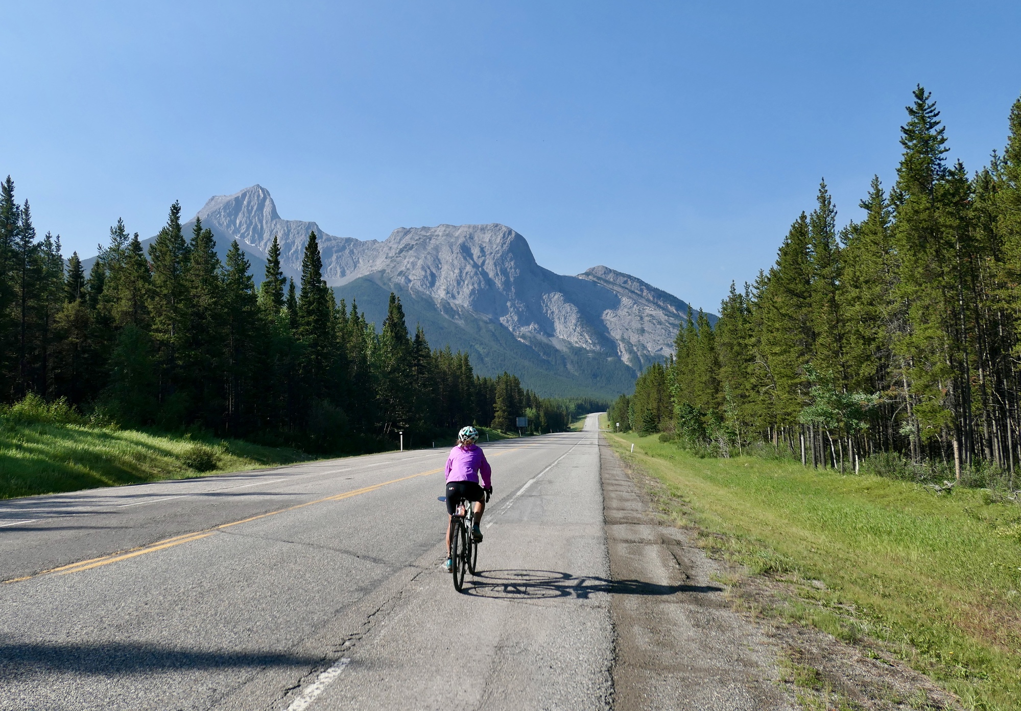
I wasn’t able to find much information about this climb, so I wasn’t sure what to expect. I’d read enough to know that it was safe and scenic, but that was about it. It’s apparently well known locally though because we saw many other bikers on the road with us today. It’s a completely safe ride on Alberta Highway 40 (the Kananaskis Trail) the whole way. Traffic is reasonably light (significantly lighter than the Icefields Parkway, by way of example), with a generous shoulder and a reasonably well maintained asphalt surface. We took the northern, easier approach (because that’s the side we were on coming from Canmore, not because we’re lazy and challenge-averse), which is a fairly gradual climb along the Kananaskis River.
We’ve experienced one stunning ride after another on this tour, but I’d have to say that this one tops them all -even the iconic rides on the Icefield Parkway. The scenery is phenomenal, and the ride quality is much more enjoyable than on the Parkway because of the absence of tour busses and massive campers. Most of the traffic consists of bicycles, motorcycles, and normal passenger cars carrying hikers to the trailheads. If you plan a visit yourself, note that the pass closes each year between December 1st and June 15th.
As far as the ride itself, there’s not that much more to say. Just another awesome day in the mountains.
| Heart | 4 | Comment | 0 | Link |


| Heart | 4 | Comment | 0 | Link |

| Heart | 5 | Comment | 0 | Link |


| Heart | 3 | Comment | 0 | Link |

| Heart | 4 | Comment | 0 | Link |

| Heart | 5 | Comment | 0 | Link |


| Heart | 4 | Comment | 0 | Link |

| Heart | 4 | Comment | 0 | Link |


| Heart | 4 | Comment | 0 | Link |

| Heart | 2 | Comment | 0 | Link |


| Heart | 2 | Comment | 0 | Link |


| Heart | 5 | Comment | 0 | Link |

| Heart | 6 | Comment | 0 | Link |
xx
Ride stats today: 50 miles, 3,500’
Today's ride: 50 miles (80 km)
Total: 918 miles (1,477 km)
| Rate this entry's writing | Heart | 2 |
| Comment on this entry | Comment | 8 |
And today's gorgeous ride that you showcased reminds me of a work trip I took there in 2012. As part of my post-doc I did a research project with uni and fire service partners in Canada and the US. We held workshops with fire agency staff here in Oz, in Bend OR and in Kananaskis. We stayed at the resort there. The coolest thing was that they took us up in a 45-min helicopter tour (they had spare hours to use up with the contractor at the end of the fire season) through all the of the mountains and valleys - showing us the fire hazards and past fire history from the air. I cannot tell you how absolutely amazing it was to fly through those valleys, over the mountains and lakes and so close to the valley walls. It was a "pinch me, is this real" absolutely amazing experience. A life highlight for sure. I did note that it looked like a great place to tour - you've confirmed it! Awesome pics today for sure!
6 years ago
I was taken by your description of Mount Robson in autumn also. We are going to have to fit a return trip for one of these years. Looking at the map, it feels like we’re just scratching the surface.
6 years ago
The same Wiki has the other high roads of Europe!:
https://en.wikipedia.org/wiki/List_of_highest_paved_roads_in_Europe_by_country
6 years ago
The Fellhorn is a mountain in the Allgäu Alps near Oberstdorf, Germany, on the border with Austria. It is known for its fields of alpenroses.
6 years ago
4 years ago
4 years ago