August 10, 2009
Day 32: To Lake Almanor
Early in the morning it was 50F with clear skies. I got up at 6:30 and on the road at 7:50. First up a big hill to get out of the campground, then downhill 1 mile to the intersection of Highways 70 and 89.

| Heart | 0 | Comment | 0 | Link |
I detoured 4 miles west on Highway 70, down the Feather river to Woody's Feather river hot spring. It's a small rural RV park with a hot spring on the premises. It's kind of unusual because there are two different hot water sources. The smaller milky pool was 98F. The larger pool was 102F, but has a rotten-egg hydrogen sulfide smell. Both pools get much warmer after the sun shines for a few hours. I soaked there for about an hour. A few steps away is a sandy beach on the river bank. It's a beautiful setting with a very user-friendly setup. It's private property but they encourage the public to go there and pay a voluntary fee of $2 per person.

| Heart | 0 | Comment | 0 | Link |
After the hot spring I had to pedal 4 miles upstream to get back to Highway 89. The hot spring detour took a total of 2 hours.

Back on Highway 89 I turned north again, going up a small fork of the Feather river. The road stays close to the river most of the time.

I parked at the Indian Falls area and walked 5 minutes down a forested nature trail to the falls and swimming area. It's surprisingly popular considering how few people live in the vicinity and how little traffic goes by on highway 89.
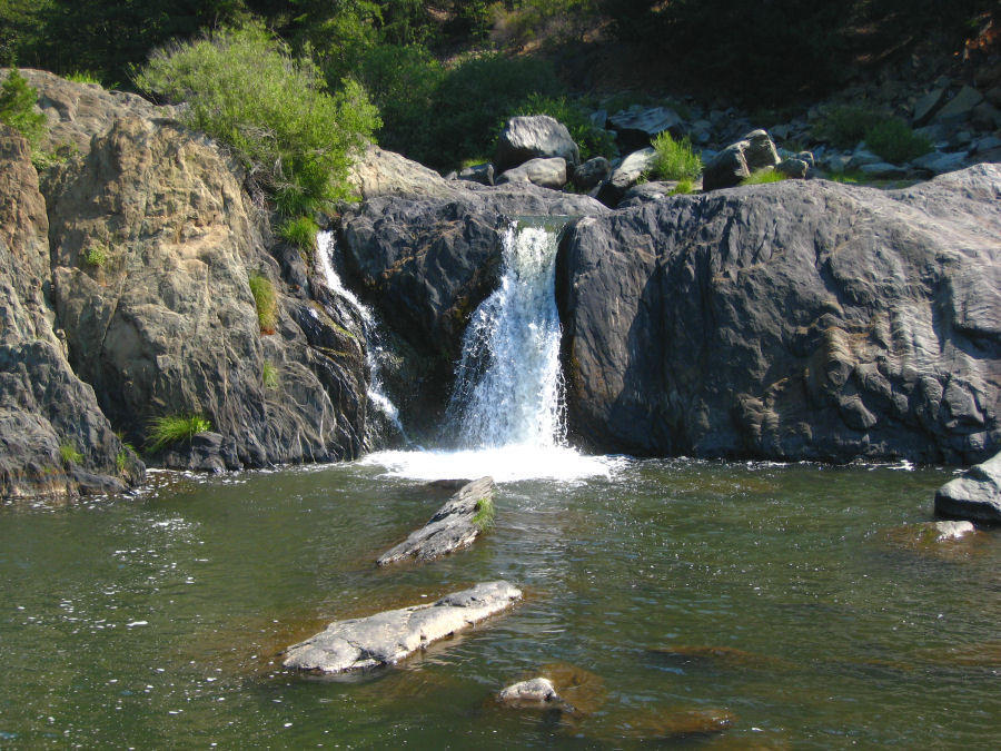
| Heart | 0 | Comment | 0 | Link |
The road climbs steadily from an elevation of 2900 feet at the 70/89 intersection to 3670 feet at the town of Greenville where I stopped for lunch and groceries. It's a quaint little town.


After Greenville I continued uphill to Lake Almanor. The road parallels a creek but it was seldom visible. It was just a boring uphill ride through the trees. The road has no shoulder, but traffic is light.

At Lake Almanor I stopped near the dam to take a few pictures, then continued on. There is a sizable seasonal residential community in the area. The reservoir was built in the 1920's and many of the buildings were built shortly afterwards. At 4:30 I arrived at the large Lake Almanor North (Forest Service, 4350 feet elevation) campground. It has huge trees, but highway 89 is within earshot and the lake is half a mile away. $17, with pit toilets.

| Heart | 0 | Comment | 0 | Link |
Today's high temperature was 88F. I'm steadily traveling north, but right now I'm at lower elevations. I never felt very strong today. One reason is that today was mostly uphill while the previous two days were mostly downhill.
I feel like I'm getting close to home, though. The mountains have the volcanic "Cascades look" that I see at home. The rocks are now mostly gray basalt instead of yellowish granite. And today I saw my first log truck of the tour.
This morning I rode along rivers and soaked in a hot spring. That was fun. The afternoon was just a boring uphill ride through the forest. Tomorrow will have much more uphill through the forest to Lassen Volcanic National Park.
Distance: 43.2 mi (69 km)
Climbing: 2478 ft (751 m)
Average speed: 8.8 mph (14.1 km/h)
Max speed: 34.5 mph (55 km/h)
Today's ride: 43 miles (69 km)
Total: 1,422 miles (2,288 km)
| Rate this entry's writing | Heart | 1 |
| Comment on this entry | Comment | 0 |