July 15, 2023
To Nelson: the Kettle River ride
It’s 63 degrees already this morning when we wake up today, and a high of 100 is expected. With a four hour drive ahead of us it will be too hot to ride if we wait until we arrive in Nelson. Another midpoint ride that breaks up the drive is planned, one we’ll have no reason to cut short because of the rain as happened back on Old Hedley Road.
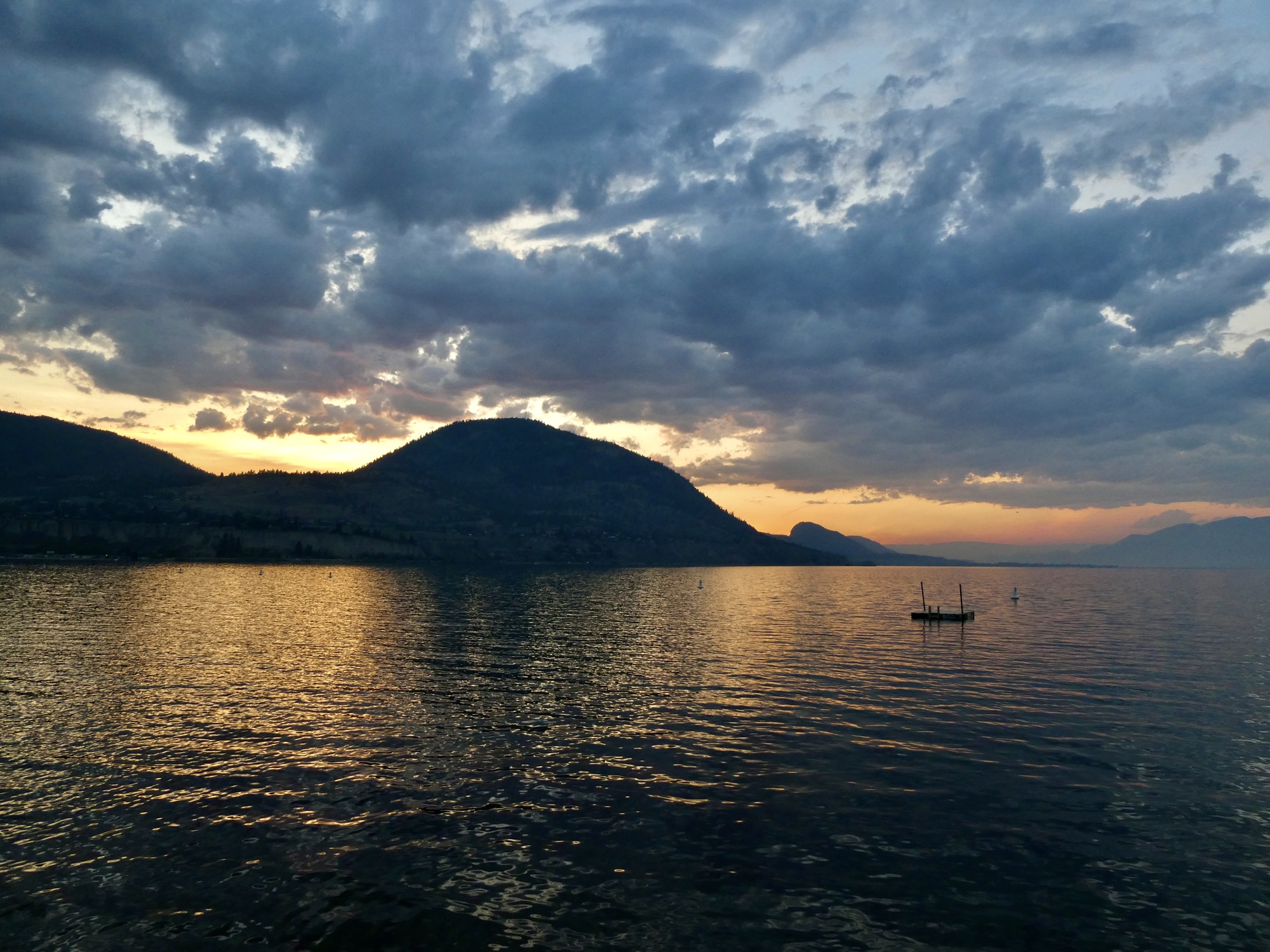
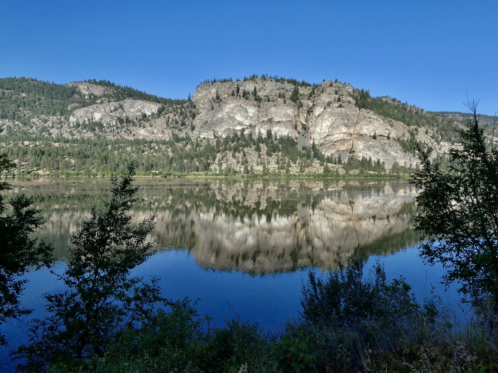
Breakfast and coffee downed and digestion duties done, we’re on the road two hours later. We drive straight through to Rock Creek on the Kettle River, stopping only for gas in Okanagan Falls and a pair of brief photo stops so I can admire views I can only briefly glance at while keeping my eye on the road.
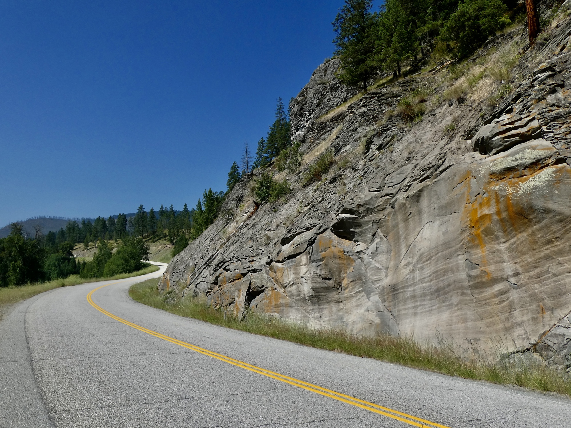
We’re on 97 south to Osoyoos, where we join the Crowsnest Highway and follow it east the rest of the way to Rock Creek. The highway is named for Crowsnest Pass across the continental divide at the B.C./Alberta border, but that’s just one of the summits it rolls across on its way from Hope to Medicine Hat. We biked over Crowsnest Pass back in 1990 in a loop that included Going-to-the-Sun, but I’ve never given much thought to the highway itself before this month’s journey. It’s really an impressive route, crossing one dramatic range after another. Leaving Osoyoos it climbs steadily for nearly a dozen miles before finally topping out at a plateau that surprises me for having no named summit. Traffic is light this morning and it looks like it would be a challenging but inspiring bike ride. We see one bikepacking cyclist just at the base east of Osoyoos on his way up and a pair of fully loaded travelers coming up the other side as we drop to Rock Creek and the Kettle River.

| Heart | 4 | Comment | 3 | Link |
9 months ago
9 months ago
9 months ago

| Heart | 2 | Comment | 0 | Link |
We’re parked by the side of the road by 9, on the shady side of the road by the bridge across the Kettle. There’s only one other car at the pullover spot now and Rachael wonders whether it’s even a legitimate spot to leave the Raven for a few hours, but when we get back there are at least a dozen others here and the river below is full of swimmers and floaters.
A digression. I’ve been on the Kettle River before, over sixty years ago. Grandma Woodings and Uncle Harry brought me up with them to Curlew Lake on a trout fishing excursion when I was about twelve, hauling his boat behind him on the long drive from Bremerton. It was country they knew well - Grandma grew up in Ione near the Idaho border. It was one of two or three trips they brought me along to Cushman, a place I think they came to every summer.
I don’t remember much at all about Curlew Lake or the fishing, but one memory still burns in my memory 65 years later. Late in the day near the end of the drive, a pair of grouse crossed the empty road just in front of us. Rather than braking to avoid them, Uncle Harry shocked me by stepping on the gas and gunning them down. Afterwards he stopped the car, walked back to pick them up and tossed them in the boat. We had them for dinner. I never really thought of Uncle Harry quite the same way after that.
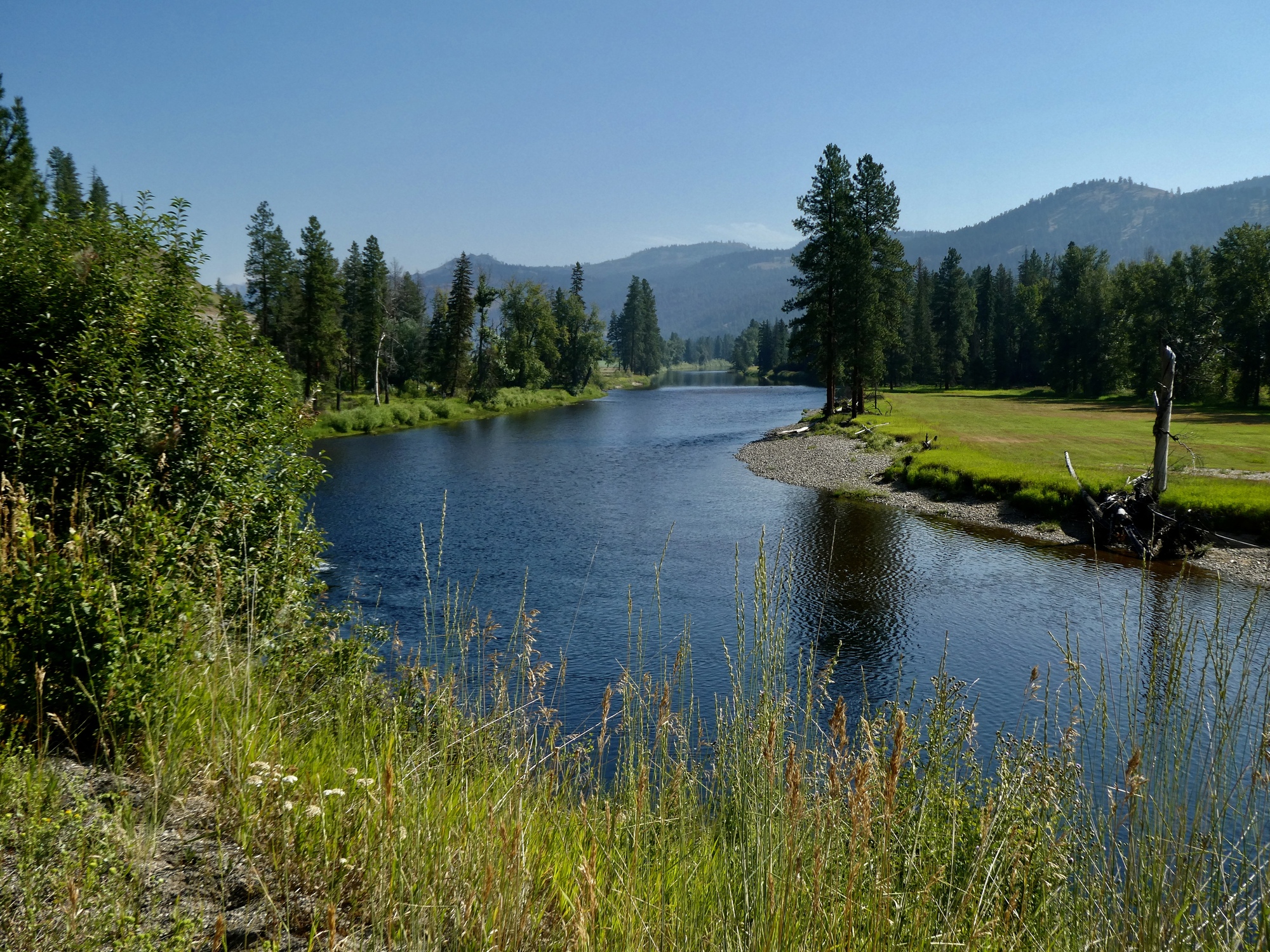
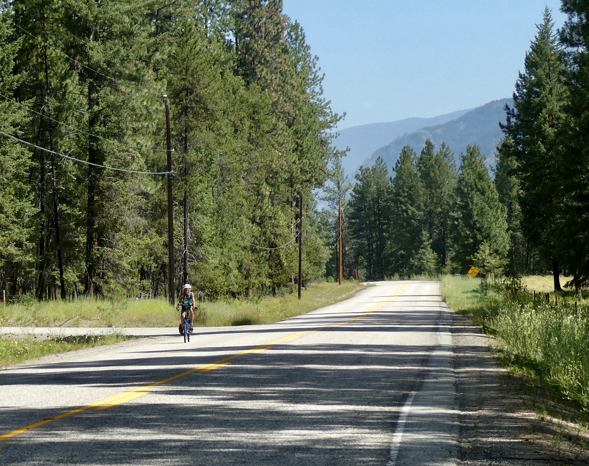
It’s the normal ride plan today, of course. After biking south a hundred yards in the wrong direction toward the international border, Rachael proposes that we turn back and go north instead. A mile later she’s out of sight and I won’t see her again for nearly twenty miles. For the first eight miles we’re riding Highway 33, the Kelowna-Rock Creek Highway. I wondered how the traffic would be here, but it’s pretty quiet today. Even quieter is the KVR (the Kettle Valley Rail Trail), which begins in Rock Creek and follows the river right below us.

| Heart | 2 | Comment | 0 | Link |

| Heart | 2 | Comment | 0 | Link |

| Heart | 1 | Comment | 0 | Link |

| Heart | 2 | Comment | 0 | Link |

| Heart | 1 | Comment | 0 | Link |
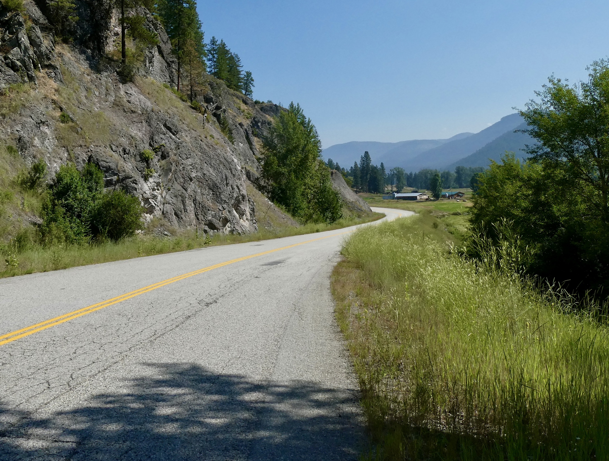
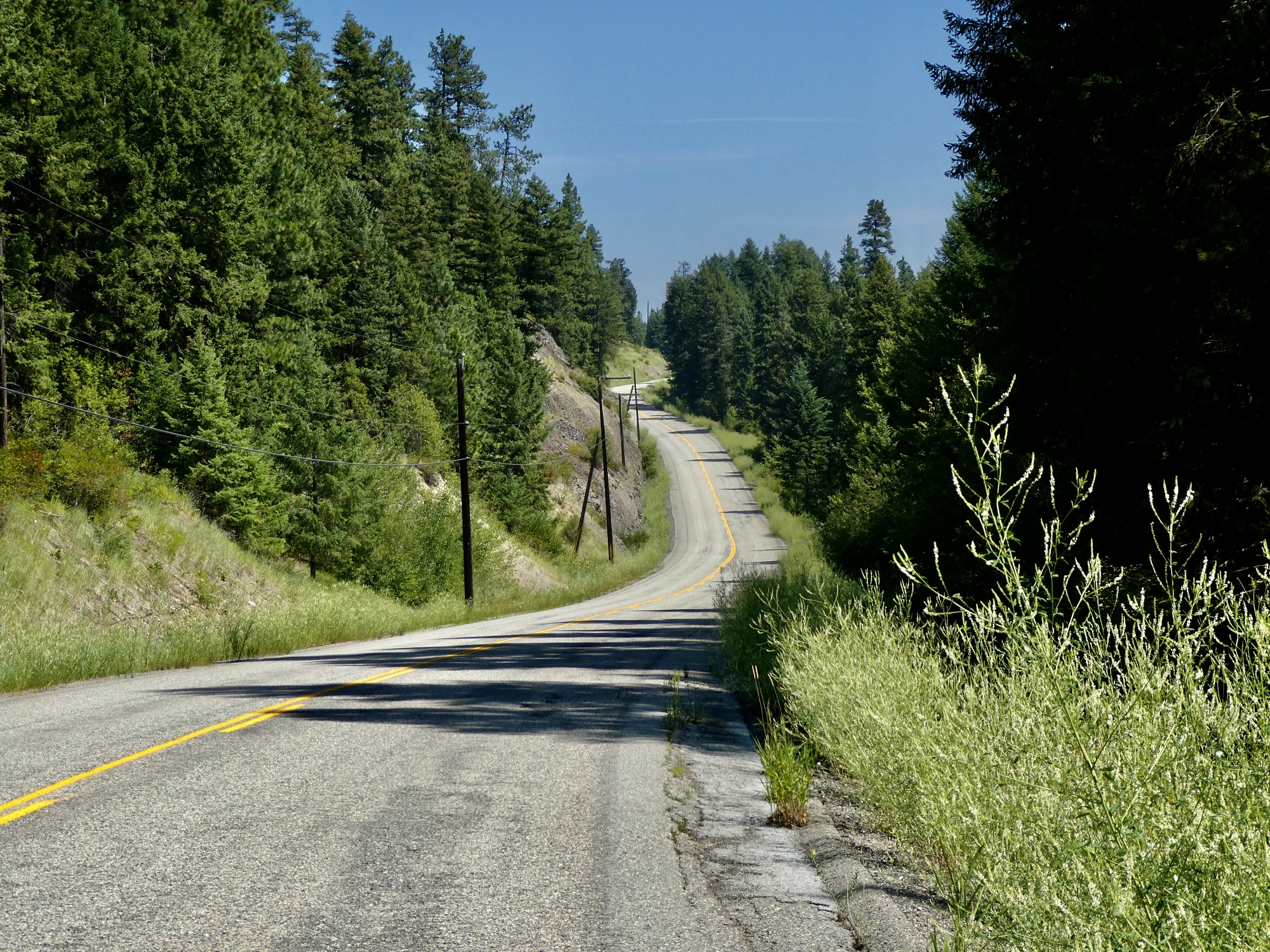
Eight miles into the ride we come to Westbridge and leave Highway 33 for Christian Valley Road. There’s a major convergence in the river here, with our road following the main branch and Highway 33 angling northwest up the west branch. It’s been a reasonably quiet ride until now, but once we’re on Christian Valley we’ll hardly see a car the rest of the way out.
There’s a gradual climb, just enough to get a nice view down to the river, and then I’ve mapped us through the descent on the other side to the end of the pavement. I don’t get that far though when I see Rachael ahead.

| Heart | 4 | Comment | 0 | Link |

| Heart | 2 | Comment | 0 | Link |
It’s heating up, so we pedal fast and bike straight through back to the car, save for one brief but essential stop when a crow-sized bird swoops down from the trees to snatch something from the road and then returns to the trees - one of the many small grasshoppers coating the pavement for the last few days, I imagine. The bird sits prominently on a branch up a nearby ponderosa beside the road, but it takes me awhile to find in the lens. I just get a shot off before he takes flight.

| Heart | 5 | Comment | 4 | Link |
9 months ago
9 months ago
Video sound track: Are We, by Gerald Clayton
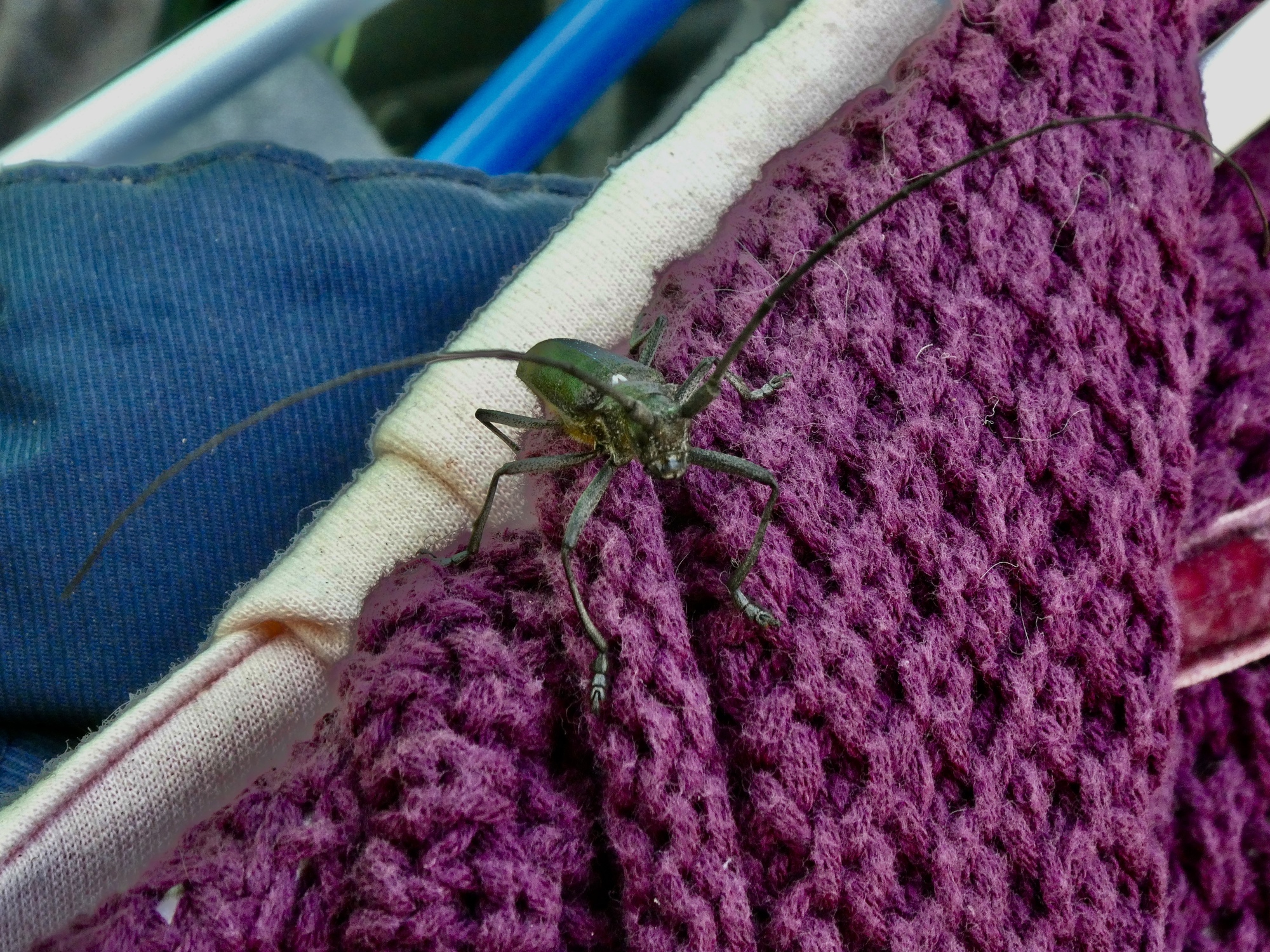
Back in Rock Creek we head straight for Rock Creek Station, a small shop in the woods Rachael noticed at the start of the ride. They sell a bit of everything - convenience groceries, DVD’s, second hand clothing - and happily what we’re looking for, ice cream sandwiches which we enjoy sitting on a bench in the shade. They’re refreshing, but for me the best thing is the wood borer that flies in and starts browsing through the used clothing looking for just the right item that’s in his fan.

| Heart | 3 | Comment | 2 | Link |
https://www.inaturalist.org/taxa/82043-Monochamus-scutellatus
9 months ago
9 months ago
Back at the car, I’m surprised and pleased to see that it’s still in the shade so we’re not stepping into an oven. It’s still another two hours to Nelson - another scenic hour on the Crowsnest highway, and then north on 3A. We stop at a Safeway when we hit town to load up for our three day stay - peanut butter, raisins, milk, and a dozen eggs since we’ve got a kitchen in our apartment this time.

| Heart | 5 | Comment | 0 | Link |
| Heart | 1 | Comment | 1 | Link |
9 months ago
____________________
2023 Bird List
170. Clark’s nutcracker
Today's ride: 43 miles (69 km)
Total: 751 miles (1,209 km)
| Rate this entry's writing | Heart | 10 |
| Comment on this entry | Comment | 2 |
9 months ago
9 months ago