In Radium: the ride to the east - An American Summer, 2023 - CycleBlaze

July 21, 2023

In Radium: the ride to the east

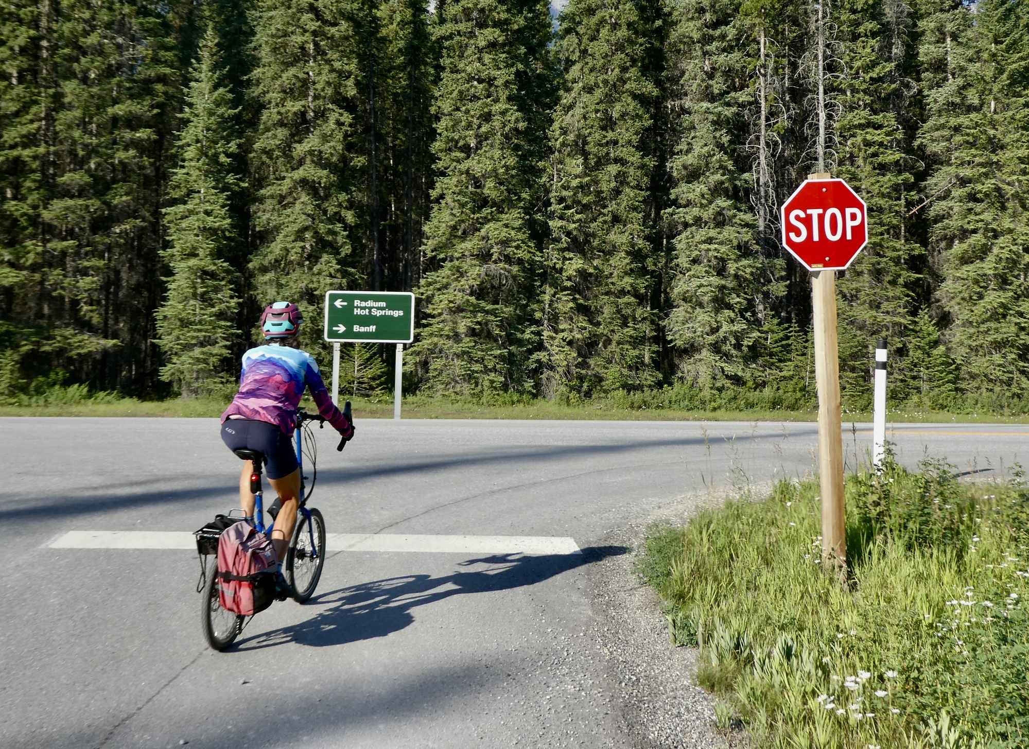
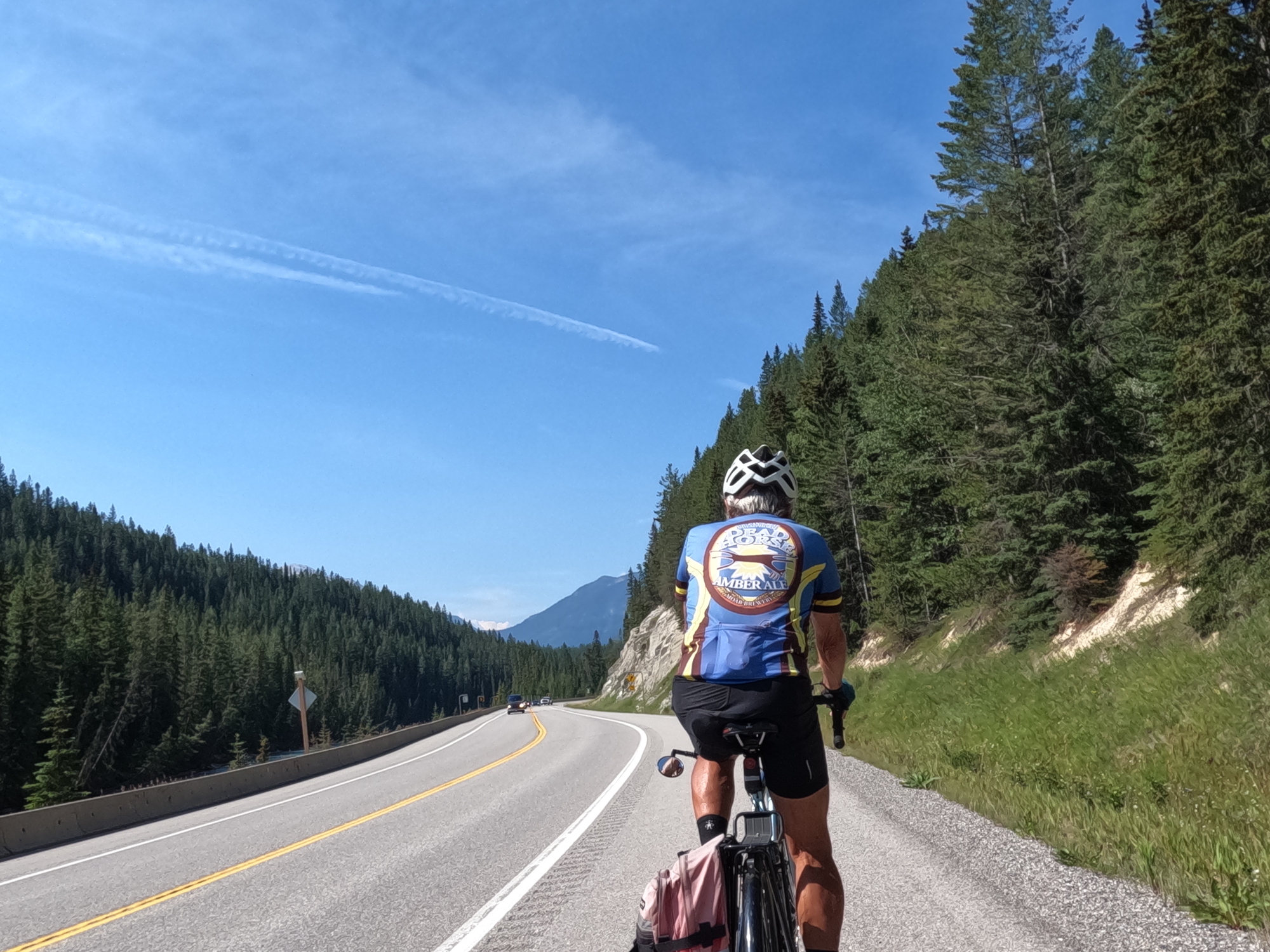
So yesterday’s plan is today’s plan.  It starts the same way, except we wake up and get out the door a half hour even earlier than yesterday, and we don’t need park passes because we picked them up at the visitor center yesterday afternoon.  Being mobilized by 7:30 is absolutely heroic by Team Anderson standards, and we’re feeling quite proud of ourselves as we bike past the closed ticket office, continue up the long climb to Sinclair Pass and reach our starting point by about eight.  

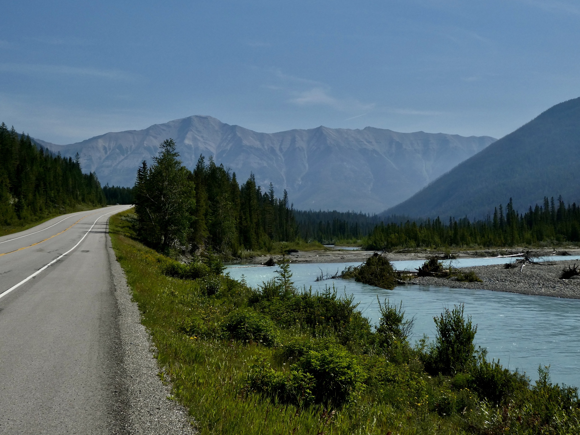
The ride we have mapped out is a 44 mile OAB, turning back at the Simpson River trailhead.  The thinking here is that if today’s ride is attractive enough we can come back up here again tomorrow, drive to the end of today’s ride and continue east from there for a second bite at the apple.  The road through the national park has almost ninety miles of reasonably tame cycling, just right for a pair of rides.

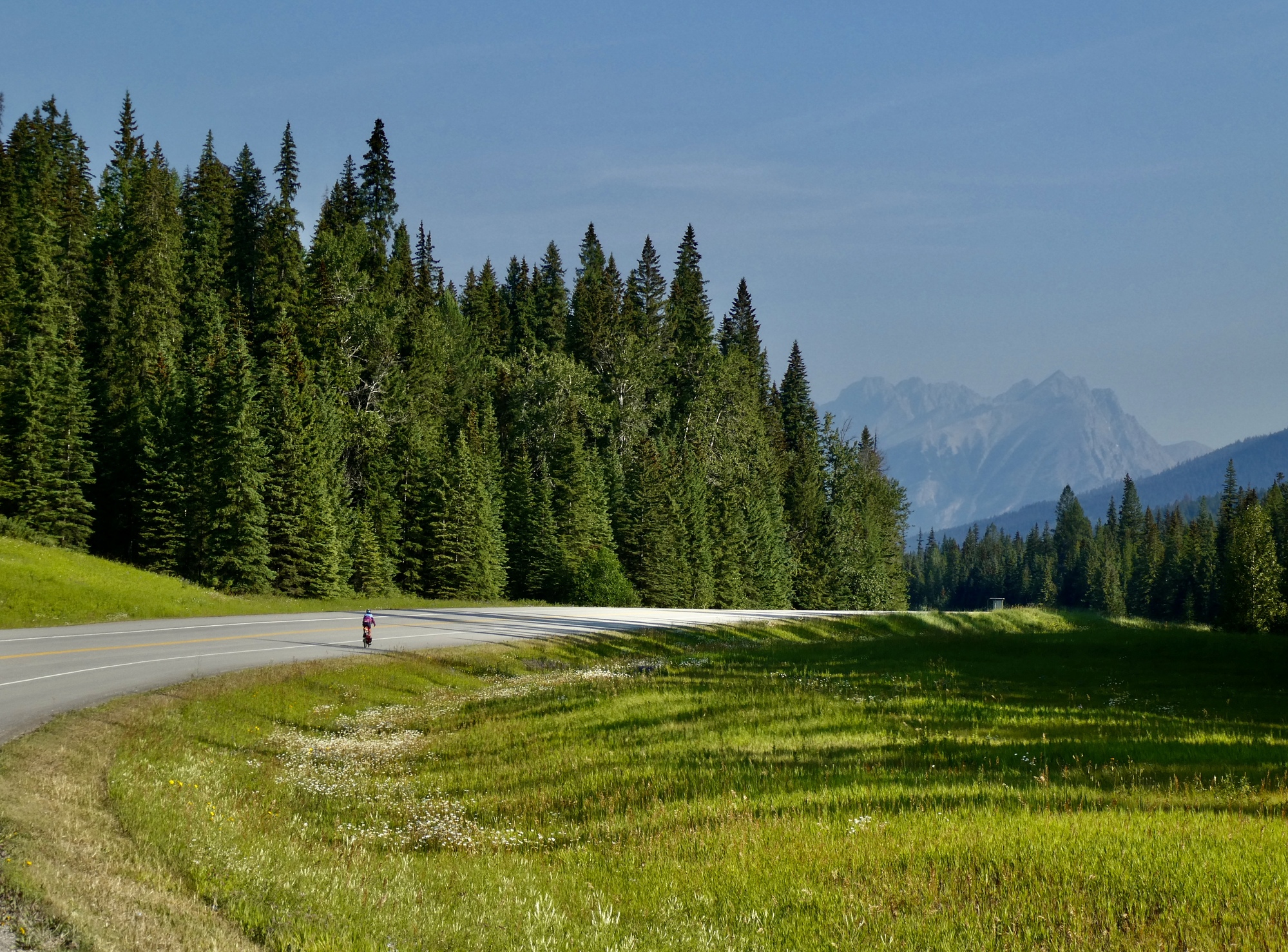
One of the concerns we had about this ride is quickly put to rest when we start biking east: there’s very little traffic on the road, and with a ten foot wide smoothly paved shoulder it feels perfectly safe.  I’d been imagining a road with minimal or no shoulder and a steady stream of campers, so we’re of course very pleased about this.  

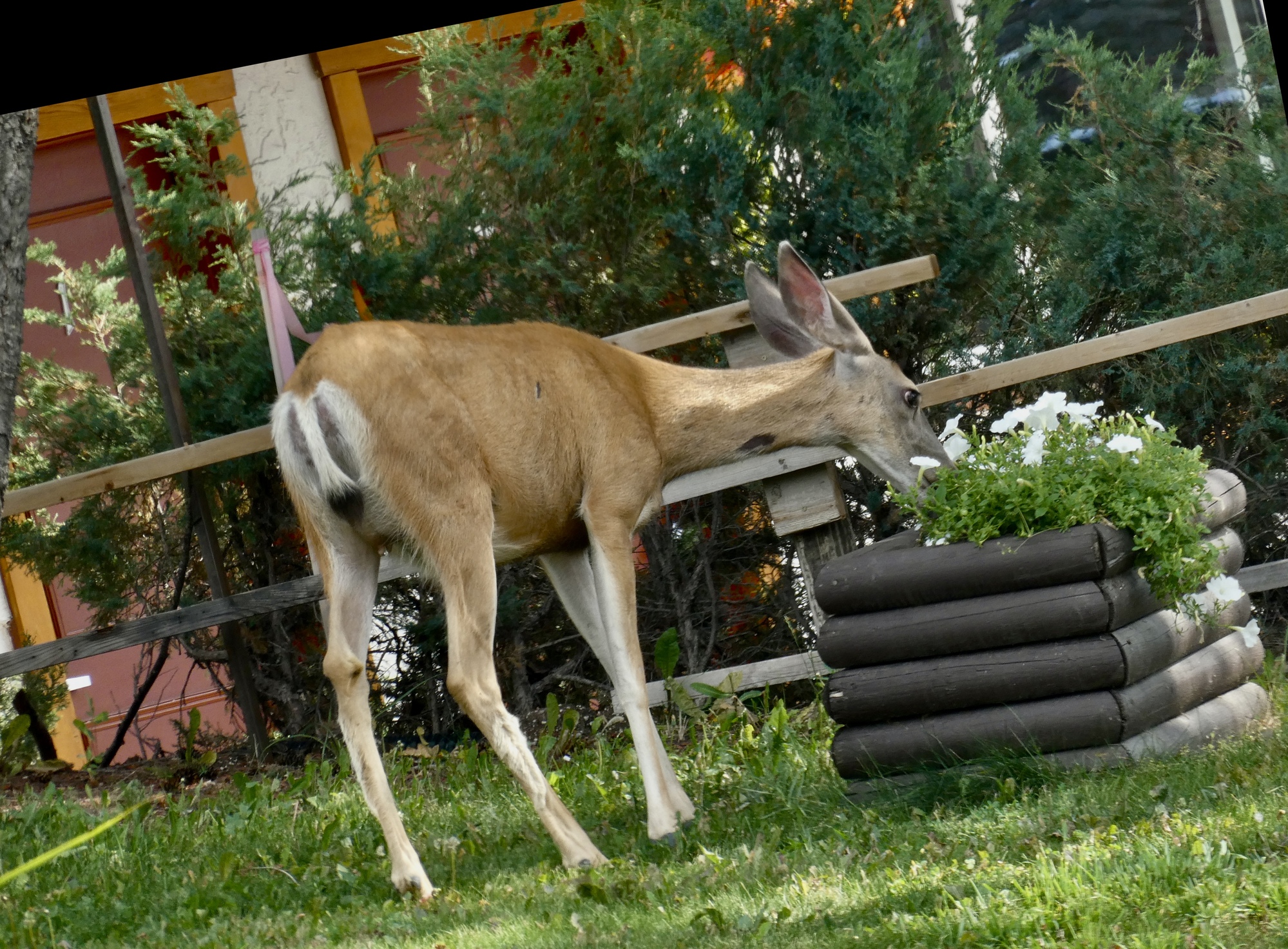
Our other anxiety (well, Rachael’s at least) is that a grizzly bear will dash out of the woods, run into the road to steal any food she has in her pannier and then move on to graze on her next.  But that doesn’t happen either, fortunately.  It’s just us out here along with the occasional chipmunk, bird or mountain goat, none of which feels like a real menace.

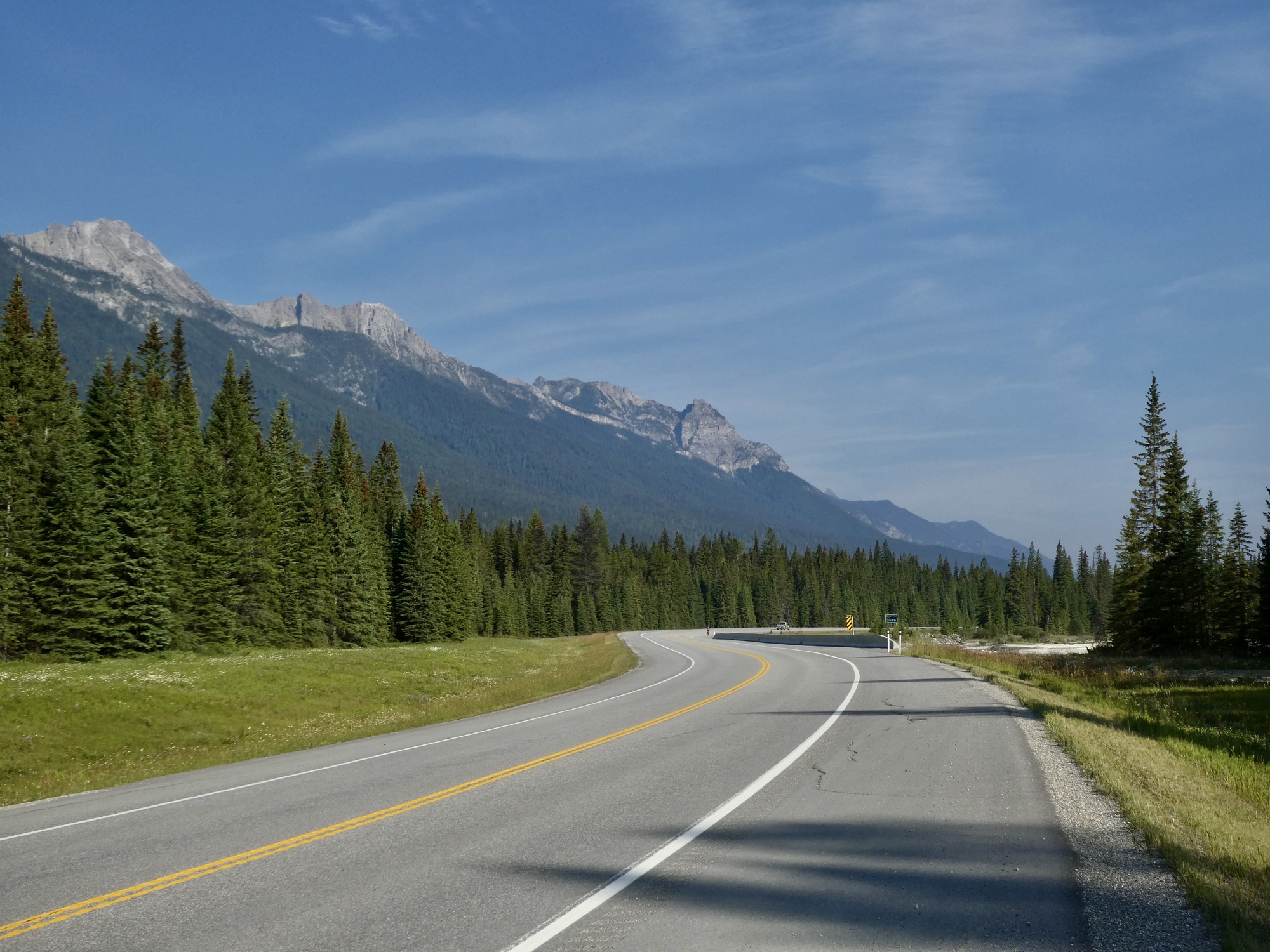
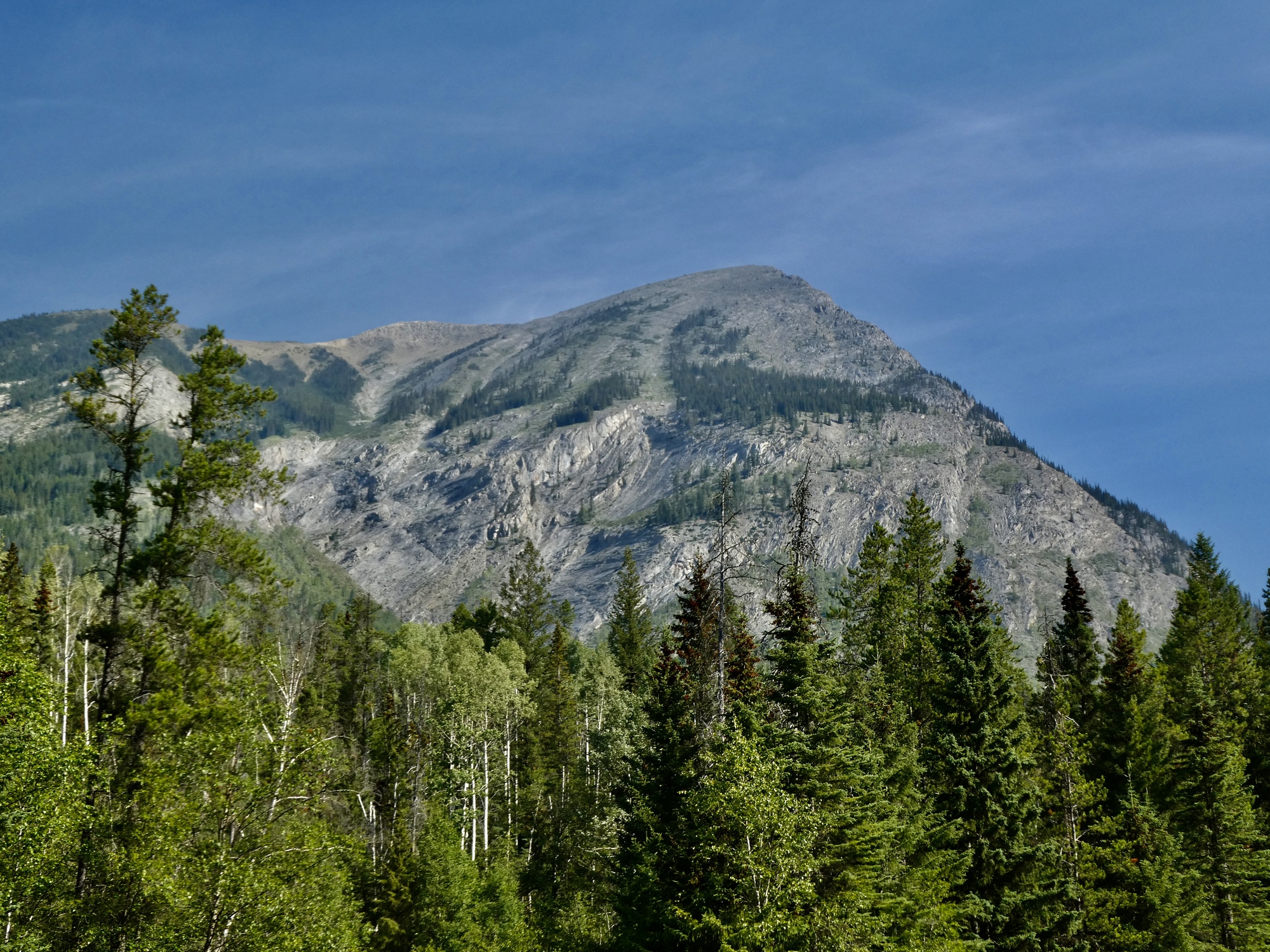
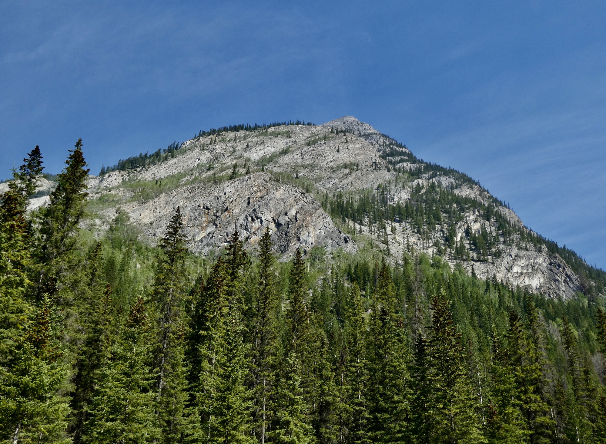
So how was the ride?  Gorgeous.  Stirring mountain and river views without end.  And the traffic volume stayed low on the way out, but steadily built up on the way back to the car.  If you come up here, early in the day is definitely the time to be out.  It’s a disappointment to see no new bird species - I thought surely I’d at least see a Canada jay, but with this huge wilderness available I guess it’s not surprising that the wildlife doesn’t choose to hang out along the road.

On the other hand though, we saw mountain goats!  I haven’t seen a wild mountain goat since hiking in the Olympics forty or fifty years ago.

Going,
Heart 3 Comment 2
Suzanne GibsonCool helmet!
Reply to this comment
9 months ago
Scott AndersonTo Suzanne GibsonIt’s perfect! It goes with all her outfits, and it’s easy to spot her in a crowd.
Reply to this comment
9 months ago
Going,
Heart 8 Comment 0
Gone!
Heart 3 Comment 1
Patrick O'HaraGreat shoulder!
Reply to this comment
9 months ago
The Kootenay River gets its start in these mountains, of course. We’ll be following it all day, and for most of a second ride if we decide to come back and continue east.
Heart 4 Comment 2
Rich FrasierSpectacular!
Reply to this comment
9 months ago
Scott AndersonTo Rich FrasierNot the Pyrenees of course, but still nice.
Reply to this comment
9 months ago
This alone made the trip up here worth it to me. Belted kingfishers keep their distance and are hard to get any kind of shot of. Usually by the time you see one it’s already too late.
Heart 10 Comment 2
Kirsten KaarsooAlways one of my favourites!
Reply to this comment
9 months ago
Mountains and rivers without end. This is such an amazing part of the world.
Heart 4 Comment 1
Lyle McLeodYes, it is :)
Reply to this comment
9 months ago
Some roadside shale. We aren’t far from where the famous Burgess Shale is found, with its ocean fossils laid down a half billion years go when this was all under sea.
Heart 3 Comment 0
That’s Mount Wardle ahead. About halfway into the ride we pass Vermillion Crossing and bend east, following the river as it cuts through the range.
Heart 2 Comment 0
Another roadside outcrop.
Heart 2 Comment 2
Kirsten Kaarsoothis is one of the many advantages of riding a bike. You see these details.
Reply to this comment
9 months ago
Keith AdamsFascinating juxtaposition of textures there.
Reply to this comment
9 months ago
Mount Wardle again.
Heart 1 Comment 0
Mountain goat! One of six I saw spread out above the top of the scree line. I think this one’s a male, identifiable because it’s horns are thicker at the base than the females.
Heart 7 Comment 3
Lyle McLeodGreat shot, and pretty amazing that you’ve seen so many this close. I can count on my hands the number of times I’ve seen goats, and only once (on the Icefield parkway) this close. All the other times have been far in the backcountry on backpacking trips, and that’s over 45 years!
Reply to this comment
9 months ago
Patrick O'HaraWow! What a lucky catch!
Reply to this comment
9 months ago
Scott AndersonTo Lyle McLeodThis really was amazingly lucky. I couldn’t believe it when I saw the first one, and then saw others strung along the ridge for a few hundred yards.
Reply to this comment
9 months ago
Two more. They’re easy to spot because they’re so white, and all of these were pretty placid and easy to observe. They must feel pretty secure, one or two hundred feet above the road. I hope Rachael saw them when she biked by earlier.
Heart 5 Comment 2
Lyle McLeodFlat land for them. It’s incredible to see them scale what appear to be shear cliff faces like they were a staircase to the upstairs bedroom
Reply to this comment
9 months ago
Kirsten KaarsooA wee bit of shedding going on here. Great photo. I'm jealous of you seeing them so close.
Reply to this comment
9 months ago
This gives you a good sense of how far off they were. One just slipped into the trees at the top of the ridge.
Heart 1 Comment 0
Still Wardle? I think so.
Heart 1 Comment 0
The river.
Heart 4 Comment 1
Andrea BrownWhen I was a child the Kootenai flowing through my hometown was exactly this color. Once the Libby dam was built, it changed to a clear green, due to the glacial sediments settling to the bottom of Lake Koocanusa.
Reply to this comment
9 months ago
This is different. Mount Shanks, I think.
Heart 2 Comment 0
We’re together again, biking back toward the car with Mount Wardle ahead. Probably my favorite spot on the ride.
Heart 4 Comment 0
Rachael missed the goats on the way out but fortunately one is still around, lower down and closer to the road than before.
Heart 5 Comment 1
Kirsten KaarsooI am happy that she saw at least one!!
Reply to this comment
9 months ago
Calling it a day, except for these next 17 miles.
Heart 3 Comment 3
Patrick O'HaraLooks like your climbing here! Is this doctor approved?
Reply to this comment
9 months ago
Scott AndersonTo Patrick O'HaraShh. Don’t tell!
Reply to this comment
9 months ago
Patrick O'HaraTo Scott AndersonMum's the word.
Reply to this comment
9 months ago

Video sound track: Bésame Mucho, by Dave Brubeck

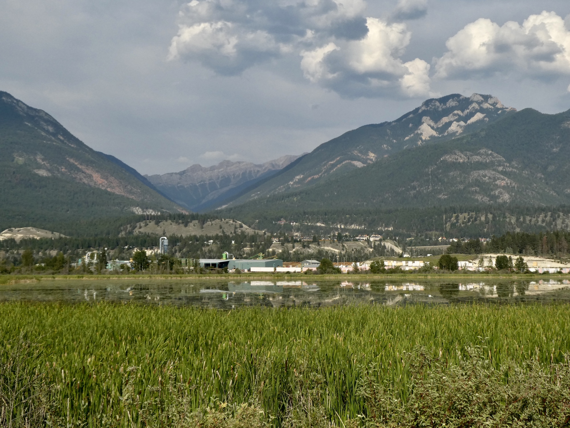
Back at the motel, we hid inside and kept cool until dinner time.  We drove a short distance to a Mexican restaurant for dinner (the corruption of having a car handy - without it we would have endured the heat and walked).  After dinner and after it had cooled down a bit I went out again, driving a couple of miles to the crossing over the Columbia, thinking I might see some birds.  Nary a one, but I did get a nice view back toward town.

As we pulled out of our motel parking lot a deer ran across the road, paused to collect a few pansy blossoms, and disappeared into the trees.
Heart 3 Comment 0
Looking back toward Rdium from the Columbia.
Heart 1 Comment 0
Heart 2 Comment 0
Heart 1 Comment 0

Today's ride: 44 miles (71 km)
Total: 922 miles (1,484 km)

Rate this entry's writing Heart 13
Comment on this entry Comment 7
Jacquie GaudetNow I’m trying to figure out if I can squeeze in another Golden Triangle ride this fall! Your photos are fantastic! I don’t think I took any when we rode here.
Reply to this comment
9 months ago
Scott AndersonTo Jacquie GaudetThat’s funny. I was just describing the Golden Triangle to Rachael on our drive through Golden to Revelstoke a few hours ago. I was considering riding it in 1990 too, the year we biked through Waterton and Glacier, but decided I wasn’t comfortable with the pass on Highway 1 east of Golden.
Reply to this comment
9 months ago
Jacquie GaudetTo Scott AndersonIt wasn't that bad, as I recall, just the nasty hill coming out of Golden, and then there was a good shoulder once we hit the first National Park. Of course, at that point I hadn't been spoiled by the quiet roads in Europe. That section, from Golden to the west boundary of Yoho National Park, is now in the fourth and final phase of a massive (20 years and counting) reconstruction project, which includes widening the road and adding "wider shoulders to accommodate cyclists."
Reply to this comment
9 months ago
Scott AndersonTo Jacquie GaudetAnd I’ll bet the traffic wasn’t as bad 33 years ago either. From what I saw today, I’d wait for the shoulder to open up. Traffic was pretty much nonstop driving west of Golden.
Reply to this comment
9 months ago
Kirsten KaarsooTo Scott AndersonThe pass East out of Golden is one HUGE construction site at the moment. It closes at 10pm and opens again at 7am these days.
If you are at all interested in what they are doing here is a link:
https://bit.ly/3NOTZ5q
Reply to this comment
9 months ago
Scott AndersonTo Kirsten KaarsooThanks, Kirsten. I forgot about this. I kept meaning to research what all the alternate route and closure signs for this road were.
Reply to this comment
9 months ago
Jacquie GaudetTo Scott AndersonThat's summer in southern BC, traffic and road construction. I'm not sure there was less traffic then, but I do know it was much more possible to be spontaneous back then.
Reply to this comment
9 months ago