April 2, 2024
To Abrucena
It’s only 27 miles to Abrucena, and our only time constraint is to arrive there in time for lunch. It’s a small mountain village with few options, but our lodging is also what looks like the best eating choice in town, so that’s the plan.
Were up at around 2,500’ here and it’s pretty chilly this morning, so we set 9:30 as our departure goal and do reasonably well to make it out by 10 after eating a more or less snack breakfast in our room. We have a pretty significant climb ahead in today’s ride, but unfortunately the day begins with a two mile, 800’ foot drop to the Andarax River that we just climbed up from last night, something I already complained about yesterday so I don’t need to do so again.
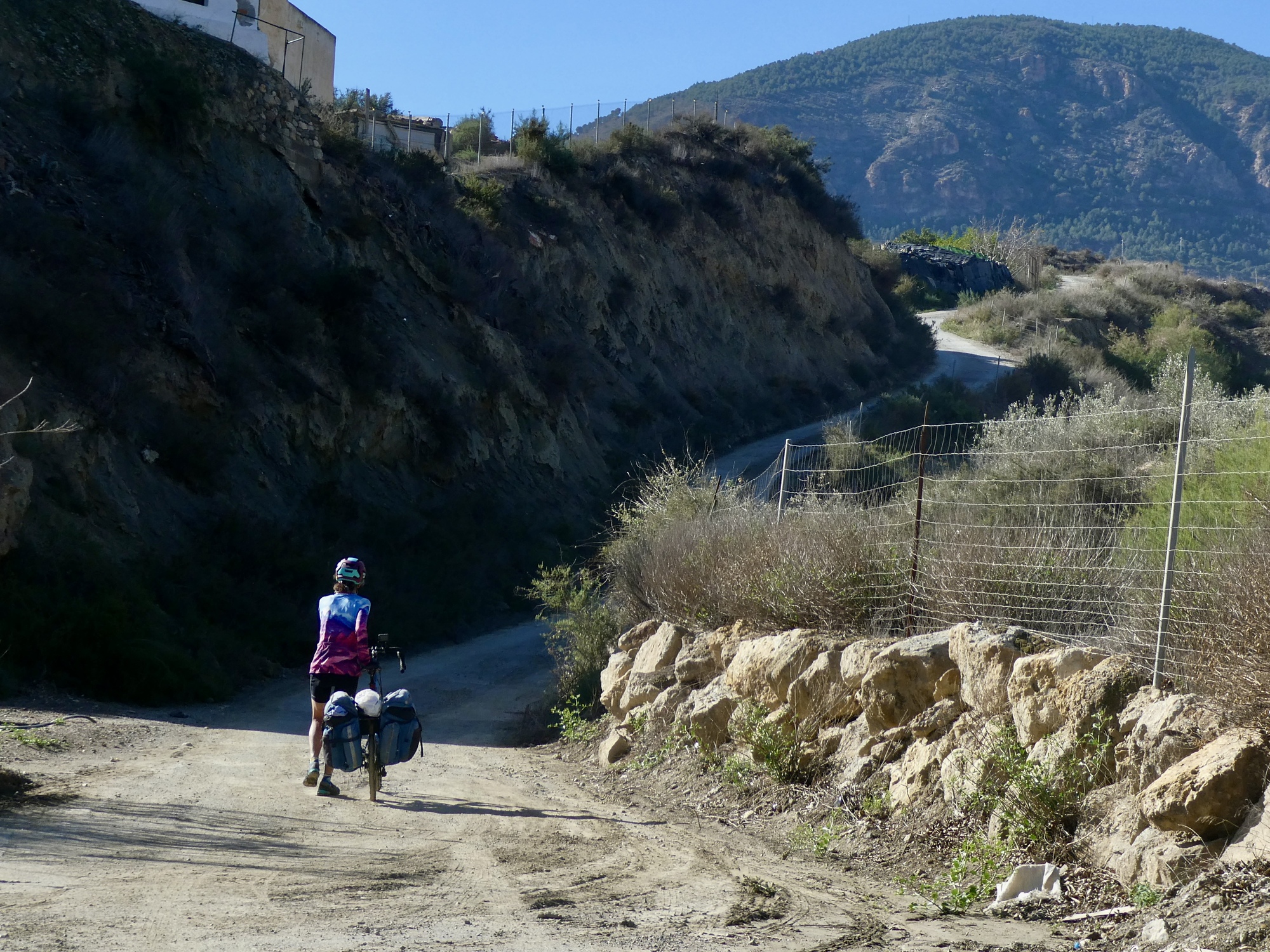
We anticipate a fast, chilly drop so we start the day well layered up. Unfortunately it doesn’t work like that. The drop is super-steep, between 10-15% in my estimate but I don’t know because the Garmin isn’t on the page that shows gradient and my hands are clutched to the brakes so I can’t scroll through to it. And the road is very narrow, single lane, twisting, and rough-surfaced - and even gravelly toward the bottom. It’s pretty scary really, and I’m probably only averaging 5-6 mph for much of it.
I’ve gotten behind Rachael because I stopped for a few photos, which as it happens was unwise because it’s not easy to remount and start biking again on such a steep slope. Toward the bottom finally I get a call from Rachael. I can’t conveniently answer though and assume she’s just checking to see if I’m Ok. I’ll be there soon though and can let her know in person.
That’s not why she’s calling though. She’s calling to let me know we’re screwed. The road dead-ends at the river, which today has a significant water flow from the recent rains and is obviously unfordable. I stand there staring at it for a few minutes watching an orange rush past bobbing in the current, and then turn back to discuss the sorry situation with Rachael. There’s obviously nothing to be done but turn back and climb back up that two mile, 800’ drop.
As a segue here - I’m not sure whether this constitutes a mapping error by the navigator or just bad luck. Later I’ll check the route on RideWithGPS and see that it’s claimed to be 100% paved; and since it’s a couple of miles shorter than the alternative it’s the obvious right choice. When I zoom in on the satellite view though I see that it’s only 99.9% paved, with the missing 0.1% limited to the width of the river. So, just bad luck perhaps.

| Heart | 0 | Comment | 0 | Link |
Later, after we’ve recovered from the day Rachael pulls up some video footage that we can laugh at now - the definition of Type 2 Fun! She started taking the clip at the top of this hill, when she’s correcting me because I’ve missed our turn and am leading us down the wrong road - which, we’ll realize an hour later was the road we needed to be on after all. If I’d just kept on with that wrong road, we’d have saved ourselves an hour and a half and a lot of grief. Ha, ha.

| Heart | 2 | Comment | 0 | Link |

| Heart | 4 | Comment | 0 | Link |

| Heart | 2 | Comment | 0 | Link |

| Heart | 2 | Comment | 2 | Link |
1 month ago
1 month ago
Knowing or suspecting it’s just bad luck is small comfort though when we start climbing the hill, steep enough that we both end up pushing most of the way. And now that I’ve got the Garmin on the right page I see that my gradient estimate was pretty good; but actually the climb is even worse than I’d guesstimated, 10-18% most of the way.

| Heart | 1 | Comment | 2 | Link |
I’ve got plenty of time to think and study the situation as we slowly climb back up to town, time enough to discover that there’s at least a small bit of good luck in the story because there’s a short cross-connecting road we can take partway up; so we only end up having to push uphill one mile, not two. No fun, but significantly better than we were expecting.
So, not the best start to the day. We’ve been out over an hour now and have advanced one mile - and our new route is about three miles longer, so in fact we still have a couple of miles further to bike than the ride we were expecting when we started. Oh, and the real climb of the day is still ahead, now that our legs have been well softened up.
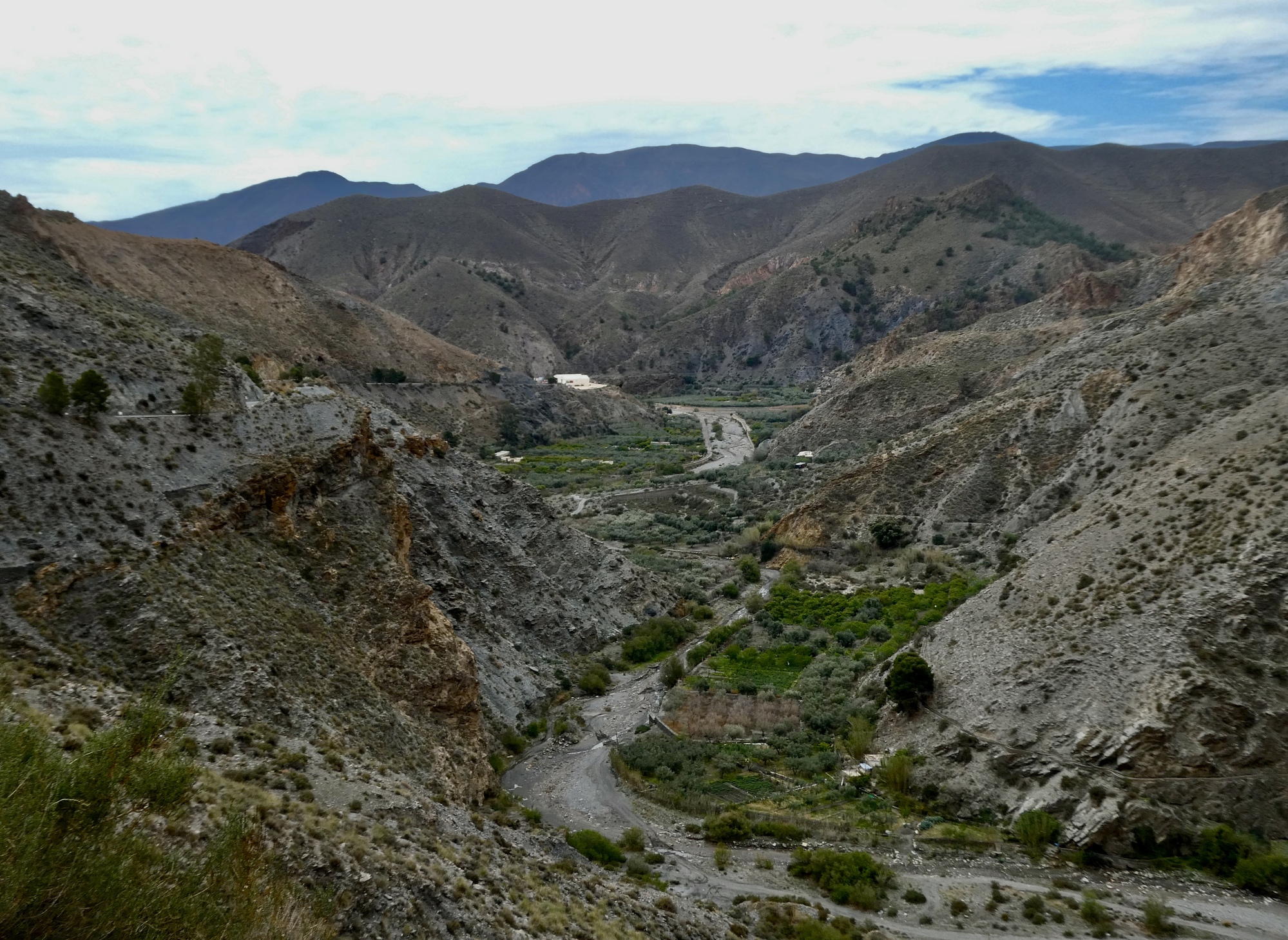
We finally start making some real progress now though. It’s a fast three mile descent to the river (and it really is fast this time - the road surface is good, the gradient reasonable), and then five miles of gradual riverside ascent to the point where the main event starts. The scenery is spectacular all the way, but I stop for very few photos because we’re well behind schedule, we’re trying to make up some time, and it doesn’t seem wise to risk pissing off anyone on the team. Maybe the day’s video will give a sense of what we experienced here.

| Heart | 3 | Comment | 0 | Link |

| Heart | 4 | Comment | 0 | Link |

| Heart | 2 | Comment | 0 | Link |
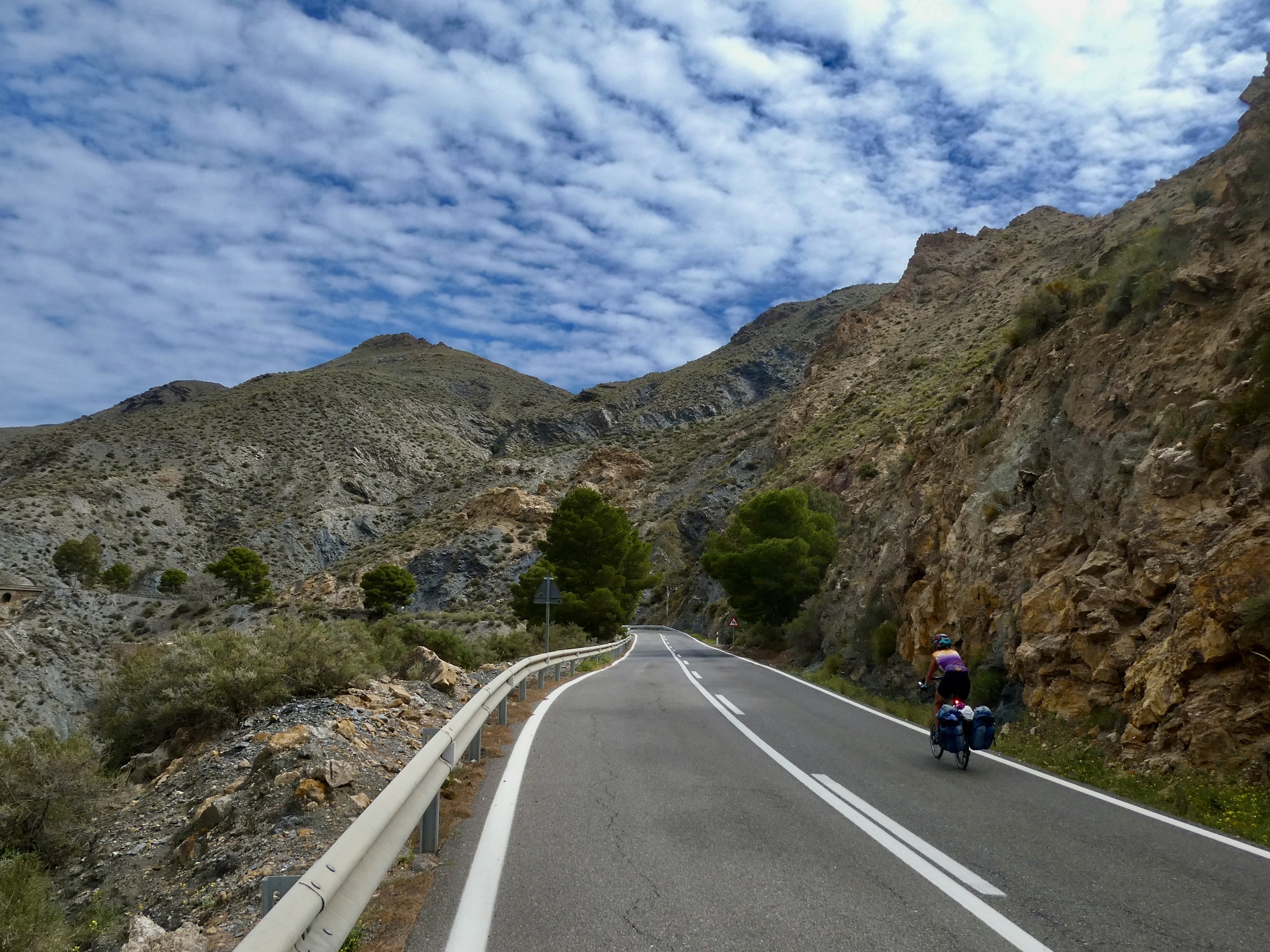
The next four miles are definitely tough, as we follow the Naciemento through a tight gorge and then start climbing above it at a steady 6-8%. Not horrible as climbs go, but we’re both getting up there in years and the negative effect of this morning’s pointless down and up didn’t help either our strength or attitudes.
| Heart | 2 | Comment | 0 | Link |

| Heart | 3 | Comment | 0 | Link |
| Heart | 3 | Comment | 0 | Link |
Another thing that weighs down on the team’s attitude is the fact that there’s still fifteen miles to go after we top out, it’s after one already, and there are still two marked climbs ahead showing on the Garmins. We’re not enthusiastic about adding any more pain to the day, and we’re getting anxious about whether our restaurant will still be serving by the time we finally roll in.
Fortunately, everything turns in our favor for the next thirteen miles. We pick up a nice tailwind, neither of the two climbs amount to anything, and we make good time sailing along an upland plateau with increasingly dramatic views of the snowy Sierra Nevadas on our left. We feel better about the time, and it’s starting to look like we’ll arrive as early as 2:30.

| Heart | 4 | Comment | 0 | Link |

| Heart | 1 | Comment | 0 | Link |

| Heart | 2 | Comment | 0 | Link |

| Heart | 4 | Comment | 0 | Link |

| Heart | 7 | Comment | 0 | Link |
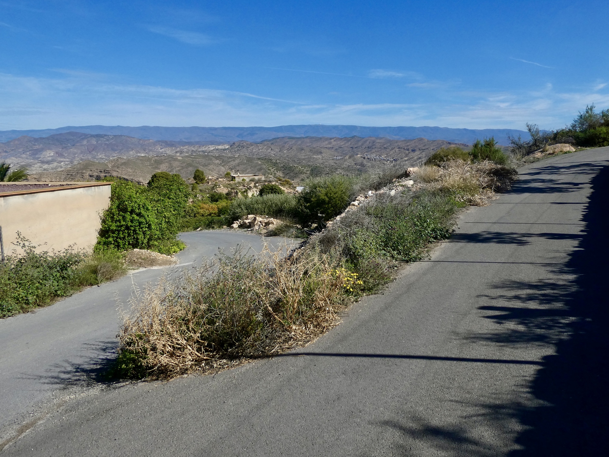
And then, two miles from our destination, Abla happens. Abla is the small white village just before ours. Rachael’s waiting for me at the turnoff into town, and at first were charmed by its setting and impossibly narrow streets. We’re gradually dropping down one of these, and I’m looking up the narrow alleys we bike past that climb up at about 30%.

| Heart | 2 | Comment | 0 | Link |
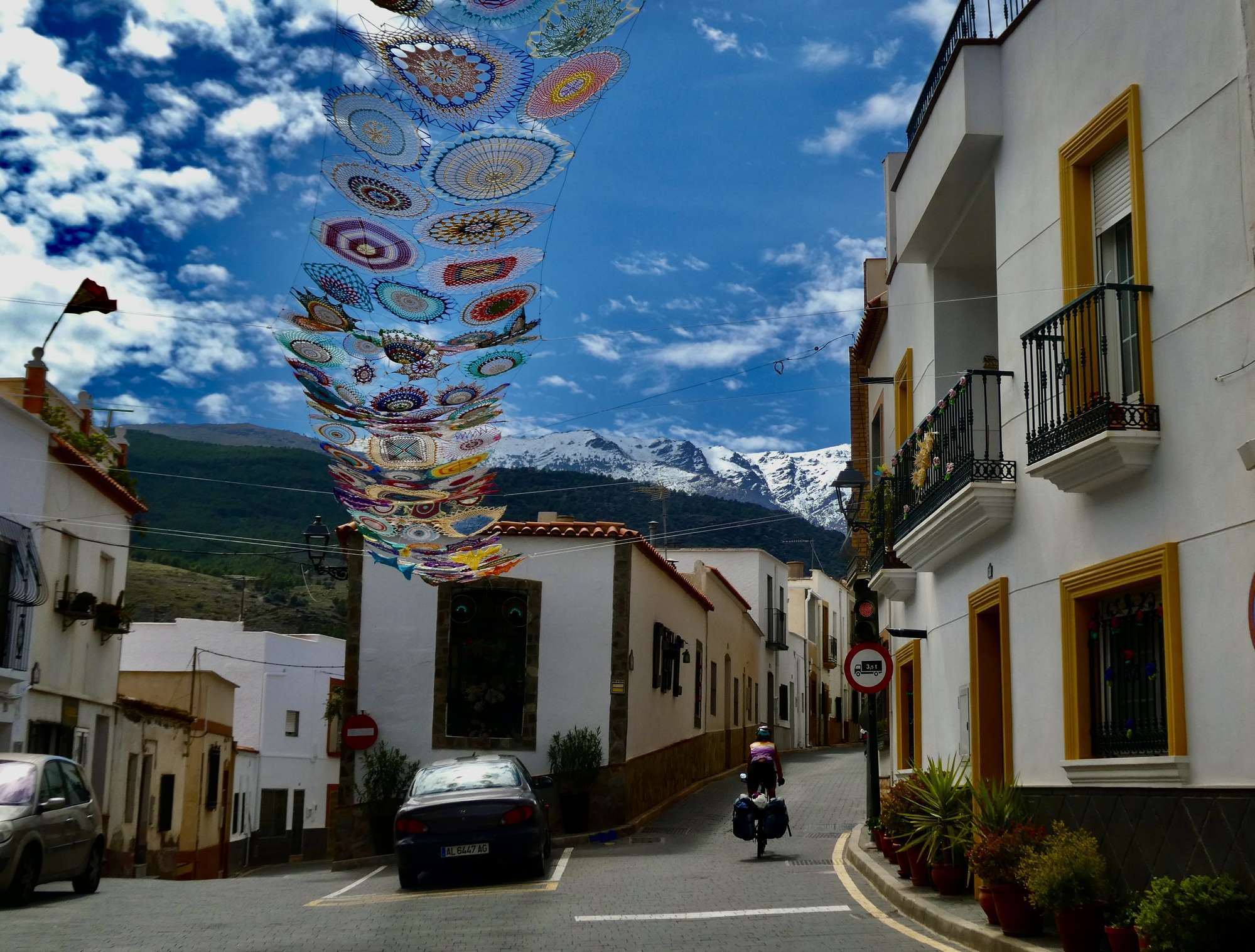
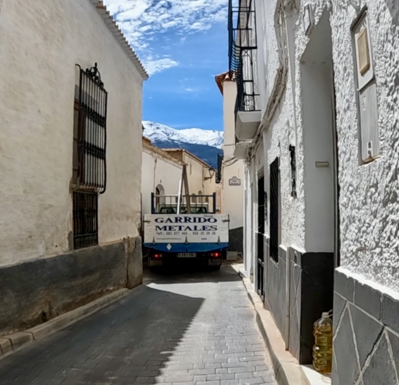
The situation loses some of its charm though when we’re held up by a trash truck that’s almost too narrow to squeeze between the buildings lining this slender filament of a street. it holds up a car and an impatient, famished Rachael who’s starting to get desperate to reach our destination and some fresh calories.

| Heart | 4 | Comment | 1 | Link |
1 month ago
Finally the slowly advancing truck turns a corner and unblocks the road. A block later though, the road we’re following comes to an end - or rather just drops down into the valley, not continuing ahead along this ridge to our town just ahead. We zoom in on the Garmins and see that we made a navigation error when we first entered this town, and have been held up on a street we didn’t want to be on in the first place. Ours is a few blocks above us, up that 30% slope I mentioned.
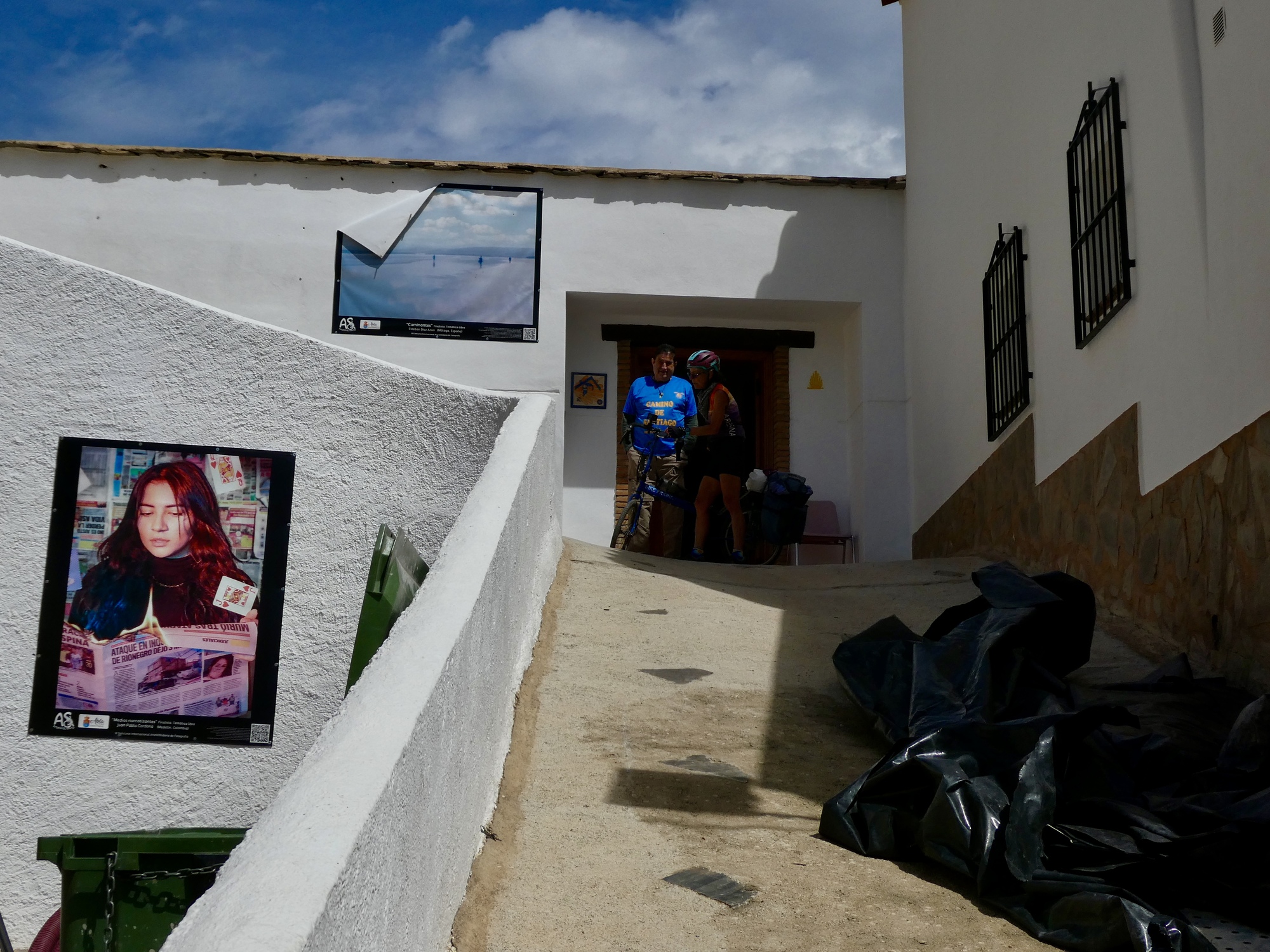
The road we’re on leads into another that hairpins steeply up the hill, but when we round the bend and look up, the pavement ends and it looks like a construction zone. Can we even get through this way? Apparently yes, because a man up at the top is waving at us and beckoning us up. So we dismount and start pushing. And then the man and the woman with him come our way, pass me, and suddenly a gleeful Rachael is giving thanks and I look around to see they’re giving her a push up the hill. Unfortunately I can’t get the camera out in time, but what good Samaritans!
We round the bend at the top, keep climbing, and then see another guy a block up the street smiling and beckoning us up. Interesting. And then we realize what’s happened here. They think we’re cycling peregrinos on the Camino Mozarabe we’ve been following most of the day, and we’re here to stay at his albergo.
There’s a fair amount of confusion at this point, since none of them speaks English. They realize that we’re not his guests, we tell them we’re trying to get to Abrucena, and eventually they get across that we need to keep climbing to get up to that ridgetop road we were supposed to be on in the first place.
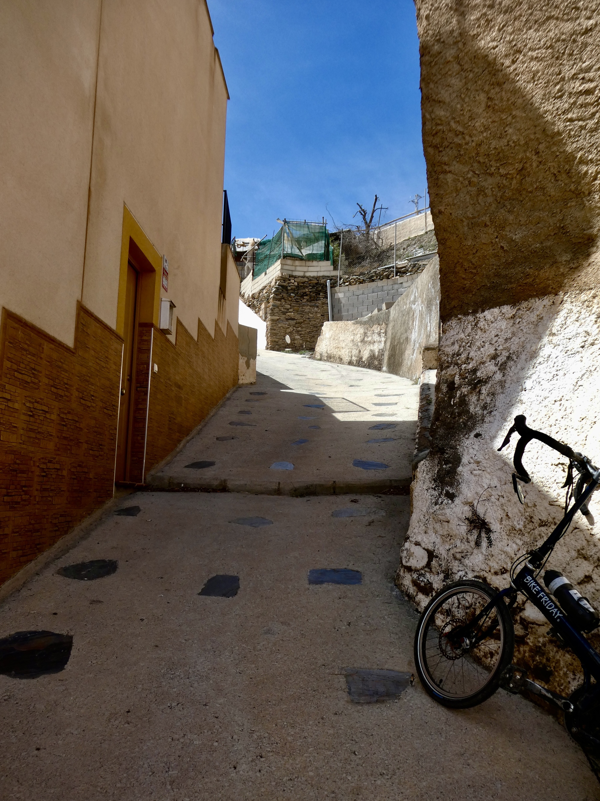
They all wish us a Bon Camino as we continue uphill - excruciatingly steeply, up a slope that we have to team up on, the two of us pushing the bikes up together one at a time until we finally reach the near top - where unfortunately there’s a set of stairs we have to lift the bike up together to get back to the right road.
And then we turn around and walk back down the road that’s so steep my knees are hating it, and push up the other one.
But finally we’re up; and the last mile to our town goes well, and when we arrive at our place we’re warmly welcomed by our host Jesus and assured we can still get a meal. First though he opens a utility room where we park the bikes and then leads us up a steep set of stairs to our room, where we leave our baggage and immediately follow him down to the restaurant where he serves us up the menu of the day.
So we’re alive, barely. Thinking back, I’m not sure we’ve had a day this tough since maybe before Covid happened, back in Albania - but Rachael remembers the hills of England as being worse, and fears returning to them this summer. In either case though, aren’t we getting too old for this sort of thing?

| Heart | 4 | Comment | 0 | Link |
Video sound track: You Can’t Always Get What You Want, by The Rolling Stones
Today's ride: 32 miles (51 km)
Total: 554 miles (892 km)
| Rate this entry's writing | Heart | 14 |
| Comment on this entry | Comment | 19 |
1 month ago
1 month ago
PS: The new jersey is a nice spot of colour in the video.
1 month ago
I see that the area you were led astray is named Los Imposibile 😲.
Regarding mapping apps, I have transferred our route into Topo GPS to check for things like this and, indeed, it shows that the road you took dead ends. The app is free and displays incredible details (Spain IGN map). Just a thought. As does RWGPS, Gaia GPS shows the route crossing the river! Ouch.
1 month ago
1 month ago
1 month ago
1 month ago
1 month ago
1 month ago
1 month ago
1 month ago
It had been raining steadily for several days before, and the Shenandoah was really BOOMING with high water and fast-moving current. When we reached the end of the road we realized that what we thought was a crossing was in actuality a low-water ford, not a bridge. In the conditions we encountered it was utterly impassable.
The four of us stood glumly looking at our shoes, the ground, the river... anything, really, than one another. Finally someone made the obvious and only realistic decision: "Well, I guess we have to go back."
In the decades since then we've recalled that moment, and that day, many times. Time and hindsight have softened the memory into Type II Fun but at the time... well, it's good that we were firm friends and were able to take it in stride.
3 weeks ago
3 weeks ago