September 20, 2022
(West of) Milford, Utah to Baker, Nevada
Alone Out There on UT-21
Before too long, the downhill ride was over and the climbing up another pass began. The area seemed even more empty than the previous valley had. If driving across this part of Utah, be sure your vehicle is in good running order and that you have plenty of gas. This is a long way for AAA to reach you on distress call. If your cell phone even has service out here, it would be very fortunate indeed. If you're on a bicycle, only God can help you!
United States Route 50 (US-50), in Nevada, is often referred to as the loneliest road in the USA. After the next leg (next year) of our cross country tour, we'll be in a better position to comment on that claim. Regardless of how it turns out, Utah State Route 21 (UT-21), between Milford and Garrison, is going to provide some stiff competition for that title.

Because a flat tire ended my ride earlier than intended yesterday, the shuttle dropped me off at milepost 71, roughly 5 miles west of Milford. The truck pulled away to take Chuck, John, and Fred to the first summit, at milepost 63, where they finished yesterday afternoon. As I started out, it was very quiet. I had the road and the whole area to myself. Frisco Peak, loomed ahead along with the expanses of rangeland rolling up to it. An occasional motorist would pass but drivers were few and far between since there weren't very many people living out here or any places to stop. The next town of any significance was Garrison, some 70 miles away.

| Heart | 0 | Comment | 0 | Link |
I covered the 8 miles to the first summit, pausing briefly and then descending to the Frisco Cemetery area. A little further on, the Indian Grave Peak loomed to my right and the view ahead was of Route 21 extending off toward the next group of mountains, approximately 18 miles away across a vast empty expanse. The view was incredible. The black asphalt road surface was so far away that it looked like a thin drainage ditch from where I was standing. With approximately 69 miles remaining in my day, the descent into this fantastic valley began in earnest.

| Heart | 0 | Comment | 0 | Link |
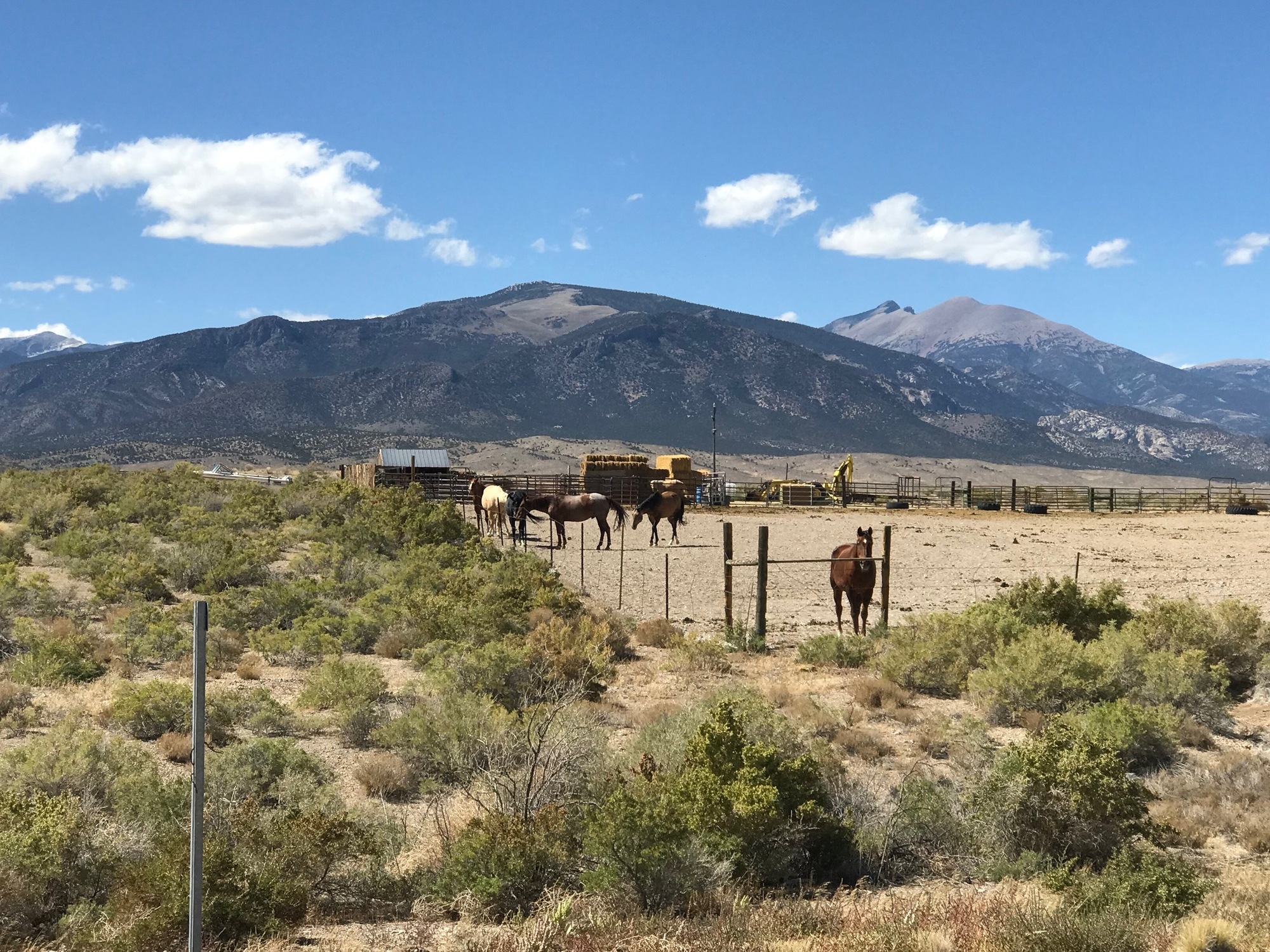
The effortless downhill ride seemed to go on for a long time. The black asphalt surface that I could see from above appeared to be going uphill. However, when it was reached, the trajectory was still downward. Along the way, I stopped a couple of times to take in the quiet and to look around. I took photos from both westward and an eastward perspectives. There was a dirt road to my right and what appeared to be a few structures making up a farm or ranch. Except for occasional range fencing, there were not any other signs of human habitation in this huge valley.

| Heart | 0 | Comment | 0 | Link |

Eventually, the optical illusion (of an upward inclination of the road) ended along with my downhill ride. The climbing to the next summit began. As is the case with many things out here, the climb seemed to go on forever. I could see a spot where the pavement surface changed. It turned out to be a cattle guard in the road, when I finally got there... but it took a while.

The dimensional scale of distance out here was immense. Back home, I have a pretty good idea of where things are and how long it takes to get there, when seeing a vista from, say Mount Washington, in Pittsburgh. In this area, you can see something but it seems to take an extraordinary amount of time to get there. Being here was fascinating and humbling at the same time. Out here, you realize you're only a small part in the grand scheme of life.

| Heart | 0 | Comment | 0 | Link |
After what seemed like a long and gradual climb, I reached the pass summit. The mountains here were called the Wah Wah. Looking some 18 miles back across the valley to the East, the first group of mountains that I had come through were visible. Two passes down, one more to go. Jack-O was at the 2nd summit with the truck. I drank some water and we talked for a bit. He took off and I headed down the mountain shortly thereafter.

| Heart | 0 | Comment | 0 | Link |
The descent was vintage Utah cycling. Long, fast, and mostly traffic free. The only real danger was from looking around too much and not paying attention to the road ahead. Road berms are relatively narrow and some drop off sharply. A mishap could be quite damaging. It was hard not to look around but I managed to eyeball enough of the road to avoid a calamity. Once the steep part of the descent ended, the road continued on a downward trajectory making it relatively easy to keep up the speed needed to cross these wide open spaces.

Before too long, the downhill ride was over and the climbing up another pass began. The area seemed even more empty than the previous valley had. If driving across this part of Utah, be sure your vehicle is in good running order and that you have plenty of gas. This is a long way for AAA to reach you on distress call. If your cell phone even has service out here, it would be very fortunate indeed. If you're on a bicycle, only God can help you!

| Heart | 0 | Comment | 0 | Link |
Once again, the long and gradual climb seemed to go on and on. A sign told me I was leaving Beaver County behind and entering Millard. This was but the 6th county we had entered in all of Utah. They were, San Juan, Garfield, Wayne, Iron, Beaver, and now Millard. These Beehive State Counties are certainly big and empty. This would be the last one for us on the tour.

| Heart | 0 | Comment | 0 | Link |
I reached the 3rd pass summit, which was about 200 feet lower than the previous two. I took a short break, looked around, and then headed down again. Starting 8 miles behind everyone else, the only person I had seen all day was Jack-O... and that was only two infrequent times.
On this stretch, I was really alone again but didn't mind at all. The descent mimicked the format of the others. A steep downhill run that leveled out but was still angled downward, allowing for the maintenance of speeds of 25-35 miles per hour. I was flying along through some tremendous countryside.

While really hammering along, I spotted a small herd of elk in a field and probably a half mile from the road. The bull elk leader of the herd was plainly visible along with some cow elk and some young ones. My cell phone camera created a grainy image from trying to zoom in beyond the lens limits but seeing these magnificent creatures in their natural habitat is truly an awesome sight.

Route 21 was all level now and the wind was at my back, which made for a very fast ride. When Preuss Lake appeared on my left, I had to stop and take in the view. The moisture out here in this arid land made for a beautiful array of colors. It was a good stop for the birds and animals as well. The mountain backdrop made it look stunning. This was fantastic countryside.

Garrison is a very small town located about 2 miles from the state line. The place looked like it had seen better days.. but when those may have happened a very long time ago. It was a collection of some dilapidated houses interspersed with horse and agricultural farms. UDOT had a garage close to the border and there was another state highway intersecting to the right. It seemed to run in a Northerly direction and parallel to the border for a considerable way.
| Heart | 0 | Comment | 0 | Link |
But all good things must come to an end and so did Utah. After 9 days and well over 400 miles, we entered Nevada. Jack-O was waiting there, to see if I needed anything or was having any trouble. I was doing well and feeling great, so after a brief pause and a photo, he headed off to Baker to meet the other guys while I pushed on for the final 8 miles.

Utah 21 turned into Nevada 487, running straight as an arrow through what is called Snake Valley. Out of nowhere, the headwind became very strong, nearly stopping me in my tracks at times. Ahead, was a long sweeping bend to the right where I figured the headwind would become a tailwind. That prediction largely turned out to be correct and calmed the remaining miles to our final destination.

| Heart | 0 | Comment | 0 | Link |
When I arrived, the guys were on the front porch of the Stargazer Inn and Bristlecone Store, enjoying some food and perhaps a cold beer. I happily joined them, celebrating a successful ride on what was the longest mileage day of the trip, for me. This was the penultimate night of the tour, so we sat out, had a few laughs, and prepared for the last day of riding ahead. After a nice meal at a restaurant in town, we camped out nearby under a clear sky with millions of stars. This area is known for the ability to see brilliant night skies. There ain't much civilization 'round these parts and no ambient light to diminish the heavens above. if you ever get here, make sure you look up at night!

Today's ride: 77 miles (124 km)
Total: 590 miles (950 km)
| Rate this entry's writing | Heart | 0 |
| Comment on this entry | Comment | 0 |