September 21, 2022
Baker to Ely, Nevada
Against the Wind

The last day on the road, for this tour, dawned a bit chilly but clear and bright. We were all walking around with a little extra spring in our steps, anxious to get on the road and bring this stage of our tour to its conclusion. Baker, Nevada lies in what is known as Snake Valley. Locals in the area consider themselves in league with folks from nearby Garrison and Eskdale, Utah. They say they are from Snake Valley rather than from the individual towns on both sides of the state line. At least that is what the waitress at the restaurant told us last evening. Snake Valley sounds like a good name for the hometown of an old western outlaw.

Baker also lies within a geological feature known as the Great Basin. A national park of the same name is nearby. A mile or two out of town, we got onto US highway 6-50, made up of two cross country routes that run together here. It was obvious that we were in a huge geological depression flanked by high mountains. At more than 13,000 feet of elevation, Wheeler Peak dominates the Western skyline. Once again, Chuck and John were ahead, while Fred and I hung back taking pictures. John is constantly running video, so he doesn't have to stop as much for still shots. Chuck manages to take a few well placed photos while riding.


| Heart | 0 | Comment | 0 | Link |
Down the road, we met up with a lady who was walking the entire American Discovery Trail (ADT). Her name, as she introduced herself, was Mary E. Davison. Since we had ridden some of the ADT in the eastern portions of our tour, we had a little bit in common with her and chatted for a while. Mary has written a couple of books and is writing another one about this current walk. We wished her well and moved on.

| Heart | 0 | Comment | 0 | Link |
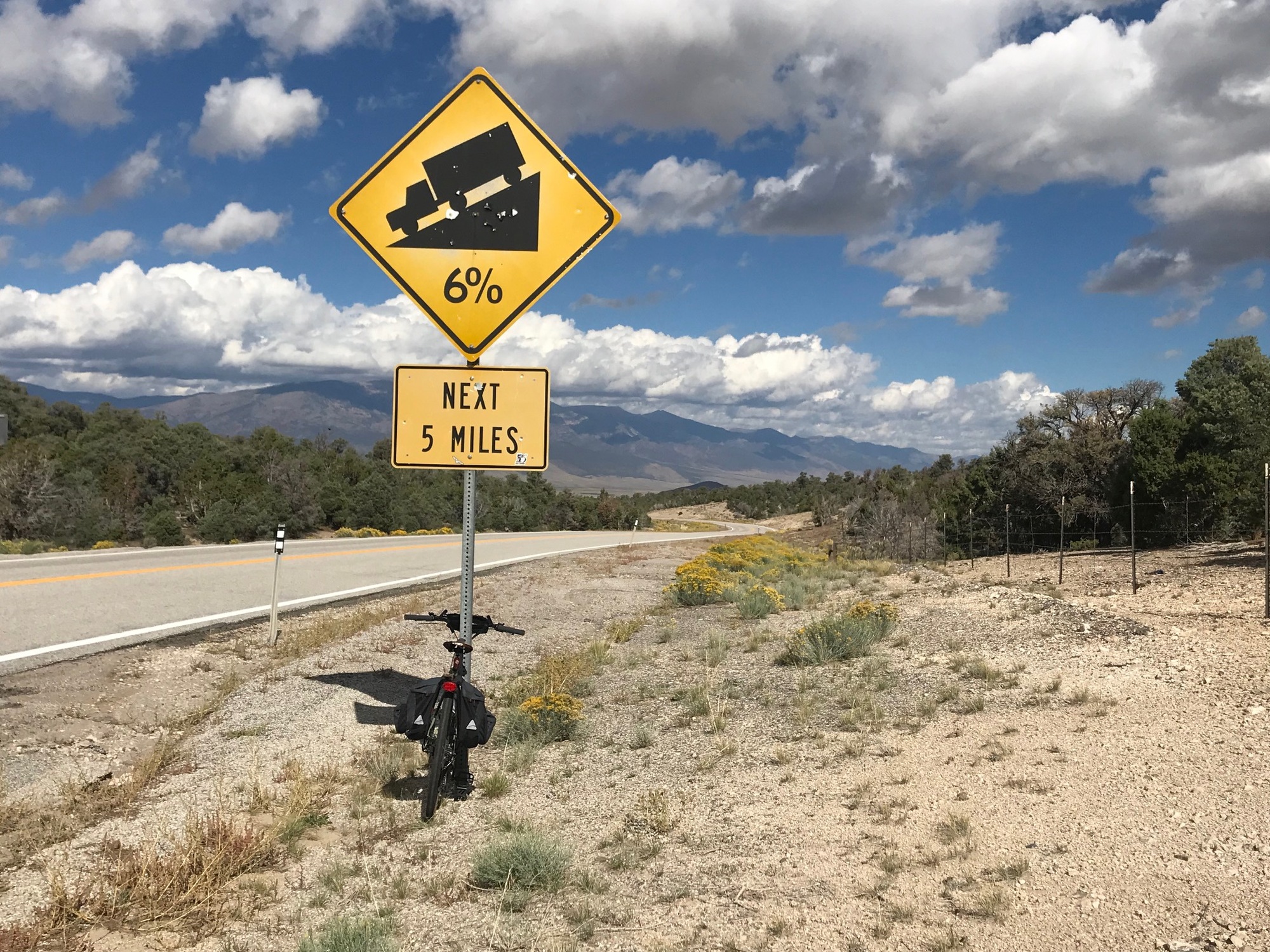
The first climb of the day was a gradual ascent of what is called Sacramento Pass. It went on for a few miles, rising up and over the Snake Range to an elevation of more than 7100 feet. Fred and I climbed it without very much difficulty. The view at the top was beautiful. We could see Spring Valley spreading out below and the road ahead was visible for a long way off.
| Heart | 0 | Comment | 0 | Link |
The descent mirrored those of the passes in Utah, going for long way and reaching of speeds between 35-40 miles per hour. The view of the valley below and the mountains that bordered its far side were spectacular. As the road made a big sweeping lefthand curve, a giant wind farm came into view. The ride was going extremely well, thus far. We were making great time while expending little effort. The scenery was tremendous as well.

| Heart | 0 | Comment | 0 | Link |
As we came around the big sweeping bend to the left, the wind nearly stopped us in our tracks. Unlike other windy spots we had dealt with on this trip, this one was very powerful and wouldn't quit. Speed, on the bike, of 5-7 miles per hour became difficult to maintain. Strong gusts seemed to come from the front and the side, making it difficult to hold a line. I was slowly moving forward but noticed Fred falling further behind. Chuck and John-F were ahead and out of view.
My sights were set on the top of a rise in the road that appeared to be a mile or two ahead. At my rate of travel, it was taking a long time to get there. The wind was relentless but I fought my way through it to reach the climbing portion of that rise in the road. Part way up, the truck was coming down toward me and I noticed two bicycles loaded on the rack. Since there was no traffic, as Jack-O slowed down I noticed Chuck and John-F were inside. I told them I was alright but wasn't sure about Fred, who was now a speck, at least a half mile back, or more. The plan was to check on him and then meet me at the top, where I would be taking a break.
A while later and after I had reached the top, the truck came back with Fred's bike racked up, as well. This wind was not a lot of fun. The crosswind caused swerving that sometimes threw a rider out into the traffic lane. I wasn't having much trouble holding my line but could see where it might be a bigger problem for someone. The guys decided to sag into Ely but I decided to keep going, for as long as I could. John-F was worried about me, so I reassured him. Reluctantly, they went on and the battle with the wind was mine to face alone.
I was determined to finish and wasn't terribly concerned, only a bit disappointed that the beautiful ride we had been enjoying had become a battle with gale force winds.

| Heart | 0 | Comment | 0 | Link |
From the top of this little rise, I could see that far ahead, the road made a big sweeping turn to the right. The prevailing direction of the wind, from my left front and side, seemed to indicate that I might get it mostly behind me once I reached that bend in the road. So, it became my mission to reach that spot.
At first, "Mission Impossible" seemed like the right name for this part of the ride. I plodded along, while that spot ahead seemed not to be getting any closer. After an hour or more, I finally reached it and got around the bend. However, the head and side winds did not abate. The road seemed to stretch out for a long way before me, and the wind was still working against me. How does that happen, I wondered? Regardless, by this time, I was more determined than ever to beat this force of nature.

A little further on, a female cyclist passed me from the opposite direction. We waved to each other and she kept on going. I figured she was enjoying a nice tailwind and didn't want to stop. Down the road another piece, a second female cyclist came along and since she wanted to talk, I crossed over to meet her. She was waiting for a third woman who had fallen back. Amazingly, they too were fighting the strong head and crosswind, even though they were traveling in the opposite direction from me. She asked me to let the other young lady know they were ahead if I saw her. The good news was that the wind had only begun for them when they entered Spring Valley. If I could make it up and out of this place, things would improve. My determination to finish this ride received some much needed hope. If I could make it out of the valley, relief might arrive, so I pushed on.
Ahead, the road was now rising toward the pass but it was a long way off (see photo above). The wind was noisy and unrelenting. A white sedan with a bicycle tied to the roof slowed down as it approached but did not stop. I motioned that the other cyclists were ahead of them and they seemed to understand. I had advised the second woman that if they made it up and over Sacramento Pass, the wind would likely be gone. I hope they made it out of Spring Valley.

| Heart | 0 | Comment | 0 | Link |
Eventually, I reached the point where US-93 meets US-6/50. The road climbed to an area where there was a wide pull off. This is the Majors Station area. Jack-O was there, with the truck. He had dropped the other guys off at the hotel and had come back to check on me. I took a break, getting into the parked truck, getting out of the constant wind for a few minutes, and enjoying a cold drink. That was nice.
The climb up the pass had begun. It was 9 miles to the top. Jack-O confirmed it would be all of that distance from this spot. I had gone roughly 10 miles, since the top of the hill where the others had decided to pack it in. There had been 2-3 miles of wind before that spot. All told, this Spring Valley misadventure (including the climb out of it) would consume more than 20 miles and several hours of riding time.
The best part of the climb was that as the road began to curve between the hills, the wind was temporarily blocked. Going uphill was actually a relief, until the wind briefly returned at some unprotected open spots. My overall speed had increased and I was making good progress toward the summit.
Fully engaged in my struggle to beat this adversity, I didn't remember to take any photos while climbing the pass. But there was even more wildness to come, if you can believe it.
As the summit of the pass grew closer, a small black sedan pulled over on the other side of the road and alongside of the guard rail. There was very little shoulder on that side, so the car was out in the traffic lane. A couple hundred feet above that spot was a big bend where vehicles were coming down from the top. Some of these were tractor trailers and large motor homes.
As I was climbing toward them, a man and his wife, in an SUV, pulled over in front of the black sedan to render assistance. By the time I got there, the ladies had unloaded a number of items from their car onto the road. Apparently, one of them was moving and had all of her worldly belongings stuffed into this small vehicle. Since they had a flat tire, everything needed to be removed to get to the spare tire and jack. I was getting pretty nervous, because this situation had all the makings of a disastrous accident waiting to happen. Doing the only thing that seemed logical at the time, I went further up the road to attempt to slow drivers down as they came around the big bend above.
We must've been quite a sight... a guy on a bicycle trying to slow down traffic while two young ladies below had their little car parked against the guard rail with all kinds of boxes and clothing sitting on the road, another vehicle parked in front of them, and four more people standing around. What is this world coming to? Fortunately, drivers were alert, courteous, and under control. They all slowed down, and went out around the two stopped vehicles (the ladies' sedan and the SUV) when clear.
Unfortunately, once everything was removed from the sedan, it turned out the ladies did not have a spare tire under the floor in the hatchback area. The fellow from the SUV was now partially under the vehicle with his legs out into the traffic lane. I could see the 6 o'clock news report now!
There was a wider spot I had passed earlier, down the road from where the sedan had stopped, a hundred feet or so and it was on the other side. I went back to the vehicles and recommended that they let their car drift to that spot and stay there until help could come. At first, the driver was resistant out of fear of damaging the rim of the tire that was flat. Then I got a little firmer with her and said if a vehicle came around that bend above and hit them, she would have a lot more than a bent rim to worry about. That convinced her. We got everything re-loaded into the vehicle and with a push, they coasted down to the wide spot and got well off the road and into some softer gravel. To my great relief, one part of this situation was now resolved.
Since cell service was hit or miss, at the moment when the ladies and their car were safe, none of us had any reception. So I said that upon reaching the summit, I would call for help. The fellow in the SUV was heading East and said he would make a call for help as soon as his service improved.

Jack-O had texted me earlier, during a moment when we both apparently had service, to say he and the truck were at the summit. However, when I got there, neither he or I had had any service. Jack-O then told me there was a highway patrol office on the outskirts of Ely. He headed there, to inform them of the situation. Later on, during my ride to Ely, I saw the patrol car going past, so the ladies must have gotten some help, courtesy of Jack-O, the good samaritan, or both. Our good deed for the day was done.

Reaching the top of Connors Pass was euphoric. As I had hoped, when there was wind, it was behind me. Riding down the pass and through Steptoe Valley, which is on this side of the mountain, was shaping up to be the exact opposite of the ride through Spring Valley. The descent was long, fast, and the best part was the wind was either non-existent or behind me. The road was straight as an arrow and the mountains near Ely were ahead. I was flying along, really enjoying myself, and feeling that times like this were what keeps me involved in this sport.

| Heart | 0 | Comment | 0 | Link |
The rest of the ride to Ely was scenic, relaxing, thrilling at times, and satisfying. The decision to keep on going was the rewarded with this memorable ride through Steptoe Valley and on to Ely.

| Heart | 0 | Comment | 0 | Link |
The approach to Ely was dominated by a beautiful mountain backdrop. There's gold and other minerals in "them thar hills" and mining is still a dominant industry in the area.


| Heart | 0 | Comment | 0 | Link |
Gambling is another big activity. Many restaurants and hotels have various forms of wagering are going on. Farming and ranching are also significant occupations. On my way into town, a fellow was plowing a field along the road and creating quite a bit of dust that I had to outrun. Two very official looking police patrol cars, from the Shoshone Indian Tribe, were parked on the edge of town.

I made it to a brand new Holiday Inn, which was our final lodging place. It was by far the nicest place we stayed on this stage of our tour. Perhaps we deserved it after this long and arduous trip. We looked around town for a good place to eat but eventually ended up next door to our hotel at The Prospector. It is a hotel, restaurant, bar, and gambling casino. The food and service were good and there was a lot of activity inside.

| Heart | 0 | Comment | 0 | Link |
The next morning, the long drive home began back across the country we had been riding across. It is always interesting to see it again from the windows of a motor vehicle. This stage of our tour was a success. We had very few problems, we had seen some wonderful sights along the way, and had all gotten along well for close to three weeks of close company. The last leg of our journey is planned for 2023 and we are all looking forward to the final stage.
Today's ride: 63 miles (101 km)
Total: 653 miles (1,051 km)
| Rate this entry's writing | Heart | 0 |
| Comment on this entry | Comment | 0 |