September 16, 2022
Escalante to Red Canyon Village (West of) Panguitch, Utah
Bryce and Red Canyons
We left Escalante and its white sandy soil behind on yet another bright, sunny, and cool morning. Route 12 remained our ribbon of pavement through the landscape. The allure of sleeping out under the stars last night did not turn out as well as I imagined. Although it was very quiet after the sun went down and the stars were beautiful, I couldn't get the the chance of a stray rain shower completely out of my mind. Morning came all too soon after a restless night. Because a good night of sleep had been eluding me over the past few days I wasn't quite myself as the ride began on this day. However, as the day wore on, I rallied to finish strong.
The ride out of Escalante drew us into a greener and less spectacular countryside. The waterways were still relatively dry but had it was obvious that vegetation was better supported. Fields of grass allowed more cattle to exist on large neighboring ranches. We cruised along, making good time. Traffic was light, the road was good, and we had no headwind with which to contend.


As I approached an intersection with a dirt road to my right, a pick-up truck with a flat bed on the back pulled out. The driver's dog was on the flat bed and walking to and fro. We had seen a few of these before in Utah. It's still the Wild West out there and the dogs seemed to like being able to roam around on the backs of these flatbed trucks.
However, I don't think I would allow my own canine companion to be put into such an unsafe situation. Drivers go pretty fast between lonely points on these Utah backroads. If the brakes had to be applied suddenly, it wouldn't be good for the dog. The truck pulled away too quickly for me to get a photo, so I put it out of my mind and continued onward following the lightly traveled UT-12.

| Heart | 0 | Comment | 0 | Link |
We entered the Escalante Grand Staircase area on our eventual approach to Bryce Canyon National Park. Most of it lies to the South of where we were riding. Since these are protected lands, there was not much development or human activity to be observed. The road climbed to another summit of 7600 feet and an area called Powell Point. There I took a brief break before beginning another thrilling downhill ride.

| Heart | 0 | Comment | 0 | Link |


From the summit, we enjoyed a long downhill and some relatively flat riding through Henrieville and all the way to Cannonville, arriving there about midday. Two towns, this close together, was an anomaly in Utah. There wasn't much to Henrieville but Cannonville had a gas station, convenience store, and a pizza joint. The was the most civilization we had seen in several days. So, we stopped for a nice rest and lunch break, enjoying the benches out front and in the shade. Although mornings start out cool here in Utah, by afternoon, the strong sun warms things up considerably.

The next town ahead was oddly named Tropic, Utah. Both it and the road leading to it were more desert-like than tropical but I suppose the name made sense to someone at some point in time. Tropic was now the third little town we had passed through within a relatively short distance in Utah. Prior to this, towns were so far apart, it was unusual to see more than one or two all day.

Beyond it, Route 12 led into Bryce Canyon National Park (BCNP). Similar to the road through Capitol Reef, there was generally enough berm to allow room for us and the increased tourist traffic. Occasionally, the road narrowed but I never felt uneasy. The Big RV drivers were very courteous to us, moving over whenever possible and patiently waiting to pass when safe.


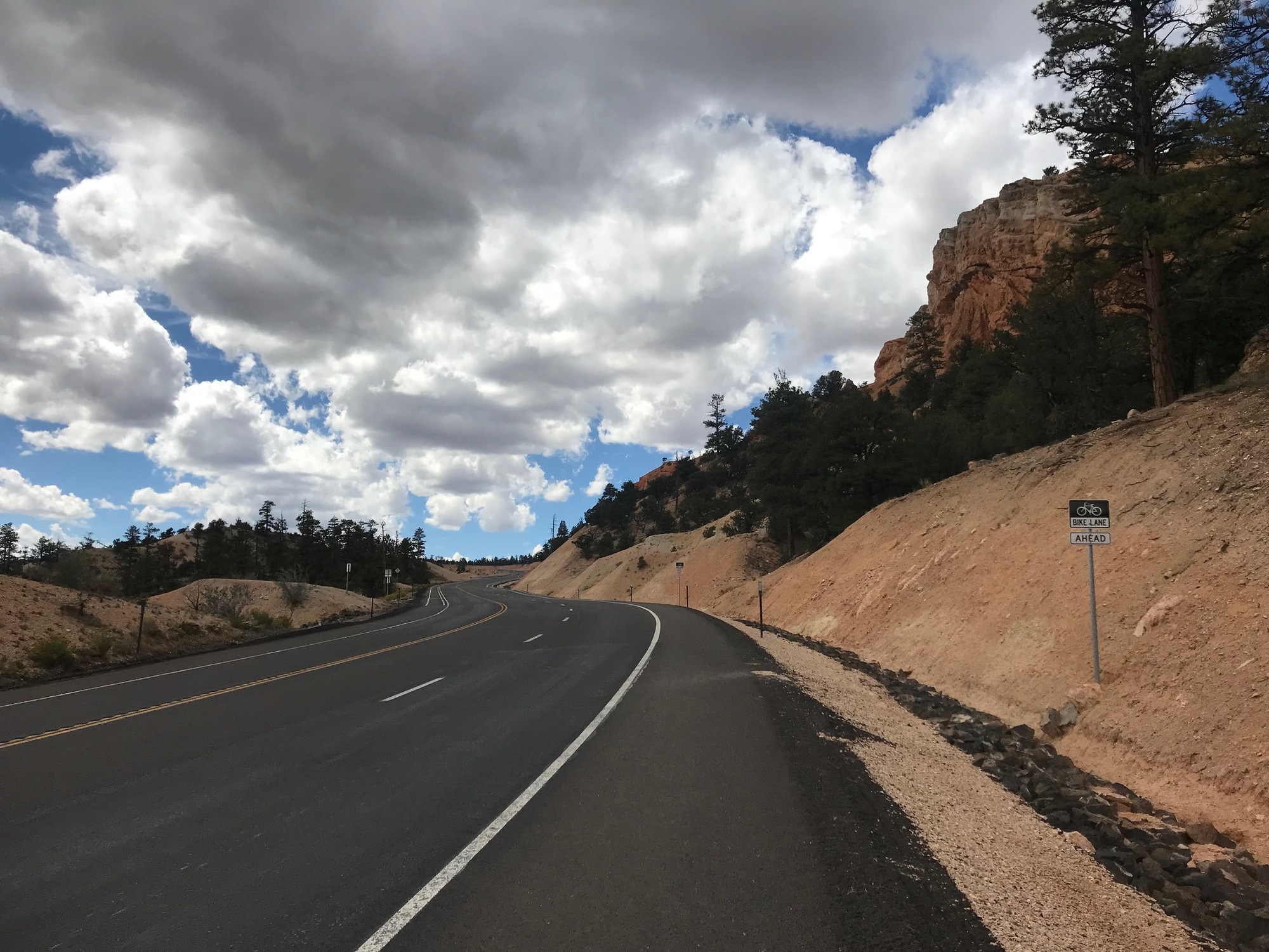
Route 12 climbed through the park to a high point to the West. The climb was long. For the last couple of miles, a bike lane allowed for some separation from traffic on the way up. It felt good to have a buffer from all of the tourist traffic rolling through the park.
| Heart | 0 | Comment | 0 | Link |
At the top, the road led to a large roundabout that several roads fed into. Again, it was more civilization that we had seen in several days. We negotiated our way around and got onto the Red Canyon Bike/Pedestrian Trail. Since I was frequently stopping to take pictures, I was by myself during this stage of the ride.

| Heart | 0 | Comment | 0 | Link |

| Heart | 0 | Comment | 0 | Link |
The Red Canyon Trail is separated from and runs parallel to Route 12. Although it was nice to be away from traffic, the trail itself has a lot of cracks, depressions, and bumps, which do not make for a smooth ride. It is also mostly a downhill ride where speed increases and the rider has to be careful to not hit an irregular spot, either losing control and/or damaging the bicycle (or one's self).

I took it relatively easy and enjoyed the ride, the red rocks, and the greenery. At one point, Route 12 can be seen passing through arching red rock tunnels... absolutely spectacular! If this trail ever gets resurfaced, it will be a tremendous place to ride.
There were several riders coming the other way. Because it was all uphill in that direction, some of them appeared to be flushed in the face and struggling. It was nice to be headed downhill at this time of day.

| Heart | 0 | Comment | 0 | Link |
The trail came to an end in a parking lot across Route 12 from an area called Red Canyon, which is a park. There seemed to be quite a few people about, which meant we also had some motor vehicle traffic as company when we had to get back onto Route 12. The situation was mitigated by the downhill trajectory and a decent berm.

| Heart | 0 | Comment | 0 | Link |
It was several more miles to our destination for the day, Red Canyon Village, a campground with cabins and RV hookups. I enjoyed the mostly downhill ride to the park, even though a thunderstorm was brewing.
With the goal of getting a better night of sleep, I reserved my own cabin, rather than crowding into one of the other ones. After getting everything inside, I took a shower and got ready to go to dinner. Getting the cabin for myself was a great idea. I slept soundly that evening. Our next day was planned for a day off the bikes, to rest and (for me at least ) to get re-organized. Having my own cabin meant I could spread everything out without inconveniencing anyone else. This reorganization effort and the rest day came at precisely the right time, at least for me.

Today's ride: 59 miles (95 km)
Total: 420 miles (676 km)
| Rate this entry's writing | Heart | 0 |
| Comment on this entry | Comment | 0 |