February 19, 2021
The Montezuma loop (incomplete)
We set off with this ambitious ride in mind: a fifty loop to the west, leaving the valley by climbing up Yaqui Pass, then continuing by mostly climbing for the next 18 miles before finally dropping 3,300’ back down to the valley in 10 miles down Montezuma Valley Road.
| Heart | 0 | Comment | 0 | Link |
It promises to be a fine, even spectacular ride. We’ve ridden most of this loop before, in pieces - all except that 3,300’ descent, down a chute nicknamed the Glass Elevator; named so because it’s such a rush dropping into the basin floor with the mountains opening up before you.
First though, we have to get up there to the top floor - through 38 miles with 4,500’ of climbing, plus a few annoying dips that mean we’ve lost some of the elevation we just worked to attain. It starts with a climb up Yaqui Pass, which is a much different affair approached from the north: a steady 1,200’ climb of perhaps 4% for 5 miles. Not bad, but not as much fun as it was swooping back the other direction two days ago.


| Heart | 2 | Comment | 0 | Link |

| Heart | 2 | Comment | 0 | Link |

| Heart | 2 | Comment | 0 | Link |

| Heart | 1 | Comment | 0 | Link |

| Heart | 1 | Comment | 0 | Link |
Eleven miles into the ride, we stop again at Tamarisk Grove Campground for the only facilities we expect to see before returning to town. While we’re stopped Rachael reminds me that it’s been a long time since I’ve checked the pressure in her tires and demands servicing. I comply, but when I remove the pump from my underbag I’m distressed to discover there’s been a significant packing error. My wallet and phone are missing.
Not good. It’s not like I really need either of them out here - there’s no cell coverage anyway, and what was I expecting to buy? The concern though is why they’re missing in the first place. Two possibilities: I forgot to pick them up from the room after pumping up my own rear tire (which I’ve been doing daily for about two weeks now because of a slow leak that I’ve been too lazy to repair); or I took them out with me and set them down outside the room somewhere and then forgot to stow them away. Thinking back, I can’t quite recreate what happened, in spite of Rocky’s repeated helpful but futile attempts to jog my memory.
So, a probability/risk calculation. If they’re in our room, or if someone helpfully picked them up and turned them in at the office, we might as well continue the ride. Otherwise though, we should head back. They might still be outside when we return, or if they’re gone then I can at least use the rest of the day to call credit card companies and so on.
At least I won’t have lost my driver’s license, since it’s already lost thanks to that scoundrel Skip.
Maybe fifteen years ago I might have voted to continue the ride, but not now. I’ve gotten more cautious over the years, probably from having endured the fallout of so many similar episodes in the past. We scrap the ride, and turn back for home.

| Heart | 1 | Comment | 0 | Link |
We just biked Yaqui Pass southbound two days ago, so we know what to expect - a manageable 300’ climb, followed by the same exhilarating five mile coast back to the valley floor. It’s awesome again, and easily makes the climb up worthwhile. On the way down we pass perhaps fifteen cyclists climbing the other direction; and overhead we enjoy the sight of three soaring ravens, two of them flying in tight formation putting on an aerial show.

| Heart | 2 | Comment | 0 | Link |
We’re back by noon. My heart sinks a bit when I see that there is an empty chair in front of our door. It would be so like me to set something down there while I pumped my tire, and then space it out when I was done and just bike off. I open the door with trepidation and feel a rush of relief when I see the wallet and phone on the counter. Phew!
The Montezuma loop still looks like an awesome ride, and I would like to take another stab at it before we go, with or without Rocky. We’ll see how it goes. For today though we unexpectedly have the afternoon free and some energy left. Rocky decides to go out on her bike again, and logs another 20 miles biking around the valley floor.
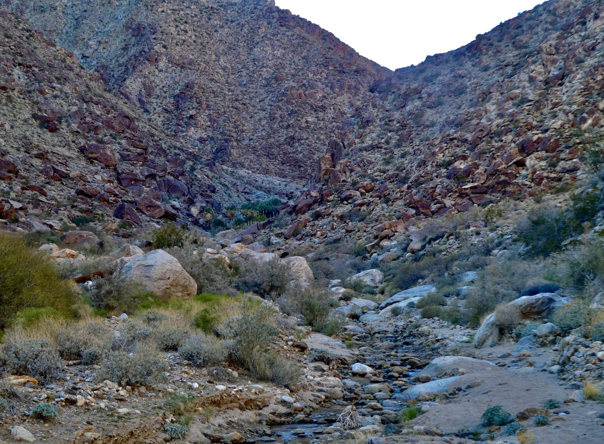
For myself though, I decide to take a short hike up Palm Canyon. I want to test out my foot to see if I’m ready for more challenging walks, and I’m still irked that Rachael saw those big horned sheep without me. I hang around the apartment until mid-afternoon and then drive to the desert visitor center. From there to Palm Canyon and back it’s roughly a five mile hike, which feels about right as a foot stress test.
Nice hike, the foot seems fine, but no goats. We’ll have to come back some morning when the trail is quieter and the sun from the east illuminates the canyon walls. I’ll bring along my goat spotter next time.

| Heart | 1 | Comment | 0 | Link |


| Heart | 1 | Comment | 0 | Link |

| Heart | 1 | Comment | 0 | Link |
| Heart | 2 | Comment | 0 | Link |

| Heart | 2 | Comment | 0 | Link |

| Heart | 1 | Comment | 0 | Link |

| Heart | 1 | Comment | 0 | Link |

| Heart | 0 | Comment | 0 | Link |

| Heart | 1 | Comment | 0 | Link |

| Heart | 2 | Comment | 3 | Link |
https://www.allaboutbirds.org/guide/Olive-sided_Flycatcher/overview
3 years ago
3 years ago
Ride stats today: 23 miles, 1,700’; for the tour: 2,870 miles, 109,900’; for the year: 37 riding days, 1,607 miles, 52,900’, and 2 flat tires
Today's ride: 23 miles (37 km)
Total: 2,871 miles (4,620 km)
| Rate this entry's writing | Heart | 7 |
| Comment on this entry | Comment | 0 |